Maiden Hill

Hill, Mountain in Devon West Devon

England

Maiden Hill

Cist and Capstone near Crow Tor (Scale 1m) <span class="nowrap"><a title="https://historicengland.org.uk/listing/the-list/list-entry/1016922?section=official-listing" rel="nofollow ugc noopener" href="https://historicengland.org.uk/listing/the-list/list-entry/1016922?section=official-listing">Link</a><img style="margin-left:2px;" alt="External link" title="External link - shift click to open in new window" src="https://s1.geograph.org.uk/img/external.png" width="10" height="10"/></span>
Cist and Capstone near Crow Tor Credit: Sandy Gerrard

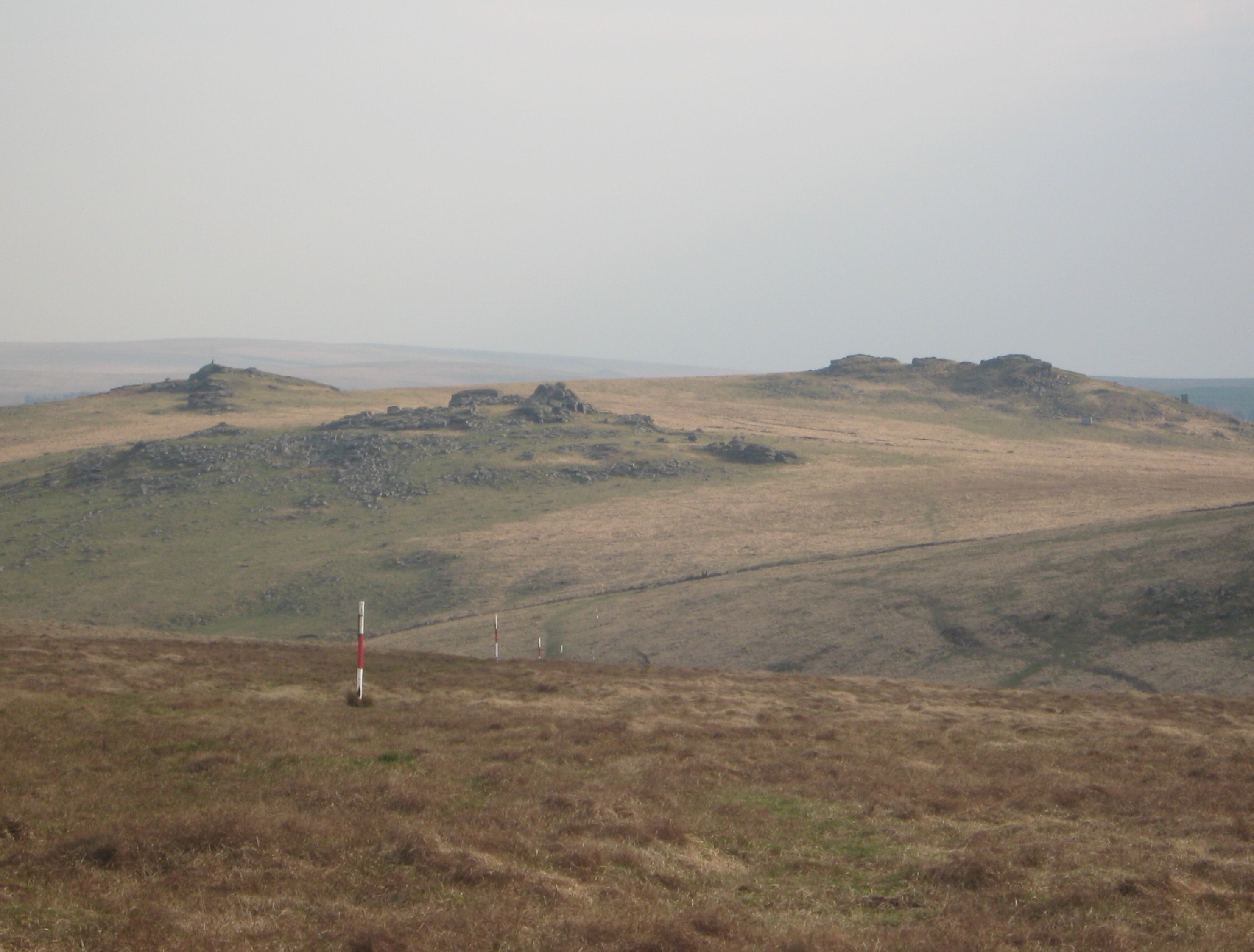
Maiden Hill is a picturesque hill located in the county of Devon, England. Situated in the southwestern part of the country, it is a popular destination for nature enthusiasts and hikers alike. With an elevation of approximately 300 meters (984 feet), Maiden Hill is considered a modest-sized hill, providing visitors with stunning panoramic views of the surrounding countryside.

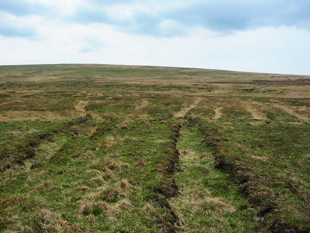
The hill is covered with lush greenery, featuring a diverse range of flora and fauna. It is home to a variety of plant species, including heather, gorse, and bracken, which create a vibrant and colorful landscape throughout the year. The hillside is also dotted with ancient oak trees, adding to its natural beauty.

Maiden Hill offers a network of well-maintained walking trails that cater to different levels of difficulty, making it accessible to both experienced hikers and casual walkers. These trails wind through meadows, woodlands, and open fields, providing a tranquil and peaceful environment for outdoor activities.

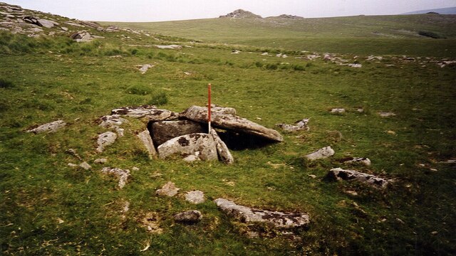
The hill is steeped in history, with evidence of human habitation dating back thousands of years. Archaeological excavations have revealed the presence of Iron Age settlements and burial mounds, indicating that Maiden Hill has been a significant location for ancient communities.

Overall, Maiden Hill is a scenic and historically rich destination that attracts visitors from near and far. Its natural beauty, diverse wildlife, and intriguing history make it a must-visit spot for those exploring the Devon countryside.

If you have any feedback on the listing, please let us know in the comments section below.

Maiden Hill Images

Images are sourced within 2km of 50.597995/-3.9955527 or Grid Reference SX5879. Thanks to Geograph Open Source API. All images are credited.

Cist and Capstone near Crow Tor (Scale 1m) <span class="nowrap"><a title="https://historicengland.org.uk/listing/the-list/list-entry/1016922?section=official-listing" rel="nofollow ugc noopener" href="https://historicengland.org.uk/listing/the-list/list-entry/1016922?section=official-listing">Link</a><img style="margin-left:2px;" alt="External link" title="External link - shift click to open in new window" src="https://s1.geograph.org.uk/img/external.png" width="10" height="10"/></span>
Cist and Capstone near Crow Tor
(Scale 1m) LinkExternal link
Cairn and cist near Crow Tor (Scale 1m) <span class="nowrap"><a title="https://historicengland.org.uk/listing/the-list/list-entry/1016922?section=official-listing" rel="nofollow ugc noopener" href="https://historicengland.org.uk/listing/the-list/list-entry/1016922?section=official-listing">Link</a><img style="margin-left:2px;" alt="External link" title="External link - shift click to open in new window" src="https://s1.geograph.org.uk/img/external.png" width="10" height="10"/></span>
Cairn and cist near Crow Tor
(Scale 1m) LinkExternal link
Below Cowsic Head
Below Cowsic Head
Lydford Tor
Lydford Tor
Stile and Boundary, Lydford Tor
Granite Outcrop Near Devil's Tor
Beardown Man A Bronze Age standing stone.
Beardown Man
A Bronze Age standing stone.
Moorland, Maiden Hill
Conies Down Tor
Conies Down Tor
Stone Row, Conies Down
Pond on Conies Down
Pond on Conies Down
Moorland on Black Dunghill
Conies Down prehistoric stone row A double prehistoric stone row measuring 174.2m long, including at least 41 mainly small with some medium-sized stones. The row is orientated north to south. <span class="nowrap"><a title="https://stonerows.wordpress.com/gazetteer/region/dartmoor/conies-down/" rel="nofollow ugc noopener" href="https://stonerows.wordpress.com/gazetteer/region/dartmoor/conies-down/">Link</a><img style="margin-left:2px;" alt="External link" title="External link - shift click to open in new window" src="https://s1.geograph.org.uk/img/external.png" width="10" height="10"/></span>
Conies Down prehistoric stone row
A double prehistoric stone row measuring 174.2m long, including at least 41 mainly small with some medium-sized stones. The row is orientated north to south. LinkExternal link
Cowsic Head - Dartmoor A small peat hag above Cowsic Head. Great Mis Tor on the horizon.
Cowsic Head - Dartmoor
A small peat hag above Cowsic Head. Great Mis Tor on the horizon.
Old peat works near Walkham Head - Dartmoor These peat workings haven't been used for a while but they covered an extensive and widely worked area. Limboro cairn on the horizon.
Old peat works near Walkham Head - Dartmoor
These peat workings haven't been used for a while but they covered an extensive and widely worked area. Limboro cairn on the horizon.
Peat Hags near South Tavy Head - Dartmoor A very isolated and exposed place and not the spot to get caught in a thunderstorm!
Peat Hags near South Tavy Head - Dartmoor
A very isolated and exposed place and not the spot to get caught in a thunderstorm!
Walkham River valley Looking south on the overgrown track from the old peatworks.
Walkham River valley
Looking south on the overgrown track from the old peatworks.
Upper Tavy valley Looking south with the North Hessary tower on the skyline (7.5 kms).
Upper Tavy valley
Looking south with the North Hessary tower on the skyline (7.5 kms).
Show me another place!

Maiden Hill is located at Grid Ref: SX5879 (Lat: 50.597995, Lng: -3.9955527)

Administrative County: Devon

District: West Devon

Police Authority: Devon and Cornwall

What 3 Words

///colder.crystal.reservoir. Near Princetown, Devon

Related Wikis

Roman Catholic Diocese of Plymouth

The Diocese of Plymouth(Latin: Dioecesis Plymuthensis) is a Latin Church diocese of the Catholic Church in England. The episcopal see is in the city of...

Beardown Tors

Beardown Tors is the 14th highest summit of Dartmoor with a height of 513 metres (1,683 ft). == References == OS OL20 Map Beardown Tors-Mountains Britain

Devonport Leat

The Devonport Leat is a leat in Devon constructed in the 1790s to carry fresh drinking water from the high ground of Dartmoor to the expanding dockyards...

Cut Hill

Cut Hill is a hill in North Dartmoor in the southwest English county of Devon. At 603 metres high, it is the joint third highest peak in Devon and Dartmoor...

Wistman's Wood

Wistman's Wood is one of three remote high-altitude oakwoods on Dartmoor in Devon, England. == Geography == The wood lies at an altitude of 380–410 metres...

Dartmoor Forest

Dartmoor Forest is a civil parish in Devon, England. It was formed in 1987 by the splitting of the former parish of Lydford. It covers about 56,000 acres...

Dartmoor

Dartmoor is an upland area in southern Devon, South West England. The moorland and surrounding land has been protected by National Park status since 1951...

Dartmoor kistvaens

Dartmoor kistvaens are burial tombs or cists from the late Neolithic and early Bronze Age, i.e. from c. 2500 BC to c. 1500 BC. Kistvaens have been found...

Nearby Amenities

Located within 500m of 50.597995,-3.9955527
Conies Down Tor
Natural: peak
Source: NPE
Lat/Long: 50.5946766/-3.9948405
Maiden Hill
Created By: Potlatch 0.10f
Natural: peak
Source: NPE
Lat/Long: 50.6001173/-3.9979567
The data included in this document is from www.openstreetmap.org. The data is made available under ODbL.

Have you been to Maiden Hill?

Leave your review of Maiden Hill below (or comments, questions and feedback).