Mid Hill
Hill, Mountain in Ayrshire
Scotland
Mid Hill

Mid Hill is a prominent hill located in the county of Ayrshire, Scotland. It is situated near the town of Cumnock and is part of the Lowther Hills range, which is known for its rolling terrain and picturesque landscapes. Mid Hill stands at an elevation of approximately 569 meters (1,867 feet), making it one of the higher peaks in the region.
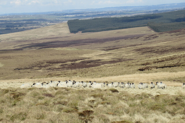
The hill is characterized by its distinct conical shape and is covered in heather and grass, creating a vibrant and colorful display during the summer months. It offers stunning panoramic views of the surrounding countryside, including the nearby towns and villages, as well as the expansive moorlands that stretch out towards the horizon.
Mid Hill is a popular destination for outdoor enthusiasts, particularly hikers and hillwalkers, who are drawn to its challenging yet rewarding trails. There are several well-marked paths that lead to the summit, providing varying levels of difficulty for different skill levels. The ascent can be steep in places, but the effort is rewarded with breathtaking views at the top.
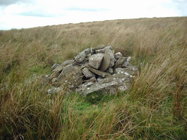
The hill is also home to a diverse range of wildlife, including various bird species, such as curlews and red grouse, as well as small mammals like hares and voles. The surrounding area is dotted with ancient stone circles and burial cairns, adding a touch of historical significance to the natural beauty of Mid Hill.
Overall, Mid Hill in Ayrshire offers a captivating blend of natural beauty, challenging terrain, and historical intrigue, making it a must-visit destination for nature lovers and adventure seekers alike.
If you have any feedback on the listing, please let us know in the comments section below.
Mid Hill Images
Images are sourced within 2km of 55.54653/-4.2393146 or Grid Reference NS5830. Thanks to Geograph Open Source API. All images are credited.


Mid Hill is located at Grid Ref: NS5830 (Lat: 55.54653, Lng: -4.2393146)
Unitary Authority: East Ayrshire
Police Authority: Ayrshire
What 3 Words
///defended.remedy.spruced. Near Darvel, East Ayrshire
Nearby Locations
Related Wikis

Garpel Linn
Garpel Linn is a waterfall of Scotland. == See also == Waterfalls of Scotland == References ==
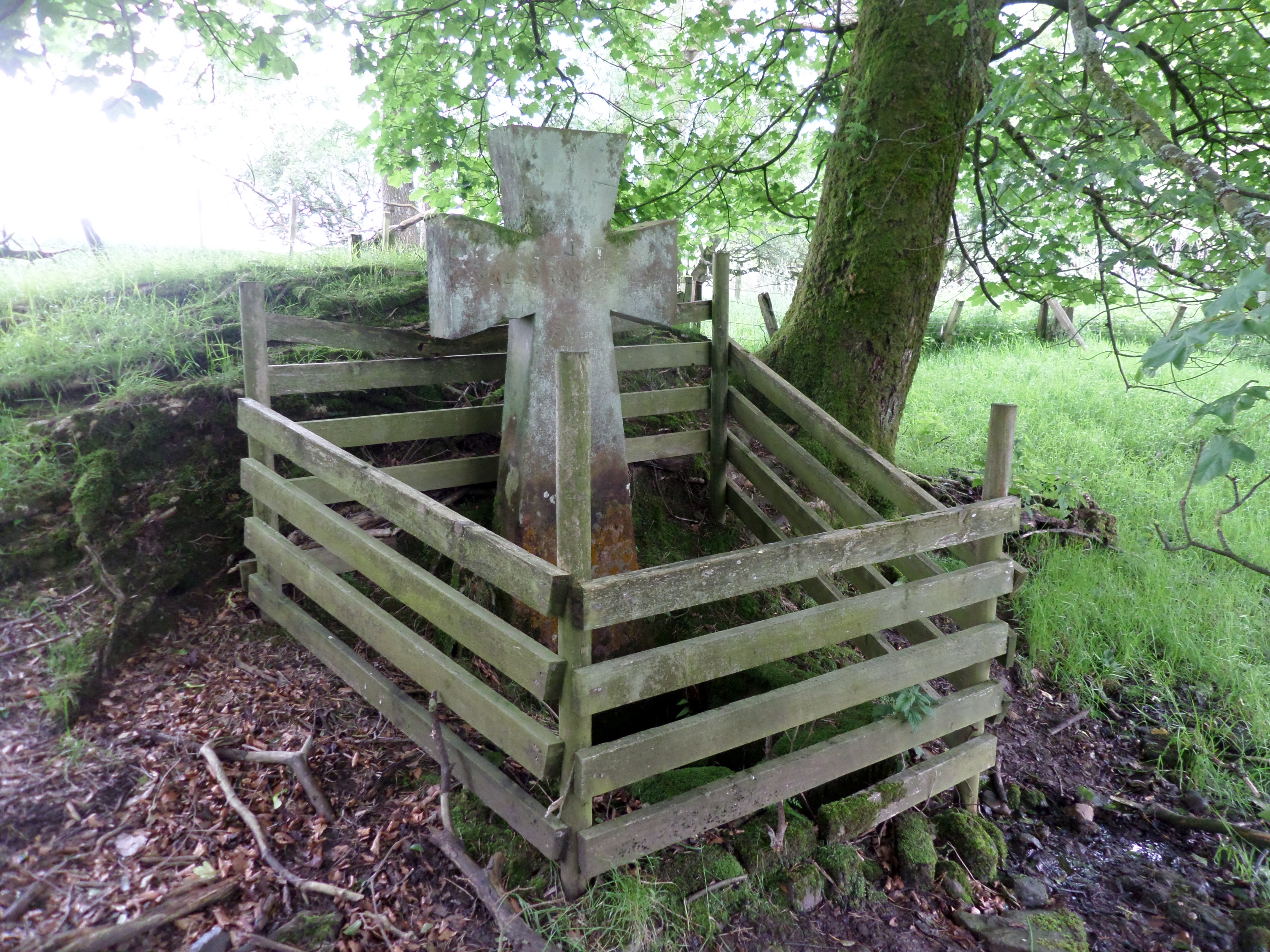
Lady's Well, Auchmannoch
The Lady's Well is a natural spring surmounted by a large cross that stands beside the Stra Burn Ford (NS254630) near Auchmannoch House in the Parish of...
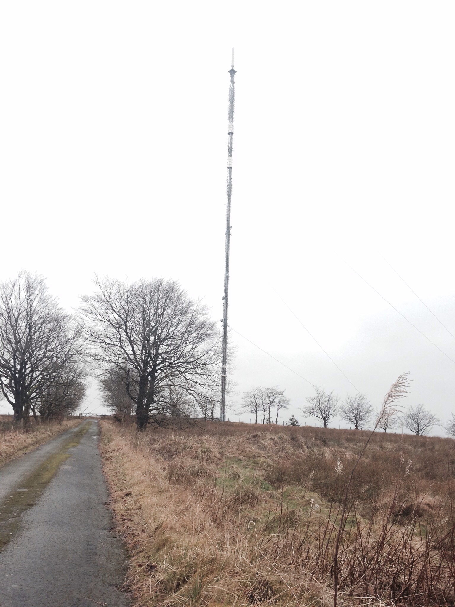
Darvel transmitting station
Darvel transmitting station is a broadcasting and telecommunications facility located near Darvel, East Ayrshire, Scotland (grid reference NS5567234132...

Sorn, East Ayrshire
Sorn (Scottish Gaelic: Sorn, meaning a kiln) is a small village in East Ayrshire, Scotland. It is situated on the River Ayr. It has a population of roughly...
Nearby Amenities
Located within 500m of 55.54653,-4.2393146Have you been to Mid Hill?
Leave your review of Mid Hill below (or comments, questions and feedback).