Hive

Settlement in Yorkshire

England

Hive

Sandholme Road Looking along Sandholme Road immediately south of the bridge over the M62.
Sandholme Road Credit: DS Pugh

Hive is a small village located in the county of Yorkshire, England. Situated in the northern part of the county, it lies within the picturesque Yorkshire Dales National Park. With a population of around 500 residents, Hive is known for its tranquil atmosphere and stunning natural surroundings.

The village itself is characterized by its traditional stone-built houses and narrow, winding streets. It has a charming village green, where locals often gather for community events and festivals. The centerpiece of Hive is the historic St. Mary's Church, which dates back to the 12th century and attracts visitors with its beautiful architecture and peaceful setting.

The Yorkshire Dales National Park, which surrounds Hive, offers a wealth of outdoor activities for nature enthusiasts. The rolling hills, expansive moorland, and crystal-clear rivers provide the perfect backdrop for hiking, cycling, and wildlife spotting. The park is also home to several scenic walking trails, including the famous Pennine Way and the Three Peaks Challenge, which attracts many adventurous hikers each year.

Hive is well-connected to neighboring towns and cities, with regular bus services and easy access to major road networks. The village also boasts a few local amenities, including a pub, a village shop, and a primary school.

Overall, Hive offers a peaceful and idyllic setting for those seeking a rural escape. Its natural beauty and community spirit make it a popular destination for both locals and visitors looking to immerse themselves in the charm of the Yorkshire Dales.

If you have any feedback on the listing, please let us know in the comments section below.
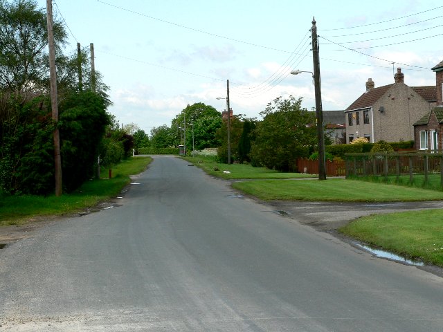
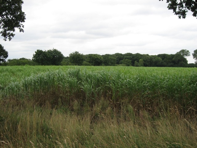
Hive Images

Images are sourced within 2km of 53.769047/-0.7548 or Grid Reference SE8231. Thanks to Geograph Open Source API. All images are credited.

Sandholme Road Looking along Sandholme Road immediately south of the bridge over the M62.
Sandholme Road
Looking along Sandholme Road immediately south of the bridge over the M62.
Edge of Gilberdyke Looking along Sandholme Road immediately south of the bridge over the M62.
Edge of Gilberdyke
Looking along Sandholme Road immediately south of the bridge over the M62.
Shops on Clementhorpe Road The postbox has a woollen top to celebrate the coronation.
Shops on Clementhorpe Road
The postbox has a woollen top to celebrate the coronation.
Farms Lane Looking south from Sandholme Road east of Eastrington.
Farms Lane
Looking south from Sandholme Road east of Eastrington.
Fields east of Mill Farm Looking north from Sandholme Road to the east of Eastrington. Ahead the course of the former Hull & Barnsley railway line can still be discerned. For information on the railway see: <span class="nowrap"><a title="https://en.wikipedia.org/wiki/Hull_and_Barnsley_Railway" rel="nofollow ugc noopener" href="https://en.wikipedia.org/wiki/Hull_and_Barnsley_Railway">Link</a><img style="margin-left:2px;" alt="External link" title="External link - shift click to open in new window" src="https://s1.geograph.org.uk/img/external.png" width="10" height="10"/></span>
Fields east of Mill Farm
Looking north from Sandholme Road to the east of Eastrington. Ahead the course of the former Hull & Barnsley railway line can still be discerned. For information on the railway see: LinkExternal link
Towards Owsthorpe Gatehouse Looking towards the course of the former Hull and Barnsley Railway with a gatehouse that protected the crossing to Owsthorpe Farm. Information on the railway can be found at: <span class="nowrap"><a title="https://en.wikipedia.org/wiki/Hull_and_Barnsley_Railway" rel="nofollow ugc noopener" href="https://en.wikipedia.org/wiki/Hull_and_Barnsley_Railway">Link</a><img style="margin-left:2px;" alt="External link" title="External link - shift click to open in new window" src="https://s1.geograph.org.uk/img/external.png" width="10" height="10"/></span>
Towards Owsthorpe Gatehouse
Looking towards the course of the former Hull and Barnsley Railway with a gatehouse that protected the crossing to Owsthorpe Farm. Information on the railway can be found at: LinkExternal link
Rape north of Mill Lane Looking towards the course of the Hull and Barnsley Railway.
Rape north of Mill Lane
Looking towards the course of the Hull and Barnsley Railway.
Fields south of Mill Lane Looking across farmland from Mill Lane between Eastrington and Sandholme.
Fields south of Mill Lane
Looking across farmland from Mill Lane between Eastrington and Sandholme.
Mill Lane towards Eastrington Looking along Mill Lane between Eastrington and Sandholme.
Mill Lane towards Eastrington
Looking along Mill Lane between Eastrington and Sandholme.
Glasshouses north of Mill Lane Looking along Mill Lane between Eastrington and Sandholme. The glasshouse was being used to grow strawberries.
Glasshouses north of Mill Lane
Looking along Mill Lane between Eastrington and Sandholme. The glasshouse was being used to grow strawberries.
Glasshouse of strawberries Situated north of Mill Lane between Eastrington and Sandholme. The glasshouse was being used to grow strawberries.
Glasshouse of strawberries
Situated north of Mill Lane between Eastrington and Sandholme. The glasshouse was being used to grow strawberries.
Glasshouse beside Mill Lane Looking along Mill Lane between Eastrington and Sandholme. The glasshouse was being used to grow strawberries.
Glasshouse beside Mill Lane
Looking along Mill Lane between Eastrington and Sandholme. The glasshouse was being used to grow strawberries.
Sign for Sandholme Looking along Mill Lane between Eastrington and Sandholme.
Sign for Sandholme
Looking along Mill Lane between Eastrington and Sandholme.
Road junction in Sandholme Old Trough Lane meets Mill Lane.
Road junction in Sandholme
Old Trough Lane meets Mill Lane.
Old Trough Lane meets Sandholme Road The junction also sees Blacktoft Grange Road and Anserdam Lane meeting.
Old Trough Lane meets Sandholme Road
The junction also sees Blacktoft Grange Road and Anserdam Lane meeting.
Blacktoft Grange Road meets Leavens Lane Blacktoft Grange Road turns to the left to head to the farm with Leavens Lane ahead.
Blacktoft Grange Road meets Leavens Lane
Blacktoft Grange Road turns to the left to head to the farm with Leavens Lane ahead.
Track to Blacktoft Grange Looking along Blacktoft Grange Road just north of the junction with Leavens Lane.
Track to Blacktoft Grange
Looking along Blacktoft Grange Road just north of the junction with Leavens Lane.
Leavens Lane Taken from Blacktoft Grange Road where it meets Leavens Lane. Leavens Lane becomes a footpath leading to Drain Lane.
Leavens Lane
Taken from Blacktoft Grange Road where it meets Leavens Lane. Leavens Lane becomes a footpath leading to Drain Lane.
Show me another place!

Hive is located at Grid Ref: SE8231 (Lat: 53.769047, Lng: -0.7548)

Division: East Riding

Unitary Authority: East Riding of Yorkshire

Police Authority: Humberside

What 3 Words

///speedy.trudges.doormat. Near Gilberdyke, East Yorkshire

Related Wikis

Hive, East Riding of Yorkshire

Hive is a hamlet in the East Riding of Yorkshire, England. It is situated approximately 8 miles (13 km) west of Brough and 7 miles (11 km) north-east...

Sandholme, East Riding of Yorkshire

Sandholme is a hamlet in the East Riding of Yorkshire, England. It is situated approximately 8 miles (13 km) west of Brough and 7 miles (11 km) north...

Sandholme railway station

Sandholme railway station was a station on the Hull and Barnsley Railway, and served the hamlet of Sandholme in the East Riding of Yorkshire, England....

Owsthorpe

Owsthorpe is a small hamlet in the East Riding of Yorkshire, England. It is situated approximately 6 miles (9.7 km) north-east of Goole and lies 1 mile...

Nearby Amenities

Located within 500m of 53.769047,-0.7548
Hive
Is In: East Riding of Yorkshire, England, UK
Is In County: East Riding of Yorkshire
Place: hamlet
Wikidata: Q5872770
Lat/Long: 53.7680818/-0.7560435
Telephone
Booth: KX100
Covered: booth
Lat/Long: 53.7662745/-0.7492108
The data included in this document is from www.openstreetmap.org. The data is made available under ODbL.

Have you been to Hive?

Leave your review of Hive below (or comments, questions and feedback).