Bryn Banog

Hill, Mountain in Caernarfonshire

Wales

Bryn Banog

Retaining Stone View of part of the retaining wall, along the course of the Gorseddau tramway.
At Gorseddau Slate Quarry, in Cwmsystradllyn, near Porthmadog, North Wales.
Retaining Stone Credit: D M Wilmot

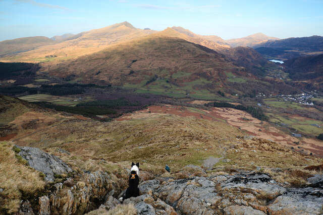
Bryn Banog is a stunning hill located in the county of Caernarfonshire, Wales. Rising to an elevation of approximately 1,093 feet (333 meters), it offers breathtaking panoramic views of the surrounding landscape. Situated near the village of Llanrug, Bryn Banog is a popular destination for outdoor enthusiasts and nature lovers.

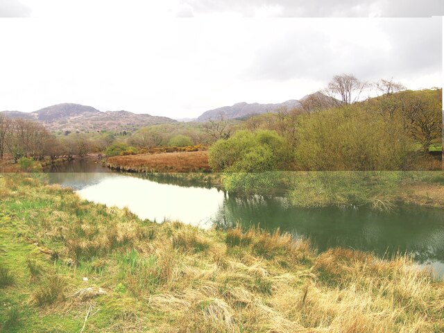
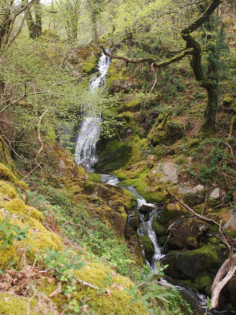
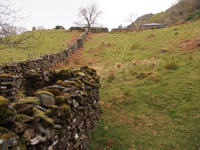
The hill is characterized by its rugged terrain, covered with heather and grasses, providing a habitat for a variety of wildlife. Walking trails wind their way up the hill, allowing visitors to explore its beauty at their own pace. As one ascends, the views become increasingly dramatic, revealing the vast expanse of Snowdonia National Park and the surrounding mountains.

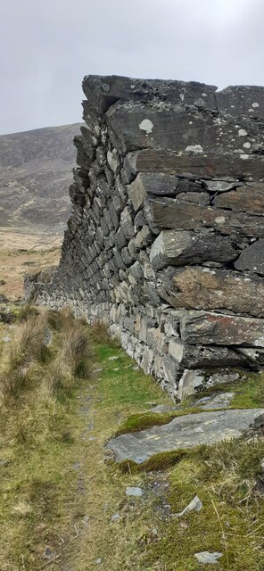
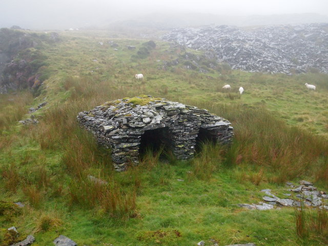
Bryn Banog is also home to an ancient hillfort, believed to date back to the Iron Age. The remains of the fortification can still be seen, offering a glimpse into the region's rich history. Archaeological excavations have uncovered artifacts from this period, shedding light on the lives of the people who once inhabited the area.

For those seeking adventure, Bryn Banog provides an ideal location for paragliding and hang gliding. Its elevated position and favorable winds attract enthusiasts from far and wide, who soar through the skies above the hill, taking in the breathtaking views from a unique vantage point.

Overall, Bryn Banog is a must-visit destination for nature lovers, history enthusiasts, and adventure seekers alike. With its stunning views, rich cultural heritage, and range of outdoor activities, it offers a truly unforgettable experience for all who visit.

If you have any feedback on the listing, please let us know in the comments section below.

Bryn Banog Images

Images are sourced within 2km of 52.989004/-4.1230069 or Grid Reference SH5745. Thanks to Geograph Open Source API. All images are credited.

Retaining Stone View of part of the retaining wall, along the course of the Gorseddau tramway.
At Gorseddau Slate Quarry, in Cwmsystradllyn, near Porthmadog, North Wales.
Retaining Stone
View of part of the retaining wall, along the course of the Gorseddau tramway. At Gorseddau Slate Quarry, in Cwmsystradllyn, near Porthmadog, North Wales.
Afon Glaslyn
Afon Glaslyn
Waterfall Below Plas Oerddwr
Converted Outbuilding in Coed Oerddwr
The Path to Llys From Coed Oerddwr
Nant Gwynant, Moel Ddu and Moel Hebog View of the peak Gallt y Wenallt on far right and the lake Llyn Gwynant, and in the distance (L to R) twin peaks of Moel y Gest near Porthmadog, and the snow-covered peaks of Moel Ddu and Moel Hebog. Midday on 12th December 2022. Ref:PC120122
Nant Gwynant, Moel Ddu and Moel Hebog
View of the peak Gallt y Wenallt on far right and the lake Llyn Gwynant, and in the distance (L to R) twin peaks of Moel y Gest near Porthmadog, and the snow-covered peaks of Moel Ddu and Moel Hebog. Midday on 12th December 2022. Ref:PC120122
Moel Hebog, Eryri Moel Hebog (782m) viewed from the B4418 road to the west of Rhyd-ddu. Ref:PC200078a3.
Moel Hebog, Eryri
Moel Hebog (782m) viewed from the B4418 road to the west of Rhyd-ddu. Ref:PC200078a3.
Starting the descent, NE ridge of Moel Hebog The line of descent shown as a green public footpath on the 1:25000 map would probably lead to some serious climbing (or a nasty accident), but the real footpath is also shown (though not as a right of way). From the summit, it starts well marked with cairns leading to the top of the first steep section (in places a little loose, but never really a scramble). A second steep section lies lower down (both of these lead to demoralising false summits if used as a route of ascent) which is probably easier, but a hazard we found was sudden gusts of wind descending the crags trying to knock one over - fortunately each gust only lasted a few seconds. By the time this photo was taken, the earlier rather dreich weather had improved to bring sunshine to the main massif of Snowdon, seen in the distance, but the gusts confirmed for us that our abandonment of the "A" plan to climb the Watkin Path was probably the right choice.
Starting the descent, NE ridge of Moel Hebog
The line of descent shown as a green public footpath on the 1:25000 map would probably lead to some serious climbing (or a nasty accident), but the real footpath is also shown (though not as a right of way). From the summit, it starts well marked with cairns leading to the top of the first steep section (in places a little loose, but never really a scramble). A second steep section lies lower down (both of these lead to demoralising false summits if used as a route of ascent) which is probably easier, but a hazard we found was sudden gusts of wind descending the crags trying to knock one over - fortunately each gust only lasted a few seconds. By the time this photo was taken, the earlier rather dreich weather had improved to bring sunshine to the main massif of Snowdon, seen in the distance, but the gusts confirmed for us that our abandonment of the "A" plan to climb the Watkin Path was probably the right choice.
Moel Hebog summit After climbing the NW ridge of Moel Hebog close to the wall seen on the left, these final few metres of easy gradient were a great relief (though the dog still had enough energy to run around barking and complaining that we'd stopped). Behind her, the peaks of Moel yr Ogof and Moel Lefn punctuate our route to get here, in a loop walk from Meillionen. Beyond again, the horizon marks out the long ridge of Garnedd Goch, Craig Cwm Silyn, Mynydd Tal-y-mignedd and Trum y Ddysgl. A longer walk for another day with more daylight...
Moel Hebog summit
After climbing the NW ridge of Moel Hebog close to the wall seen on the left, these final few metres of easy gradient were a great relief (though the dog still had enough energy to run around barking and complaining that we'd stopped). Behind her, the peaks of Moel yr Ogof and Moel Lefn punctuate our route to get here, in a loop walk from Meillionen. Beyond again, the horizon marks out the long ridge of Garnedd Goch, Craig Cwm Silyn, Mynydd Tal-y-mignedd and Trum y Ddysgl. A longer walk for another day with more daylight...
How did you get down there, mum ? There are two steep, rocky sections, in places a little scrambly, on the northeasterly descent from Moel Hebog, and this is about halfway down the lower, and easier, of the two, on which the dogs can find their way down mostly unsupervised, though they are inclined to take their time and watch carefully where their people have chosen to go. Usually, the route is picked out, and the beast rushes down just as the photographer prepares to press the shutter release. On this occasion, Teasel remained in place just long enough to be the perfect photographer's minion, enjoying the view to the fading light on Snowdon and Yr Aran - the latter becoming more prominent in the view as we lost height towards Beddgelert.
How did you get down there, mum ?
There are two steep, rocky sections, in places a little scrambly, on the northeasterly descent from Moel Hebog, and this is about halfway down the lower, and easier, of the two, on which the dogs can find their way down mostly unsupervised, though they are inclined to take their time and watch carefully where their people have chosen to go. Usually, the route is picked out, and the beast rushes down just as the photographer prepares to press the shutter release. On this occasion, Teasel remained in place just long enough to be the perfect photographer's minion, enjoying the view to the fading light on Snowdon and Yr Aran - the latter becoming more prominent in the view as we lost height towards Beddgelert.
Old Milestone, A4085, Pont Aberglaslyn Carved in slate at the junction with the A498 on the parapet of the bridge crossing Afon Glaslyn. Penrhyn Deudraeth translates as "two beach peninsula". More milestones on the bridge or near see <a title="https://www.geograph.org.uk/stuff/list.php?title=Old+Milestone&gridref=SH5946" href="https://www.geograph.org.uk/stuff/list.php?title=Old+Milestone&gridref=SH5946">Link</a>

Inscription: Penrhyndeudraeth 6 Miles ☛

Milestone Society National ID: CAE_PYBD06a
Old Milestone, A4085, Pont Aberglaslyn
Carved in slate at the junction with the A498 on the parapet of the bridge crossing Afon Glaslyn. Penrhyn Deudraeth translates as "two beach peninsula". More milestones on the bridge or near see Link Inscription: Penrhyndeudraeth 6 Miles ☛ Milestone Society National ID: CAE_PYBD06a
Bridge House, A498, Pont Aberglaslyn Former Toll House opposite the bridge taking the A4085 to Penrhyndeudraeth (peninsula with two beaches). It would have originally served the Porthdinllaen & Nanthwynant Turnpike Trust.

Milestone Society National ID: GWY.BED02
Bridge House, A498, Pont Aberglaslyn
Former Toll House opposite the bridge taking the A4085 to Penrhyndeudraeth (peninsula with two beaches). It would have originally served the Porthdinllaen & Nanthwynant Turnpike Trust. Milestone Society National ID: GWY.BED02
Ruined Stable Near Plas-llyn The Gorseddau tramway runs along the side of this building.
Ruined Stable Near Plas-llyn
The Gorseddau tramway runs along the side of this building.
Blast Shelter, Gorseddau Quarry
Old Milestone Old milestone on the A498 near to Pont Aberglaslyn, Gwynedd. For overall view see <a title="https://www.geograph.org.uk/photo/4775971" href="https://www.geograph.org.uk/photo/4775971">Link</a>
Old Milestone
Old milestone on the A498 near to Pont Aberglaslyn, Gwynedd. For overall view see Link
Tremadog 5 Old milestone on the A.498 near to Pont Aberglaslyn, Gwynedd. For close up view see <a title="https://www.geograph.org.uk/photo/4775961" href="https://www.geograph.org.uk/photo/4775961">Link</a>
Tremadog 5
Old milestone on the A.498 near to Pont Aberglaslyn, Gwynedd. For close up view see Link
View NE from the upper slopes of Moel Hebog This viewpoint gives a comprehensive view of the Snowdon Massif, including Yr Wyddfa, Crib Goch, Lliwedd and Yr Aran.
View NE from the upper slopes of Moel Hebog
This viewpoint gives a comprehensive view of the Snowdon Massif, including Yr Wyddfa, Crib Goch, Lliwedd and Yr Aran.
Nantgwynant from the summit of Moel Hebog On the left of the Nantgwynant Pass is the Snowdon Massif, and on the right, the familiar outline of Moel Siabod.
Nantgwynant from the summit of Moel Hebog
On the left of the Nantgwynant Pass is the Snowdon Massif, and on the right, the familiar outline of Moel Siabod.
Show me another place!

Bryn Banog is located at Grid Ref: SH5745 (Lat: 52.989004, Lng: -4.1230069)

Unitary Authority: Gwynedd

Police Authority: North Wales

What 3 Words

///rebounds.browsers.dislikes. Near Porthmadog, Gwynedd

Nearby Locations

Ffrîdd y Bwlch Bryn Banog

Related Wikis

Moel Lefn

Moel Lefn is a summit in Snowdonia. It is a subsidiary peak of Moel Hebog and a sister peak of Moel yr Ogof. Its summit marks the end of the Hebog ridge...

Moel Hebog

Moel Hebog (Welsh for Bare Hill of the Hawk) is a mountain in Snowdonia, north Wales which dominates the view west from the village of Beddgelert. It...
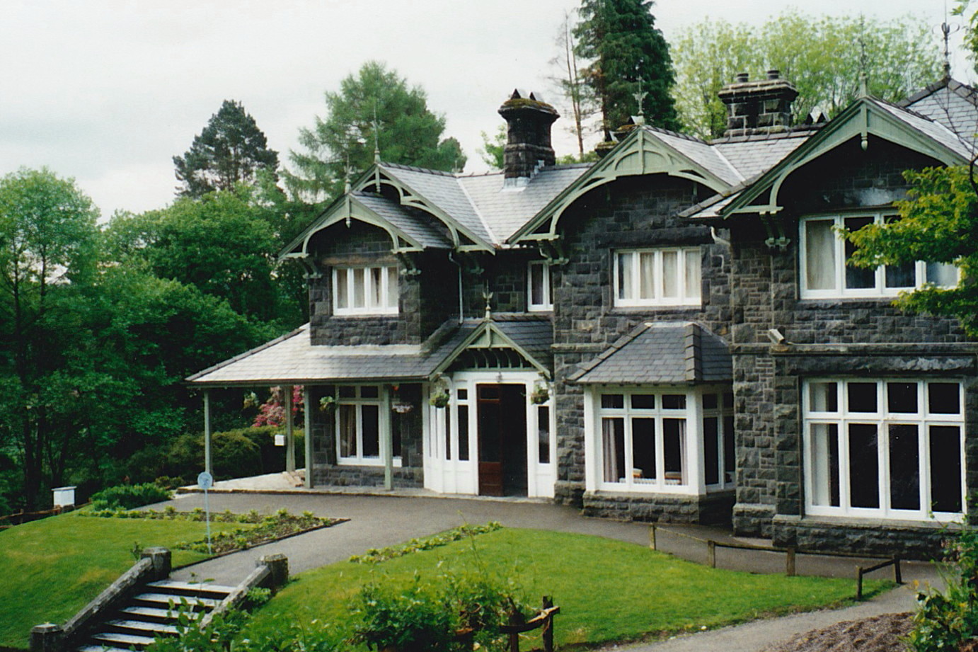
Aberglaslyn Hall

Aberglaslyn Hall is an outdoor learning centre near Beddgelert, North Wales on the edge of the Snowdonia National Park. The hall was purchased by Leicestershire...

Pont Aberglaslyn

Pont Aberglaslyn is a stone arch bridge over the Afon Glaslyn and the surrounding hamlet, located near Beddgelert and Nantmor in Gwynedd, north-west Wales...

Nearby Amenities

Located within 500m of 52.989004,-4.1230069
Bryn Banog
Ele: 520
Natural: peak
Wikidata: Q20584854
Lat/Long: 52.9899327/-4.1229496
The data included in this document is from www.openstreetmap.org. The data is made available under ODbL.

Have you been to Bryn Banog?

Leave your review of Bryn Banog below (or comments, questions and feedback).