Banc Disgwylfa

Hill, Mountain in Carmarthenshire

Wales

Banc Disgwylfa

Heol Rhandir Gini Road Cerddwyr yn dilyn hen heol i gyfeiriad Rhandir Gini (adfail)

Walkers following an old road in the direction of the ruined property known as Rhandir Gini.
Heol Rhandir Gini Road Credit: Alan Richards

Banc Disgwylfa is a prominent hill located in Carmarthenshire, Wales. Situated in the western part of the county, it stands at an elevation of approximately 335 meters (1,099 feet) above sea level. The hill is part of the Preseli Hills range, which stretches across Pembrokeshire and Carmarthenshire.

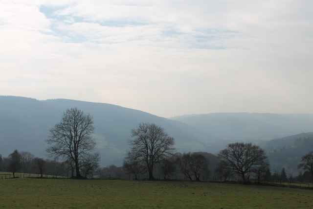
Banc Disgwylfa offers breathtaking panoramic views of the surrounding countryside. On a clear day, visitors can admire the picturesque landscapes of Carmarthenshire, with rolling green hills, meandering rivers, and quaint villages scattered throughout the region. The hill is particularly renowned for its stunning views of the Preseli Hills, which encompass a diverse range of natural beauty, including moorlands, heathlands, and rocky outcrops.

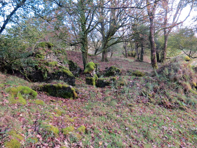
In addition to its scenic appeal, Banc Disgwylfa also holds historical significance. The area is known for its connection to the Neolithic era, with nearby sites such as Carn Menyn, believed to be the source of the famous bluestones used in the construction of Stonehenge. The hill itself has remnants of ancient settlements and burial sites, adding to its archaeological importance.

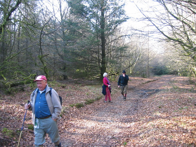
Banc Disgwylfa attracts outdoor enthusiasts, hikers, and nature lovers who enjoy exploring its trails and experiencing its tranquil atmosphere. The hill offers a variety of walking routes, ranging from gentle strolls to more challenging hikes. Its location within the Preseli Hills also makes it a popular destination for birdwatching, as numerous species of birds can be spotted in the area.

Overall, Banc Disgwylfa in Carmarthenshire is a captivating hill that combines natural beauty, historical significance, and outdoor recreation, making it a must-visit destination for those exploring the Welsh countryside.

If you have any feedback on the listing, please let us know in the comments section below.

Banc Disgwylfa Images

Images are sourced within 2km of 51.994009/-4.0883902 or Grid Reference SN5634. Thanks to Geograph Open Source API. All images are credited.
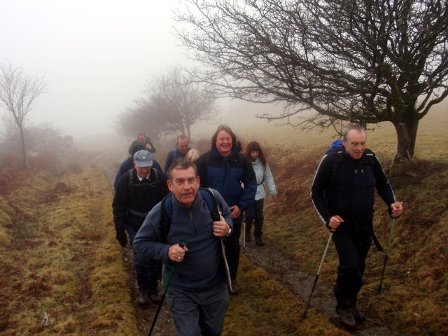
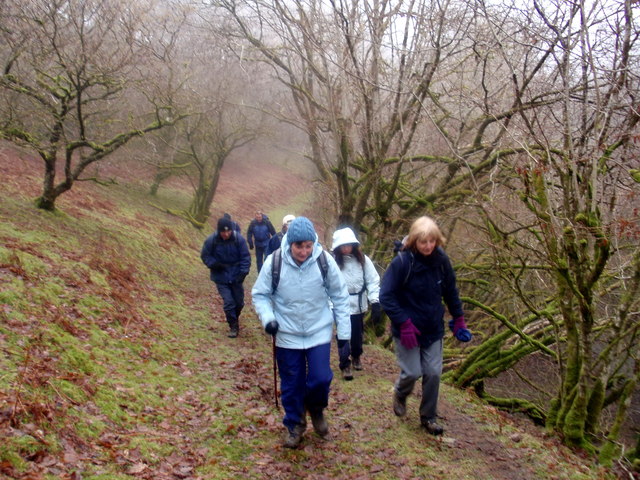
Heol Rhandir Gini Road Cerddwyr yn dilyn hen heol i gyfeiriad Rhandir Gini (adfail)

Walkers following an old road in the direction of the ruined property known as Rhandir Gini.
Heol Rhandir Gini Road
Cerddwyr yn dilyn hen heol i gyfeiriad Rhandir Gini (adfail) Walkers following an old road in the direction of the ruined property known as Rhandir Gini.
Ger Banc Disgwylfa / Near Banc Disgwylfa Cerddwyr yn agosau at Fryn Disgwylfa.

Walkers going in the direction of Bryn Disgwylfa (trans. lookout hill).
Ger Banc Disgwylfa / Near Banc Disgwylfa
Cerddwyr yn agosau at Fryn Disgwylfa. Walkers going in the direction of Bryn Disgwylfa (trans. lookout hill).
Ger Ffarm y Banc / Near Banc Farm Cerddwyr yn dilyn cilfordd ucheldir ger Ffarm y Banc i gyfeiriad Abergorlech.

Walkers following an upland byway near Banc Farm in the direction of Abergorlech (trans. confluence of the Gorlech [stream]).
Ger Ffarm y Banc / Near Banc Farm
Cerddwyr yn dilyn cilfordd ucheldir ger Ffarm y Banc i gyfeiriad Abergorlech. Walkers following an upland byway near Banc Farm in the direction of Abergorlech (trans. confluence of the Gorlech [stream]).
Ger / Near Ffarm y Banc Farm Cerddywr yn dilyn heol ucheldir sy'n arwain i Ffarm y Banc.

Walkers following an upland access road to Banc Farm.
Ger / Near Ffarm y Banc Farm
Cerddywr yn dilyn heol ucheldir sy'n arwain i Ffarm y Banc. Walkers following an upland access road to Banc Farm.
Llwybr Ceffyl Llanfihangel Rhos y Corn Bridleway Cerddwyr yn dilyn llwybr ceffyl ger Eglwys Llanfihangel Rhos y Corn.

Walkers following a bridleway near Llanfihangel Rhos y Corn Church.
Llwybr Ceffyl Llanfihangel Rhos y Corn Bridleway
Cerddwyr yn dilyn llwybr ceffyl ger Eglwys Llanfihangel Rhos y Corn. Walkers following a bridleway near Llanfihangel Rhos y Corn Church.
Rhyd Nant Llwyd Ford Cerddwyr yn croesi Nant Llwyd.

Walkers fording Nant Llwyd stream.
Rhyd Nant Llwyd Ford
Cerddwyr yn croesi Nant Llwyd. Walkers fording Nant Llwyd stream.
Allt Fach Cerddwyr yn dilyn llwybr ceffyl o dan Allt Fach.

Walkers following a bridleway below Allt Fach (small wooded slope)
Allt Fach
Cerddwyr yn dilyn llwybr ceffyl o dan Allt Fach. Walkers following a bridleway below Allt Fach (small wooded slope)
Hen heol / Old road Cerddwyr yn dilyn hen heol i lawr y waered tuag at bentre Abergorlech.

Walkers descending along an old road in the direction of Aberegorlech.
Hen heol / Old road
Cerddwyr yn dilyn hen heol i lawr y waered tuag at bentre Abergorlech. Walkers descending along an old road in the direction of Aberegorlech.
Bank of Trees above the Gorlech At the confluence of Nant Llewele and the Gorlech
Bank of Trees above the Gorlech
At the confluence of Nant Llewele and the Gorlech
View from below Rhandir Gini
Ffarm Pantyfyda / Pantyfyda Farm Adfeilion tai mas Ffarm Pantyfyda.

Ruined outhouses at Pantyfyda Farm (trans. hollow of the ?beehive).
Ffarm Pantyfyda / Pantyfyda Farm
Adfeilion tai mas Ffarm Pantyfyda. Ruined outhouses at Pantyfyda Farm (trans. hollow of the ?beehive).
Ffarm Pantyfyda / Pantyfyda Farm Gweddillion Pantyfyda. Yn 1766 ganwyd Daniel Jones yma a rhwng 1792 a 1814 bu'n filwr yn y Fyddin Prydeinig a bu'n bresennol ym Mrwydr Maida yn 1806 yn Ne'r Eidal. Bu farw Daniel yn 1867 yn Llanedi lle bu ef a'i wraig Lydia yn cadw Tafarn y Black Boy a safai ym mynwent Eglwys Llanedi. Claddwyd ef a'i wraig ar yr un diwrnod.

The remains of Pantyfyda farmhouse (trans. hollow of the ?beehive). In 1766 Daniel Jones was born here and between 1792 and 1814 he had enlisted in the British Army and saw action at the Battle of Maida (1806) in southern Italy. Daniel died in Llanedi in 1867 where he resided in a small cottage within Llanedi churchyard and according to tradition it was also a public house known as the Black Boy. Daniel and his wife Lydia were buried on the same day.
Ffarm Pantyfyda / Pantyfyda Farm
Gweddillion Pantyfyda. Yn 1766 ganwyd Daniel Jones yma a rhwng 1792 a 1814 bu'n filwr yn y Fyddin Prydeinig a bu'n bresennol ym Mrwydr Maida yn 1806 yn Ne'r Eidal. Bu farw Daniel yn 1867 yn Llanedi lle bu ef a'i wraig Lydia yn cadw Tafarn y Black Boy a safai ym mynwent Eglwys Llanedi. Claddwyd ef a'i wraig ar yr un diwrnod. The remains of Pantyfyda farmhouse (trans. hollow of the ?beehive). In 1766 Daniel Jones was born here and between 1792 and 1814 he had enlisted in the British Army and saw action at the Battle of Maida (1806) in southern Italy. Daniel died in Llanedi in 1867 where he resided in a small cottage within Llanedi churchyard and according to tradition it was also a public house known as the Black Boy. Daniel and his wife Lydia were buried on the same day.
Church Llanfihangel Rhos y Corn church.
I need to go back with a wider lens!
Church
Llanfihangel Rhos y Corn church. I need to go back with a wider lens!
River at Abergorlech, early Spring The river runs down towards Abergorlech.
River at Abergorlech, early Spring
The river runs down towards Abergorlech.
Forest track
Forest track
Afon Cothi The river Cothi as it runs parallel to the B4310 road between Abergorlechand Nant-y-Ffin
Afon Cothi
The river Cothi as it runs parallel to the B4310 road between Abergorlechand Nant-y-Ffin
Brechfa MTB route On a St David's Day Mountain Bike Ride
Brechfa MTB route
On a St David's Day Mountain Bike Ride
Cyffordd ffyrdd fforest  /  Forest roads junction Yng nghanol y Fforest Brechfa / In the middle of the Brechfa Forest.
Cyffordd ffyrdd fforest / Forest roads junction
Yng nghanol y Fforest Brechfa / In the middle of the Brechfa Forest.
Show me another place!

Banc Disgwylfa is located at Grid Ref: SN5634 (Lat: 51.994009, Lng: -4.0883902)

Unitary Authority: Carmarthenshire

Police Authority: Dyfed Powys

What 3 Words

///worthy.material.circus. Near Llansawel, Carmarthenshire

Related Wikis

Abergorlech

Abergorlech is a village 8 miles (13 km) to the north-west of Llandeilo in Carmarthenshire, Wales. It lies on the River Cothi on the B4310 road, between...

Llanfihangel Rhos-y-Corn

Llanfihangel Rhos-y-Corn is a sparsely populated community of Carmarthenshire, Wales. The population of the community taken at the 2011 census was 468...

Brechfa Forest

The Brechfa Forest is a forest in Carmarthenshire, south Wales. Brechfa Forest is the 'modern' name for part of the ancient Glyn Cothi Forest. From before...

Gwernogle

Gwernogle is an isolated hamlet in Carmarthenshire, Wales, nestled in the Brechfa Forest. The Ty Cwrdd Welsh Independent Chapel is situated in the hamlet...

Rhydcymerau

Rhydcymerau is a small village 8.5 kilometres to the south-east of Llanybydder, around the side of Mynydd Llanybydder, in Carmarthenshire, south-west Wales...

Brechfa Forest Wind Farm

Brechfa Forest West Wind Farm is a wind farm in Brechfa Forest in Carmarthenshire in south west Wales. Construction of the wind farm began in November...

Llansawel

Llansawel is a village and community in Carmarthenshire, Wales, about ten miles north of Llandeilo. It covers an area of 4,079 hectares (15.75 sq mi)....

Llansawel transmitting station

The Llansawel television relay station is sited on high ground to the north of the village of Llansawel in Carmarthenshire, South Wales. It was originally...

Have you been to Banc Disgwylfa?

Leave your review of Banc Disgwylfa below (or comments, questions and feedback).