Beinn Sgiath

Hill, Mountain in Inverness-shire

Scotland

Beinn Sgiath

Allt an Iuill Moorland stream draining the northern slopes of Geal Charn into Loch na Lairige. A vast expanse of Monadhliath wilderness which may soon be blighted by windfarms if the scoping mast we saw to the north west is an omen.
Allt an Iuill Credit: Karl and Ali

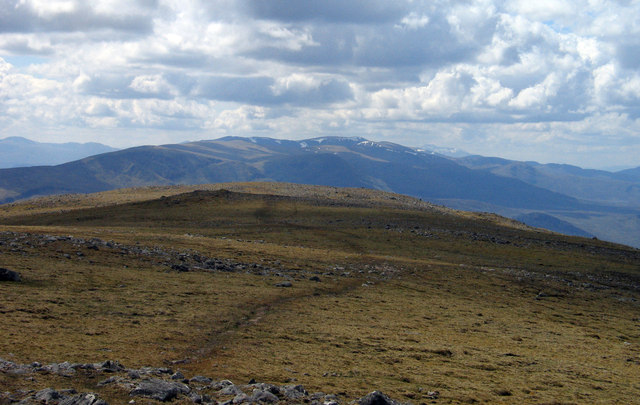
Beinn Sgiath is a prominent hill located in Inverness-shire, Scotland. It is part of the Cairngorms National Park and is known for its stunning views and challenging hiking trails. The hill stands at an elevation of 830 meters (2,723 feet) and offers panoramic views of the surrounding countryside, including the nearby town of Kingussie and the Spey Valley.

The terrain of Beinn Sgiath is rugged and rocky, with steep slopes and craggy outcrops, making it a popular destination for experienced hikers and climbers. The hill is also home to a variety of wildlife, including red deer, mountain hares, and golden eagles.

Hiking to the summit of Beinn Sgiath is a rewarding experience, with breathtaking views of the surrounding mountains and valleys. The climb is strenuous and requires good physical fitness and navigation skills, as the terrain can be challenging and the weather conditions unpredictable.

Overall, Beinn Sgiath is a beautiful and rugged hill that offers outdoor enthusiasts a unique and memorable hiking experience in the heart of the Scottish Highlands.

If you have any feedback on the listing, please let us know in the comments section below.
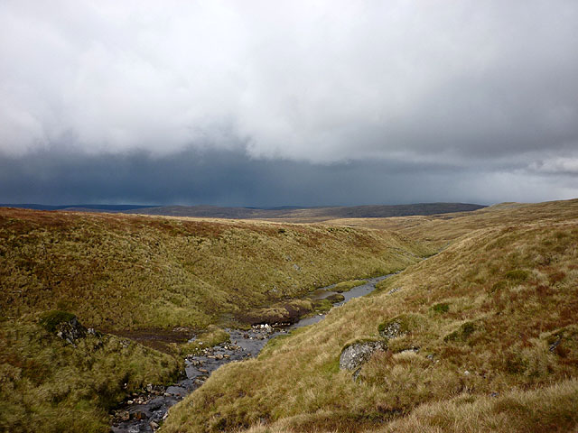
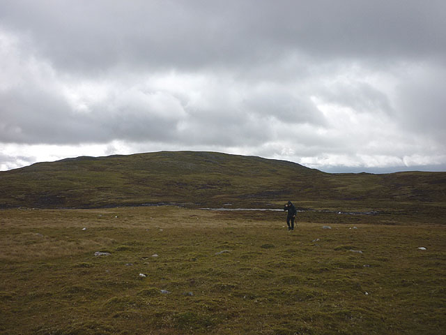
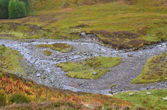
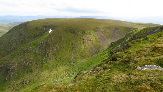
Beinn Sgiath Images

Images are sourced within 2km of 57.051753/-4.3648029 or Grid Reference NN5698. Thanks to Geograph Open Source API. All images are credited.

Allt an Iuill Moorland stream draining the northern slopes of Geal Charn into Loch na Lairige. A vast expanse of Monadhliath wilderness which may soon be blighted by windfarms if the scoping mast we saw to the north west is an omen.
Allt an Iuill
Moorland stream draining the northern slopes of Geal Charn into Loch na Lairige. A vast expanse of Monadhliath wilderness which may soon be blighted by windfarms if the scoping mast we saw to the north west is an omen.
Crossing moorland east of Allt an Iuill Geal Charn in the background.
Crossing moorland east of Allt an Iuill
Geal Charn in the background.
Course of the Markie Burn A patch of sunlight illuminating glacial deposits cut through by the burn. See also Richard Webb's photo <a href="https://www.geograph.org.uk/photo/129765">NN5896 : Sheep pens, Glen Markie</a>.
Course of the Markie Burn
A patch of sunlight illuminating glacial deposits cut through by the burn. See also Richard Webb's photo NN5896 : Sheep pens, Glen Markie.
Plantation edge, Glen Markie The upper corner of the plantation on the west bank of the Markie Burn.
Plantation edge, Glen Markie
The upper corner of the plantation on the west bank of the Markie Burn.
Braided course of the Markie Burn Compare the current course with that shown in Richard Webb's 2006 image: <a href="https://www.geograph.org.uk/photo/129763">NN5896 : River braiding.</a>.
Braided course of the Markie Burn
Compare the current course with that shown in Richard Webb's 2006 image: NN5896 : River braiding..
The Markie Burn The burn winds down between banks of glacial deposit in the higher part of the glen.
The Markie Burn
The burn winds down between banks of glacial deposit in the higher part of the glen.
An Dirc Mhòr The striking cleft of An Dirc Mhòr seen from its western end.
The distant mountains are beyond Glen Markie and are those at the west end of Glen Banchor.
An Dirc Mhòr
The striking cleft of An Dirc Mhòr seen from its western end. The distant mountains are beyond Glen Markie and are those at the west end of Glen Banchor.
Heading NE towards summit of Geal Charn
Geal Charn summit cairn
Cliffs on the eastern side of Geal Charn
Beinn Sgiath from Geal Charn
Uinneag Coire an Lochain, Geal Charn The wind funnelling through this gap made it difficult to stand up at this spot.
Uinneag Coire an Lochain, Geal Charn
The wind funnelling through this gap made it difficult to stand up at this spot.
On Beinn Sgiath - view towards Geal Charn A tiny cairn marks this unremarkable summit.
On Beinn Sgiath - view towards Geal Charn
A tiny cairn marks this unremarkable summit.
Descending SW from Beinn Sgiath A faint quad bike track can be followed southwest for some distance from the summit plateau of Beinn Sgiath.
Descending SW from Beinn Sgiath
A faint quad bike track can be followed southwest for some distance from the summit plateau of Beinn Sgiath.
Sheep pens beside the Markie Burn Sheep pens as seen from an estate road above the river. Beinn Sgiath, rising to Geal Charn is on the left side of the image.
Sheep pens beside the Markie Burn
Sheep pens as seen from an estate road above the river. Beinn Sgiath, rising to Geal Charn is on the left side of the image.
South-west ridge of Geal Charn The name Geal Charn appears many times on maps of the Scottish Highlands; this is one of four alone which are Munros. The view is along the broad south-west ridge with the Creag Meagaidh group distant.
South-west ridge of Geal Charn
The name Geal Charn appears many times on maps of the Scottish Highlands; this is one of four alone which are Munros. The view is along the broad south-west ridge with the Creag Meagaidh group distant.
Lochan a' Choire Lochan a' Choire is seen from the outflow of the stream draining it, the Piper's Burn. Geal Charn's broken east face rises beyond.
Lochan a' Choire
Lochan a' Choire is seen from the outflow of the stream draining it, the Piper's Burn. Geal Charn's broken east face rises beyond.
East bank of Markie Burn with hill slope above The Markie Burn has cut a remarkable profile through the landscape here with boulder clay (presumably) exposed at the water's edge overlain by an astonishing band of boulders. Above the boulder band lies recently accumulated peat and on top the current moorland vegetation. The continuing slope rises beyond, eventually to a ridge of Beinn a' Chràsgain.
East bank of Markie Burn with hill slope above
The Markie Burn has cut a remarkable profile through the landscape here with boulder clay (presumably) exposed at the water's edge overlain by an astonishing band of boulders. Above the boulder band lies recently accumulated peat and on top the current moorland vegetation. The continuing slope rises beyond, eventually to a ridge of Beinn a' Chràsgain.
Show me another place!

Beinn Sgiath is located at Grid Ref: NN5698 (Lat: 57.051753, Lng: -4.3648029)

Unitary Authority: Highland

Police Authority: Highlands and Islands

What 3 Words

///senses.intruding.calculating. Near Newtonmore, Highland

Related Wikis

Dùn dà Làmh

Dùn dà Làmh is a Pictish now ruined hill fort near Laggan in the Scottish Highlands. It became a scheduled monument in 1986, with an extension to the protected...

Laggan, Badenoch

Laggan (Gaelic: Lagan ) is a village in Badenoch, in the Highland region of Scotland. It is beside the River Spey, about 10 km west of Newtonmore. The...

Càrn Dearg, Monadh Liath

Càrn Dearg is the highest peak of the Monadh Liath mountains in the Highlands of Scotland. Its eastern flanks slope steeply down into Glen Ballach, while...

Catlodge

Catlodge (Scottish Gaelic: Caitleag) is a hamlet, in the district of Newtonmore in Inverness-shire, Scottish Highlands and is in the Scottish council...

Nearby Amenities

Located within 500m of 57.051753,-4.3648029
Beinn Sgiath
Ele: 867
Natural: peak
Lat/Long: 57.0491094/-4.3665186
The data included in this document is from www.openstreetmap.org. The data is made available under ODbL.

Have you been to Beinn Sgiath?

Leave your review of Beinn Sgiath below (or comments, questions and feedback).