Meall Odhar Loch Monaidh

Hill, Mountain in Perthshire

Scotland

Meall Odhar Loch Monaidh

Dawn light over Loch Monaidh Schiehallion in the distance.
Dawn light over Loch Monaidh Credit: Alan Reid

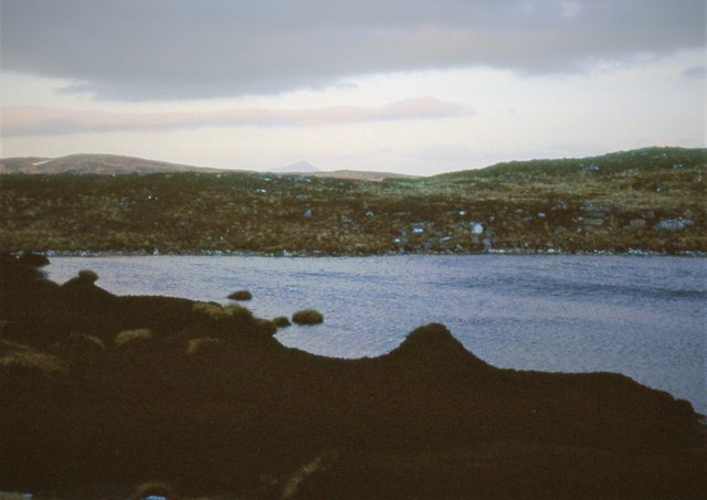
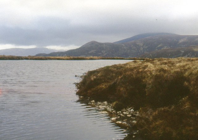
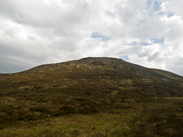
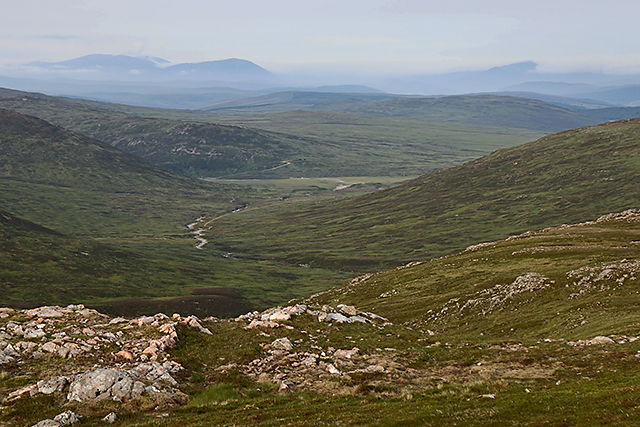
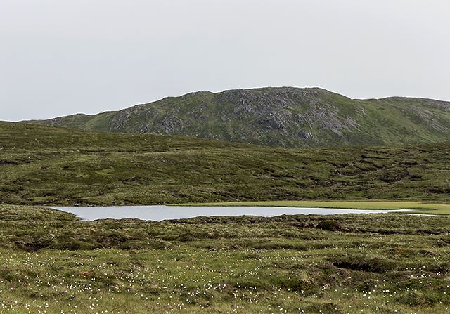
Meall Odhar Loch Monaidh is a prominent hill located in Perthshire, in the central region of Scotland. It is situated near the picturesque Loch Monaidh, adding to its scenic beauty and allure. Measuring approximately 578 meters (1,896 feet) in height, it offers stunning panoramic views of the surrounding landscape.

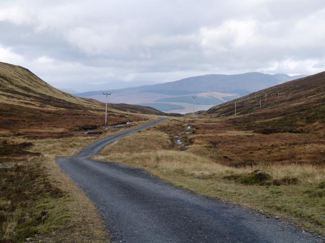
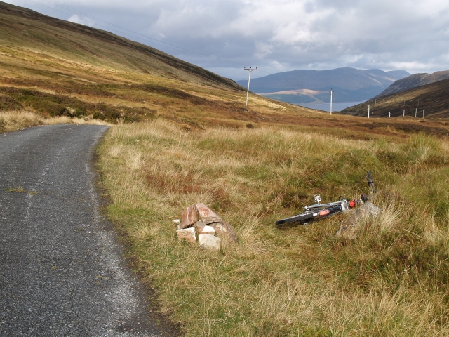
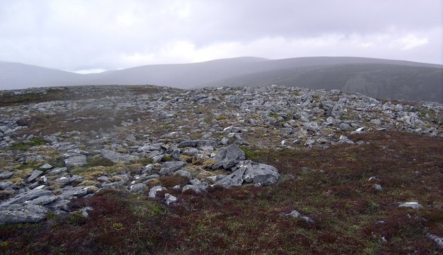
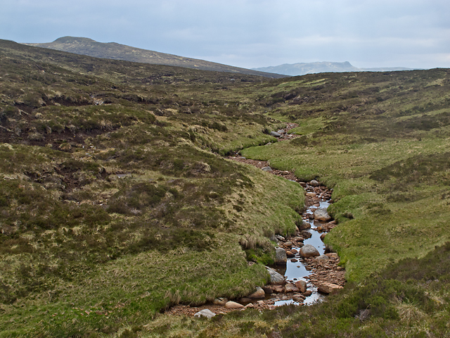
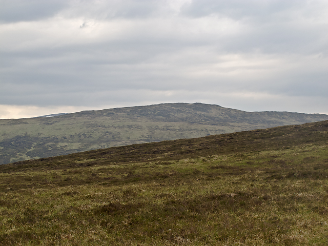
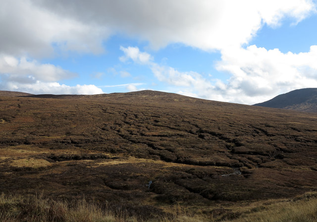
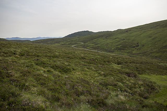
The hill is characterized by its distinct cone-shaped summit, covered with heather and grassy slopes. The terrain is generally rugged, with some rocky sections that require careful navigation. A well-defined path leads to the summit, making it accessible to hikers and outdoor enthusiasts.

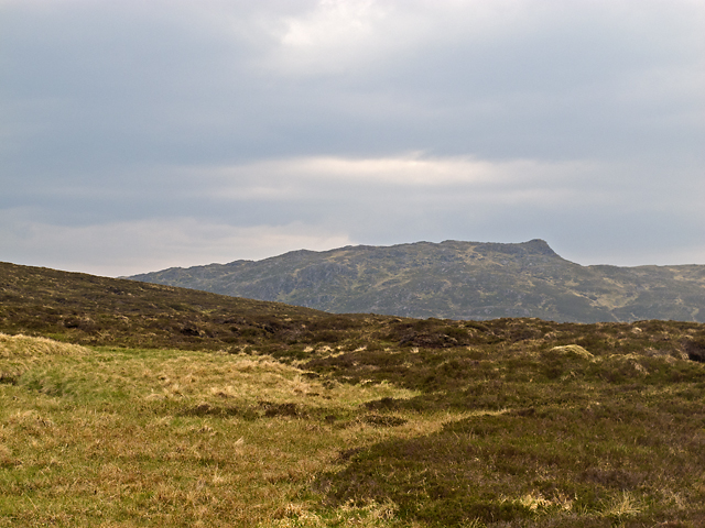
The hill is part of a larger range known as the Grampian Mountains, which stretch across Scotland. Meall Odhar Loch Monaidh stands out due to its unique geological features and its strategic location, providing a vantage point for observing the surrounding countryside.

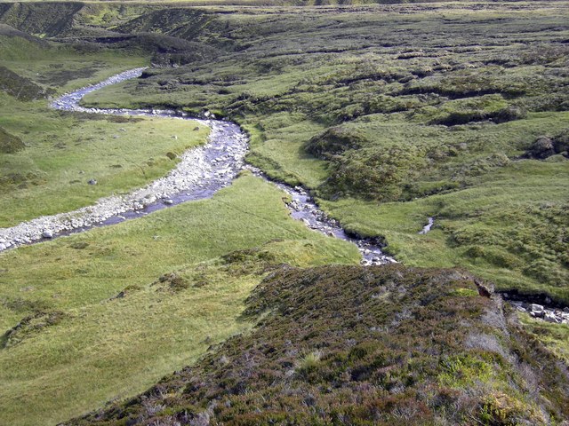
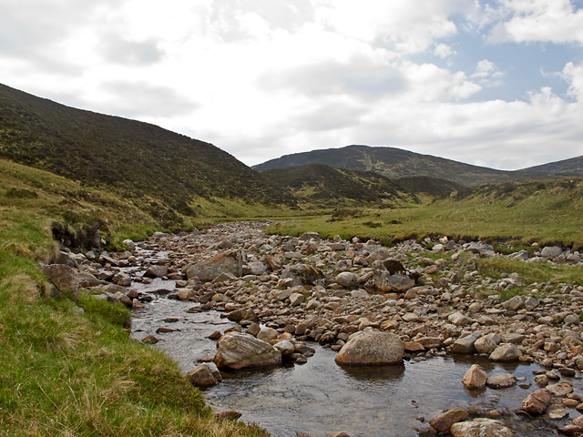
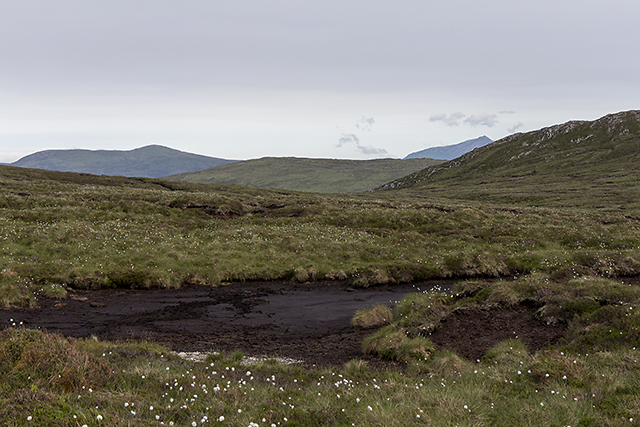
The summit offers breathtaking views of Loch Monaidh and the surrounding countryside, including the rolling hills, picturesque valleys, and distant mountains. On clear days, it is possible to see as far as the Cairngorms National Park, providing a truly awe-inspiring vista.

Meall Odhar Loch Monaidh is also home to a variety of wildlife, including deer, hares, and a wide range of bird species. The hill is a popular destination for nature lovers, photographers, and those seeking a peaceful retreat in the heart of Scotland's natural beauty.

Overall, Meall Odhar Loch Monaidh is a captivating hill in Perthshire, offering a blend of scenic splendor, challenging terrain, and abundant wildlife, making it a must-visit destination for outdoor enthusiasts.

If you have any feedback on the listing, please let us know in the comments section below.

Meall Odhar Loch Monaidh Images

Images are sourced within 2km of 56.786264/-4.3488002 or Grid Reference NN5668. Thanks to Geograph Open Source API. All images are credited.

Dawn light over Loch Monaidh Schiehallion in the distance.
Dawn light over Loch Monaidh
Schiehallion in the distance.
Lochan on Glas Meall Mòr Beinn Udlamain in the clouds.
Lochan on Glas Meall Mòr
Beinn Udlamain in the clouds.
Private road, Allt an Sgailean. On the descent to Coire Lodge.
Private road, Allt an Sgailean.
On the descent to Coire Lodge.
Highest point on the Coire Lodge road. The cairn marks the highest point at 634m.  Looking down into Loch Ericht.
Highest point on the Coire Lodge road.
The cairn marks the highest point at 634m. Looking down into Loch Ericht.
Glas Mheall a' Chumhainn The rock strewn summit of Glas Mheall a' Chumhainn.
Glas Mheall a' Chumhainn
The rock strewn summit of Glas Mheall a' Chumhainn.
Allt na Glaise The Allt na Glaise and the outflow from Loch Monaidh.
Allt na Glaise
The Allt na Glaise and the outflow from Loch Monaidh.
Allt Shallainn The upper region of the Allt Shallainn, a seldom visited area lying to the south of the Munros Sgairneach Mhor and Beinn Udlamain. The river system here (Allt Shallainn > Allt Feith Gharuiareagan > Allt an Sgailean) offers a relatively easy passage from Loch Garry to Loch Ericht in the absence of any paths or tracks.
Allt Shallainn
The upper region of the Allt Shallainn, a seldom visited area lying to the south of the Munros Sgairneach Mhor and Beinn Udlamain. The river system here (Allt Shallainn > Allt Feith Gharuiareagan > Allt an Sgailean) offers a relatively easy passage from Loch Garry to Loch Ericht in the absence of any paths or tracks.
Glas Mheall Mor The northern slopes of Glas Mheall Mor, viewed from the banks of the Allt Feith Gharuiareagan. This is seldom frequented country, and difficult walking, many kilometres from the nearest road.
Glas Mheall Mor
The northern slopes of Glas Mheall Mor, viewed from the banks of the Allt Feith Gharuiareagan. This is seldom frequented country, and difficult walking, many kilometres from the nearest road.
Allt Feith Gharuiareagan The Allt Feith Gharuiareagan, flowing through seldom frequented country between Loch Garry and Loch Ericht. Boggy ground and peat hags make for difficult walking here.
Allt Feith Gharuiareagan
The Allt Feith Gharuiareagan, flowing through seldom frequented country between Loch Garry and Loch Ericht. Boggy ground and peat hags make for difficult walking here.
Meallanan Odhar The northern flank of Meallanan Odhar, very remote country in the Talla Bheith Forest between Loch Garry and Loch Ericht.
Meallanan Odhar
The northern flank of Meallanan Odhar, very remote country in the Talla Bheith Forest between Loch Garry and Loch Ericht.
Stob Loch Monaidh The lower slopes of Stob Loch Monaidh, with Stob an Aonaich Mhoir visible in the distance. These hills are situated in seldom frequented country between Loch Garry and Loch Ericht, and visiting this area requires a lengthy approach - a 30km return journey for me today.
Stob Loch Monaidh
The lower slopes of Stob Loch Monaidh, with Stob an Aonaich Mhoir visible in the distance. These hills are situated in seldom frequented country between Loch Garry and Loch Ericht, and visiting this area requires a lengthy approach - a 30km return journey for me today.
Peat haggs on western slope of Stob Loch Monaidh Stob Loch Monaidh is seen from the high point of the estate road passing between it and the Corbett, Stob an Aonaich Mhòir.
Peat haggs on western slope of Stob Loch Monaidh
Stob Loch Monaidh is seen from the high point of the estate road passing between it and the Corbett, Stob an Aonaich Mhòir.
Summit of Glas Meall Mòr A view from the summit of Summit of Glas Meall Mòr, with the course of the Allt Shallain  - my return route - visible in the centre of the image. After several days of hot weather much of the ground - usually bog - is now tinder dry, and the upper region of many watercourses have completely dried out.
Summit of Glas Meall Mòr
A view from the summit of Summit of Glas Meall Mòr, with the course of the Allt Shallain - my return route - visible in the centre of the image. After several days of hot weather much of the ground - usually bog - is now tinder dry, and the upper region of many watercourses have completely dried out.
Moorland north of Loch Monaidh Featureless terrain north of Loch Monaidh. Walking here is extremely difficult due to a labyrinth of peat hags - it's like being hit by the waves of an immobile sea. I watched red deer moving across the same moorland with speed and grace in contrast to my efforts - they are superb athletes.
Moorland north of Loch Monaidh
Featureless terrain north of Loch Monaidh. Walking here is extremely difficult due to a labyrinth of peat hags - it's like being hit by the waves of an immobile sea. I watched red deer moving across the same moorland with speed and grace in contrast to my efforts - they are superb athletes.
Leacann an Sgàilean The upper region of Leacann an Sgàilean, a remote area near Loch Ericht. The service road leading from Bridge of Ericht to Corrievarkie Lodge and the nearby hydroelectric power station can be seen in the middle distance.
Leacann an Sgàilean
The upper region of Leacann an Sgàilean, a remote area near Loch Ericht. The service road leading from Bridge of Ericht to Corrievarkie Lodge and the nearby hydroelectric power station can be seen in the middle distance.
South west of Glas Mheall Mòr A view towards the Allt Crò-Chloich taken from high ground south west of the summit of Glas Mheall Mòr. Schiehallion can be seen on the skyline, a prominent landmark from many areas of central Scotland.
South west of Glas Mheall Mòr
A view towards the Allt Crò-Chloich taken from high ground south west of the summit of Glas Mheall Mòr. Schiehallion can be seen on the skyline, a prominent landmark from many areas of central Scotland.
View towards Loch Monaidh Peat-hagged moorland by Loch Monaidh, with Glas Mheall Mòr visible on the skyline. This is a remote area, a little under three hours from Dalnaspidal for me today.
View towards Loch Monaidh
Peat-hagged moorland by Loch Monaidh, with Glas Mheall Mòr visible on the skyline. This is a remote area, a little under three hours from Dalnaspidal for me today.
Show me another place!

Meall Odhar Loch Monaidh is located at Grid Ref: NN5668 (Lat: 56.786264, Lng: -4.3488002)

Unitary Authority: Perth and Kinross

Police Authority: Tayside

What 3 Words

///gratuity.cakewalk.oblige. Near Pubil, Perth & Kinross

Related Wikis

Stob an Aonaich Mhòir

Stob an Aonaich Mhoir (855 m) is a remote mountain in the Grampian Mountains of Scotland. It lies in Perthshire, on the eastern shore of Loch Ericht. Due...

Sgairneach Mhòr

Sgairneach Mhòr is a Scottish mountain which lies in a group of seven Munros near the summit of the Pass of Drumochter and are known as the Drumochter...

Beinn Udlamain

Beinn Udlamain is a Scottish mountain which stands just to the west of the summit of the Pass of Drumochter and east of Loch Ericht, some 30 km west-northwest...

Beinn Bheoil

Beinn Bheoil (1,019 m) is a mountain in the Grampian Mountains of Scotland, located on the western shore of Loch Ericht in Highland. Taking the form of...

Loch Garry (Dalnaspidal)

Loch Garry is a large upland freshwater loch located in Perth and Kinross in Scotland, within the Forest of Atholl just to the south of the Cairngorms...

Loch Ericht

Loch Ericht (Scottish Gaelic: Loch Eireachd) is a freshwater loch on the border between the former Perthshire, now Perth and Kinross and the former Inverness...

Ben Alder

Ben Alder (Scottish Gaelic: Beinn Eallair) is the highest mountain in the remote area of the Scottish Highlands between Loch Ericht and Glen Spean. It...

Lochan a' Garbh Coire

Lochan a' Garbh Coire is a small freshwater loch located below the summit of Ben Alder in the Highlands of Scotland. At over 1,120 m (3,670 ft) above sea...

Have you been to Meall Odhar Loch Monaidh?

Leave your review of Meall Odhar Loch Monaidh below (or comments, questions and feedback).