Meall nan Uan

Hill, Mountain in Sutherland

Scotland

Meall nan Uan

A beautiful cataract on the River Vagastie in summer
A beautiful cataract on the River Vagastie in summer Credit: Alan Reid

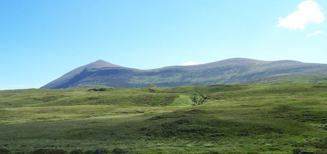
Meall nan Uan is a prominent hill located in the remote region of Sutherland, Scotland. Standing at an elevation of 452 meters (1,483 feet), it offers breathtaking panoramic views of the surrounding landscape. Situated in the far north of Scotland, Meall nan Uan is a part of the Scottish Highlands, characterized by its rugged terrain, deep glens, and vast open spaces.

The hill is easily accessible from the village of Durness, which is approximately 15 kilometers (9 miles) to the south. A narrow footpath leads visitors to the summit, winding its way through heather-covered moorland and rocky outcrops. As visitors climb higher, the views become increasingly dramatic, showcasing the vastness of the Scottish wilderness.

Once at the top, hikers are rewarded with uninterrupted vistas of the Atlantic Ocean to the west, the peaks of the Ben Hope range to the south, and the pristine Durness coastline to the north. On clear days, it is even possible to catch a glimpse of the distant Outer Hebrides islands.

Meall nan Uan is known for its rich biodiversity, with various bird species, such as golden eagles and peregrine falcons, frequently spotted soaring above its slopes. The hill also boasts a diverse range of plant life, including wildflowers and rare mosses.

Due to its moderate height and relatively straightforward ascent, Meall nan Uan is a popular destination for hikers of all abilities, offering a rewarding outdoor experience and a chance to immerse oneself in the unspoiled beauty of the Scottish Highlands.

If you have any feedback on the listing, please let us know in the comments section below.

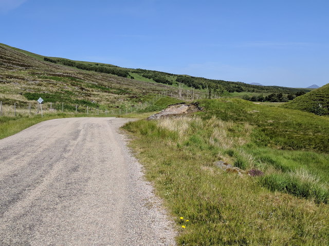
Meall nan Uan Images

Images are sourced within 2km of 58.23042/-4.4504016 or Grid Reference NC5629. Thanks to Geograph Open Source API. All images are credited.

A beautiful cataract on the River Vagastie in summer
River Vagastie Downstream view from the A836.
River Vagastie
Downstream view from the A836.
Glacial deposition features, Strath Vagastie Gravel hummocks midway up the glen.
Glacial deposition features, Strath Vagastie
Gravel hummocks midway up the glen.
River Vagastie A set of small falls on the Vagastie beside the A836.
River Vagastie
A set of small falls on the Vagastie beside the A836.
River Vagastie seen from the A836
The A836, heading north
A beautiful cataract on the River Vagastie
Loch nan Uan with Klibreck in the background
Trees and wee falls
Trees and wee falls
Loch nan Uan A large lochan hard underneath the steep slopes of A' Chioch on Ben Klibreck. A boat moored at the north end suggests it may be a fishing loch for the local estate.
Loch nan Uan
A large lochan hard underneath the steep slopes of A' Chioch on Ben Klibreck. A boat moored at the north end suggests it may be a fishing loch for the local estate.
Loch Bad an Loch, Ben Klibreck
Beside the Feith Bad an Loch Vague deer and walker tracks lead alongside the stream en route to Ben Klibreck.
Beside the Feith Bad an Loch
Vague deer and walker tracks lead alongside the stream en route to Ben Klibreck.
Loch Bad an Loch, Ben Klibreck The first of two lochs passed on our ascent of Ben Klibreck. The horseflies were an absolute nuisance!
Loch Bad an Loch, Ben Klibreck
The first of two lochs passed on our ascent of Ben Klibreck. The horseflies were an absolute nuisance!
Moorland above Loch Bad an Loch Two small lochs on the lower moorland of Ben Klibreck seen on the climb.
Moorland above Loch Bad an Loch
Two small lochs on the lower moorland of Ben Klibreck seen on the climb.
Stream flowing into Loch nan Uan Ben Loyal rising in the distance beyond the outflow. The white speck is a moored boat, probably used for fishing on this high moorland loch below the upper slopes of Ben Klibreck.
Stream flowing into Loch nan Uan
Ben Loyal rising in the distance beyond the outflow. The white speck is a moored boat, probably used for fishing on this high moorland loch below the upper slopes of Ben Klibreck.
Climbing the flank of A' Chioch, Ben Klibreck Ali gets some quality aerobic exercise on the steep climb up from Loch nan Uan. Ben Hee is the mountain in the hazy distance.
Climbing the flank of A' Chioch, Ben Klibreck
Ali gets some quality aerobic exercise on the steep climb up from Loch nan Uan. Ben Hee is the mountain in the hazy distance.
Traversing path, Creag an Lochain A fellow summiteer alerted us to the presence of this track which runs south from the col on A' Chioch without necessitating a climb over the Creag. The top of Ben Klibreck is beyond with Ben Loyal on the left skyline.
Traversing path, Creag an Lochain
A fellow summiteer alerted us to the presence of this track which runs south from the col on A' Chioch without necessitating a climb over the Creag. The top of Ben Klibreck is beyond with Ben Loyal on the left skyline.
Descending moorland towards Loch Bad an Loch Ben Hope is the prominent mountain on the skyline.
Descending moorland towards Loch Bad an Loch
Ben Hope is the prominent mountain on the skyline.
Show me another place!

Meall nan Uan is located at Grid Ref: NC5629 (Lat: 58.23042, Lng: -4.4504016)

Unitary Authority: Highland

Police Authority: Highlands and Islands

What 3 Words

///bends.unpainted.photocopy. Near Altnaharra, Highland

Nearby Locations

Meall nan Uan Loch nan Uan

Related Wikis

Ben Klibreck

Ben Klibreck (Scottish Gaelic: Beinn Clìbric) is a Scottish mountain located in central Sutherland. It is an isolated mountain, rising above a large area...

Sutherland

Sutherland (Scottish Gaelic: Cataibh) is a historic county, registration county and lieutenancy area in the Highlands of Scotland. Its county town is Dornoch...

Altnaharra

Altnaharra (Scottish Gaelic: Allt na h-Eirbhe) is a small hamlet in Sutherland in the Highland region of northern Scotland. The hamlet is on the A836 road...
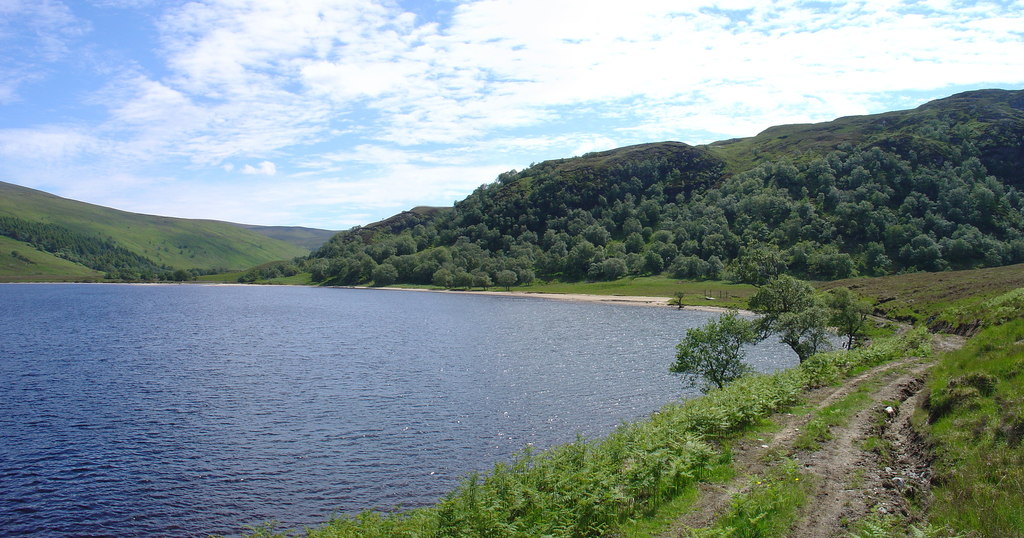
Loch Choire

Loch Choire is a loch in Sutherland in the Highland council area of northern Scotland. It is located at the end of a rural street which links the loch...

Nearby Amenities

Located within 500m of 58.23042,-4.4504016
Meall nan Uan
Natural: peak
Lat/Long: 58.2307112/-4.4495166
The data included in this document is from www.openstreetmap.org. The data is made available under ODbL.

Have you been to Meall nan Uan?

Leave your review of Meall nan Uan below (or comments, questions and feedback).