Knockdon
Hill, Mountain in Ayrshire
Scotland
Knockdon

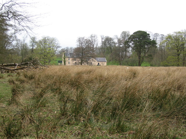
Knockdon is a prominent hill located in Ayrshire, a county in southwest Scotland. It is part of the Carrick Hills range and stands at an elevation of approximately 334 meters (1,096 feet) above sea level. The hill is situated near the small village of Dalrymple, about 8 kilometers (5 miles) south of the town of Ayr.
Knockdon boasts a picturesque landscape characterized by rolling greenery, heather-covered moorlands, and scattered trees. The hill offers stunning panoramic views of the surrounding countryside, including the Firth of Clyde and the Isle of Arran on a clear day.
The area around Knockdon is popular among hikers, nature enthusiasts, and outdoor adventurers. Several well-marked trails and footpaths traverse the hill, providing opportunities for exploration and enjoyment of the natural beauty. Walking to the summit of Knockdon rewards visitors with breathtaking vistas and a sense of tranquility.
Flora and fauna are abundant on the hill, with heather, gorse, and various grasses dominating the vegetation. The area is home to a diverse range of wildlife, including birds such as buzzards, kestrels, and pheasants. Visitors may also spot rabbits, hares, and deer roaming freely.
Knockdon is a cherished destination for locals and tourists alike, offering a peaceful retreat from the hustle and bustle of urban life. Its accessibility, natural beauty, and captivating views make it a must-visit location for anyone exploring the Ayrshire region.
If you have any feedback on the listing, please let us know in the comments section below.
Knockdon Images
Images are sourced within 2km of 55.554221/-4.281802 or Grid Reference NS5631. Thanks to Geograph Open Source API. All images are credited.


Knockdon is located at Grid Ref: NS5631 (Lat: 55.554221, Lng: -4.281802)
Unitary Authority: East Ayrshire
Police Authority: Ayrshire
What 3 Words
///barrel.herbs.heckler. Near Darvel, East Ayrshire
Nearby Locations
Related Wikis
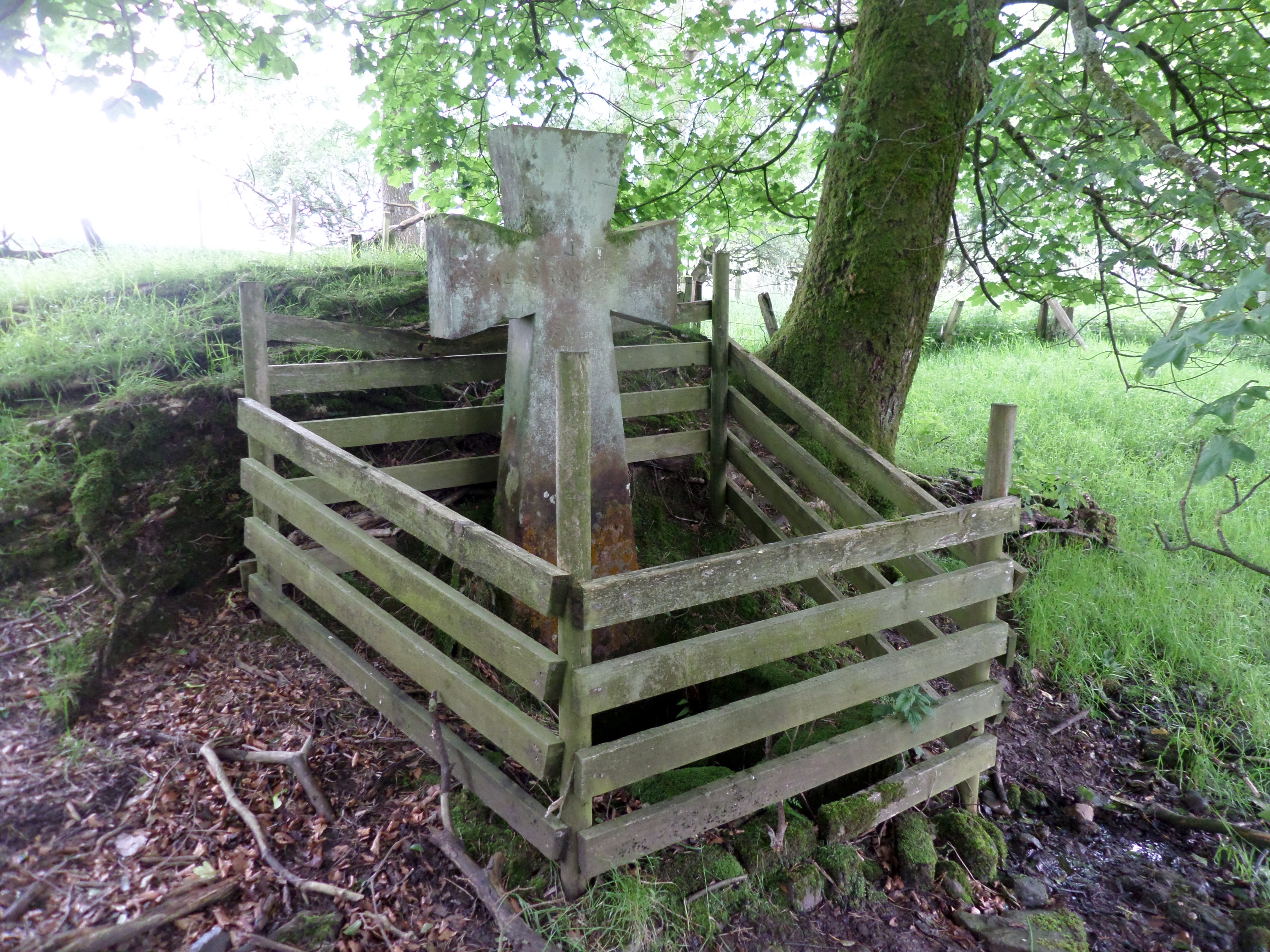
Lady's Well, Auchmannoch
The Lady's Well is a natural spring surmounted by a large cross that stands beside the Stra Burn Ford (NS254630) near Auchmannoch House in the Parish of...
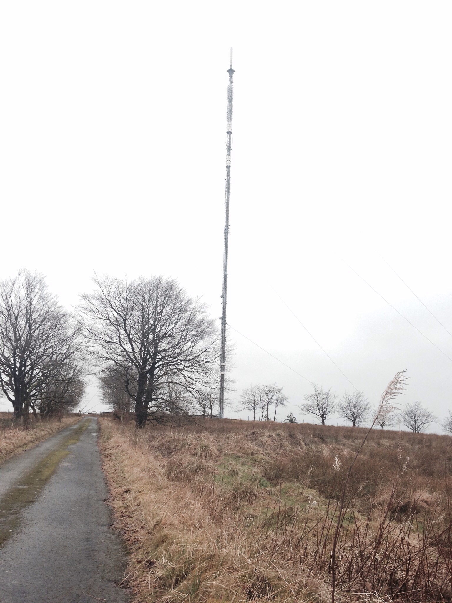
Darvel transmitting station
Darvel transmitting station is a broadcasting and telecommunications facility located near Darvel, East Ayrshire, Scotland (grid reference NS5567234132...

Kilmarnock and Loudoun (UK Parliament constituency)
Kilmarnock and Loudoun is a county constituency of the House of Commons of the Parliament of the United Kingdom. It elects one Member of Parliament (MP...

Sorn Castle
Sorn Castle is located by the River Ayr just outside the village of Sorn in East Ayrshire, Scotland. The castle comprises a medieval tower house, which...
Have you been to Knockdon?
Leave your review of Knockdon below (or comments, questions and feedback).