Woodcock Hill

Hill, Mountain in Devon West Devon

England

Woodcock Hill

Black-a-Tor Copse Looking down on the valley with the woodland on the opposite bank of the West Okement River
Black-a-Tor Copse Credit: David Smith

Woodcock Hill is a prominent hill located in the county of Devon, England. Standing at an elevation of approximately 279 meters (915 feet), it is considered one of the notable landmarks in the region. Situated near the village of Woodbury, the hill offers breathtaking views of the surrounding countryside.

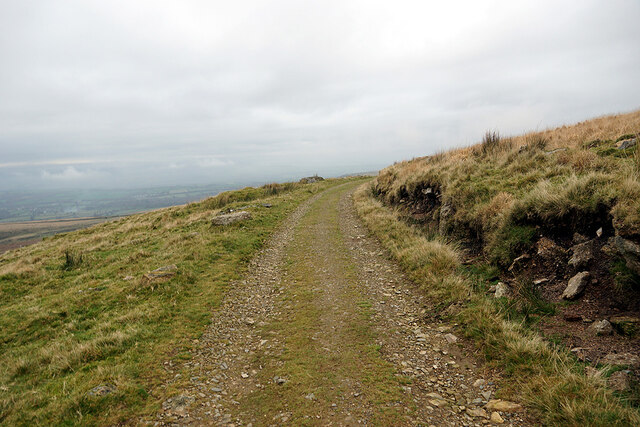
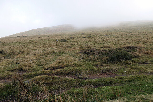
The hill is characterized by its gentle slopes and lush greenery, making it a popular destination for hikers, nature enthusiasts, and outdoor adventurers. It is covered with a variety of vegetation, including grasses, wildflowers, and trees, providing a diverse habitat for local wildlife.

Woodcock Hill is part of the East Devon Area of Outstanding Natural Beauty, a designation that acknowledges its exceptional natural and cultural significance. This protected status ensures the preservation of the hill's unique ecosystem and ensures that it remains accessible to the public for recreational activities.

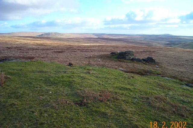
Visitors to Woodcock Hill can embark on several walking trails that lead to its summit, where they can enjoy panoramic views of the surrounding countryside, including the nearby Woodbury Common and the Exe Estuary. On a clear day, it is even possible to catch a glimpse of the distant coastline.

The hill also holds historical significance, with evidence of human activity in the area dating back thousands of years. Archaeological remains, including ancient burial mounds and settlements, have been discovered in the vicinity, adding to the hill's allure for history enthusiasts.

In conclusion, Woodcock Hill in Devon is a picturesque and historically significant landmark that offers stunning views and recreational opportunities for visitors. Its natural beauty and cultural heritage make it an appealing destination for both locals and tourists alike.

If you have any feedback on the listing, please let us know in the comments section below.

Woodcock Hill Images

Images are sourced within 2km of 50.673694/-4.0383069 or Grid Reference SX5687. Thanks to Geograph Open Source API. All images are credited.

Black-a-Tor Copse Looking down on the valley with the woodland on the opposite bank of the West Okement River
Black-a-Tor Copse
Looking down on the valley with the woodland on the opposite bank of the West Okement River
Spoil heaps from tin mining on Bridestowe and Sourton Common
Bleak House revisited This was an attempt to recreate a photograph which I took back in 1966 whilst on exercise with the Territorial Army <a href="https://www.geograph.org.uk/photo/6434520">SX5586 : 135 Survey Engineer Regt. TA  on exercise at Bleak House, Dartmoor</a>. On that occasion, as I recall, we yomped in from Okehampton Camp. This time I caught a bus from Okehampton to Dartmoor Inn and walked the 3 miles in. Then walked 7 miles back to Okehampton.

I had difficulty in identifying the exact location of the original photograph when on the ground but, on studying this shot afterwards, it's quite near, perhaps a few feet to the south compared to the original.

Bleak House is, of course, in a far more ruinous state than in 1966.
Bleak House revisited
This was an attempt to recreate a photograph which I took back in 1966 whilst on exercise with the Territorial Army SX5586 : 135 Survey Engineer Regt. TA on exercise at Bleak House, Dartmoor. On that occasion, as I recall, we yomped in from Okehampton Camp. This time I caught a bus from Okehampton to Dartmoor Inn and walked the 3 miles in. Then walked 7 miles back to Okehampton. I had difficulty in identifying the exact location of the original photograph when on the ground but, on studying this shot afterwards, it's quite near, perhaps a few feet to the south compared to the original. Bleak House is, of course, in a far more ruinous state than in 1966.
Path away from Bleak House Heading for Hunt Tor.
Path away from Bleak House
Heading for Hunt Tor.
Embankment of the Rattlebrook peat tramway Evidence of peat extraction can be seen on the opposite hillside, and there were peat works below that. The works ceased operation in 1932, and the tramway then closed, leaving an excellent walking route across the moor.
Embankment of the Rattlebrook peat tramway
Evidence of peat extraction can be seen on the opposite hillside, and there were peat works below that. The works ceased operation in 1932, and the tramway then closed, leaving an excellent walking route across the moor.
The Rattlebrook peat tramway trackbed Climbing on the flanks of Woodcock Hill.
The Rattlebrook peat tramway trackbed
Climbing on the flanks of Woodcock Hill.
A steep incline on the erstwhile Rattlebrook peat tramway
Cloud descending over Great Links Tor
Still climbing on the Rattlebrook tramway trackbed On the slopes of Woodcock Hill. The old tramway route just crosses into the east of this grid square
Still climbing on the Rattlebrook tramway trackbed
On the slopes of Woodcock Hill. The old tramway route just crosses into the east of this grid square
On Woodcock Hill Looking towards Coombe Down.
On Woodcock Hill
Looking towards Coombe Down.
Lyd Head A main tributary of the River Lyd.
Lyd Head
A main tributary of the River Lyd.
Path on Cwm Down on Bridestowe and Sourton Common An embankment carrying the Rattlebrook peat tramway is near the top of the view. Near here, the tramway route was via a switchback in order to negotiate the steep (in railway terms) terrain. The path in view is a link between the upper and lower levels of the switchback without having to walk the whole route.
Path on Cwm Down on Bridestowe and Sourton Common
An embankment carrying the Rattlebrook peat tramway is near the top of the view. Near here, the tramway route was via a switchback in order to negotiate the steep (in railway terms) terrain. The path in view is a link between the upper and lower levels of the switchback without having to walk the whole route.
Looking up to Corn Ridge On Lake Down. With low cloud over the tops.
Looking up to Corn Ridge
On Lake Down. With low cloud over the tops.
Boggy ground near Bleak House With Lower Dunna Goat in view
Boggy ground near Bleak House
With Lower Dunna Goat in view
Path leading to Bleak House On the slopes of Great Links Tor.
Path leading to Bleak House
On the slopes of Great Links Tor.
Old tramway trackbed Skirting Woodcock Hill.
Old tramway trackbed
Skirting Woodcock Hill.
Tramway embankment crossing beneath Woodcock Hill Hay Tor on the hillside on the left.
Tramway embankment crossing beneath Woodcock Hill
Hay Tor on the hillside on the left.
On Woodcock Hill Looking over Bridestowe and Sourton Common.
On Woodcock Hill
Looking over Bridestowe and Sourton Common.
Show me another place!

Woodcock Hill is located at Grid Ref: SX5687 (Lat: 50.673694, Lng: -4.0383069)

Administrative County: Devon

District: West Devon

Police Authority: Devon and Cornwall

What 3 Words

///skills.dispensed.homework. Near Okehampton, Devon

Related Wikis

Amicombe Hill

Amicombe Hill, also known as the Devil's Dome, is a hill in North Dartmoor in the southwest English county of Devon. At 584 metres high, it is the sixth...

Bridestowe and Sourton Common

Bridestowe and Sourton Common, also known as Common to Bridestowe and Sourton and Lands common to the Parishes of Bridestowe and Sourton, is a civil parish...

High Willhays

High Willhays ( WIL-eez, WIL-hayz), or according to some authorities High Willes, is the highest point on Dartmoor, Devon, at 621 metres (2,039 feet) above...

Great Links Tor

Great Links Tor is a prominent tor on the north-western flank of Dartmoor, Devon, England. It is visible for a considerable distance on the approach to...

Nearby Amenities

Located within 500m of 50.673694,-4.0383069
Woodcock Hill
Place: locality
Population: 0
Source: NPE
Wpt Symbol: Summit
Lat/Long: 50.6707901/-4.0431716
Natural: spring
Lat/Long: 50.6698171/-4.0393173
The data included in this document is from www.openstreetmap.org. The data is made available under ODbL.

Have you been to Woodcock Hill?

Leave your review of Woodcock Hill below (or comments, questions and feedback).