Barbeys Hill
Hill, Mountain in Ayrshire
Scotland
Barbeys Hill

Barbeys Hill is a prominent hill located in Ayrshire, Scotland. Standing at an elevation of approximately 250 meters (820 feet), it offers stunning panoramic views of the surrounding countryside. Situated around 8 kilometers (5 miles) northeast of Ayr, Barbeys Hill is easily accessible and attracts both locals and tourists alike.
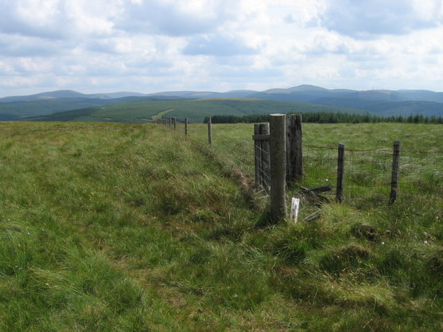
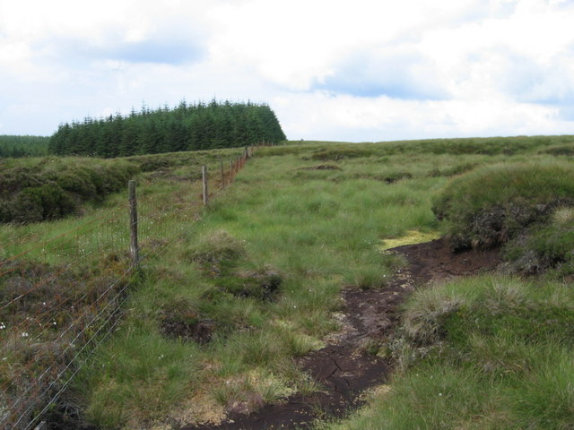
The hill is a part of the Carrick Hills, which form a picturesque backdrop to the town of Ayr. It is characterized by its gentle slopes and grassy terrain, making it a popular destination for hiking and outdoor activities. The well-maintained footpaths ensure that visitors can explore the hill with ease and safety.
Barbeys Hill is rich in natural beauty, adorned with an abundance of flora and fauna. The summit provides a vantage point from which visitors can admire the rolling hills, farmland, and coastline. On a clear day, it is possible to see the Isle of Arran in the distance, adding to the allure of the view.
Due to its location, Barbeys Hill is a haven for wildlife enthusiasts. The hill is home to a variety of bird species, including kestrels and pheasants. It is also a popular spot for birdwatching, with many visitors coming to observe the diverse avian population.
Overall, Barbeys Hill offers a tranquil escape from the hustle and bustle of everyday life. Whether it's a leisurely walk or a challenging hike, the hill provides an opportunity to immerse oneself in nature and enjoy the breathtaking scenery of Ayrshire.
If you have any feedback on the listing, please let us know in the comments section below.
Barbeys Hill Images
Images are sourced within 2km of 55.339291/-4.2745345 or Grid Reference NS5507. Thanks to Geograph Open Source API. All images are credited.


Barbeys Hill is located at Grid Ref: NS5507 (Lat: 55.339291, Lng: -4.2745345)
Unitary Authority: East Ayrshire
Police Authority: Ayrshire
What 3 Words
///gossiped.drivers.flaunting. Near Dalmellington, East Ayrshire
Nearby Locations
Related Wikis

Knockshinnoch disaster
The Knockshinnoch disaster was a mining accident that occurred in September 1950 in the village of New Cumnock, Ayrshire, Scotland. A glaciated lake filled...

Dalmellington
Dalmellington (Scots: Dawmellinton, Scottish Gaelic: Dail M'Fhaolain) is a market town and civil parish in East Ayrshire, Scotland. In 2001 the village...
Dalmellington railway station
Dalmellington railway station served the town of Dalmellington, East Ayrshire, Scotland, from 1856 to 1964 on the Ayr and Dalmellington Railway. ��2�...

Doon Academy
Doon Academy is a secondary school in Dalmellington that caters to the local surrounding areas Dalmellington, Patna, Rankinston and Bellsbank. The current...
Nearby Amenities
Located within 500m of 55.339291,-4.2745345Have you been to Barbeys Hill?
Leave your review of Barbeys Hill below (or comments, questions and feedback).