Allt Maestir

Hill, Mountain in Cardiganshire

Wales

Allt Maestir

St Mary's Church, Maestir <span class="nowrap"><a title="https://coflein.gov.uk/cy/safle/310150/" rel="nofollow ugc noopener" href="https://coflein.gov.uk/cy/safle/310150/">Link</a><img style="margin-left:2px;" alt="External link" title="External link - shift click to open in new window" src="https://s1.geograph.org.uk/img/external.png" width="10" height="10"/></span>
St Mary's Church, Maestir Credit: Sandy Gerrard

Allt Maestir is a prominent hill located in the county of Cardiganshire, Wales. Rising to an elevation of 270 meters (886 feet), it is a popular destination for hikers and nature enthusiasts.

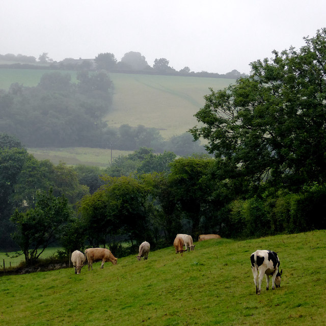
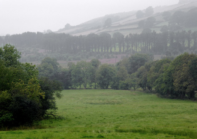
Situated in the western part of the county, Allt Maestir offers breathtaking panoramic views of the surrounding landscape. From its summit, visitors can admire the rolling hills and valleys that stretch out towards the coast, providing a stunning backdrop for photographs and moments of tranquility. On clear days, it is even possible to catch a glimpse of the Irish Sea in the distance.

The hill is covered in a variety of vegetation, including grasses, heather, and scattered trees, providing a habitat for a diverse range of wildlife. Birdwatchers in particular will find Allt Maestir to be a haven, as the hill attracts a wide array of species. From buzzards soaring in the sky to skylarks serenading from above, there is always something to spot and appreciate.

For those seeking outdoor activities, there are several walking trails that traverse Allt Maestir. These trails vary in difficulty, catering to both beginners and experienced hikers. Along the way, visitors can explore the hill's unique geological features, such as its rocky outcrops and deep gorges.

With its natural beauty and recreational opportunities, Allt Maestir is a must-visit destination for anyone looking to immerse themselves in the stunning Welsh countryside.

If you have any feedback on the listing, please let us know in the comments section below.
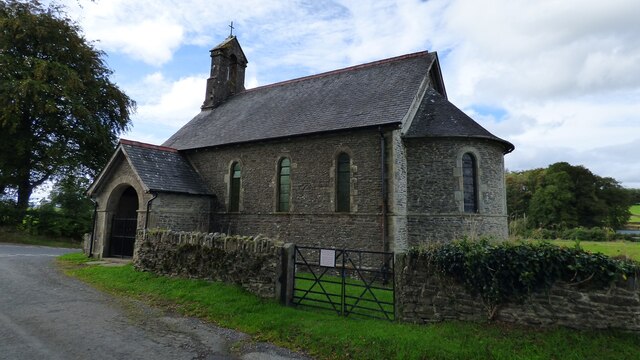
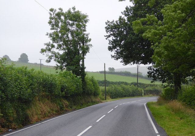
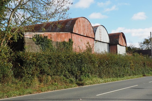
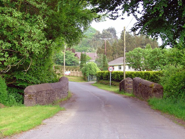
Allt Maestir Images

Images are sourced within 2km of 52.133561/-4.123874 or Grid Reference SN5450. Thanks to Geograph Open Source API. All images are credited.

St Mary's Church, Maestir <span class="nowrap"><a title="https://coflein.gov.uk/cy/safle/310150/" rel="nofollow ugc noopener" href="https://coflein.gov.uk/cy/safle/310150/">Link</a><img style="margin-left:2px;" alt="External link" title="External link - shift click to open in new window" src="https://s1.geograph.org.uk/img/external.png" width="10" height="10"/></span>
St Mary's Church, Maestir
Grazing north-west of Lampeter, Ceredigion Cattle and the steep hillsides of Cwm Nant Creuddyn on a wet morning.
Grazing north-west of Lampeter, Ceredigion
Cattle and the steep hillsides of Cwm Nant Creuddyn on a wet morning.
Farmland near Pont Creuddyn, Ceredigion Looking from the A482 across the valley of Nant Creuddyn on a wet morning.
Farmland near Pont Creuddyn, Ceredigion
Looking from the A482 across the valley of Nant Creuddyn on a wet morning.
Pasture near Pont Creuddyn, Ceredigion Looking across fields from the A482, which crosses the image between the hedges below the askyline farm at Rhyd-y-gof-isaf. It was a dull wet morning which improved nearer the coast an hour later.
Pasture near Pont Creuddyn, Ceredigion
Looking across fields from the A482, which crosses the image between the hedges below the askyline farm at Rhyd-y-gof-isaf. It was a dull wet morning which improved nearer the coast an hour later.
Pasture south of Pont Creuddyn, Ceredigion Seen on a wet morning using telephoto assistance from the A482.
Pasture south of Pont Creuddyn, Ceredigion
Seen on a wet morning using telephoto assistance from the A482.
Pasture south of Pont Creuddyn, Ceredigion Seen on a wet morning from the A482.
Pasture south of Pont Creuddyn, Ceredigion
Seen on a wet morning from the A482.
The A482 to Aberaeron, Ceredigion Looking north and approaching Pont Creuddyn.
The A482 to Aberaeron, Ceredigion
Looking north and approaching Pont Creuddyn.
The A482 to Lampeter, Ceredigion Looking south towards Lampeter; the road has come from Aberaeron.
The A482 passes through Lampeter and joins the A40 neat Llandovery.
The A482 to Lampeter, Ceredigion
Looking south towards Lampeter; the road has come from Aberaeron. The A482 passes through Lampeter and joins the A40 neat Llandovery.
Pasture south-east of Pont Creuddyn, Ceredigion Seen from the A482 layby on a dull and drizzly morning.
Pasture south-east of Pont Creuddyn, Ceredigion
Seen from the A482 layby on a dull and drizzly morning.
Road junction south-east of Pont Creuddyn, Ceredigion The A482 from Aberaeron is seeh here on its way to Lampeter. The lane off to the left leads to the hamet of Silian.
Road junction south-east of Pont Creuddyn, Ceredigion
The A482 from Aberaeron is seeh here on its way to Lampeter. The lane off to the left leads to the hamet of Silian.
The A482 to Aberaeron, Ceredigion The A482 has come from near Llandovery through Lampeter, and her it is passing Rhyd-y-gof-isaf farm near Pont Creuddyn.
The A482 to Aberaeron, Ceredigion
The A482 has come from near Llandovery through Lampeter, and her it is passing Rhyd-y-gof-isaf farm near Pont Creuddyn.
Road junction south-east of Pont Creuddyn, Ceredigion On the right, the A482 from Aberaeron is seen here on its way to Lampeter. The lane off to the left leads to the hamlet of Silian.
Road junction south-east of Pont Creuddyn, Ceredigion
On the right, the A482 from Aberaeron is seen here on its way to Lampeter. The lane off to the left leads to the hamlet of Silian.
Milestone - Aberaeron 10 There should be an Ordnance Survey cut mark on the lower part of the stone. It marks a point 191.484m above mean sea level.
Milestone - Aberaeron 10
There should be an Ordnance Survey cut mark on the lower part of the stone. It marks a point 191.484m above mean sea level.
Corrugated iron barns at Dderigoch Range of hoop-topped barns with a lean-to at the N end. Adjoins A482 road between Llanbedr Pont Steffan and Felin Fach
Corrugated iron barns at Dderigoch
Range of hoop-topped barns with a lean-to at the N end. Adjoins A482 road between Llanbedr Pont Steffan and Felin Fach
Old Milestone by the A48, south of Pont Creuddyn, Llangybi parish Aberayron tombstone by the A482, in parish of Llangybi (Ceredigion District), South of Pont Creuddyn, South of junction with UC road.

Inscription reads:-
ABERAYRON
10 MILES
Lampeter 3

Surveyed

Milestone Society National ID: CRD_AALP10
Old Milestone by the A48, south of Pont Creuddyn, Llangybi parish
Aberayron tombstone by the A482, in parish of Llangybi (Ceredigion District), South of Pont Creuddyn, South of junction with UC road. Inscription reads:- ABERAYRON 10 MILES Lampeter 3 Surveyed Milestone Society National ID: CRD_AALP10
Small stream above Cwm Mawr
Ordnance Survey Cut Mark This OS cut mark can be found on the gatepost south side of the road junction. It marks a point 176.671m above mean sea level.
Ordnance Survey Cut Mark
This OS cut mark can be found on the gatepost south side of the road junction. It marks a point 176.671m above mean sea level.
Ordnance Survey Cut Mark This OS cut mark can be found on the gatepost NW side of the road. It marks a point 239.084m above mean sea level.
Ordnance Survey Cut Mark
This OS cut mark can be found on the gatepost NW side of the road. It marks a point 239.084m above mean sea level.
Show me another place!

Allt Maestir is located at Grid Ref: SN5450 (Lat: 52.133561, Lng: -4.123874)

Unitary Authority: Ceredigion

Police Authority: Dyfed Powys

What 3 Words

///corn.potato.mastering. Near Lampeter, Ceredigion

Nearby Locations

Allt Maestir

Related Wikis

Maestir

Maestir is a hamlet in the community of Llanwnnen, Ceredigion, Wales, which is 59.9 miles (96.3 km) from Cardiff and 175.5 miles (282.4 km) from London...

Falcondale

Falcondale (Welsh: Glyn Hebog) is a hamlet in the community of Lampeter, Ceredigion, Wales, and occupies a low bluff overlooking the Nant Creuddyn north...

Falcondale Lake

Falcondale Lake is a man-made lake in the hamlet of Falcondale near Lampeter in Ceredigion It was created as part of the landscaping for Falcondale House...
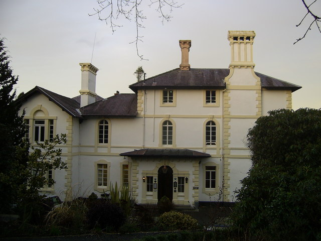
Falcondale House

Falcondale House is a Grade II listed former country house, now the Falcondale Mansion Hotel, which is situated some 1 mile north-west of Lampeter, Ceredigion...

Cribyn

Cribyn is a small village in Ceredigion, Wales, about 7 miles (11 km) north of Lampeter and with the villages of Troed y Rhiw, Mydroilyn and Dihewyd to...

Neudd-fawr

Neudd-fawr (also spelt Neuadd Fawr) is a small village in the community of Llanwnnen, Ceredigion, Wales, which is 59.9 miles (96.4 km) from Cardiff and...

Silian, Ceredigion

Silian, originally Sulien, is a village in the valley of the River Teifi, Ceredigion, Wales. It is located approximately two miles north-west of Lampeter...

Lampeter

Lampeter (; Welsh: Llanbedr Pont Steffan (formal); Llambed (colloquial)) is a town, community and electoral ward in Ceredigion, Wales, at the confluence...

Nearby Amenities

Located within 500m of 52.133561,-4.123874
Power: pole
Lat/Long: 52.1335226/-4.1173035
Power: pole
Lat/Long: 52.1343359/-4.1178077
Power: pole
Lat/Long: 52.1352431/-4.1184139
Power: pole
Lat/Long: 52.1357897/-4.1187626
Power: pole
Lat/Long: 52.1364828/-4.1191945
The data included in this document is from www.openstreetmap.org. The data is made available under ODbL.

Have you been to Allt Maestir?

Leave your review of Allt Maestir below (or comments, questions and feedback).