West Down

Hill, Mountain in Devon South Hams

England

West Down

Old Bridge Marker in Shaugh Prior near Cadover Bridge County Bridge Marker on the north side of the road from Cadover Bridge, River Plym, to Blackaton Cross, 30 metres southeast of the junction below the bridge. Shaugh Prior parish. Inscribed C to mark the extent of roadway adjoining the bridge that the County was obliged to maintain.

Milestone Society National ID: DV_IBSP01Abr
Old Bridge Marker in Shaugh Prior near Cadover Bridge Credit: T Jenkinson

West Down is a small hill located in the county of Devon, in southwestern England. Situated within the geographical region of North Devon, it is part of the larger parish of West Down. Although referred to as a hill, it is sometimes referred to as a mountain due to its relatively elevated height compared to the surrounding landscape.

Standing at approximately 229 meters (751 feet) above sea level, West Down offers visitors breathtaking panoramic views of the surrounding countryside, including the picturesque valleys and rolling hills of Devon. The hill is covered in lush greenery, predominantly consisting of grasslands and scattered trees, which adds to its natural beauty.

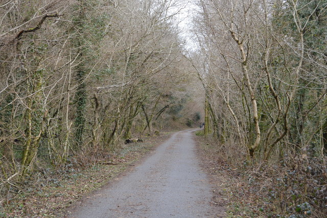
Access to West Down is relatively easy, with a network of footpaths and trails leading to the summit. These trails attract hikers, walkers, and nature enthusiasts who seek to explore the area's natural wonders. The hill also serves as a popular destination for birdwatching, as it is home to various species of birds, including buzzards, kestrels, and skylarks.

In addition to its natural allure, West Down is also notable for its historical significance. The hill is home to several ancient burial mounds and remnants of Iron Age settlements, showcasing its rich cultural heritage.

Overall, West Down is a captivating destination for those seeking to immerse themselves in the natural beauty and history of Devon. Its stunning views, diverse wildlife, and cultural significance make it a must-visit location for tourists and locals alike.

If you have any feedback on the listing, please let us know in the comments section below.

West Down Images

Images are sourced within 2km of 50.453761/-4.0486721 or Grid Reference SX5463. Thanks to Geograph Open Source API. All images are credited.

Old Bridge Marker in Shaugh Prior near Cadover Bridge County Bridge Marker on the north side of the road from Cadover Bridge, River Plym, to Blackaton Cross, 30 metres southeast of the junction below the bridge. Shaugh Prior parish. Inscribed C to mark the extent of roadway adjoining the bridge that the County was obliged to maintain.

Milestone Society National ID: DV_IBSP01Abr
Old Bridge Marker in Shaugh Prior near Cadover Bridge
County Bridge Marker on the north side of the road from Cadover Bridge, River Plym, to Blackaton Cross, 30 metres southeast of the junction below the bridge. Shaugh Prior parish. Inscribed C to mark the extent of roadway adjoining the bridge that the County was obliged to maintain. Milestone Society National ID: DV_IBSP01Abr
Old Bridge Marker beside Shaugh Bridge County Bridge Marker against the south end of the southwest parapet of Shaugh Bridge, River Plym. Shaugh Prior parish. No 'Stones' are marked around this bridge on old OS maps and this looks as if it has been moved here.

Milestone Society National ID: DV_SHAUPR07br
Old Bridge Marker beside Shaugh Bridge
County Bridge Marker against the south end of the southwest parapet of Shaugh Bridge, River Plym. Shaugh Prior parish. No 'Stones' are marked around this bridge on old OS maps and this looks as if it has been moved here. Milestone Society National ID: DV_SHAUPR07br
Moorland Hotel, Wotter A lovely place to stay.
Moorland Hotel, Wotter
A lovely place to stay.
Cadover Bridge The line of upright stones is somewhat reminiscent of the prehistoric stones row found on Dartmoor, but these ones are to stop vehicles straying.
Cadover Bridge
The line of upright stones is somewhat reminiscent of the prehistoric stones row found on Dartmoor, but these ones are to stop vehicles straying.
Road side bollards Dartmoor Style
Alluvial Tin Streamwork at Brisworthy Burrows An extensive and well preserved alluvial tin streamwork.
Alluvial Tin Streamwork at Brisworthy Burrows
An extensive and well preserved alluvial tin streamwork.
Light at the end of the tunnel
Valley of Lovaton Brook The track (public footpath) leads to Durance and Lovaton
Valley of Lovaton Brook
The track (public footpath) leads to Durance and Lovaton
Cadover Bridge
Cadover Bridge
Minor road in the valley of the Plym at Cadover Bridge
Road on the edge of Shaugh Moor Looking south by the junction for Brag Lane on the right
Road on the edge of Shaugh Moor
Looking south by the junction for Brag Lane on the right
Road entering Wotter from the moor on the west The pole on the left of the road is there to brace that opposite
Road entering Wotter from the moor on the west
The pole on the left of the road is there to brace that opposite
Ordnance Survey Cut Mark This OS cut mark can be found on the west face of St Edward's Church. It marks a point 183.154m above mean sea level.
Ordnance Survey Cut Mark
This OS cut mark can be found on the west face of St Edward's Church. It marks a point 183.154m above mean sea level.
Ordnance Survey Cut Mark This OS cut mark can be found on Ham Pool Cottage. It marks a point 47.262m above mean sea level.
Ordnance Survey Cut Mark
This OS cut mark can be found on Ham Pool Cottage. It marks a point 47.262m above mean sea level.
Pigs making best use of rough pasture, near Cadover Bridge, Dartmoor
Bend in the River Plym, plus confluence with small stream, Cadover Bridge, Dartmoor I cannot really call this kink in the River Plym a meander!
Bend in the River Plym, plus confluence with small stream, Cadover Bridge, Dartmoor
I cannot really call this kink in the River Plym a meander!
Former Tavistock to Plymouth railway, Heleball Wood The South Devon and Tavistock Railway linked Plymouth with Tavistock in Devon; it opened in 1859. It was extended by the Launceston and South Devon Railway to Launceston, in Cornwall in 1865.
For a period it carried the standard gauge (then referred to as narrow gauge) trains of the London and South Western Railway between Lydford and Plymouth: a third rail, making mixed gauge was provided.
The line closed in 1962. A short section has since been reopened as a preserved line by the Plym Valley Railway.
National Cycle Network Route 27 follows much of the course of the railway as does, The West Devon Way
Wikipedia: <span class="nowrap"><a title="http://en.wikipedia.org/wiki/South_Devon_and_Tavistock_Railway" rel="nofollow ugc noopener" href="http://en.wikipedia.org/wiki/South_Devon_and_Tavistock_Railway">Link</a><img style="margin-left:2px;" alt="External link" title="External link - shift click to open in new window" src="https://s1.geograph.org.uk/img/external.png" width="10" height="10"/></span>
Former Tavistock to Plymouth railway, Heleball Wood
The South Devon and Tavistock Railway linked Plymouth with Tavistock in Devon; it opened in 1859. It was extended by the Launceston and South Devon Railway to Launceston, in Cornwall in 1865. For a period it carried the standard gauge (then referred to as narrow gauge) trains of the London and South Western Railway between Lydford and Plymouth: a third rail, making mixed gauge was provided. The line closed in 1962. A short section has since been reopened as a preserved line by the Plym Valley Railway. National Cycle Network Route 27 follows much of the course of the railway as does, The West Devon Way Wikipedia: LinkExternal link
Former Tavistock to Plymouth railway The South Devon and Tavistock Railway linked Plymouth with Tavistock in Devon; it opened in 1859. It was extended by the Launceston and South Devon Railway to Launceston, in Cornwall in 1865.
For a period it carried the standard gauge (then referred to as narrow gauge) trains of the London and South Western Railway between Lydford and Plymouth: a third rail, making mixed gauge was provided.
The line closed in 1962. A short section has since been reopened as a preserved line by the Plym Valley Railway.
National Cycle Network Route 27 follows much of the course of the railway as does, The West Devon Way
Wikipedia: <span class="nowrap"><a title="http://en.wikipedia.org/wiki/South_Devon_and_Tavistock_Railway" rel="nofollow ugc noopener" href="http://en.wikipedia.org/wiki/South_Devon_and_Tavistock_Railway">Link</a><img style="margin-left:2px;" alt="External link" title="External link - shift click to open in new window" src="https://s1.geograph.org.uk/img/external.png" width="10" height="10"/></span>
Former Tavistock to Plymouth railway
The South Devon and Tavistock Railway linked Plymouth with Tavistock in Devon; it opened in 1859. It was extended by the Launceston and South Devon Railway to Launceston, in Cornwall in 1865. For a period it carried the standard gauge (then referred to as narrow gauge) trains of the London and South Western Railway between Lydford and Plymouth: a third rail, making mixed gauge was provided. The line closed in 1962. A short section has since been reopened as a preserved line by the Plym Valley Railway. National Cycle Network Route 27 follows much of the course of the railway as does, The West Devon Way Wikipedia: LinkExternal link
Show me another place!

West Down is located at Grid Ref: SX5463 (Lat: 50.453761, Lng: -4.0486721)

Administrative County: Devon

District: South Hams

Police Authority: Devon and Cornwall

What 3 Words

///audio.lights.hooks. Near Yelverton, Devon

Related Wikis

Dewerstone

Dewerstone is the site of an Iron Age Hill fort on a rocky promontory overlooking the River Plym on the South West edge of Dartmoor to the North of Plympton...

Shaugh Prior

Shaugh Prior is a village and civil parish on the south-western side of Dartmoor in the county of Devon, England. It is situated about 8 miles north-east...

River Meavy

The River Meavy is a river in the southwest part of Dartmoor in Devon in south-west England. It runs entirely in the national park and connects Burrator...

Wotter

Wotter is a village near Shaugh Prior on the south western edge of Dartmoor, in the English county of Devon. The village was founded in 1906: previously...

Brisworthy stone circle

Brisworthy stone circle (grid reference SX564654) is a stone circle on Dartmoor, Devon. It is located three miles east of the A386, northeast of the village...

Bickleigh, South Hams

Bickleigh is a small village on the southern edge of Dartmoor in Devon, England. It has a population of about 50 people. It is in the South Hams district...

RM Bickleigh

RM Bickleigh, or Bickleigh Barracks, is a military installation at Bickleigh, South Hams which is currently used by 42 Commando. == History == The barracks...

Ringmoor stone row and cairn circle

Ringmoor stone row and cairn circle (grid reference SX563658) is a prehistoric stone row and cairn circle on Ringmoor Down in Devon. It is located three...

Have you been to West Down?

Leave your review of West Down below (or comments, questions and feedback).