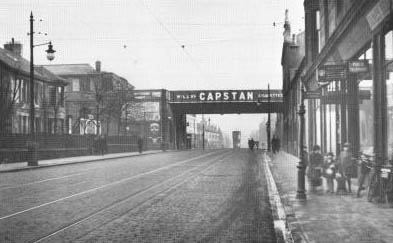
Byres Hill

Hill, Mountain in Renfrewshire

Scotland

Byres Hill
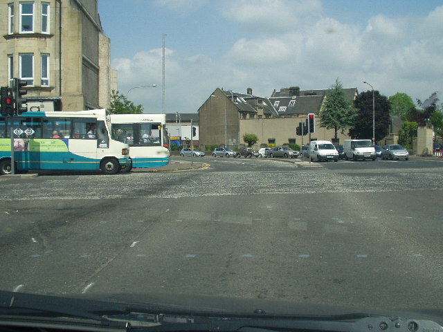
Central Paisley
Central Paisley Credit: G McK

Byres Hill is a prominent landmark located in Renfrewshire, Scotland. Situated approximately 6 miles southwest of Paisley, it is part of the wider Clyde Muirshiel Regional Park. Rising to a height of 340 meters (1,115 feet), Byres Hill is classified as a hill rather than a mountain, but its commanding position grants sweeping views of the surrounding countryside.

The hill is characterized by its gently sloping sides, covered in a patchwork of heather, grasses, and scattered trees. It is primarily composed of sedimentary rocks, including sandstone and shale, which contribute to its distinctive reddish-brown color. Byres Hill is crisscrossed by a network of footpaths, making it a popular destination for walkers and hikers.

At the summit, there is a trig point that marks the highest point of Byres Hill. From this vantage point, visitors can enjoy panoramic vistas, including views of the nearby Clyde Estuary, the city of Glasgow in the distance, and the surrounding hills and moorland.

Flora and fauna are abundant in the area, with a diverse range of plant species, including heather, bilberry, and bracken, providing habitats for various wildlife. Birdwatchers may spot buzzards, kestrels, and peregrine falcons soaring overhead, while deer and rabbits are often seen grazing on the lower slopes.

Overall, Byres Hill offers outdoor enthusiasts a chance to immerse themselves in the natural beauty of Renfrewshire, providing both a challenging hike and stunning views of the surrounding landscape.

If you have any feedback on the listing, please let us know in the comments section below.

Byres Hill Images

Images are sourced within 2km of 55.852683/-4.3967494 or Grid Reference NS5064. Thanks to Geograph Open Source API. All images are credited.

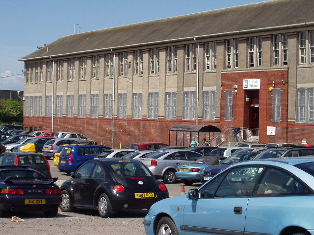
Central Paisley
Central Paisley
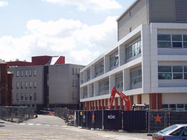
St Mirin Block, Reid Kerr College
The new teaching block, Reid Kerr College
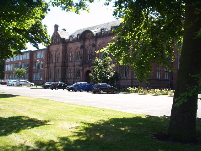
Paisley Grammar School Glasgow Road, Paisley
Paisley Grammar School
Glasgow Road, Paisley
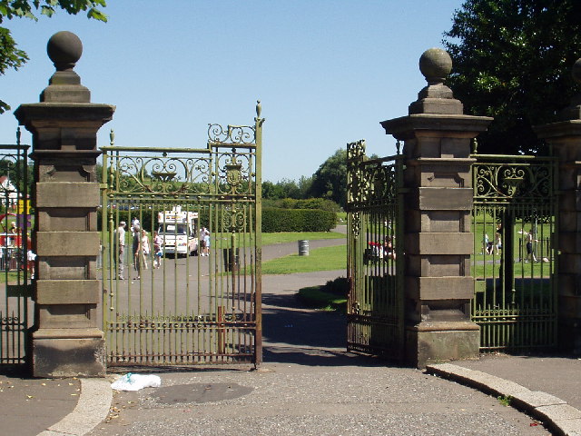
Barshaw Park, Paisley
Hawkhead Station, Paisley
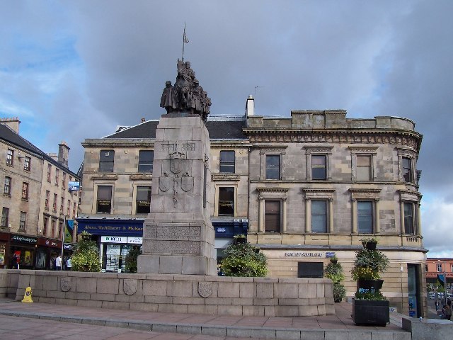
War memorial, Paisley
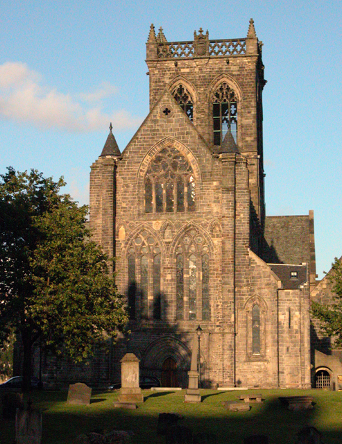
Paisley Abbey View of the historic abbey from over the White Cart Water.
Paisley Abbey
View of the historic abbey from over the White Cart Water.
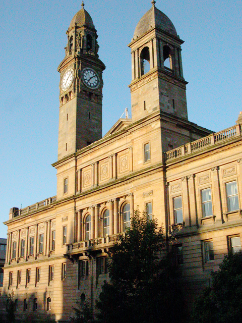
Paisley Town Hall View from St Mirren Street, across the White Cart Water.
Paisley Town Hall
View from St Mirren Street, across the White Cart Water.
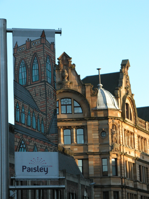
Tenements Tenements at the top of Causeyside Street, Paisley, taken from St Mirren Street.
Tenements
Tenements at the top of Causeyside Street, Paisley, taken from St Mirren Street.
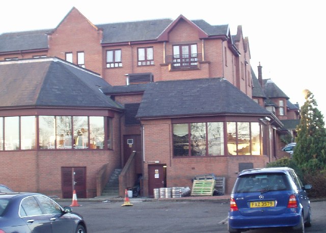
The Glynhill Hotel Paisley Road, Renfrew (close to the M8 motorway)

We use this place for a lot of conferences!
The Glynhill Hotel
Paisley Road, Renfrew (close to the M8 motorway) We use this place for a lot of conferences!
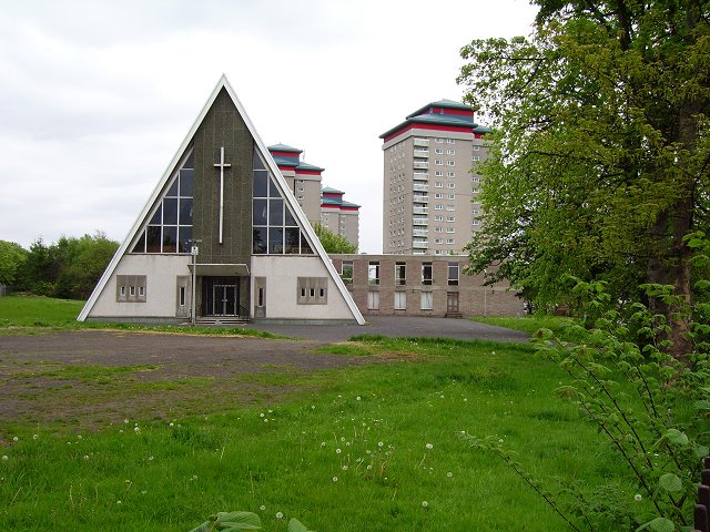
Sandyford Kirk Church of Scotland church and towerblocks, Paisley.
Sandyford Kirk
Church of Scotland church and towerblocks, Paisley.
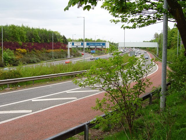
M8 Western approaches to Glasgow at junction 27. An elder bush in the way is far preferable to a windscreen.  Main route into the city from Paisley, Renfrewshire and the Airport.
M8
Western approaches to Glasgow at junction 27. An elder bush in the way is far preferable to a windscreen. Main route into the city from Paisley, Renfrewshire and the Airport.
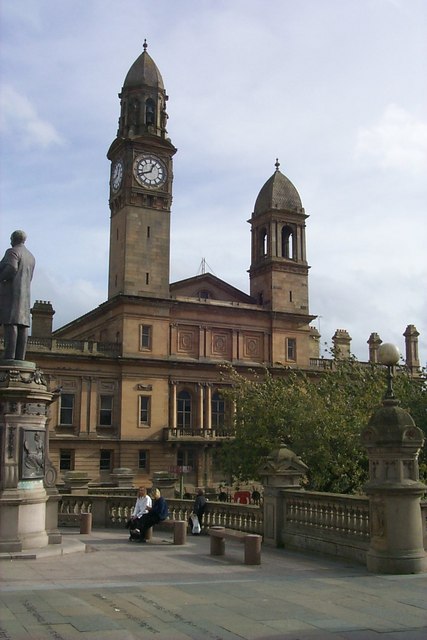
Paisley Town Hall One of the most famous landmarks in the town this monument to civic pride has a beautiful setting bounded by the White Cart Water and Paisley Abbey.
Paisley Town Hall
One of the most famous landmarks in the town this monument to civic pride has a beautiful setting bounded by the White Cart Water and Paisley Abbey.
Western (Scottish) Leyland Fleetline Bus Prior to the deregulation of the bus network, Paisley was 'home' to the Western Bus Company which provided services to Glasgow and most of the Clyde coast as far south as Stranraer and parts in-between.
Western (Scottish) Leyland Fleetline Bus
Prior to the deregulation of the bus network, Paisley was 'home' to the Western Bus Company which provided services to Glasgow and most of the Clyde coast as far south as Stranraer and parts in-between.
St Mirren Park More commonly known as Love Street. Home of St Mirren FC.

This is Cairters Corner at the south east corner of the ground. Members of The Paisley Carters society user their horses and carts to move materials used in the construction of the ground 1894. This was done in return for lifetime free entry to the ground. During matches, the ‘Cairters’ (carters) congregated in this corner to support St Mirren.

Information from Cairters Corner, an unofficial St Mirren FC fan site: <span class="nowrap"><a title="https://cairterscorner.com/" rel="nofollow ugc noopener" href="https://cairterscorner.com/">Link</a><img style="margin-left:2px;" alt="External link" title="External link - shift click to open in new window" src="https://s1.geograph.org.uk/img/external.png" width="10" height="10"/></span> .

See the scene in April 2022 <a href="https://www.geograph.org.uk/photo/7144299">NS4864 : Cairters Corner</a>.

The stadium was demolished in 2010 <a href="https://www.geograph.org.uk/photo/2174618">NS4864 : Remains of St Mirren Park</a>, after St Mirren moved to a new stadium at Ferguslie park <a href="https://www.geograph.org.uk/photo/1076878">NS4764 : St Mirren's new stadium</a>.
St Mirren Park
More commonly known as Love Street. Home of St Mirren FC. This is Cairters Corner at the south east corner of the ground. Members of The Paisley Carters society user their horses and carts to move materials used in the construction of the ground 1894. This was done in return for lifetime free entry to the ground. During matches, the ‘Cairters’ (carters) congregated in this corner to support St Mirren. Information from Cairters Corner, an unofficial St Mirren FC fan site: LinkExternal link . See the scene in April 2022 NS4864 : Cairters Corner. The stadium was demolished in 2010 NS4864 : Remains of St Mirren Park, after St Mirren moved to a new stadium at Ferguslie park NS4764 : St Mirren's new stadium.
RBS Building On the ring road in Paisley.
RBS Building
On the ring road in Paisley.
Gilmour Street Station A junction station with lines from Glasgow to Ayr and Gourock & Wemyss Bay.
Gilmour Street Station
A junction station with lines from Glasgow to Ayr and Gourock & Wemyss Bay.
Show me another place!

Byres Hill is located at Grid Ref: NS5064 (Lat: 55.852683, Lng: -4.3967494)

Unitary Authority: Renfrewshire

Police Authority: Renfrewshire and Inverclyde

What 3 Words

///lifted.gentle.asset. Near Renfrew, Renfrewshire

Nearby Locations

Byres Hill Honeybog Hill

Related Wikis

Barshaw Park

Barshaw Park is public park in Paisley, Scotland. It has 55 acres (22 hectares) of recreational parkland and garden areas which are open to the public...

Whitehaugh Oval

Whitehaugh Oval is a cricket ground in Paisley, Renfrewshire, Scotland. It has been the home ground of Kelburne Cricket Club since their previous ground...

Paisley Barracks

Paisley Barracks was a military installation in Paisley, Renfrewshire. == History == The infantry barracks, which were built on the south side of the Glasgow...

Old Ralston Park

Old Ralston Park was a football ground in Paisley, Scotland. It was the home ground of Abercorn during their second decade in the Scottish Football League...

Gallowhill

Gallowhill is a housing estate in the north east of Paisley, a town in Renfrewshire, Scotland. Its approximate boundaries are formed by the M8 motorway...

New Ralston Park

New Ralston Park was a football ground in Paisley, Scotland. It was the home ground of Abercorn during their third decade in the Scottish Football League...

Paisley East railway station

Paisley East was an unopened railway station in Paisley, Renfrewshire, Scotland. == History == The station was originally part of the Paisley and Barrhead...

Paisley Grammar School

Paisley Grammar School is a secondary school in Paisley, the largest town in Renfrewshire, Scotland. The school was founded in 1576 by royal charter of...

Related Videos

Buskers at Paisley Cross #scotland #scottish #tourism #travelvlog

I came across some buskers today at Paisley Cross.

Put a Little Love in Your Heart by Jimmy Holiday

Performed by The Gleniffer Singers in Holy Trinity and St Barnabas Church, Paisley, Scotland Conducted by Dr Roger McLean ...

Nearby Amenities

Located within 500m of 55.852683,-4.3967494
Mini Roundabout
Direction: clockwise
Lat/Long: 55.855169/-4.3992177
Mini Roundabout
Direction: clockwise
Lat/Long: 55.8539157/-4.4007818
Traffic Calming: table
Lat/Long: 55.8537779/-4.4015199
Traffic Calming: table
Lat/Long: 55.8534478/-4.4031083
Traffic Calming: table
Lat/Long: 55.8531324/-4.4041978
Bus Stop
Lat/Long: 55.8540587/-4.403453
Bus Stop
Nat Ref: 6140277
Lat/Long: 55.8547342/-4.4009852
Bus Stop
Nat Ref: 6140279
Lat/Long: 55.8532642/-4.4013737
Traffic Calming: table
Lat/Long: 55.8536956/-4.4022689
Barshaw Central
Railway: station
Usage: tourism
Lat/Long: 55.8487724/-4.3963559
Crossing
Crossing: zebra
Lat/Long: 55.8513301/-4.4023904
Bicycle Parking
Bicycle Parking: wall_hoops
Capacity: 10
Covered: no
Note: ground hoops/wheelbenders
Lat/Long: 55.8488028/-4.3961837
Railway: switch
Lat/Long: 55.8539031/-4.4025377
Railway: switch
Lat/Long: 55.8556522/-4.392953
Railway: switch
Lat/Long: 55.855811/-4.3921717
Railway: switch
Lat/Long: 55.8556118/-4.3937292
Railway: switch
Lat/Long: 55.8553911/-4.3952221
Railway: switch
Lat/Long: 55.8545361/-4.4000163
Railway: switch
Lat/Long: 55.8541193/-4.4016473
Bench
Backrest: yes
Lat/Long: 55.8488668/-4.3946708
Bench
Backrest: yes
Lat/Long: 55.8488147/-4.398215
Addr Housenumber: 1
Lat/Long: 55.8495195/-4.3978484
Arkleston Junction
Railway: junction
Lat/Long: 55.8536906/-4.403478
The data included in this document is from www.openstreetmap.org. The data is made available under ODbL.

Have you been to Byres Hill?

Leave your review of Byres Hill below (or comments, questions and feedback).