Dykebar Hill

Hill, Mountain in Renfrewshire

Scotland

Dykebar Hill

Renfrewshire Council Headquarters
Renfrewshire Council Headquarters Credit: G McK

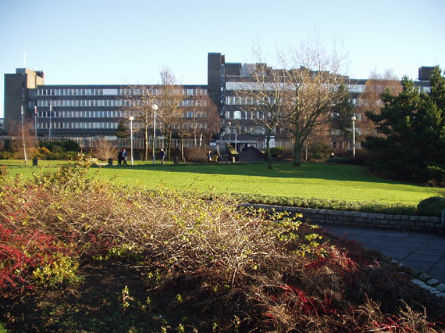
Dykebar Hill, located in Renfrewshire, Scotland, is a prominent hill that offers breathtaking views and serves as a popular recreational spot for locals and tourists alike. Rising to an elevation of approximately 159 meters (522 feet), it stands as a prominent feature in the landscape of the area.

Situated to the northeast of Paisley, Dykebar Hill boasts a distinctive shape with a gentle slope on one side and a steeper incline on the other. The hill is primarily covered in grassland, adorned with scattered trees and shrubs. Its summit offers panoramic vistas of the surrounding countryside, including the nearby towns and villages.

The hill also holds historical significance, as it was once the site of Dykebar Hospital, a psychiatric institution that operated from 1909 to 2002. Although the hospital buildings no longer remain, the hill retains its association with the institution and its history.

Dykebar Hill attracts numerous visitors who enjoy outdoor activities such as walking, hiking, and picnicking. It is a perfect spot for nature enthusiasts who appreciate the tranquility and beauty of the Scottish countryside. The hill is accessible via various footpaths, and there are ample parking facilities in the vicinity.

Overall, Dykebar Hill in Renfrewshire offers a picturesque setting, historical significance, and recreational opportunities, making it a notable landmark in the region.

If you have any feedback on the listing, please let us know in the comments section below.

Dykebar Hill Images

Images are sourced within 2km of 55.830734/-4.3999817 or Grid Reference NS4962. Thanks to Geograph Open Source API. All images are credited.

Renfrewshire Council Headquarters
Canal St, Paisley Road junction near the centre of Paisley
Canal St, Paisley
Road junction near the centre of Paisley
The Abbey Hotel, Paisley
Paisley Grammar School Glasgow Road, Paisley
Paisley Grammar School
Glasgow Road, Paisley
Barshaw Park, Paisley
Hawkhead Station, Paisley
Former "Brown & Polson" Admin Building, Paisley This Admin building is all that remains of the Brown & Polson Factory, the site has been cleared and new houses are being built there.
Former "Brown & Polson" Admin Building, Paisley
This Admin building is all that remains of the Brown & Polson Factory, the site has been cleared and new houses are being built there.
Former "Brown & Polson" Admin Building, Paisley Front Entrance Detail.
Former "Brown & Polson" Admin Building, Paisley
Front Entrance Detail.
Former "Brown & Polson" Admin Building, Paisley Rear Entrance detail.
Former "Brown & Polson" Admin Building, Paisley
Rear Entrance detail.
"Brown & Polson" Workers Houses, Paisley Houses originally built for the B&P workers.
"Brown & Polson" Workers Houses, Paisley
Houses originally built for the B&P workers.
Woodland Path Near Dykebar Hospital
Dyke and Trig Point A dyke runs up a hill to a Trig Point near Barrhead
Dyke and Trig Point
A dyke runs up a hill to a Trig Point near Barrhead
Barrhead Fire Station
Neilston Road, Paisley Looking south.
Neilston Road, Paisley
Looking south.
Stoney Brae Stoney Brae, off Caplethill Road, Paisley.
Stoney Brae
Stoney Brae, off Caplethill Road, Paisley.
Former railway station Located off Neilston Road, Paisley, this was originally Potterhill station on the long since closed Paisley-Barrhead line.
Former railway station
Located off Neilston Road, Paisley, this was originally Potterhill station on the long since closed Paisley-Barrhead line.
Disused railway line The short-lived Paisley-Barrhead line, looking towards Barrhead from the bridge on Neilston Road, Paisley.
Disused railway line
The short-lived Paisley-Barrhead line, looking towards Barrhead from the bridge on Neilston Road, Paisley.
Neilston Road, Paisley Looking north, towards the town centre.
Neilston Road, Paisley
Looking north, towards the town centre.
Show me another place!

Dykebar Hill is located at Grid Ref: NS4962 (Lat: 55.830734, Lng: -4.3999817)

Unitary Authority: Renfrewshire

Police Authority: Renfrewshire and Inverclyde

What 3 Words

///tried.blast.trail. Near Paisley, Renfrewshire

Related Wikis

Dykebar

Dykebar is a small residential estate at the south-easternmost periphery of Paisley, Renfrewshire, Scotland, close to the local authority boundaries with...

Dykebar railway station

Dykebar was a railway station in the Dykebar area to the south of Paisley, Renfrewshire, Scotland. The station was originally part of the Paisley and...

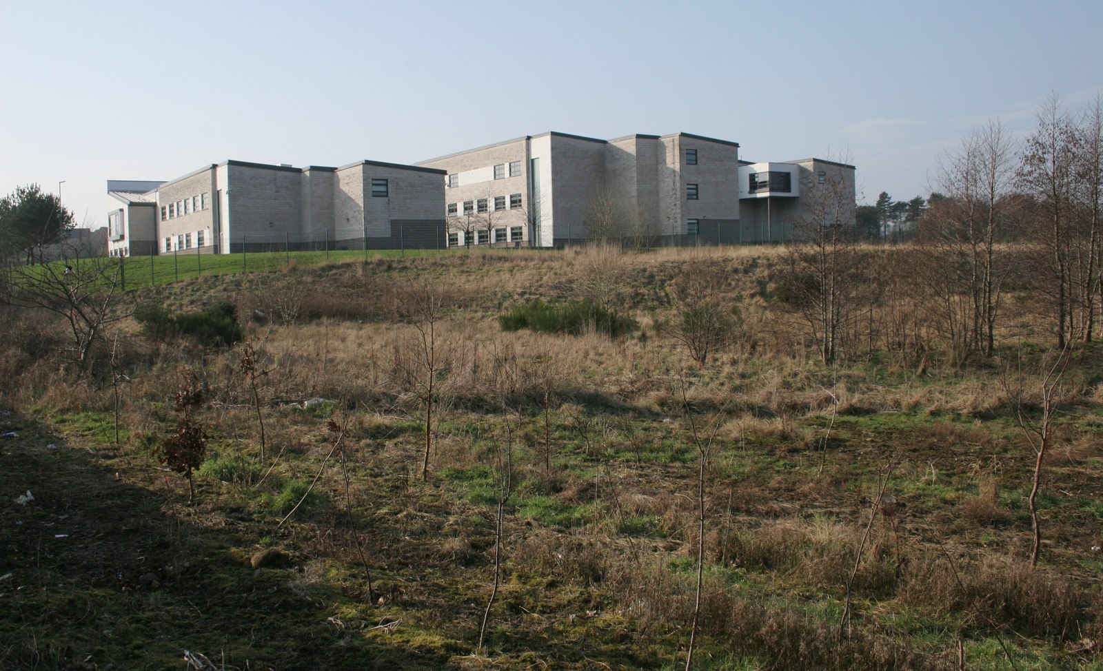
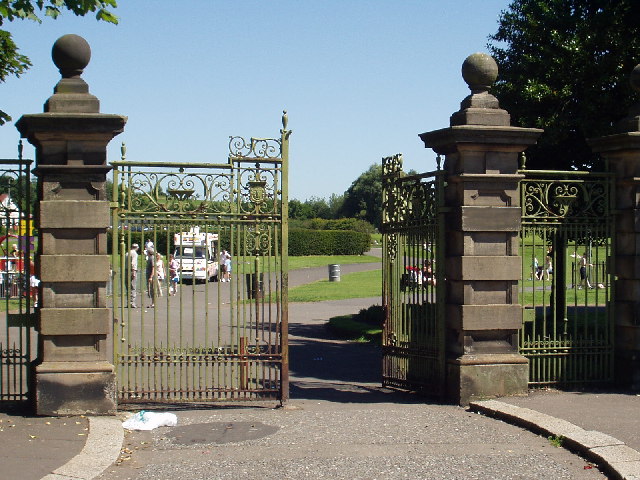
St Andrew's Academy, Paisley

St Andrew's Academy is a Roman Catholic secondary school in Hawkhead, Paisley, Scotland. The school was opened in 1990, with its importance growing in...

Hawkhead Hospital

Hawkhead Hospital was a health facility on Hawkhead Road in Hawkhead, Renfrewshire, Scotland. The complex is Grade B listed. == History == The facility...
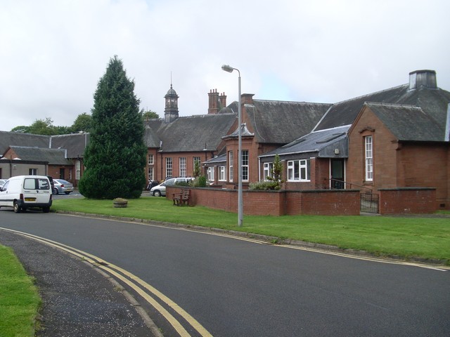
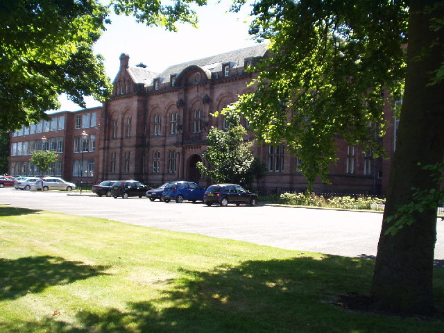
Dykebar Hospital

Dykebar Hospital is a mental health facility in Dykebar, Paisley, Renfrewshire, Scotland. The main building is a Grade B listed building. The hospital...

Abbey, Renfrewshire

Abbey, or sometimes Abbey Paisley, is a civil parish in Renfrewshire, Scotland traditionally centred on the towns of Paisley and Johnstone and including...

Hawkhead

Hawkhead (Scots: Hauchheid, Scottish Gaelic: Ceann an Dail) is an area near Paisley in Renfrewshire, Scotland. The village is on the Hawkhead Burn and...

Blackhall Manor

Blackhall Manor is a tower house in Paisley in Renfrewshire, in the western central Lowlands of Scotland. It dates to the sixteenth century, although parts...

Nearby Amenities

Located within 500m of 55.830734,-4.3999817
Traffic Signals
Traffic Signals: signal
Lat/Long: 55.8334718/-4.4027011
Bus Stop
Check Date Shelter: 2023-04-22
Naptan AtcoCode: 6140316
Naptan NaptanCode: 73923546
Shelter: yes
Lat/Long: 55.8292769/-4.3943915
Bus Stop
Naptan AtcoCode: 6140317
Naptan NaptanCode: 73923632
Lat/Long: 55.8289043/-4.3938231
Traffic Calming: table
Lat/Long: 55.8271069/-4.40323
Turning Circle
Lat/Long: 55.8329312/-4.4067234
Crossing
Crossing: traffic_signals
Crossing Ref: pelican
Lat/Long: 55.8294961/-4.3943151
Crossing
Crossing: traffic_signals
Crossing Ref: pelican
Lat/Long: 55.8296307/-4.3941952
Traffic Calming: table
Lat/Long: 55.8275284/-4.4037996
Traffic Calming: table
Lat/Long: 55.8277063/-4.4021021
Traffic Calming: table
Lat/Long: 55.8279304/-4.4017256
Traffic Calming: table
Lat/Long: 55.8278338/-4.4045023
Dykebar
Historic Railway: station
Railway: site
Wikidata: Q5318670
Wikipedia: en:Dykebar railway station
Lat/Long: 55.8317547/-4.394054
Traffic Calming: table
Lat/Long: 55.8282264/-4.4049535
Dykebarhill
Ele: 52
Natural: peak
Old Name: Dikebarhill
Lat/Long: 55.8309611/-4.4002416
Traffic Calming: cushion
Lat/Long: 55.8296446/-4.4027585
Traffic Calming: cushion
Lat/Long: 55.8299809/-4.4031642
Traffic Calming: table
Lat/Long: 55.827478/-4.4025526
Traffic Calming: cushion
Lat/Long: 55.8292851/-4.4023257
Traffic Calming: cushion
Lat/Long: 55.830302/-4.4035661
Traffic Calming: cushion
Lat/Long: 55.8288752/-4.4018322
Traffic Calming: cushion
Lat/Long: 55.8284169/-4.4012773
Crossing
Bicycle: yes
Crossing: traffic_signals
Crossing Ref: toucan
Lat/Long: 55.8342412/-4.3953481
Crossing
Crossing: traffic_signals
Crossing Island: no
Lat/Long: 55.8324493/-4.3958795
Bus Stop
Lochfield Road/Todholm Primary
Covered: yes
Naptan AtcoCode: 6140338
Naptan NaptanCode: 73923468
Shelter: yes
Lat/Long: 55.8318303/-4.4033495
Ncn Milepost: mills
Sustrans Ref: MP341
Lat/Long: 55.8342702/-4.3977391
Dykebar
Place: suburb
Lat/Long: 55.829449/-4.4021882
Waste Basket
Lat/Long: 55.8350193/-4.4011277
Ford: yes
Lat/Long: 55.8268602/-4.3993906
Crossing
Crossing: traffic_signals
Lat/Long: 55.8322446/-4.3993861
The data included in this document is from www.openstreetmap.org. The data is made available under ODbL.

Have you been to Dykebar Hill?

Leave your review of Dykebar Hill below (or comments, questions and feedback).