Creag Chathalain

Hill, Mountain in Inverness-shire

Scotland

Creag Chathalain

The Spey below Creag Chathalain Creag Chathalain is a steep rocky nose overlooking the Spey.
The Spey below Creag Chathalain Credit: Jim Barton

Creag Chathalain is a prominent hill located in Inverness-shire, Scotland. It is situated in the Glen Strathfarrar area, which is known for its stunning natural beauty and rugged landscapes. The hill stands at an elevation of approximately 790 meters (2592 feet) above sea level, making it a significant landmark in the region.

Creag Chathalain offers breathtaking panoramic views of the surrounding area, including the picturesque Glen Strathfarrar and the nearby mountains. Its distinctive shape and rocky terrain make it a popular destination for hikers and outdoor enthusiasts looking for a challenging climb.

The hill is also home to a variety of flora and fauna, with heather-covered slopes and scattered trees dotting the landscape. Wildlife such as red deer and golden eagles can often be spotted in the area, adding to the natural charm of Creag Chathalain.

Access to Creag Chathalain is primarily through Glen Strathfarrar, which requires a permit to enter due to its status as a private estate. This limited access helps preserve the natural environment and ensures a peaceful and undisturbed experience for those who visit.

For those seeking an adventure, Creag Chathalain provides an opportunity to immerse oneself in the beauty of the Scottish Highlands. Whether you are an experienced hiker or simply looking to enjoy the serenity of the region, this hill offers a unique and unforgettable experience for all who venture to its summit.

If you have any feedback on the listing, please let us know in the comments section below.

Creag Chathalain Images

Images are sourced within 2km of 57.018314/-4.4890261 or Grid Reference NN4894. Thanks to Geograph Open Source API. All images are credited.
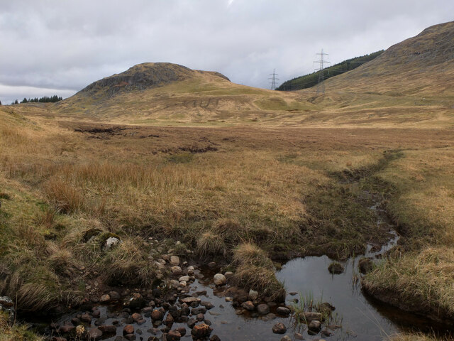
The Spey below Creag Chathalain Creag Chathalain is a steep rocky nose overlooking the Spey.
The Spey below Creag Chathalain
Creag Chathalain is a steep rocky nose overlooking the Spey.
General Wade's road and the River Spey The road about 3km from Melgarve with the Spey alongside and the Beauly to Denny power line heading into the distance towards the bend to the northwest into Corrie Yairack. The previous lower voltage power line passed to the south of Creag Bheag, whereas the new line takes a more direct route to the north side.
General Wade's road and the River Spey
The road about 3km from Melgarve with the Spey alongside and the Beauly to Denny power line heading into the distance towards the bend to the northwest into Corrie Yairack. The previous lower voltage power line passed to the south of Creag Bheag, whereas the new line takes a more direct route to the north side.
Downstream view of the Spey The river heading towards the plantation on Druim na h-Iolairig with the hillside of Stac Buidhe in the background.
Downstream view of the Spey
The river heading towards the plantation on Druim na h-Iolairig with the hillside of Stac Buidhe in the background.
A car on Wade's Road The last few kilometres of the road to Melgarve from Garva Bridge is in good condition but pretty quiet. I saw about half a dozen vehicles and a few cyclists in about 4 hours.
A car on Wade's Road
The last few kilometres of the road to Melgarve from Garva Bridge is in good condition but pretty quiet. I saw about half a dozen vehicles and a few cyclists in about 4 hours.
A bend in the River Spey The river about 3km downstream from Melgarve.
A bend in the River Spey
The river about 3km downstream from Melgarve.
Bog and Creag Bheag The Beauly to Denny power line runs to the north of Creag Bheag.
Bog and Creag Bheag
The Beauly to Denny power line runs to the north of Creag Bheag.
Power line tower below Creag Mhor One of the towers that support the Beauly to Denny power line, a 220km long set of lines transmitting electric power at 400kV. Towers range in height from 42 to 65m; in this one the six sets of twin lines are strung with their insulators horizontal, rather than hanging from the arms. The background is the steep southern face of Creag Mhor.
Power line tower below Creag Mhor
One of the towers that support the Beauly to Denny power line, a 220km long set of lines transmitting electric power at 400kV. Towers range in height from 42 to 65m; in this one the six sets of twin lines are strung with their insulators horizontal, rather than hanging from the arms. The background is the steep southern face of Creag Mhor.
Alltachaorain across the Spey An estate bothy which takes its name from the burn behind it, the Allt a' Chaorainn or burn of the rowan - see 'Reading the Gaelic Landscape' by John Murray (Whittles Publishing 2014).
Alltachaorain across the Spey
An estate bothy which takes its name from the burn behind it, the Allt a' Chaorainn or burn of the rowan - see 'Reading the Gaelic Landscape' by John Murray (Whittles Publishing 2014).
Levelled area by the Military Road A rectangular area by the road has been levelled for some purpose. It does not coincide with the map location of a tower from the previous power line, now removed. Perhaps it was a compound used in the removal programme.
Levelled area by the Military Road
A rectangular area by the road has been levelled for some purpose. It does not coincide with the map location of a tower from the previous power line, now removed. Perhaps it was a compound used in the removal programme.
Bothy above the south bank of the Spey The bothy is named as Attachorain on the OS map and stands close by a burn of the same name. The burn isn't visible on this shot, whilst there's only a glimpse of the Spey.
Bothy above the south bank of the Spey
The bothy is named as Attachorain on the OS map and stands close by a burn of the same name. The burn isn't visible on this shot, whilst there's only a glimpse of the Spey.
Upper Spey valley scene General Wade's road is seen on the right of the photo, with modern power lines and a service road heading along the hillside. The small craggy lump is Creag Bheag.
Upper Spey valley scene
General Wade's road is seen on the right of the photo, with modern power lines and a service road heading along the hillside. The small craggy lump is Creag Bheag.
Upstream along the Spey Already quite a wide river, this is the Spey a few miles downstream from its source.
Upstream along the Spey
Already quite a wide river, this is the Spey a few miles downstream from its source.
Downstream along the Spey A view down the Spey with the surfaced road from Garva Bridge to near Melgarve to the left.  It was about here that I was flagged down by a motorist heading the opposite way having turned round at the road end. His satnav had sent him this way to reach Fort Augustus and he was anxious to know if I was doing the same. [no] It's a long way back to the A86 and then A82, but slightly less rough.
Downstream along the Spey
A view down the Spey with the surfaced road from Garva Bridge to near Melgarve to the left. It was about here that I was flagged down by a motorist heading the opposite way having turned round at the road end. His satnav had sent him this way to reach Fort Augustus and he was anxious to know if I was doing the same. [no] It's a long way back to the A86 and then A82, but slightly less rough.
New bridge over Allt a Ghiubhais On an access road being built for construction of the Beauly to Denny power line.
New bridge over Allt a Ghiubhais
On an access road being built for construction of the Beauly to Denny power line.
Access road for Beauly - Denny power line construction A small part of hundreds of miles of track being bulldozed across the countryside to give access for construction of the Beauly to Denny power line.  This section goes from the Spey Dam to Melgarve.
Access road for Beauly - Denny power line construction
A small part of hundreds of miles of track being bulldozed across the countryside to give access for construction of the Beauly to Denny power line. This section goes from the Spey Dam to Melgarve.
Boggy ground beside the River Spey A flood plain at Alltachorain.
Boggy ground beside the River Spey
A flood plain at Alltachorain.
Facilities in the glen Portable toilets for the use of forestry workers during felling to make way for the Beauly to Denny power line.
Facilities in the glen
Portable toilets for the use of forestry workers during felling to make way for the Beauly to Denny power line.
Sheiling on the Upper Spey Crofters and their animals used to spend their summer in sheilings like this one in the hills.
Sheiling on the Upper Spey
Crofters and their animals used to spend their summer in sheilings like this one in the hills.
Show me another place!

Creag Chathalain is located at Grid Ref: NN4894 (Lat: 57.018314, Lng: -4.4890261)

Unitary Authority: Highland

Police Authority: Highlands and Islands

What 3 Words

///inflict.soggy.competing. Near Newtonmore, Highland

Nearby Locations

Creag Chathalain

Related Wikis

A86 road

The A86 is a major road in Scotland. It runs from the Great Glen at Spean Bridge to Kingussie and the Cairngorms National Park via Loch Laggan. It is a...

Loch Spey

Loch Spey is a small freshwater loch located in the Central Highlands of Scotland. This loch is significant because it forms the headwaters of the powerful...

Kinloch Laggan

Kinloch Laggan (Scottish Gaelic: Ceann Loch Lagain) is a hamlet located at the head of Loch Laggan in Newtonmore, Inverness-shire, Scottish Highlands...

East Highland Way

The East Highland Way (Scottish Gaelic: Slighe Gaidhealtachd an Ear) is a long-distance walking route in Scotland that connects Fort William (56.8178°N...

Nearby Amenities

Located within 500m of 57.018314,-4.4890261
Creag Chathalain
Natural: peak
Source: NLS_OS7
Lat/Long: 57.0177208/-4.4898048
The data included in this document is from www.openstreetmap.org. The data is made available under ODbL.

Have you been to Creag Chathalain?

Leave your review of Creag Chathalain below (or comments, questions and feedback).