Ardwell Hill

Hill, Mountain in Kirkcudbrightshire

Scotland

Ardwell Hill

Path for Cairnsmore of Fleet passing through woodland The main path for Cairnsmore of Fleet beginning to climb north-east of the buildings at Cairnsmore Farm.
Path for Cairnsmore of Fleet passing through woodland Credit: Trevor Littlewood

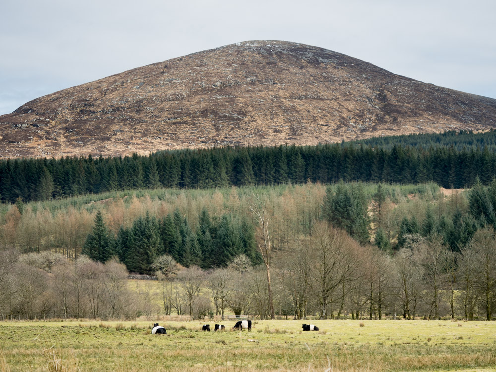
Ardwell Hill, located in Kirkcudbrightshire, Scotland, is a prominent hill standing at an elevation of approximately 200 meters above sea level. It is nestled within the Galloway Hills, a range known for its scenic beauty and diverse wildlife.

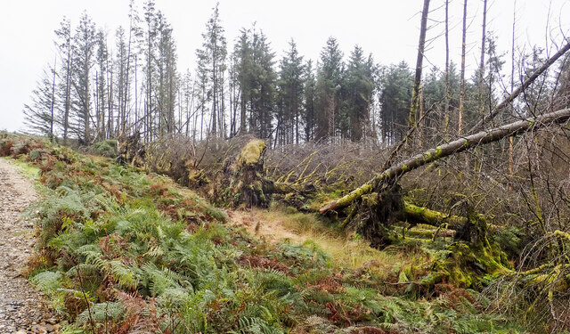
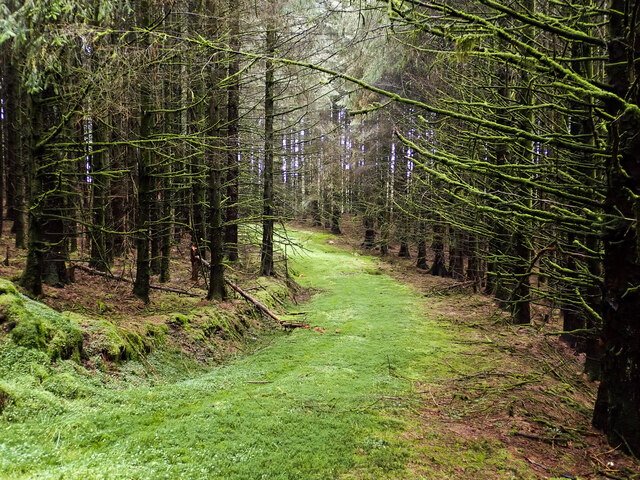
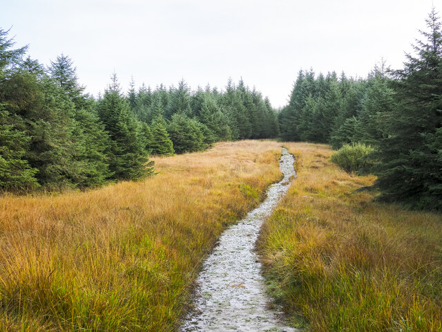
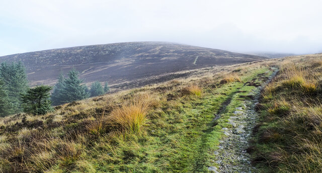
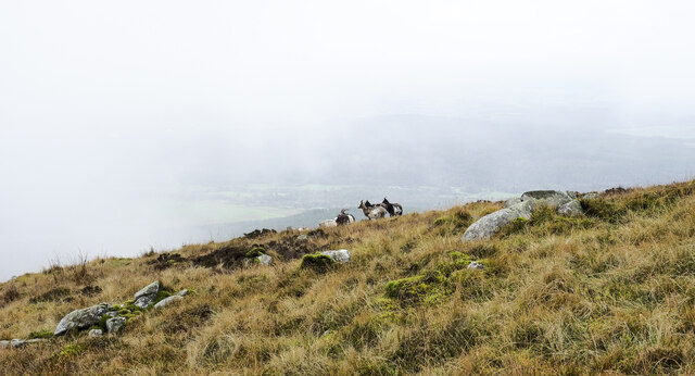
The hill is characterized by its gentle slopes, covered in heather and grass, which provide a habitat for various plants and animals. The surrounding landscape offers breathtaking views of the surrounding countryside, including the nearby Solway Firth and the Irish Sea.

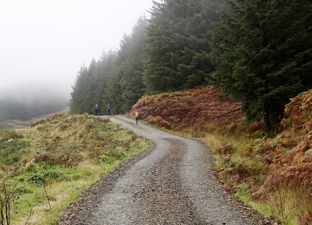
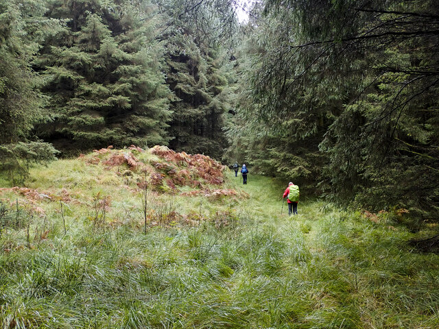
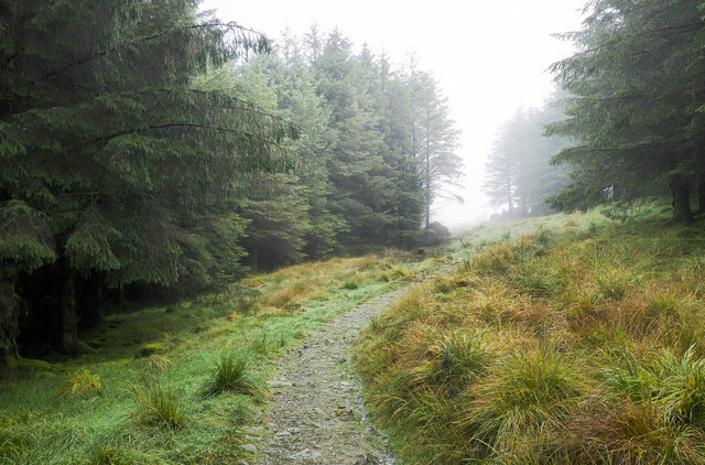
Ardwell Hill is a popular destination for nature enthusiasts and hikers who are drawn to its tranquil atmosphere and stunning vistas. Several trails wind through the area, allowing visitors to explore the hill's diverse flora and fauna while enjoying the serenity of the surrounding countryside. The hill's summit offers a panoramic view of the surrounding hills and valleys, providing a rewarding experience for those who make the climb.

In addition to its natural beauty, Ardwell Hill also holds historical significance. It is believed to have been inhabited since ancient times, with evidence of ancient settlements and burial sites found in the vicinity. The hill and its surroundings are steeped in local folklore and legends, adding to its allure for those interested in the region's history and culture.

Overall, Ardwell Hill is a captivating destination that offers both natural beauty and historical intrigue. Its accessibility and scenic charm make it a must-visit location for anyone exploring Kirkcudbrightshire or the wider Galloway region.

If you have any feedback on the listing, please let us know in the comments section below.
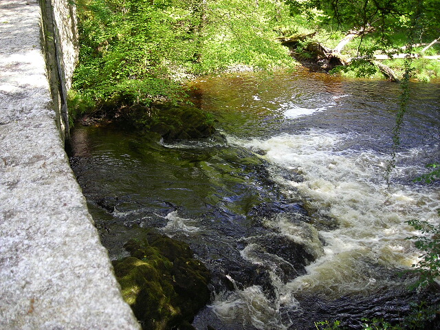
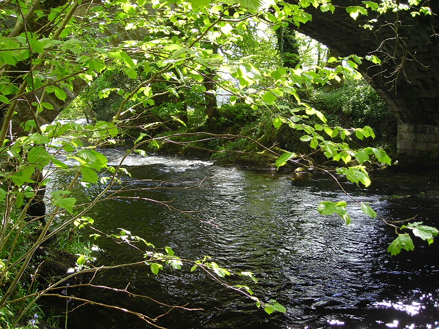
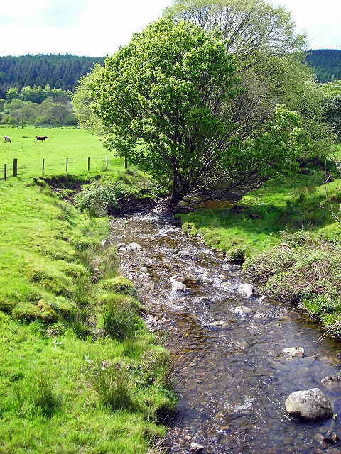
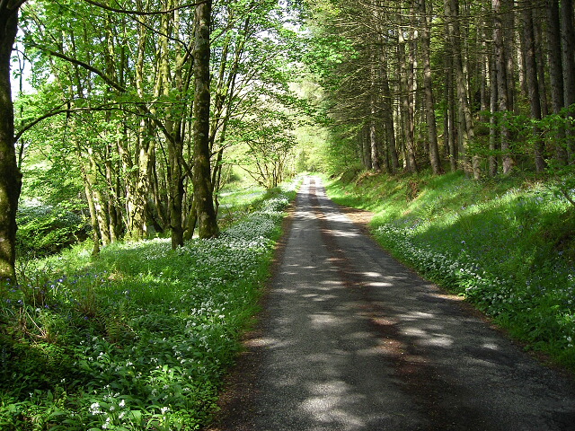
Ardwell Hill Images

Images are sourced within 2km of 54.963572/-4.37946 or Grid Reference NX4765. Thanks to Geograph Open Source API. All images are credited.

Path for Cairnsmore of Fleet passing through woodland The main path for Cairnsmore of Fleet beginning to climb north-east of the buildings at Cairnsmore Farm.
Path for Cairnsmore of Fleet passing through woodland
The main path for Cairnsmore of Fleet beginning to climb north-east of the buildings at Cairnsmore Farm.
Walkers on forest road on slope of Ardwell Hill Ardwell Hill is part of a western spur of the hill Cairnsmore of Fleet, it rises to the right out of the image.
Walkers on forest road on slope of Ardwell Hill
Ardwell Hill is part of a western spur of the hill Cairnsmore of Fleet, it rises to the right out of the image.
Forest road on Ardwell Hill Ardwell Hill is a forested, western spur of Cairnsmore of Fleet. Here, the forest road more or less contours around it then continues towards a crossing of the Mill Burn.
Forest road on Ardwell Hill
Ardwell Hill is a forested, western spur of Cairnsmore of Fleet. Here, the forest road more or less contours around it then continues towards a crossing of the Mill Burn.
Windthrown trees on west side of forest road The road and trees are on the west side of the hill, Cairnsmore of Fleet. A good number of trees have been brought down both in view in the image and further along the road.
Windthrown trees on west side of forest road
The road and trees are on the west side of the hill, Cairnsmore of Fleet. A good number of trees have been brought down both in view in the image and further along the road.
Vague path through coniferous plantation Coniferous plantings occupy much of the eastern side of the Bargaly Glen as the slope rises towards Cairnsmore of Fleet. A virtually disused, vegetated forest road heads south into the trees to reach and cross the Knock Burn by a bridge; from there the road gradually looses its identity becoming the path being followed by the walking party in the image.
Vague path through coniferous plantation
Coniferous plantings occupy much of the eastern side of the Bargaly Glen as the slope rises towards Cairnsmore of Fleet. A virtually disused, vegetated forest road heads south into the trees to reach and cross the Knock Burn by a bridge; from there the road gradually looses its identity becoming the path being followed by the walking party in the image.
Route through trees in Bargaly Glen The way is through trees to the east of the Palnure Burn and properties such as Bargaly Farm House. Further north the route it's a little used or even disused forest road until it reaches the Knock Burn which is crossed by a sort of bridge. South from there it becomes more of a path, fading progressively and becoming very wet in places. From this location however the way is absolutely clear between coniferous trees.
Route through trees in Bargaly Glen
The way is through trees to the east of the Palnure Burn and properties such as Bargaly Farm House. Further north the route it's a little used or even disused forest road until it reaches the Knock Burn which is crossed by a sort of bridge. South from there it becomes more of a path, fading progressively and becoming very wet in places. From this location however the way is absolutely clear between coniferous trees.
Bungalow beside Mill Burn The burn flows just below the slope to the right, it then passes beneath the Woodend Bridge from which the image was made.
Bungalow beside Mill Burn
The burn flows just below the slope to the right, it then passes beneath the Woodend Bridge from which the image was made.
Sunlit field east of Little Park Shadowed trees beyond and shadowed bracken before but a luminously-lit grassed field in between.
Sunlit field east of Little Park
Shadowed trees beyond and shadowed bracken before but a luminously-lit grassed field in between.
Road heading north in valley of Palnure Burn The road is on the eastern side of the burn approaching Bardrochwood and other properties at Bargaly where it terminates, at least for public, motorised use.
Road heading north in valley of Palnure Burn
The road is on the eastern side of the burn approaching Bardrochwood and other properties at Bargaly where it terminates, at least for public, motorised use.
Path over Bardrochwood Moor Bardrochwood Moor is on the western side of Crammery Hill, part of the extensive hill, Cairnsmore of Fleet. The path is the main route used by people climbing the hill.
Path over Bardrochwood Moor
Bardrochwood Moor is on the western side of Crammery Hill, part of the extensive hill, Cairnsmore of Fleet. The path is the main route used by people climbing the hill.
Path approaching exit of coniferous plantation The path has risen through the coniferous planting on Bardrochwood Moor to this location north of Crammery Hill. Crammery Hill and the moor are both part of the major hill, Cairnsmore of Fleet; the path is the main route used by people climbing that hill.
Path approaching exit of coniferous plantation
The path has risen through the coniferous planting on Bardrochwood Moor to this location north of Crammery Hill. Crammery Hill and the moor are both part of the major hill, Cairnsmore of Fleet; the path is the main route used by people climbing that hill.
Path rising for Cairnsmore of Fleet The path is the  main route for the ascent of Cairnsmore of Fleet; at this location it's north of Crammery Hill. The path can also be seen more distantly rising on the hill dome.
Path rising for Cairnsmore of Fleet
The path is the main route for the ascent of Cairnsmore of Fleet; at this location it's north of Crammery Hill. The path can also be seen more distantly rising on the hill dome.
Wild goats and boulders on hill slope The slope is part of the hill, Cairnsmore of Fleet. The goats are on the near horizon to the left of the highest rocks; just six animals can be seen but there were more.
Wild goats and boulders on hill slope
The slope is part of the hill, Cairnsmore of Fleet. The goats are on the near horizon to the left of the highest rocks; just six animals can be seen but there were more.
Farmhouse at Craignine The farmhouse seen over a field from the west side of Craignine Bridge which carries a minor road over the Palnure Burn.
Farmhouse at Craignine
The farmhouse seen over a field from the west side of Craignine Bridge which carries a minor road over the Palnure Burn.
Falls on Palnure Burn at Craignine Bridge
Palnure Burn at Craignine Bridge
Burn at Woodend Bridge
Minor Road Flanked by Wild Garlic and Bluebells
Show me another place!

Ardwell Hill is located at Grid Ref: NX4765 (Lat: 54.963572, Lng: -4.37946)

Unitary Authority: Dumfries and Galloway

Police Authority: Dumfries and Galloway

What 3 Words

///outdoor.tonal.adding. Near Newton Stewart, Dumfries & Galloway

Nearby Locations

Ardwell Hill

Related Wikis

Cairnsmore of Fleet

Cairnsmore of Fleet is an isolated mountain in the Southern Uplands of Scotland. The mountain forms an unafforested granite massif, whose highest point...

Kirroughtree

Kirroughtree Forest is located near Newton Stewart in Dumfries and Galloway, southwest Scotland and overlooks the Irish Sea. It is managed by Forestry...

Palnure railway station

Palnure railway station (NX450634) was a railway station on the Portpatrick and Wigtownshire Joint Railway close to Newton Stewart and the junction for...

Palnure

Palnure (Scottish Gaelic: Poll an Iùbhair) is a small village in the historical county of Kirkcudbrightshire in Dumfries and Galloway, Scotland, on the...

Kirroughtree House

Kirroughtree House is the heritage-listed mansion house (Category B listing.) of the Kirroughtree estate. It occupies a prominent position 1 mile (1.6...

Talnotrie Hoard

The Talnotrie Hoard is a 9th-century mixed hoard of jewellery, coinage, metal-working objects and raw materials found in Talnotrie, Scotland, in 1912....

Creetown railway station

Creetown railway station served the town of Creetown, Dumfries and Galloway, Scotland from 1861 to 1965 on the Portpatrick and Wigtownshire Joint Railway...

Minnigaff

Minnigaff is a village and civil parish in the historic county of Kirkcudbrightshire in Dumfries and Galloway, Scotland. Lead was discovered there in...

Nearby Amenities

Located within 500m of 54.963572,-4.37946
The data included in this document is from www.openstreetmap.org. The data is made available under ODbL.

Have you been to Ardwell Hill?

Leave your review of Ardwell Hill below (or comments, questions and feedback).