Black Law

Hill, Mountain in Ayrshire

Scotland

Black Law

B769 near Blacklaw Wet road (Stewarton to Newton Mearns) after a rain shower.
B769 near Blacklaw Credit: wfmillar

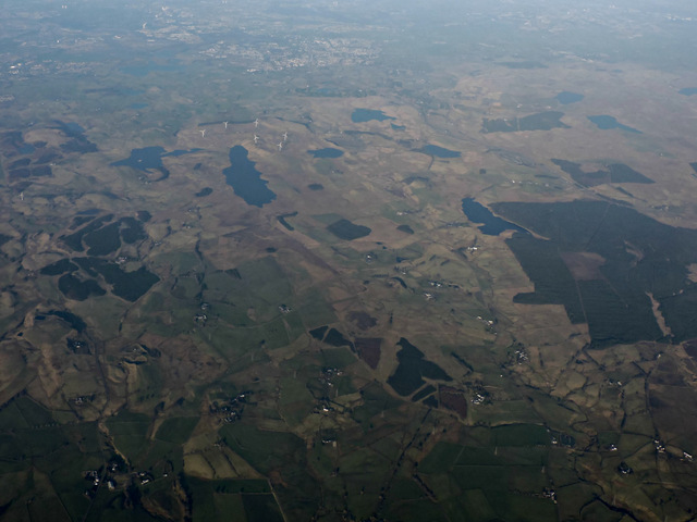
Black Law is a prominent hill located in Ayrshire, Scotland. Situated approximately 6 miles northeast of the town of Ayr, it forms part of the Southern Uplands range. Rising to a height of 479 meters (1,572 feet), Black Law offers stunning panoramic views of the surrounding countryside and is a popular destination for hikers and nature enthusiasts.

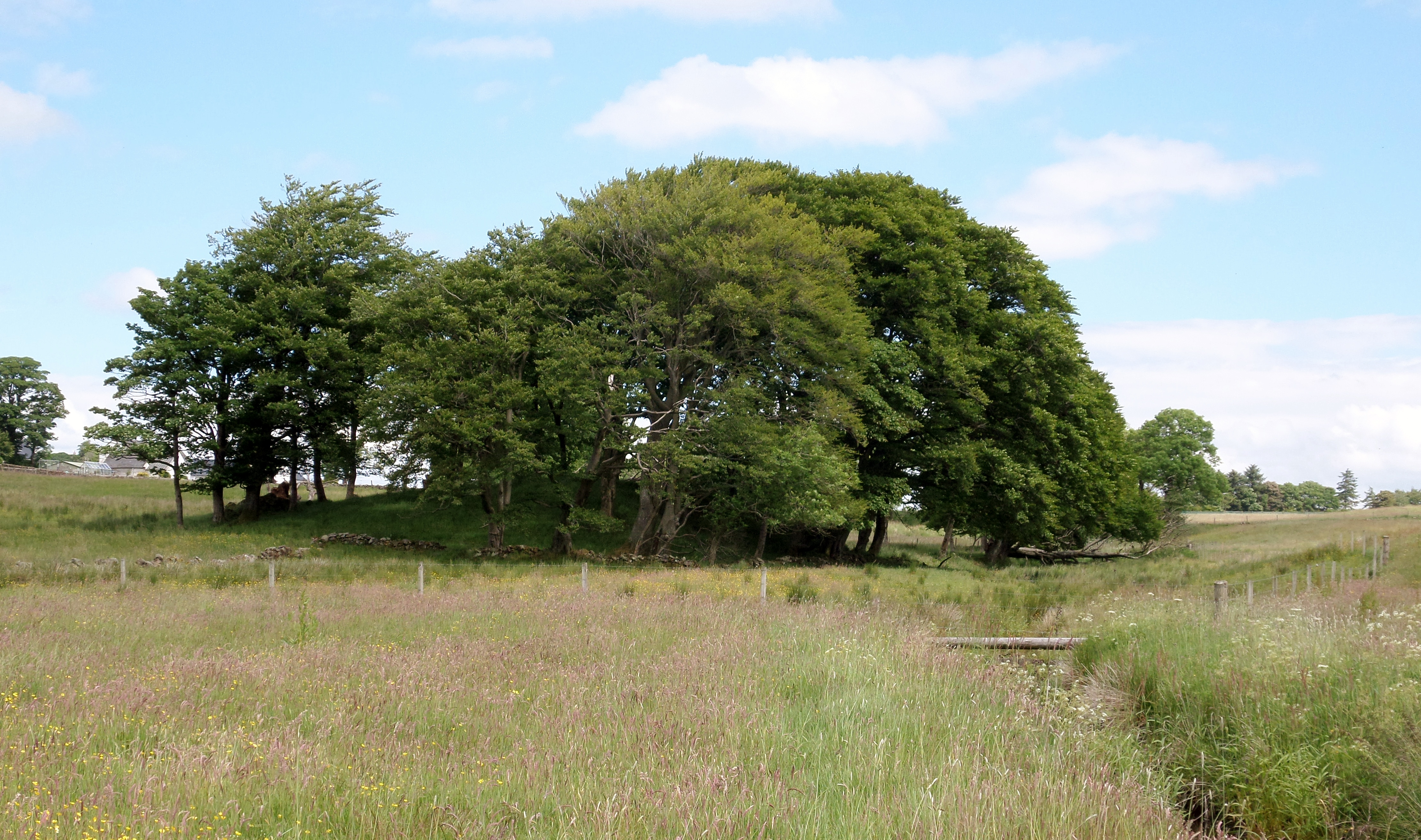
The hill is characterized by its rugged terrain, featuring steep slopes, rocky outcrops, and heather-covered moorland. It is known for its diverse flora and fauna, with an abundance of wildflowers, grasses, and mosses, as well as various bird species, including peregrine falcons and red grouse.

Black Law is also of historical significance, with traces of human activity dating back centuries. There are remnants of ancient settlements and burial sites, indicating that the hill has been inhabited throughout different periods of history. Moreover, the hill has played a role in local folklore and legends, further adding to its cultural and historical appeal.

Access to Black Law is relatively straightforward, with various footpaths and trails leading to the summit. The most popular approach is from the nearby village of Coylton, where a well-marked path guides visitors through the rolling countryside and up the hill. Along the way, hikers can enjoy the peaceful ambiance and stunning views of the surrounding landscape.

In conclusion, Black Law in Ayrshire is a captivating hill that offers a combination of natural beauty, historical significance, and recreational opportunities. It is a must-visit destination for those seeking an immersive outdoor experience in Scotland's picturesque countryside.

If you have any feedback on the listing, please let us know in the comments section below.

Black Law Images

Images are sourced within 2km of 55.720388/-4.4465191 or Grid Reference NS4650. Thanks to Geograph Open Source API. All images are credited.

B769 near Blacklaw Wet road (Stewarton to Newton Mearns) after a rain shower.
B769 near Blacklaw
Wet road (Stewarton to Newton Mearns) after a rain shower.
Black Law The hill is to the right of the photograph and the tautologically named Blacklawhill Farm to its left.
Black Law
The hill is to the right of the photograph and the tautologically named Blacklawhill Farm to its left.
Ruinous shelter Two brown cows under a ruined bridge across a burn ... sheltering from the sun or just down for a drink?
Ruinous shelter
Two brown cows under a ruined bridge across a burn ... sheltering from the sun or just down for a drink?
Glenouther Moor from the air The woodland on the right is Glenouther Moor, with Corsehouse reservoir alongside it. The largest of the other visible reservoirs is Long Loch, with Harelaw Dam to its left.
Glenouther Moor from the air
The woodland on the right is Glenouther Moor, with Corsehouse reservoir alongside it. The largest of the other visible reservoirs is Long Loch, with Harelaw Dam to its left.
Glenouther Moor from the air The woodland is Glenouther Moor, with Corsehouse reservoir alongside it. Long Loch is visible on the left, Swinzie Burn can be seen leaving the woodland and heading towards the bottom of the photo.

The M77 motorway and part of Whitelee wind farm can also be seen.
Glenouther Moor from the air
The woodland is Glenouther Moor, with Corsehouse reservoir alongside it. Long Loch is visible on the left, Swinzie Burn can be seen leaving the woodland and heading towards the bottom of the photo. The M77 motorway and part of Whitelee wind farm can also be seen.
Annick Water Bridge takes the B769 over the burn.
Annick Water
Bridge takes the B769 over the burn.
Trees by Corsehouse farm road Farm road leads south from the B769.
Trees by Corsehouse farm road
Farm road leads south from the B769.
Townened of Fulwood from the air The disused quarry opposite Craignaught Farm <a href="https://www.geograph.org.uk/photo/171003">NS4451 : Disused quarry</a> can be seen in the lower right corner.
Townened of Fulwood from the air
The disused quarry opposite Craignaught Farm NS4451 : Disused quarry can be seen in the lower right corner.
B769 road at Windy-Yett Passing through farmland between Newton Mearns and Stewarton, the B769 is always called the "Stewarton road". Here it heads south, passing the entrance to Windy-Yett farm on the right, and the junction with the minor road to the A77 on the left.
B769 road at Windy-Yett
Passing through farmland between Newton Mearns and Stewarton, the B769 is always called the "Stewarton road". Here it heads south, passing the entrance to Windy-Yett farm on the right, and the junction with the minor road to the A77 on the left.
Stewarton Road near Blacklaw The Stewarton Road passing through the farming country of North Ayrshire
Stewarton Road near Blacklaw
The Stewarton Road passing through the farming country of North Ayrshire
West Whitelee Wet fields at West Whitelee Farm.
West Whitelee
Wet fields at West Whitelee Farm.
Blacklaw Rough grazing land at Blacklaw - on a foul afternoon.
Blacklaw
Rough grazing land at Blacklaw - on a foul afternoon.
Blacklawhill Farm Black Law behind farm.
Blacklawhill Farm
Black Law behind farm.
Blacklawhill Farm Road
Glenouther Cottage Being sympathetically renovated.
Glenouther Cottage
Being sympathetically renovated.
Lying Down But Not Dead Beside the track leading to Glenouther. This hawthorn was bursting into leaf.
Lying Down But Not Dead
Beside the track leading to Glenouther. This hawthorn was bursting into leaf.
Glenouther Moor Now forest.
Glenouther Moor
Now forest.
Glenouther Moor Track
Show me another place!

Black Law is located at Grid Ref: NS4650 (Lat: 55.720388, Lng: -4.4465191)

Unitary Authority: East Ayrshire

Police Authority: Ayrshire

What 3 Words

///tastes.newly.earliest. Near Dunlop, East Ayrshire

Nearby Locations

Black Law

Related Wikis

Lands of Blacklaw

The Lands of Blacklaw formed a small property of five merks worth, in the Lordship of Stewarton at the eastern extremity of Strathannick, between the hamlet...

Kingsford, East Ayrshire

Kingsford is a hamlet or clachan in Strathannick, East Ayrshire, parish of Stewarton, Scotland. The habitation is situated on the B769, two miles north...

Dunlop Castle

Dunlop Castle was a 14th-century castle, about 2.5 miles (4.0 km) north of Stewarton, East Ayrshire, Scotland. A large Jacobean-style house, Dunlop House...

Castle and Barony of Robertland

The Castle and Barony of Robertland (NS 4428 4693) is located near Stewarton, off the B769 road, in the old district of Cunninghame, Parish of Stewarton...

Nearby Amenities

Located within 500m of 55.720388,-4.4465191
Power: pole
Lat/Long: 55.716815/-4.4498473
Power: pole
Lat/Long: 55.7174568/-4.4488665
Power: pole
Lat/Long: 55.717907/-4.4482154
Power: pole
Lat/Long: 55.7185205/-4.4473598
Power: pole
Lat/Long: 55.718939/-4.4467734
Power: pole
Lat/Long: 55.7193716/-4.4461703
Power: pole
Lat/Long: 55.7196431/-4.4449641
Power: pole
Lat/Long: 55.7199205/-4.4437287
Power: pole
Lat/Long: 55.7200733/-4.4430338
Power: pole
Lat/Long: 55.7202825/-4.4420843
Power: pole
Lat/Long: 55.7205082/-4.4410596
Power: pole
Lat/Long: 55.7208255/-4.4396447
Power: pole
Lat/Long: 55.7184829/-4.4465626
Power: pole
Lat/Long: 55.7184512/-4.4456757
Power: pole
Lat/Long: 55.718403/-4.444505
Power: pole
Lat/Long: 55.7183701/-4.4435492
Power: pole
Lat/Long: 55.7214255/-4.4424338
Power: pole
Lat/Long: 55.7218792/-4.4421062
Power: pole
Lat/Long: 55.7221201/-4.4419413
Power: pole
Lat/Long: 55.7223317/-4.4417806
Power: pole
Lat/Long: 55.7219709/-4.4406475
Power: pole
Lat/Long: 55.7215736/-4.4394016
The data included in this document is from www.openstreetmap.org. The data is made available under ODbL.

Have you been to Black Law?

Leave your review of Black Law below (or comments, questions and feedback).