Fynloch Hill

Hill, Mountain in Dunbartonshire

Scotland

Fynloch Hill

View from Doughnot Hill The trig point sits a metre below the actual summit of 375 metres.
The hill's name amuses most people as it sounds a lot like 'doughnut'! The earliest record of it I have found is from a mid-1600s map on which it is recorded as 'Dounnet' Hill. All this is fanciful guesswork of course, but it is possible that it once had a small fort on it at some stage, 'dun' being an old word for fort in Scotland - there is, though, no mention of this anywhere.
It is the fifth highest hill in the Kilpatrick range, but having a prominence of just 20 metres or so, doesn't make it onto even the most obscure hill lists.
View from Doughnot Hill Credit: Ian Dodds

Fynloch Hill, also known as Fynloch Hillfort, is an ancient hill located in Dunbartonshire, Scotland. It is situated approximately 4 miles northeast of the town of Helensburgh and stands at an elevation of around 1,050 feet (320 meters) above sea level. The hill is part of the Kilpatrick Hills range, which forms a natural boundary between Dunbartonshire and Stirlingshire.

The hill is renowned for its historical significance, as it is home to the remains of an Iron Age hillfort. This hillfort is believed to have been constructed around 2,500 years ago and is one of the largest in the area. The fortification is circular in shape and encloses an area of approximately 2.5 acres. The defensive ramparts and ditches that once protected the hilltop settlement can still be observed today.

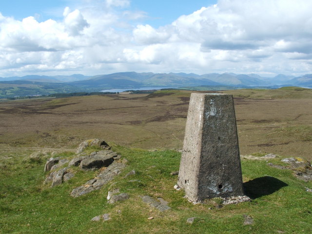
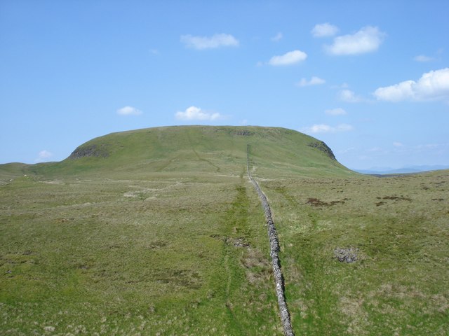
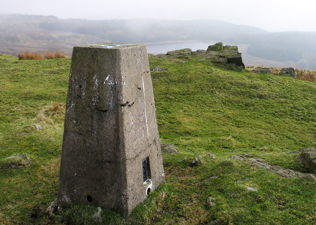
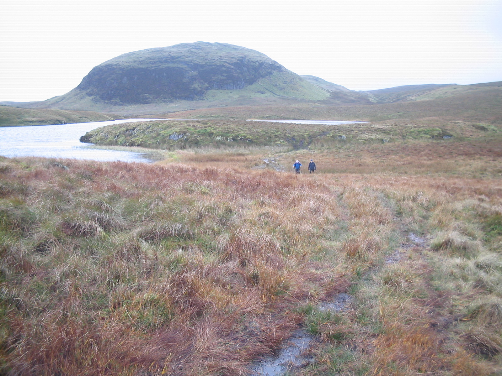
Fynloch Hill offers spectacular panoramic views of the surrounding countryside, including the River Clyde, Loch Lomond, and the nearby towns. The hill is a popular destination for hikers and offers various walking trails to explore its rugged terrain. The ascent to the summit can be challenging, but the breathtaking views make it well worth the effort.

The hill is also known for its diverse wildlife and is home to numerous bird species, including kestrels, buzzards, and peregrine falcons. Visitors may also come across deer, foxes, and rabbits during their exploration of the hill.

Overall, Fynloch Hill is a historically and geographically significant landmark, offering visitors a glimpse into the rich cultural heritage and natural beauty of Dunbartonshire.

If you have any feedback on the listing, please let us know in the comments section below.

Fynloch Hill Images

Images are sourced within 2km of 55.961466/-4.4666344 or Grid Reference NS4677. Thanks to Geograph Open Source API. All images are credited.

View from Doughnot Hill The trig point sits a metre below the actual summit of 375 metres.
The hill's name amuses most people as it sounds a lot like 'doughnut'! The earliest record of it I have found is from a mid-1600s map on which it is recorded as 'Dounnet' Hill. All this is fanciful guesswork of course, but it is possible that it once had a small fort on it at some stage, 'dun' being an old word for fort in Scotland - there is, though, no mention of this anywhere.
It is the fifth highest hill in the Kilpatrick range, but having a prominence of just 20 metres or so, doesn't make it onto even the most obscure hill lists.
View from Doughnot Hill
The trig point sits a metre below the actual summit of 375 metres. The hill's name amuses most people as it sounds a lot like 'doughnut'! The earliest record of it I have found is from a mid-1600s map on which it is recorded as 'Dounnet' Hill. All this is fanciful guesswork of course, but it is possible that it once had a small fort on it at some stage, 'dun' being an old word for fort in Scotland - there is, though, no mention of this anywhere. It is the fifth highest hill in the Kilpatrick range, but having a prominence of just 20 metres or so, doesn't make it onto even the most obscure hill lists.
The summit of the Doughnot Hill <a href="https://www.geograph.org.uk/photo/2836727">NS4477 : Doughnot Hill</a> is shown as "Douennet Hil" on the Pont/Blaeu map (which was based on surveys in the 1580s-90s). The "Dough-" of the modern spelling probably indicates the sound of "ch" in "loch" (the entirely accidental similarity to the much later word "doughnut" is misleading).

Likewise, in his booklet "Off the Main Road" (1976), I.M.M.MacPhail says that "beyond the Black Linn is the oddly-named Doughnot, a name pronounced formerly as 'Deochnay'. It is 1228 feet high and worth the short ascent for the fine view it offers". The "Black Linn" mentioned there is a waterfall: <a href="https://www.geograph.org.uk/photo/1734378">NS4477 : The Black Linn (detail)</a>. It gave its name to a reservoir built nearby: <a href="https://www.geograph.org.uk/photo/1654859">NS4477 : The Black Linn Reservoir</a>.

In the background of the present photograph, the areas of water are all part of Loch Lomond; the hills on the far side of the loch are more prominent in this view. The point from which this photograph was taken gives a fine view directly up the length of Glen Finlas (centred on <a href="https://www.geograph.org.uk/gridref/NS3388">NS3388</a>), just left of centre. Above the right-hand edge of the top of the trig point is the entrance of Glen Luss, viewed obliquely.

For other views of this summit area, see <a href="https://www.geograph.org.uk/photo/30697">NS4477 : Doughnot Hill</a>, <a href="https://www.geograph.org.uk/photo/284408">NS4477 : Doughnot Hill trig point S5142</a>, and <a href="https://www.geograph.org.uk/photo/830905">NS4477 : Trig point on Doughnot Hill</a>. For views of the hill from a distance, see, among others, <a href="https://www.geograph.org.uk/photo/830896">NS4477 : Doughnot Hill</a>, <a href="https://www.geograph.org.uk/photo/1937090">NS4377 : Weather station</a>, <a href="https://www.geograph.org.uk/photo/1595358">NS4477 : Doughnot Hill and Black Linn Reservoir</a>, and <a href="https://www.geograph.org.uk/photo/1796929">NS4377 : View along top of escarpment</a>.

Although its name is not now shown on maps, the little burn that arises on the eastern side of the hill, and which winds around the hill's northern side before meeting the Overtoun Burn, is called the Doughnot Burn (according to the OS Object Name Books).
The summit of the Doughnot Hill
NS4477 : Doughnot Hill is shown as "Douennet Hil" on the Pont/Blaeu map (which was based on surveys in the 1580s-90s). The "Dough-" of the modern spelling probably indicates the sound of "ch" in "loch" (the entirely accidental similarity to the much later word "doughnut" is misleading). Likewise, in his booklet "Off the Main Road" (1976), I.M.M.MacPhail says that "beyond the Black Linn is the oddly-named Doughnot, a name pronounced formerly as 'Deochnay'. It is 1228 feet high and worth the short ascent for the fine view it offers". The "Black Linn" mentioned there is a waterfall: NS4477 : The Black Linn (detail). It gave its name to a reservoir built nearby: NS4477 : The Black Linn Reservoir. In the background of the present photograph, the areas of water are all part of Loch Lomond; the hills on the far side of the loch are more prominent in this view. The point from which this photograph was taken gives a fine view directly up the length of Glen Finlas (centred on NS3388), just left of centre. Above the right-hand edge of the top of the trig point is the entrance of Glen Luss, viewed obliquely. For other views of this summit area, see NS4477 : Doughnot Hill, NS4477 : Doughnot Hill trig point S5142, and NS4477 : Trig point on Doughnot Hill. For views of the hill from a distance, see, among others, NS4477 : Doughnot Hill, NS4377 : Weather station, NS4477 : Doughnot Hill and Black Linn Reservoir, and NS4377 : View along top of escarpment. Although its name is not now shown on maps, the little burn that arises on the eastern side of the hill, and which winds around the hill's northern side before meeting the Overtoun Burn, is called the Doughnot Burn (according to the OS Object Name Books).
Doughnot Hill Doughnot Hill is viewed from near the point where the Crags Circular Path enters the forest. Looking closely one sees the burns that run down from either side - the Black Linn to the right - and a drystane wall that runs across its flank. A gibbous moon is at upper right.
Doughnot Hill
Doughnot Hill is viewed from near the point where the Crags Circular Path enters the forest. Looking closely one sees the burns that run down from either side - the Black Linn to the right - and a drystane wall that runs across its flank. A gibbous moon is at upper right.
Black Linn Reservoir and Doughnot Hill The photo looks along the wee dam on the northwest side of the Black Linn reservoir. Doughnot Hill's top lies just to the right of the trees.
Black Linn Reservoir and Doughnot Hill
The photo looks along the wee dam on the northwest side of the Black Linn reservoir. Doughnot Hill's top lies just to the right of the trees.
Gap in the forest on the Crags Circular Path The photo was taken at the point where the track to Humphrey Loch meets the Crags Circular Path. The Humphrey Loch track is at the photographer's back and the sign in the foreground indicates the way northeast along the Crags Circular path. The monoculture forest is a little bit unremitting but there is a slight gap at this point.
Gap in the forest on the Crags Circular Path
The photo was taken at the point where the track to Humphrey Loch meets the Crags Circular Path. The Humphrey Loch track is at the photographer's back and the sign in the foreground indicates the way northeast along the Crags Circular path. The monoculture forest is a little bit unremitting but there is a slight gap at this point.
Fallen tree across the path The Crags Circular Path is not quite blocked here by a fallen tree. These sights are almost routine in the forests since the big storm of 3 January 2012.
Fallen tree across the path
The Crags Circular Path is not quite blocked here by a fallen tree. These sights are almost routine in the forests since the big storm of 3 January 2012.
New moorland fence The green area on the right is the south-western slopes of Meikle Saughen Brae. Near the fence, there were a few sticks with pink labels on them; they were mostly set on rather slight mounds that were a little greener than their surroundings; they are perhaps related to surveying that was carried out in preparation for building the fence. Compare <a href="https://www.geograph.org.uk/photo/1759026">NS4775 : The first of a group of three shielings</a>, where the same sort of marker (from an archaeological survey) is visible.
New moorland fence
The green area on the right is the south-western slopes of Meikle Saughen Brae. Near the fence, there were a few sticks with pink labels on them; they were mostly set on rather slight mounds that were a little greener than their surroundings; they are perhaps related to surveying that was carried out in preparation for building the fence. Compare NS4775 : The first of a group of three shielings, where the same sort of marker (from an archaeological survey) is visible.
Spout of the Three Marches "A waterfall on the Little Saughen Brae Burn. At this point three Laird's lands met at one time, hence the name" [OS Object Name Book (late 19th century)].

In his book "The Waterfalls of Scotland" (1987), Louis Stott comments that "the burn comes to life with a five metre leap", and that the three estates meeting here were Wester Cameron (<a href="https://www.geograph.org.uk/photo/3355569">NS4583 : Wester Cameron Farm</a>), Strathleven (<a href="https://www.geograph.org.uk/photo/1058768">NS3978 : Strathleven House</a>) and Aucheneck (<a href="https://www.geograph.org.uk/photo/3620932">NS4883 : Aucheneck House</a>).

See <a href="https://www.geograph.org.uk/photo/2940310">NS4778 : Spout of the Three Marches</a> for another view. For a more distant view providing some context, see <a href="https://www.geograph.org.uk/photo/2940283">NS4778 : Spout of the Three Marches</a>.

One mile to the north-east, there used to be another waterfall called the <a href="https://www.geograph.org.uk/photo/2940257">NS4879 : Spout of the White Horse</a>; there is still a cascade of sorts there, but the area was greatly changed when a reservoir was built nearby.
Spout of the Three Marches
"A waterfall on the Little Saughen Brae Burn. At this point three Laird's lands met at one time, hence the name" [OS Object Name Book (late 19th century)]. In his book "The Waterfalls of Scotland" (1987), Louis Stott comments that "the burn comes to life with a five metre leap", and that the three estates meeting here were Wester Cameron (NS4583 : Wester Cameron Farm), Strathleven (NS3978 : Strathleven House) and Aucheneck (NS4883 : Aucheneck House). See NS4778 : Spout of the Three Marches for another view. For a more distant view providing some context, see NS4778 : Spout of the Three Marches. One mile to the north-east, there used to be another waterfall called the NS4879 : Spout of the White Horse; there is still a cascade of sorts there, but the area was greatly changed when a reservoir was built nearby.
Spout of the Three Marches The spout is a waterfall on the Little Saughen Brae Burn. The present photograph is a distant view intended mainly to provide some context. For a better view of the falls, and for more information, see <a href="https://www.geograph.org.uk/photo/2940274">NS4778 : Spout of the Three Marches</a>.
Spout of the Three Marches
The spout is a waterfall on the Little Saughen Brae Burn. The present photograph is a distant view intended mainly to provide some context. For a better view of the falls, and for more information, see NS4778 : Spout of the Three Marches.
Spout of the Three Marches This is a five-metre waterfall on the Little Saughen Brae Burn. See <a href="https://www.geograph.org.uk/photo/2940274">NS4778 : Spout of the Three Marches</a> for an explanation of its name, and for further details.
Spout of the Three Marches
This is a five-metre waterfall on the Little Saughen Brae Burn. See NS4778 : Spout of the Three Marches for an explanation of its name, and for further details.
The Crags Circular Path Compare <a href="https://www.geograph.org.uk/photo/1307597">NS4477 : The Crags Circular Path</a>, showing the path 4½ years earlier, when it was newly made.
The Crags Circular Path
Compare NS4477 : The Crags Circular Path, showing the path 4½ years earlier, when it was newly made.
The Black Linn The map shows the falls, which are on the Overtoun Burn, as being near the corner of a wall; that corner is directly behind the top of the waterfall.

When I visited this location in February 2010, the waterfall was entirely frozen. Click on the end-note title for other pictures, including some taken on that occasion.
The Black Linn
The map shows the falls, which are on the Overtoun Burn, as being near the corner of a wall; that corner is directly behind the top of the waterfall. When I visited this location in February 2010, the waterfall was entirely frozen. Click on the end-note title for other pictures, including some taken on that occasion.
The Black Linn Click on the end-note title for other views. In the present picture, the falls are flowing, though fringed by ice; on a previous visit, the falls had been entirely frozen.
The Black Linn
Click on the end-note title for other views. In the present picture, the falls are flowing, though fringed by ice; on a previous visit, the falls had been entirely frozen.
Track towards Loch Humphrey dam Icy access track to Loch Humphrey dam with Fynloch Hill (in the top left) and Duncolm (top right) visible beyond the reservoir.
Track towards Loch Humphrey dam
Icy access track to Loch Humphrey dam with Fynloch Hill (in the top left) and Duncolm (top right) visible beyond the reservoir.
Duncolm View to Duncolm my destination by bike.
Duncolm
View to Duncolm my destination by bike.
Duncolm Summit Duncolm trig point after a slog/push to the top by bike,return journey down the Loch Humphrey Road was amazing and quick.
Duncolm Summit
Duncolm trig point after a slog/push to the top by bike,return journey down the Loch Humphrey Road was amazing and quick.
Summit of Doughnot Hill The summit  of Doughnot Hill has a trig point, a grassed surface and outcrops of rock; Black Linn Reservoir which is also in grid square NS4477, can be seen in the distance.
Summit of Doughnot Hill
The summit of Doughnot Hill has a trig point, a grassed surface and outcrops of rock; Black Linn Reservoir which is also in grid square NS4477, can be seen in the distance.
Doughnot Hill From the path leading from the Lang Crags.
Doughnot Hill
From the path leading from the Lang Crags.
Show me another place!

Fynloch Hill is located at Grid Ref: NS4677 (Lat: 55.961466, Lng: -4.4666344)

Unitary Authority: West Dunbartonshire

Police Authority: Argyll and West Dunbartonshire

What 3 Words

///billiard.imposes.flanks. Near Old Kilpatrick, West Dunbartonshire

Nearby Locations

Fynloch Hill

Related Wikis

Duncolm

Duncolm (Scottish Gaelic: Dùn Choluim) is a hill in Scotland. It is the highest point in both West Dunbartonshire and the Kilpatrick Hills, at an elevation...

Loch Humphrey

Loch Humphrey is a loch in West Dunbartonshire, Scotland. It is fished for mainly perch and occasional trout by members of the Bearsden Angling Club, who...

Kilpatrick Hills

The Kilpatrick Hills are a range of hills in central Scotland, stretching from Dumbarton in the west to Strathblane in the east. Strathblane divides the...

West Dunbartonshire (UK Parliament constituency)

West Dunbartonshire is a county constituency of the House of Commons of the Parliament of the United Kingdom. It elects one Member of Parliament (MP) by...

Nearby Amenities

Located within 500m of 55.961466,-4.4666344
Fynloch Hill
Ele: 400
Ele Ft: 1313
Natural: peak
Lat/Long: 55.9614066/-4.4670519
Little Duncolm
Natural: peak
Lat/Long: 55.9597184/-4.4595851
The data included in this document is from www.openstreetmap.org. The data is made available under ODbL.

Have you been to Fynloch Hill?

Leave your review of Fynloch Hill below (or comments, questions and feedback).