Mullach Coire na Gaoitheag

Hill, Mountain in Ross-shire

Scotland

Mullach Coire na Gaoitheag

Abhainn na Glasa road, Kildermorie
Abhainn na Glasa road, Kildermorie Credit: Richard Webb

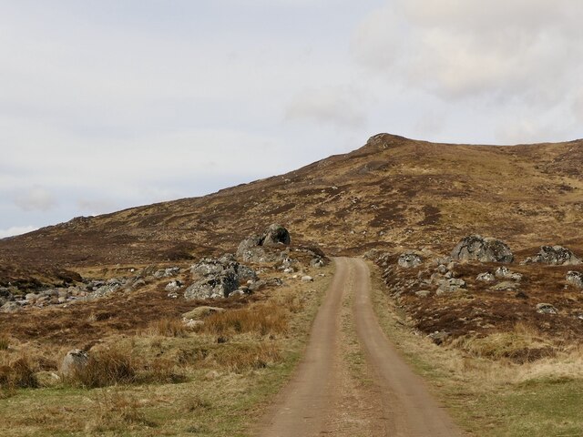
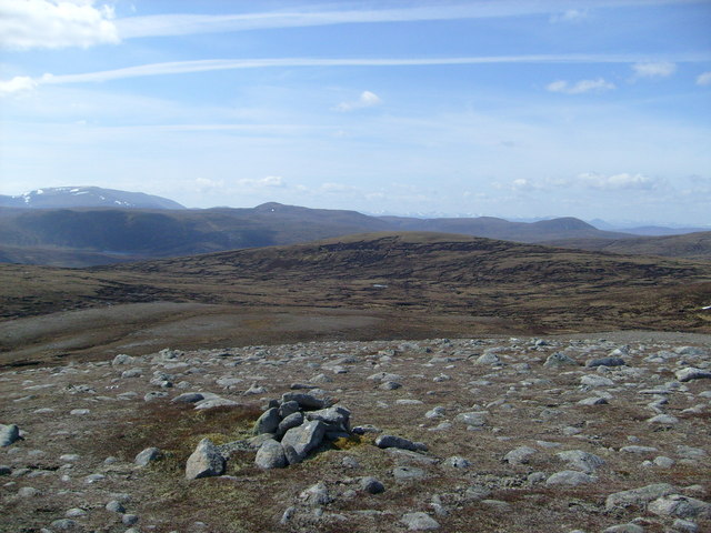
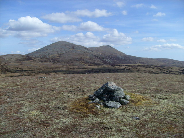
Mullach Coire na Gaoitheag, located in Ross-shire, Scotland, is a prominent hill/mountain standing at an elevation of approximately 855 meters (2,805 feet). It is part of the vast and picturesque northwest Highlands, which are renowned for their stunning landscapes and rugged terrains.

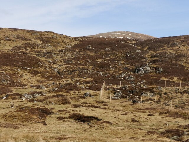
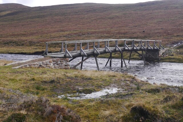
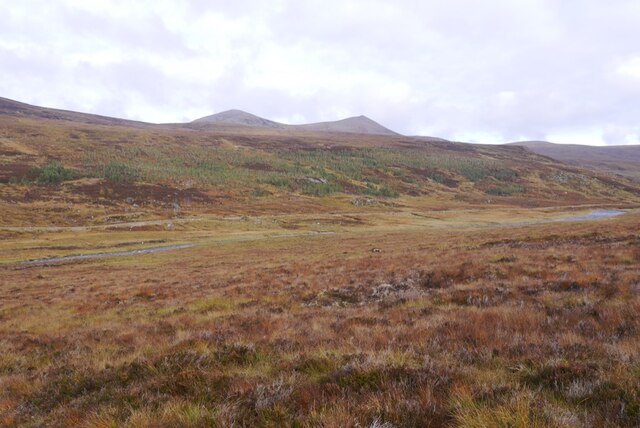
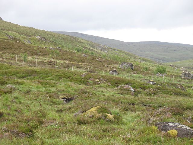
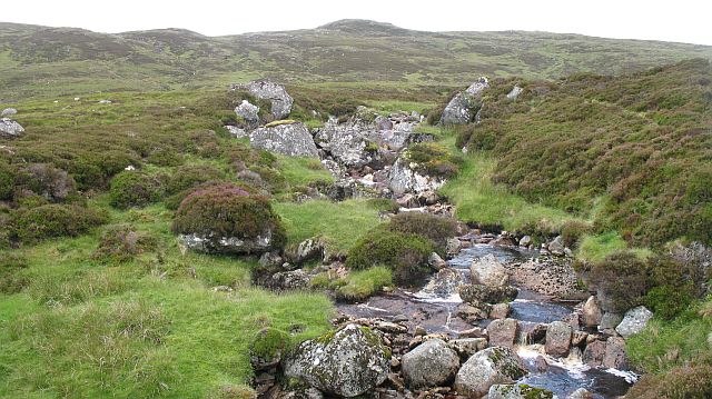
The hill/mountain is situated in a remote and untouched area, surrounded by vast moorlands, lochs, and rolling hills. It offers breathtaking panoramic views of the surrounding countryside, including the nearby Torridon Mountains and Loch Maree, one of Scotland's largest freshwater lochs.

Mullach Coire na Gaoitheag is known for its challenging and steep slopes, making it a popular destination for outdoor enthusiasts and hillwalkers looking for an adrenaline-filled adventure. The ascent to the summit can be arduous, especially in inclement weather conditions, but the reward is unparalleled views and a sense of accomplishment.

The hill/mountain is home to a diverse range of flora and fauna, including several species of birds, mammals, and plants that have adapted to the harsh mountain environment. The surrounding area also boasts a rich cultural and historical heritage, with ancient ruins and archaeological sites scattered throughout the landscape.

Overall, Mullach Coire na Gaoitheag is a captivating natural landmark, offering a challenging yet rewarding experience for those seeking to explore the rugged beauty of the Scottish Highlands.

If you have any feedback on the listing, please let us know in the comments section below.

Mullach Coire na Gaoitheag Images

Images are sourced within 2km of 57.798488/-4.5911676 or Grid Reference NH4681. Thanks to Geograph Open Source API. All images are credited.

Abhainn na Glasa road, Kildermorie
Allt na Cuinneige Mhòire Southern slopes of Carn na Chuinneag.
Allt na Cuinneige Mhòire
Southern slopes of Carn na Chuinneag.
Bridge, Abhainn na Glasa
Bogs beside the Glasa
Bouldery SW ridge of Carn Chuinneag
Stony summit immediately SW of Carn Chuinneag
Mullach Coire na Gaoitheag and Carn Chuinneag Great viewpoint for the Corbett
Mullach Coire na Gaoitheag and Carn Chuinneag
Great viewpoint for the Corbett
New woodland, Abhainn na Glasa One of several mixed native woodland areas recently planted along the Glasa. Several granite boulders in the picture.
New woodland, Abhainn na Glasa
One of several mixed native woodland areas recently planted along the Glasa. Several granite boulders in the picture.
Allt a' Bhaid Sgàilich This is an area of huge granite boulders. Most are buried in peat and are more visible along watercourses.
Allt a' Bhaid Sgàilich
This is an area of huge granite boulders. Most are buried in peat and are more visible along watercourses.
Allt a' Bhullain Rhiabhaich Bhig Small burn which is part of the Alness system. The Ordnance Survey show a path running beside the burn, but it is not used and is rather intermittent.
Allt a' Bhullain Rhiabhaich Bhig
Small burn which is part of the Alness system. The Ordnance Survey show a path running beside the burn, but it is not used and is rather intermittent.
Bogs on the Allt a' Bhullain Rhiabhaich Bhig A shallow and very boggy corrie beneath Creag Ruadh.
Bogs on the Allt a' Bhullain Rhiabhaich Bhig
A shallow and very boggy corrie beneath Creag Ruadh.
Path on Mullach Coire Preas nan Seana-char The faint and intermittent path up on to Mullach Coire Preas nan Seana-char is more obvious on the high tundra. Down in the peatlands where it is really wanted it is hard to trace.
Path on Mullach Coire Preas nan Seana-char
The faint and intermittent path up on to Mullach Coire Preas nan Seana-char is more obvious on the high tundra. Down in the peatlands where it is really wanted it is hard to trace.
On Creag Ruadh Deer crossing the plateau between the two tops of Creag Ruadh, a gravelly ridge west of Carn Chuinneag.
On Creag Ruadh
Deer crossing the plateau between the two tops of Creag Ruadh, a gravelly ridge west of Carn Chuinneag.
Bare peat, Creag Ruadh Eroding peatland just below the gravel ridge of Creag Ruadh. View over the boggy corrie of Bullan Riabhach Beag.
Bare peat, Creag Ruadh
Eroding peatland just below the gravel ridge of Creag Ruadh. View over the boggy corrie of Bullan Riabhach Beag.
Kildermorie Forest View from the slopes of Mullach Coire Preas nan Seana-char towards Loch a' Chaorainn on the other side of the Abhainn na Glasa. All terrain vehicle tracks in the foreground. These only run far as the summit of Mullach Coire Preas nan Seana-char.

As with nearly every day I had spent on the hills this Summer, it was raining. This did not bother the golden plovers which were calling in almost all the boggy bits of Kildermorie.
Kildermorie Forest
View from the slopes of Mullach Coire Preas nan Seana-char towards Loch a' Chaorainn on the other side of the Abhainn na Glasa. All terrain vehicle tracks in the foreground. These only run far as the summit of Mullach Coire Preas nan Seana-char. As with nearly every day I had spent on the hills this Summer, it was raining. This did not bother the golden plovers which were calling in almost all the boggy bits of Kildermorie.
New woodland, Abhainn na Glasa A young native tree plantation, probably planted later than the other Glasa woodlands as it has yet to make it on to the Ordnance Survey maps.
New woodland, Abhainn na Glasa
A young native tree plantation, probably planted later than the other Glasa woodlands as it has yet to make it on to the Ordnance Survey maps.
Path to Loch a' Chaorainn Path connecting the Glasa road to the loch. It runs through peaty land over a low pass.
Path to Loch a' Chaorainn
Path connecting the Glasa road to the loch. It runs through peaty land over a low pass.
Gleann Mhuire An estate road runs along the Abhainn Glasa. Away from the road the ground is rough and boggy.
Gleann Mhuire
An estate road runs along the Abhainn Glasa. Away from the road the ground is rough and boggy.
Show me another place!

Mullach Coire na Gaoitheag is located at Grid Ref: NH4681 (Lat: 57.798488, Lng: -4.5911676)

Unitary Authority: Highland

Police Authority: Highlands and Islands

What 3 Words

///notes.expensive.expert. Near Evanton, Highland

Related Wikis

Càrn Chuinneag

Carn Chuinneag (839 m) is a mountain in the Northwest Highlands of Scotland, south of Strathcarron in Sutherland. A distinct twin-summited peak, it lies...

Beinn nan Eun

Beinn nan Eun (743 m) is a mountain in the Northwest Highlands of Scotland. It is located in Easter Ross, several miles northwest of Dingwall. A very remote...

Amatnatua

Amatnatua (Scottish Gaelic: Àmait na Tuath) is a hamlet in Highland, Scotland.

Alladale Wilderness Reserve

Alladale Wilderness Reserve is a 23,000-acre (93 km2) highland estate in the Caledonian Forest in Sutherland, in the Scottish Highlands. The estate was...

Have you been to Mullach Coire na Gaoitheag?

Leave your review of Mullach Coire na Gaoitheag below (or comments, questions and feedback).