Beinn Sgeireach

Hill, Mountain in Sutherland

Scotland

Beinn Sgeireach

Aerial south-west of Beinn Sgeireach The aerial is held in place entirely by the staying cables - it stands on large baulks of wood rather than being embedded in the ground - it's perhaps a temporary construction. The distant hill is of course Beinn Sgeireach.
Aerial south-west of Beinn Sgeireach Credit: Trevor Littlewood

The requested URL returned error: 429 Too Many Requests

If you have any feedback on the listing, please let us know in the comments section below.

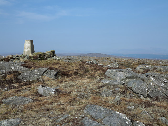
Beinn Sgeireach Images

Images are sourced within 2km of 58.068322/-4.6233482 or Grid Reference NC4511. Thanks to Geograph Open Source API. All images are credited.

Aerial south-west of Beinn Sgeireach The aerial is held in place entirely by the staying cables - it stands on large baulks of wood rather than being embedded in the ground - it's perhaps a temporary construction. The distant hill is of course Beinn Sgeireach.
Aerial south-west of Beinn Sgeireach
The aerial is held in place entirely by the staying cables - it stands on large baulks of wood rather than being embedded in the ground - it's perhaps a temporary construction. The distant hill is of course Beinn Sgeireach.
Rocks south-west of Beinn Sgeireach Beinn Sgeireach is a minor, moorland hill on the north-east side of Glen Cassley; much of the hill is wet heather and grass moorland but rock outcrops such as these occur widely.
Rocks south-west of Beinn Sgeireach
Beinn Sgeireach is a minor, moorland hill on the north-east side of Glen Cassley; much of the hill is wet heather and grass moorland but rock outcrops such as these occur widely.
Summit area of Beinn Sgeireach Beinn Sgeireach lies above the north-east side of Glen Cassley; although surrounded by wet moorland the summit area has interest with a trig point located within a 'nest' of boulders and numerous rock outcrops.
Summit area of Beinn Sgeireach
Beinn Sgeireach lies above the north-east side of Glen Cassley; although surrounded by wet moorland the summit area has interest with a trig point located within a 'nest' of boulders and numerous rock outcrops.
Hillocks on north side of Loch Sgeireach Loch Sgeireach lies to the south-east of Beinn Sgeireach and the minor rises seen here beyond its waters are part of what is effectively the hill's east ridge.
Hillocks on north side of Loch Sgeireach
Loch Sgeireach lies to the south-east of Beinn Sgeireach and the minor rises seen here beyond its waters are part of what is effectively the hill's east ridge.
Bogs on moorland south of Loch Sgeireach Loch Sgeireach lies to the south-east of Beinn Sgeireach which is the mountain summit at the left side of the distant ridge.
Bogs on moorland south of Loch Sgeireach
Loch Sgeireach lies to the south-east of Beinn Sgeireach which is the mountain summit at the left side of the distant ridge.
Stream groove over moorland The stream groove descends towards the head of Coire Buidhe below Càrn nam Bò Maola, which is drained by the stream, Allt Bad na t-Sagairt.  Beinn Sgeireach is the hill beyond.
Stream groove over moorland
The stream groove descends towards the head of Coire Buidhe below Càrn nam Bò Maola, which is drained by the stream, Allt Bad na t-Sagairt. Beinn Sgeireach is the hill beyond.
Coire Buidhe Coire is used for almost any hollow in the hills, not just the classical glacial bowl. (similarly Cwm in the original Welsh can and usually means a glen as well). This cleg ridden boggy hollow is drained by the Allt Bad an t-Sagairt and is now the haunt of the reputedly canny Sika deer.  Carn nam Bo-maola, the hill visible hints at there being cattle up here once.
Coire Buidhe
Coire is used for almost any hollow in the hills, not just the classical glacial bowl. (similarly Cwm in the original Welsh can and usually means a glen as well). This cleg ridden boggy hollow is drained by the Allt Bad an t-Sagairt and is now the haunt of the reputedly canny Sika deer. Carn nam Bo-maola, the hill visible hints at there being cattle up here once.
Coire Buidhe The upper bowl on a drizzly morning.
Coire Buidhe
The upper bowl on a drizzly morning.
Beinn Sgeireach The summit with a trig pillar with no number.
Beinn Sgeireach
The summit with a trig pillar with no number.
On Beinn Sgeirich A dismal day and one of the nastiest wee walks I can remember. Bogs, oppressive heat and humidity combined with constant attacks by all manner of flies - big clegs, wee clegs, luminous eyed deer flies.  Its no fun being down the food chain. Loch Sgeirich beyond - I left that for another , I had had enough.
On Beinn Sgeirich
A dismal day and one of the nastiest wee walks I can remember. Bogs, oppressive heat and humidity combined with constant attacks by all manner of flies - big clegs, wee clegs, luminous eyed deer flies. Its no fun being down the food chain. Loch Sgeirich beyond - I left that for another , I had had enough.
Beinn Sgeireach Some crags just below the summit.
Beinn Sgeireach
Some crags just below the summit.
Beinn Sgeireach Bogs just north of the summit.
Beinn Sgeireach
Bogs just north of the summit.
Alltan Leacach The headwaters of the Alltan Leacach drain this area of peatbog. Its clearing up a bit now, the haar retreating and clearer weather moving from the west.
Alltan Leacach
The headwaters of the Alltan Leacach drain this area of peatbog. Its clearing up a bit now, the haar retreating and clearer weather moving from the west.
Meall Donn Boggy hillside looking across to Beinn Sgeireach.
Meall Donn
Boggy hillside looking across to Beinn Sgeireach.
Meall Donn Wet moorland above Glen Cassley.
Meall Donn
Wet moorland above Glen Cassley.
Loch Sgeireach Small loch in the middle of the hills of Sutherland
Loch Sgeireach
Small loch in the middle of the hills of Sutherland
Small Boulder The higher ground in this peat bog area has many more rocks than the bog itself
Small Boulder
The higher ground in this peat bog area has many more rocks than the bog itself
Fishing boat Fishing boat on Loch Sgeireach
Fishing boat
Fishing boat on Loch Sgeireach
Show me another place!

Beinn Sgeireach is located at Grid Ref: NC4511 (Lat: 58.068322, Lng: -4.6233482)

Unitary Authority: Highland

Police Authority: Highlands and Islands

What 3 Words

///quietest.decays.dampen. Near Lairg, Highland

Nearby Locations

Beinn Sgeireach

Related Wikis

Loch Shin

Loch Shin (Scottish Gaelic: Loch Sìn, pronounced [l̪ˠɔx ˈʃiːn]) is a loch in the Scottish North West Highlands. To the south is the small town of Lairg...

Achness Falls

Achness Falls, also known as the Achness Waterfall or Cassley Falls, is a waterfall located on the River Cassley in Sutherland, Scotland, near Rosehall...

Rosehall

Rosehall is a remote hamlet in the Parish of Creich near the confluence of the River Cassley and the River Oykel, 1 mile northwest of Altass, in Sutherland...

Nearby Amenities

Located within 500m of 58.068322,-4.6233482
Beinn Sgeireach
Corbett: no
Ele: 476
Graham: no
Munro: no
Natural: peak
Prominence: 157
Lat/Long: 58.0685258/-4.6233622
The data included in this document is from www.openstreetmap.org. The data is made available under ODbL.

Have you been to Beinn Sgeireach?

Leave your review of Beinn Sgeireach below (or comments, questions and feedback).