Beinn Chochan

Hill, Mountain in Perthshire

Scotland

Beinn Chochan

Ledard Burn On the hottest September day for 115 years it was a welcome spot to stop and fill water bottles crossing the Ledard Burn. Looking to Beinn Bhreac.
Ledard Burn Credit: Adam Ward

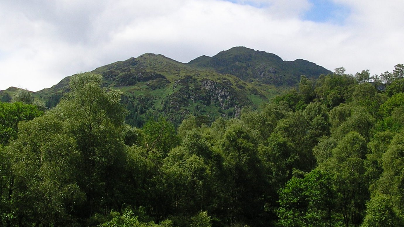
Beinn Chochan is a prominent hill located in Perthshire, Scotland. With an elevation of 923 meters (3,028 feet), it is classified as a Marilyn, which denotes a hill or mountain with a prominence of at least 150 meters (492 feet) regardless of its overall height. The hill is situated in the southern part of Perthshire, near the village of Glen Lyon.

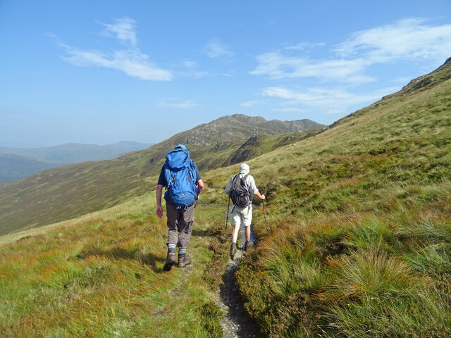
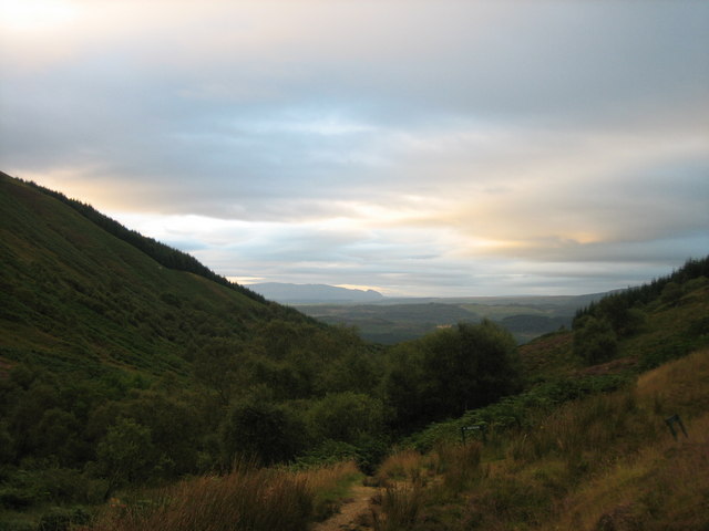
Beinn Chochan offers stunning panoramic views of the surrounding landscapes, including the picturesque Glen Lyon, which is often referred to as Scotland's longest enclosed glen. The hill itself is characterized by its gentle slopes, making it a relatively accessible climb for hikers and hillwalkers of various experience levels.

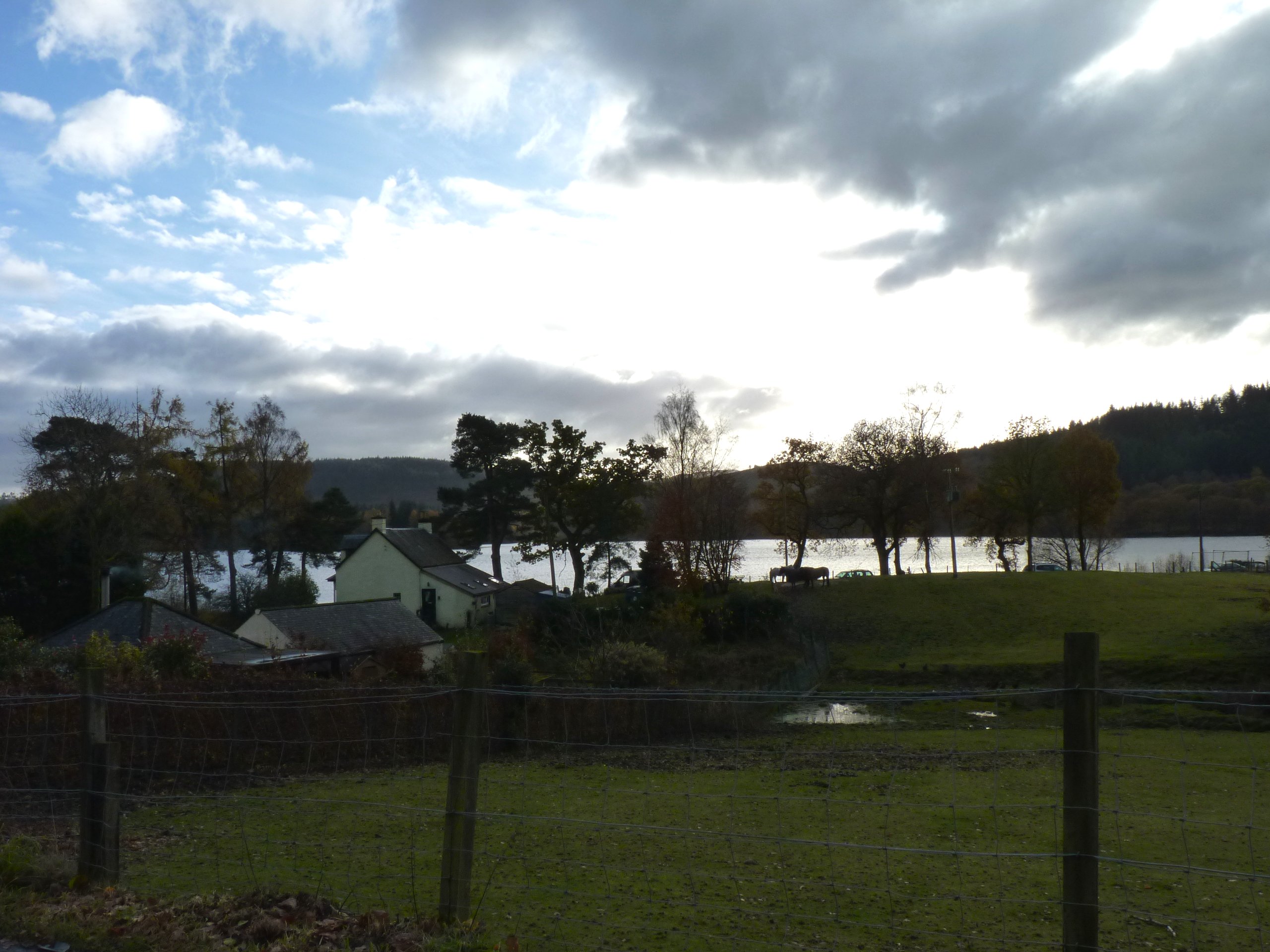
The ascent of Beinn Chochan typically begins from the small parking area near Loch an Daimh. From there, a well-defined path leads up the hill, gradually gaining elevation as it winds through heather-covered terrain. As climbers ascend, they are rewarded with breathtaking vistas of the glen and the distant mountains that dot the horizon.

The summit of Beinn Chochan offers a trig point, which serves as a marker for surveying purposes. On clear days, it provides an excellent vantage point to admire the surrounding peaks, including the Ben Lawers range and the dramatic slopes of Schiehallion. The descent from the summit follows the same path, allowing hikers to retrace their steps back to the starting point.

Beinn Chochan is a popular destination for outdoor enthusiasts seeking a rewarding hillwalking experience in Perthshire. Its accessibility, coupled with its stunning views, make it a must-visit location for those exploring the region.

If you have any feedback on the listing, please let us know in the comments section below.

Beinn Chochan Images

Images are sourced within 2km of 56.219367/-4.4957821 or Grid Reference NN4505. Thanks to Geograph Open Source API. All images are credited.

Ledard Burn On the hottest September day for 115 years it was a welcome spot to stop and fill water bottles crossing the Ledard Burn. Looking to Beinn Bhreac.
Ledard Burn
On the hottest September day for 115 years it was a welcome spot to stop and fill water bottles crossing the Ledard Burn. Looking to Beinn Bhreac.
Not There Yet It's the hottest September day in 115 years and Ben Venue is still some way off. At least there is a bit of a breeze to ease our way up.
Not There Yet
It's the hottest September day in 115 years and Ben Venue is still some way off. At least there is a bit of a breeze to ease our way up.
Bealach na h-Imriche Superfluous stile at the Bealach na h-Imriche as there is now no fence.
Looking to Ben Venue on the hottest September day since 1906.
Bealach na h-Imriche
Superfluous stile at the Bealach na h-Imriche as there is now no fence. Looking to Ben Venue on the hottest September day since 1906.
Head of Gleann Riabhach Path leading to the head of Gleann Riabhach.
Head of Gleann Riabhach
Path leading to the head of Gleann Riabhach.
Ben Venue Looking up at the summit from the western path.
Ben Venue
Looking up at the summit from the western path.
Misty lookout This is the summit of Stob an Lochain (as named on the 1:25000 Explorer map but not on the Landranger map) as viewed from nearby Creag a' Bhealaich, looking south south east. The curious veranda-ed building just below the summit is not marked on any map. I assume it to be a hunting lodge / lookout. There were certainly plenty of stags bellowing in the mist on this day.
Misty lookout
This is the summit of Stob an Lochain (as named on the 1:25000 Explorer map but not on the Landranger map) as viewed from nearby Creag a' Bhealaich, looking south south east. The curious veranda-ed building just below the summit is not marked on any map. I assume it to be a hunting lodge / lookout. There were certainly plenty of stags bellowing in the mist on this day.
Ledard Burn On the path from Loch Ard up to Ben Venue.
Ledard Burn
On the path from Loch Ard up to Ben Venue.
Ledard Burn On the way from Loch Ard up to Ben Venue.
Ledard Burn
On the way from Loch Ard up to Ben Venue.
Cairn The large cairn just before the last pull up to Ben Venue's summit. The weather closed in soon afterwards and this was in thick cloud on the way down.
Cairn
The large cairn just before the last pull up to Ben Venue's summit. The weather closed in soon afterwards and this was in thick cloud on the way down.
Herd of goats The slopes of Ben Venue are home to numerous goats
Herd of goats
The slopes of Ben Venue are home to numerous goats
Path up Ben Venue Path from Loch Ard to the summit of Ben Venue just before it crosses the Ledard Burn.
Path up Ben Venue
Path from Loch Ard to the summit of Ben Venue just before it crosses the Ledard Burn.
Footpath to Ben Venue Looking south from the footpath to Ben Venue.
Footpath to Ben Venue
Looking south from the footpath to Ben Venue.
Ledard burn The Ledard burn rises in this square, below Beinn Bhreac and its col with Creag a'Bhealaich, then flows south to Loch Ard.
Ledard burn
The Ledard burn rises in this square, below Beinn Bhreac and its col with Creag a'Bhealaich, then flows south to Loch Ard.
Path up Ben Venue The path follows the course of the Ledard Burn. The steep sided Beinn Bhreac is in the distance.
Path up Ben Venue
The path follows the course of the Ledard Burn. The steep sided Beinn Bhreac is in the distance.
Path up Ben Venue crosses a small burn Approaching the pass between Beinn Bhreac and Creag a' Bhealaich.
Path up Ben Venue crosses a small burn
Approaching the pass between Beinn Bhreac and Creag a' Bhealaich.
Stile on the path up Ben Venue Looking towards the impressive twin-topped Ben Venue.
Stile on the path up Ben Venue
Looking towards the impressive twin-topped Ben Venue.
Cairn on the path up Ben Venue This is the point where the paths from Loch Ard and Loch Achray meet for the final steep climb to the summit.
Cairn on the path up Ben Venue
This is the point where the paths from Loch Ard and Loch Achray meet for the final steep climb to the summit.
Forest clearing above Loch Chon A break in the forest gives great views towards lower slopes of Beinn Bhreac.
Forest clearing above Loch Chon
A break in the forest gives great views towards lower slopes of Beinn Bhreac.
Show me another place!

Beinn Chochan is located at Grid Ref: NN4505 (Lat: 56.219367, Lng: -4.4957821)

Unitary Authority: Stirling

Police Authority: Forth Valley

What 3 Words

///aquatics.drags.twee. Near Callander, Stirling

Nearby Locations

Beinn Bhreac Beinn Chochan

Related Wikis

Ben Venue

Ben Venue (Scottish Gaelic: A' Bheinn Mheanbh) is a mountain in the Trossachs area of Scotland. The name Ben Venue is derived from the Scottish Gaelic...

Beinn an Fhogharaidh

Beinn an Fhogharaidh is a mountain ridge, 616 metres (2,021 ft) high, in the southern Scottish Highlands near the village of Aberfoyle in Stirling council...

Loch Chon

Loch Chon is a freshwater loch situated west of the village of Aberfoyle, near the small village of Kinlochard, Stirling, Scotland, UK. Loch Chon lies...

Kinlochard

Kinlochard is a village in Stirling, Scotland. It lies to the western end of Loch Ard. Children in Kinlochard attend Aberfoyle Primary School and eventually...

Nearby Amenities

Located within 500m of 56.219367,-4.4957821
Beinn Bhreac
Ele: 699
Natural: peak
Wikidata: Q13125812
Lat/Long: 56.2204141/-4.4891572
Beinn Chochan
Ele: 703
Natural: peak
Wikidata: Q13125830
Lat/Long: 56.2190296/-4.4958403
The data included in this document is from www.openstreetmap.org. The data is made available under ODbL.

Have you been to Beinn Chochan?

Leave your review of Beinn Chochan below (or comments, questions and feedback).