Hillmorton

Settlement in Warwickshire Rugby

England

Hillmorton

Pendolino approaching Rugby Seen from Clifton Road bridge a Pendolino, operated by Avanti West Coast, on a Sunday morning London - Glasgow service that has run via Northampton approaches Rugby.
Pendolino approaching Rugby Credit: Stephen McKay

Hillmorton is a small village located in Warwickshire, England. Situated just two miles north-west of Rugby, Hillmorton is a part of the borough of Rugby. The village has a rich history dating back to the medieval period, with evidence of human settlement in the area since Roman times.

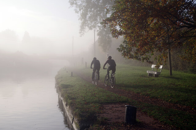
Hillmorton is known for its picturesque countryside and charming rural atmosphere. The village is surrounded by lush green fields and rolling hills, offering stunning views and a tranquil environment. It is a popular destination for nature lovers and hikers, with several walking trails and nature reserves in the vicinity.

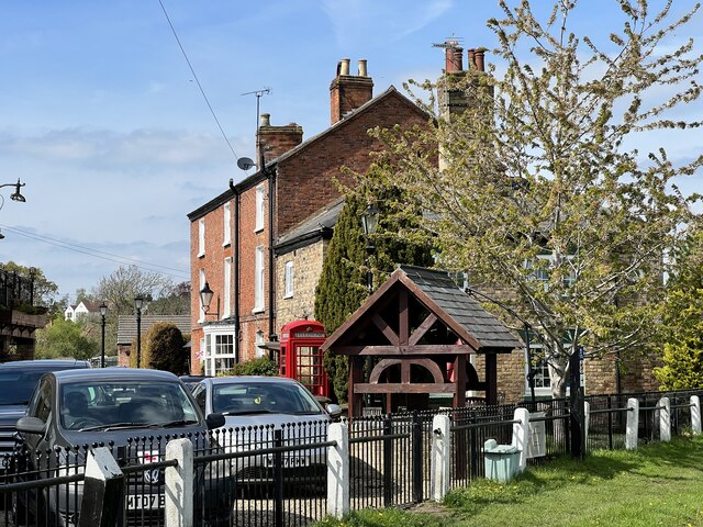
The village itself is characterized by its traditional architecture, with many well-preserved historic buildings lining the streets. The centerpiece of Hillmorton is the All Saints Church, a beautiful Grade I listed building with a distinctive tower. The church dates back to the 14th century and is considered a significant architectural and historical landmark in the area.

Hillmorton offers a small range of amenities to its residents, including a primary school, a local pub, and a few shops. However, for more extensive shopping and entertainment options, the nearby town of Rugby provides a wider selection. The village is well-connected to surrounding areas by road, with easy access to major motorways such as the M1 and M6.

Overall, Hillmorton is a charming and idyllic village, offering a peaceful countryside setting with a strong sense of community and history.

If you have any feedback on the listing, please let us know in the comments section below.
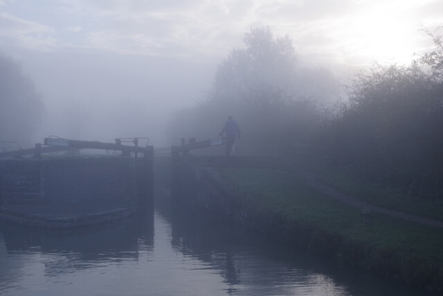
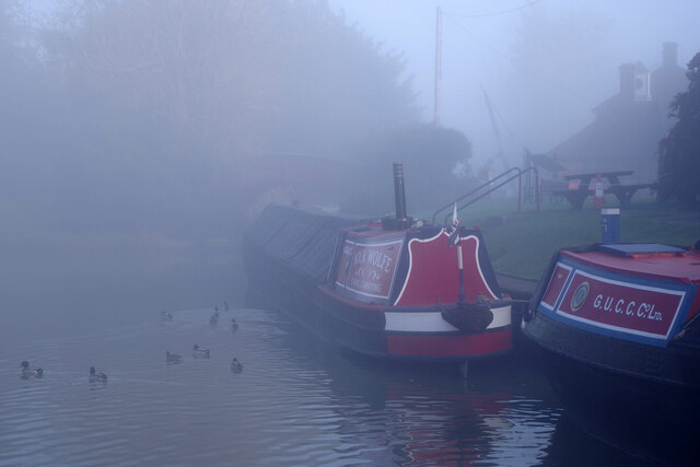
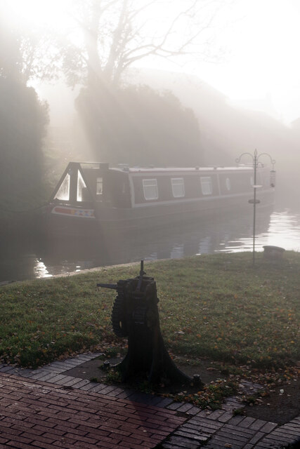
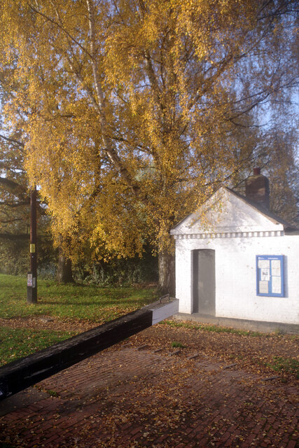
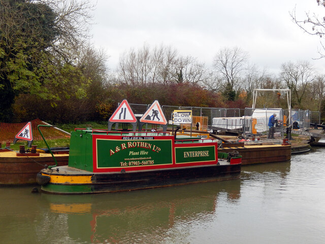
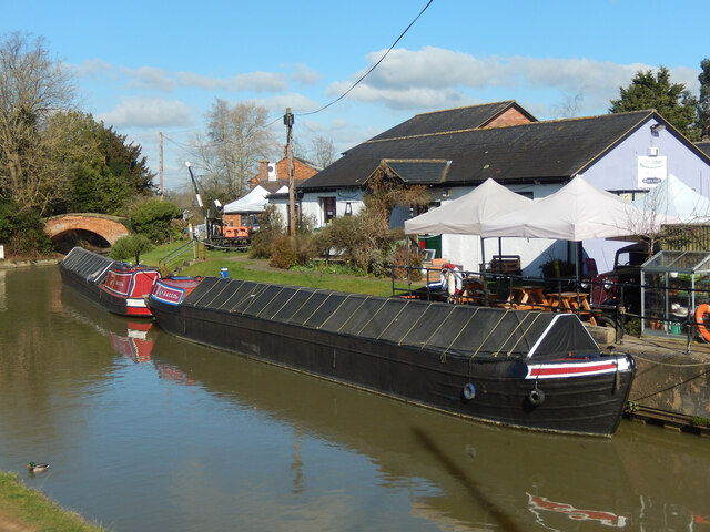
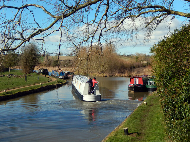
Hillmorton Images

Images are sourced within 2km of 52.361025/-1.224016 or Grid Reference SP5273. Thanks to Geograph Open Source API. All images are credited.

Pendolino approaching Rugby Seen from Clifton Road bridge a Pendolino, operated by Avanti West Coast, on a Sunday morning London - Glasgow service that has run via Northampton approaches Rugby.
Pendolino approaching Rugby
Seen from Clifton Road bridge a Pendolino, operated by Avanti West Coast, on a Sunday morning London - Glasgow service that has run via Northampton approaches Rugby.
Oxford Canal above Hillmorton Locks 8am on an autumn morning and the pale light is beginning to illuminate the canal where a line of narrowboats are moored above the top lock at Hillmorton.
Oxford Canal above Hillmorton Locks
8am on an autumn morning and the pale light is beginning to illuminate the canal where a line of narrowboats are moored above the top lock at Hillmorton.
Hillmorton Top Locks, Oxford Canal Seen early on a misty autumn morning, this shows the top gate of one of the paired locks at Hillmorton. There are no further locks on the Oxford Canal until Napton about 13 miles away.
Hillmorton Top Locks, Oxford Canal
Seen early on a misty autumn morning, this shows the top gate of one of the paired locks at Hillmorton. There are no further locks on the Oxford Canal until Napton about 13 miles away.
Hillmorton Top Locks, Oxford Canal Misty conditions have descended on this autumn morning enveloping the top pair of locks in the Hillmorton flight. At the time the left hand lock was closed for repairs leaving only one lock for the use of boats.
Hillmorton Top Locks, Oxford Canal
Misty conditions have descended on this autumn morning enveloping the top pair of locks in the Hillmorton flight. At the time the left hand lock was closed for repairs leaving only one lock for the use of boats.
Oxford Canal, Hillmorton Barely discernable through the mist, the boat ahead is Nick Wolfe's traditional Grand Union narrowboat 'Aldgate'. It is usually moored here or hereabouts. Beyond that is Grantham's Bridge on a short arm; the canal itself leads off to the left and down Hillmorton bottom locks.
Oxford Canal, Hillmorton
Barely discernable through the mist, the boat ahead is Nick Wolfe's traditional Grand Union narrowboat 'Aldgate'. It is usually moored here or hereabouts. Beyond that is Grantham's Bridge on a short arm; the canal itself leads off to the left and down Hillmorton bottom locks.
Hillmorton Locks A shaft of sunlight pierces the mist where a boat is moored just above the bottom pair of locks at Hillmorton.
Hillmorton Locks
A shaft of sunlight pierces the mist where a boat is moored just above the bottom pair of locks at Hillmorton.
Hillmorton Locks The small Canal & River Trust building beside the bottom pair of locks at Hillmorton basks in the autumn sunshine.
Hillmorton Locks
The small Canal & River Trust building beside the bottom pair of locks at Hillmorton basks in the autumn sunshine.
Cycling along the towpath at Hillmorton Locks Two cyclists head along the towpath just above the bottom pair of locks on a misty morning.
Cycling along the towpath at Hillmorton Locks
Two cyclists head along the towpath just above the bottom pair of locks on a misty morning.
Hillmorton Locks Major work is being undertaken at Hillmorton Locks. In most locations this would entail a complete stoppage for several weeks but here, because the three sets of locks are paired, it is possible to pass through. Boaters need to be careful, however, to avoid the various work boats and other equipment on site. The name A&R Rothen Ltd is familiar to regular users of the Midlands narrow canal network; the company is based at Atherstone and operates a fleet of specialist narrow beam maintenance vessels and associated plant.
Hillmorton Locks
Major work is being undertaken at Hillmorton Locks. In most locations this would entail a complete stoppage for several weeks but here, because the three sets of locks are paired, it is possible to pass through. Boaters need to be careful, however, to avoid the various work boats and other equipment on site. The name A&R Rothen Ltd is familiar to regular users of the Midlands narrow canal network; the company is based at Atherstone and operates a fleet of specialist narrow beam maintenance vessels and associated plant.
Oxford Canal, Hillmorton Traditional working narrowboats are moored on the Oxford Canal at Hillmorton, outside Badseys Wharf Café (which was actually closed in this Monday lunchtime view). The bridge is Grantham's Bridge which is actually on a short arm (the canal itself leads off to the left).
Oxford Canal, Hillmorton
Traditional working narrowboats are moored on the Oxford Canal at Hillmorton, outside Badseys Wharf Café (which was actually closed in this Monday lunchtime view). The bridge is Grantham's Bridge which is actually on a short arm (the canal itself leads off to the left).
Oxford Canal below Hillmorton Locks The grey narrowboat is a brand new hull and has left Hillmorton Locks on its way to be fitted out.
Oxford Canal below Hillmorton Locks
The grey narrowboat is a brand new hull and has left Hillmorton Locks on its way to be fitted out.
Bridge 75 on the Oxford Canal Near Hillmorton.
Bridge 75 on the Oxford Canal
Near Hillmorton.
Tarry's Bridge Carrying the B4038 over the Oxford Canal.
Tarry's Bridge
Carrying the B4038 over the Oxford Canal.
Wharf Farmhouse Grade II listed. Listing number 1183911.
Wharf Farmhouse
Grade II listed. Listing number 1183911.
Hillmorton Wharf On the Oxford Canal.
Hillmorton Wharf
On the Oxford Canal.
The Waterside Pub and Carvery Near Hillmorton.
The Waterside Pub and Carvery
Near Hillmorton.
West Coast Mainline crosses the Oxford Canal Near Hillmorton.
West Coast Mainline crosses the Oxford Canal
Near Hillmorton.
New canalside development In Hillmorton.
New canalside development
In Hillmorton.
Show me another place!

Hillmorton is located at Grid Ref: SP5273 (Lat: 52.361025, Lng: -1.224016)

Administrative County: Warwickshire

District: Rugby

Police Authority: Warwickshire

What 3 Words

///trip.shops.scarf. Near Rugby, Warwickshire

Related Wikis

Hillmorton

Hillmorton is a suburb of Rugby, Warwickshire, England, around 2 miles (3.2 km) south-east of Rugby town centre, forming much of the eastern half of the...

Ashlawn School

Ashlawn School (or simply Ashlawn), is a large partially selective secondary school located in the Hillmorton area of Rugby, Warwickshire, England that...

Rugby Borough F.C.

Rugby Borough Football Club is a football club based in Rugby, Warwickshire. They are currently members of the United Counties League Premier Division...

Rugby Town F.C.

Rugby Town Football Club is a football club based in Rugby, Warwickshire, which plays in the Northern Premier League Division One Midlands. It is nicknamed...

Rugby Central railway station

Rugby Central was a railway station serving Rugby in Warwickshire on the former Great Central Main Line, which opened in 1899 and closed in 1969. The station...

Rugby Parkway railway station

Rugby Parkway is a proposed railway station on the eastern outskirts of Rugby, promoted by Warwickshire County Council. It was the subject of a high level...

Hospital of St. Cross, Rugby

The Hospital of St. Cross is a National Health Service hospital on Barby Road, in Rugby, Warwickshire, England, managed by the University Hospitals Coventry...

Rugby Locomotive Testing Station

The Rugby Locomotive Testing Station was a British railway testing plant in Rugby, Warwickshire. Originally envisioned by Sir Nigel Gresley as a joint...

Nearby Amenities

Located within 500m of 52.361025,-1.224016
Source: Warwicks CC Aerial Imagery 2013
Traffic Calming: bump
Lat/Long: 52.3580486/-1.2282696
Pub
Red Lion
Addr City: Rugby
Addr Housenumber: 53
Addr Postcode: CV21 4EG
Addr Street: High Street
Addr Suburb: Hillmorton
Fhrs Id: 210213
Outdoor Seating: yes
Source Addr: FHRS Open Data
Lat/Long: 52.3585548/-1.2191528
Atm
Co-op
Lat/Long: 52.3584377/-1.2187911
Traffic Signals
Crossing: traffic_signals
Crossing Ref: pelican
Traffic Signals: signal
Lat/Long: 52.3582733/-1.21867
Post Box
Collection Times: Mo-Fr 17:15; Sa 12:00
Operator: Royal Mail
Operator Wikidata: Q638098
Post Box Type: pillar
Postal Code: CV21
Ref: CV21 218
Royal Cypher: EIIR
Royal Cypher Wikidata: Q33102113
Source: survey
Lat/Long: 52.3583365/-1.2186284
Power: substation
Lat/Long: 52.3611952/-1.2226493
Post Box
Postal Code: CV21
Ref: CV21 255
Lat/Long: 52.3626693/-1.2242577
Turning Circle
Lat/Long: 52.3598128/-1.2190348
Turning Circle
Lat/Long: 52.3605776/-1.2268111
Bus Stop
Shops
Bus: yes
Naptan AtcoCode: 4200F028100
Naptan Bearing: S
Naptan CommonName: Shops
Naptan Indicator: Adj
Naptan NaptanCode: wardgpad
Naptan PlusbusZoneRef: RUGBY
Naptan Street: Featherbed Lane
Naptan Verified: no
Public Transport: platform
Source: naptan_import
Lat/Long: 52.3620395/-1.2219473
Bus Stop
Lever Road
Bus: yes
Naptan AtcoCode: 4200F121501
Naptan Bearing: S
Naptan CommonName: Lever Road
Naptan Indicator: Adj
Naptan NaptanCode: warajdmt
Naptan PlusbusZoneRef: RUGBY
Naptan Street: Coton Road
Naptan Verified: no
Public Transport: platform
Source: naptan_import
Lat/Long: 52.3620147/-1.2195897
Bus Stop
Featherbed Lane
Bus: yes
Naptan AtcoCode: 4200F121601
Naptan Bearing: NE
Naptan CommonName: Featherbed Lane
Naptan Indicator: Nr
Naptan NaptanCode: warajdmw
Naptan PlusbusZoneRef: RUGBY
Naptan Street: Coton Road
Naptan Verified: no
Public Transport: platform
Source: naptan_import
Lat/Long: 52.3610102/-1.2213109
Bus Stop
Pettiver Crescent
Bus: yes
Naptan AtcoCode: 4200F121801
Naptan Bearing: E
Naptan CommonName: Pettiver Crescent
Naptan Crossing: Pettiver Crescent
Naptan Indicator: Opp
Naptan NaptanCode: warajdpa
Naptan PlusbusZoneRef: RUGBY
Naptan Street: Bromwich Road
Naptan Verified: no
Public Transport: platform
Source: naptan_import
Lat/Long: 52.3627108/-1.2239186
Bus Stop
Eden Road
Bus: yes
Naptan AtcoCode: 4200F122302
Naptan Bearing: S
Naptan CommonName: Eden Road
Naptan Indicator: Adj
Naptan NaptanCode: wardajta
Naptan PlusbusZoneRef: RUGBY
Naptan Street: Vere Road
Naptan Verified: no
Public Transport: platform
Source: naptan_import
Lat/Long: 52.3644224/-1.2278521
Bus Stop
Phipps Avenue
Bus: yes
Naptan AtcoCode: 4200F122404
Naptan Bearing: E
Naptan CommonName: Phipps Avenue
Naptan Indicator: Adj
Naptan NaptanCode: wardajtm
Naptan PlusbusZoneRef: RUGBY
Naptan Street: Bromwich Road
Naptan Verified: no
Public Transport: platform
Source: naptan_import
Lat/Long: 52.3632706/-1.2273658
Bus Stop
Dyson Close
Bus: yes
Naptan AtcoCode: 4200F150850
Naptan Bearing: N
Naptan CommonName: Dyson Close
Naptan Indicator: Adj
Naptan NaptanCode: wardjmdp
Naptan PlusbusZoneRef: RUGBY
Naptan Street: Featherbed Lane
Naptan Verified: no
Public Transport: platform
Route Ref: 3;3A
Source: naptan_import
Lat/Long: 52.3628462/-1.2218335
Bus Stop
Rathbone Close
Bus: yes
Naptan AtcoCode: 4200F151221
Naptan Bearing: NE
Naptan CommonName: Rathbone Close
Naptan Indicator: Opp
Naptan NaptanCode: wardjmjg
Naptan Street: Deerings Road
Naptan Verified: no
Public Transport: platform
Source: naptan_import
Lat/Long: 52.359684/-1.2217043
Bus Stop
Rathbone Close
Bus: yes
Naptan AtcoCode: 4200F151222
Naptan Bearing: SW
Naptan CommonName: Rathbone Close
Naptan Indicator: Adj
Naptan NaptanCode: wardjmjm
Naptan Street: Deerings Road
Naptan Verified: no
Public Transport: platform
Source: naptan_import
Lat/Long: 52.3596094/-1.2215851
Bus Stop
High Street
Bus: yes
Naptan AtcoCode: 4200F151890
Naptan Bearing: SW
Naptan CommonName: High Street
Naptan Indicator: Opp
Naptan NaptanCode: wardjmwj
Naptan Street: Barby Lane
Naptan Verified: no
Public Transport: platform
Source: naptan_import
Lat/Long: 52.3581716/-1.2246797
Bus Stop
High Street
Bus: yes
Naptan AtcoCode: 4200F151891
Naptan Bearing: NE
Naptan CommonName: High Street
Naptan Indicator: Jcn
Naptan NaptanCode: wardjpam
Naptan Street: Barby Lane
Naptan Verified: no
Public Transport: platform
Source: naptan_import
Lat/Long: 52.3581667/-1.2250466
Bus Stop
Wesley Road
Bus: yes
Naptan AtcoCode: 4200F153411
Naptan Bearing: E
Naptan CommonName: Wesley Road
Naptan Indicator: Opp
Naptan NaptanCode: wardjtjd
Naptan Street: Deerings Road
Naptan Verified: no
Public Transport: platform
Source: naptan_import
Lat/Long: 52.3607784/-1.2175262
Bus Stop
Wesley Road
Bus: yes
Naptan AtcoCode: 4200F153412
Naptan Bearing: W
Naptan CommonName: Wesley Road
Naptan Indicator: Adj
Naptan NaptanCode: wardjtjg
Naptan Street: Deerings Road
Naptan Verified: no
Public Transport: platform
Source: naptan_import
Lat/Long: 52.3606616/-1.2175429
Bus Stop
Walford Place
Bus: yes
Naptan AtcoCode: 4200F188701
Naptan Bearing: S
Naptan CommonName: Walford Place
Naptan Indicator: Adj
Naptan NaptanCode: wardgdpj
Naptan PlusbusZoneRef: RUGBY
Naptan Street: Hillmorton Road
Naptan Verified: no
Public Transport: platform
Source: naptan_import
Lat/Long: 52.3585547/-1.2280061
Bus Stop
Paddox
Bus: yes
Naptan AtcoCode: 4200F188702
Naptan Bearing: N
Naptan CommonName: Paddox
Naptan Indicator: Adj
Naptan Landmark: Paddox
Naptan NaptanCode: wardgdpm
Naptan PlusbusZoneRef: RUGBY
Naptan Street: Hillmorton Road
Naptan Verified: no
Public Transport: platform
Source: naptan_import
Lat/Long: 52.3584025/-1.2281115
Bus Stop
Deerings Road
Bus: yes
Naptan AtcoCode: 4200F188801
Naptan Bearing: E
Naptan CommonName: Deerings Road
Naptan Indicator: Adj
Naptan NaptanCode: wardgdpt
Naptan PlusbusZoneRef: RUGBY
Naptan Street: Ashlawn Road
Naptan Verified: no
Public Transport: platform
Source: naptan_import
Lat/Long: 52.3585278/-1.2238949
Bus Stop
Fellows Way
Bus: yes
Naptan AtcoCode: 4200F188802
Naptan Bearing: W
Naptan CommonName: Fellows Way
Naptan Crossing: Fellows Way
Naptan Indicator: Adj
Naptan NaptanCode: warajgjp
Naptan PlusbusZoneRef: RUGBY
Naptan Street: Ashlawn Road
Naptan Verified: no
Public Transport: platform
Source: naptan_import
Lat/Long: 52.3583832/-1.22378
Bus Stop
Duffy Place
Bus: yes
Naptan AtcoCode: 4200F188901
Naptan Bearing: E
Naptan CommonName: Duffy Place
Naptan Indicator: Opp
Naptan NaptanCode: warajgjt
Naptan PlusbusZoneRef: RUGBY
Naptan Street: High Street
Naptan Verified: no
Public Transport: platform
Source: naptan_import
Lat/Long: 52.3584097/-1.2196238
Bus Stop
Duffy Place
Bus: yes
Naptan AtcoCode: 4200F189001
Naptan Bearing: W
Naptan CommonName: Duffy Place
Naptan Indicator: Adj
Naptan NaptanCode: warajgjw
Naptan PlusbusZoneRef: RUGBY
Naptan Street: High Street
Naptan Verified: no
Public Transport: platform
Shelter: yes
Source: naptan_import
Lat/Long: 52.3582978/-1.2196986
Bus Stop
Paddox Shops
Bus: yes
Naptan AtcoCode: 4200F228901
Naptan Bearing: NW
Naptan CommonName: Paddox Shops
Naptan Indicator: Adj
Naptan Landmark: Paddox Shops
Naptan NaptanCode: waraptdm
Naptan PlusbusZoneRef: RUGBY
Naptan Street: Hillmorton Road
Naptan Verified: no
Public Transport: platform
Source: naptan_import
Lat/Long: 52.3608255/-1.230184
Crossing
Crossing: uncontrolled
Crossing Ref: tiger
Lat/Long: 52.3611858/-1.2304463
Post Office
Hillmorton Post Office
Addr City: Rugby
Addr Country: GB
Addr Housenumber: 59-61
Addr Postcode: CV21 4EG
Addr Street: High Street
Addr Village: Hillmorton
Brand: Post Office
Brand Wikidata: Q1783168
Brand Wikipedia: en:Post Office Ltd
Contact Website: https://www.postoffice.co.uk/branch-finder/408246x/hillmorton
Opening Hours: Mo-We 08:30-19:00; Th 08:30-18:00; Fr 08:30-18:30; Sa 09:00-17:30
Ref Pol Id: 14652
Lat/Long: 52.3584463/-1.2184062
Barrier: cycle_barrier
Bicycle: no
Foot: yes
Source: survey
Lat/Long: 52.3611354/-1.2224545
Shop: convenience
Lat/Long: 52.3606199/-1.216678
Fast Food
Cuisine: fish_and_chips
Lat/Long: 52.3584125/-1.2181021
Restaurant
Cuisine: pizza
Lat/Long: 52.3584189/-1.2181753
Restaurant
Cuisine: fish_and_chips
Lat/Long: 52.362109/-1.2217433
Shop: convenience
Lat/Long: 52.3623153/-1.221729
Bench
Backrest: yes
Source: survey
Lat/Long: 52.3583239/-1.2185262
Crossing
Crossing: traffic_signals
Crossing Island: no
Source: Warwicks CC Aerial Imagery 2013
Lat/Long: 52.3584502/-1.2222639
Stop
Source: Warwicks CC Aerial Imagery 2013
Lat/Long: 52.358148/-1.2225348
Historic: memorial
Source: Warwicks CC Aerial Imagery 2013
Lat/Long: 52.3582905/-1.2202428
Bus Stop
Linnell Road
Bus: yes
Naptan AtcoCode: 4200F121201
Naptan Bearing: W
Naptan CommonName: Linnell Road
Naptan Indicator: Opp
Naptan NaptanCode: warajdmj
Naptan PlusbusZoneRef: RUGBY
Naptan Street: Lower Hillmorton Road
Naptan Verified: no
Public Transport: platform
Source: naptan_import
Lat/Long: 52.3652673/-1.2253625
Crossing
Crossing: traffic_signals
Crossing Island: no
Source: Warwicks CC Aerial Imagery 2013
Lat/Long: 52.3599466/-1.2293355
Generator Method: photovoltaic
Generator Output Electricity: yes
Generator Source: solar
Generator Type: solar_photovoltaic_panel
Location: roof
Power: generator
Lat/Long: 52.3630415/-1.2288192
Generator Method: photovoltaic
Generator Output Electricity: yes
Generator Source: solar
Generator Type: solar_photovoltaic_panel
Location: roof
Power: generator
Lat/Long: 52.3575804/-1.220558
Generator Method: photovoltaic
Generator Output Electricity: yes
Generator Source: solar
Generator Type: solar_photovoltaic_panel
Location: roof
Power: generator
Lat/Long: 52.3620358/-1.2284625
Generator Method: photovoltaic
Generator Output Electricity: yes
Generator Source: solar
Generator Type: solar_photovoltaic_panel
Location: roof
Power: generator
Lat/Long: 52.3639784/-1.2222692
Generator Method: photovoltaic
Generator Output Electricity: yes
Generator Source: solar
Generator Type: solar_photovoltaic_panel
Location: roof
Power: generator
Lat/Long: 52.363523/-1.2247261
Generator Method: photovoltaic
Generator Output Electricity: yes
Generator Source: solar
Generator Type: solar_photovoltaic_panel
Location: roof
Power: generator
Lat/Long: 52.3633871/-1.2224194
Generator Method: photovoltaic
Generator Output Electricity: yes
Generator Source: solar
Generator Type: solar_photovoltaic_panel
Location: roof
Power: generator
Lat/Long: 52.363469/-1.2229317
Generator Method: photovoltaic
Generator Output Electricity: yes
Generator Source: solar
Generator Type: solar_photovoltaic_panel
Location: roof
Power: generator
Lat/Long: 52.3634461/-1.2226635
Generator Method: photovoltaic
Generator Output Electricity: yes
Generator Source: solar
Generator Type: solar_photovoltaic_panel
Location: roof
Power: generator
Lat/Long: 52.3615493/-1.2189111
Generator Method: photovoltaic
Generator Output Electricity: yes
Generator Source: solar
Generator Type: solar_photovoltaic_panel
Location: roof
Power: generator
Lat/Long: 52.3602504/-1.2176934
Generator Method: photovoltaic
Generator Output Electricity: yes
Generator Source: solar
Generator Type: solar_photovoltaic_panel
Location: roof
Power: generator
Lat/Long: 52.3593921/-1.2181963
Waste Basket
Lat/Long: 52.3600383/-1.2267205
Barrier: height_restrictor
Maxheight: 2.1
Lat/Long: 52.3594138/-1.2232786
Generator Method: photovoltaic
Generator Output Electricity: yes
Generator Source: solar
Generator Type: solar_photovoltaic_panel
Location: roof
Power: generator
Lat/Long: 52.3645022/-1.2256723
Atm
Lat/Long: 52.3583825/-1.2183242
Defibrillator
Emergency: defibrillator
Indoor: no
Ref GB The Circuit: 527FD290-7100-4FD6-861E-AAA70112F696
Lat/Long: 52.3605813/-1.2301953
Defibrillator
Emergency: defibrillator
Indoor: no
Not Ref GB The Circuit: FA31CB61-FDAB-475F-9557-B0270107B4AC
Lat/Long: 52.3584827/-1.2190909
Generator Method: photovoltaic
Generator Output Electricity: yes
Generator Source: solar
Generator Type: solar_photovoltaic_panel
Location: roof
Power: generator
Lat/Long: 52.3648644/-1.2263918
Generator Method: photovoltaic
Generator Output Electricity: yes
Generator Source: solar
Generator Type: solar_photovoltaic_panel
Location: roof
Power: generator
Lat/Long: 52.3644992/-1.225791
Give Way
Source: Warwicks CC Aerial Imagery 2013
Lat/Long: 52.3625223/-1.2300597
Source: Warwicks CC Aerial Imagery 2013
Traffic Calming: bump
Lat/Long: 52.3579672/-1.2290811
Give Way
Source: Warwicks CC Aerial Imagery 2013
Lat/Long: 52.3587021/-1.2281937
Give Way
Source: Warwicks CC Aerial Imagery 2013
Lat/Long: 52.3592213/-1.2287743
Generator Method: photovoltaic
Generator Output Electricity: yes
Generator Source: solar
Generator Type: solar_photovoltaic_panel
Location: roof
Power: generator
Lat/Long: 52.3571487/-1.2254543
Generator Method: photovoltaic
Generator Output Electricity: yes
Generator Source: solar
Generator Type: solar_photovoltaic_panel
Location: roof
Power: generator
Lat/Long: 52.3616009/-1.2251084
Generator Method: photovoltaic
Generator Output Electricity: yes
Generator Source: solar
Generator Type: solar_photovoltaic_panel
Location: roof
Power: generator
Lat/Long: 52.3616615/-1.2250829
Generator Method: photovoltaic
Generator Output Electricity: yes
Generator Source: solar
Generator Type: solar_photovoltaic_panel
Location: roof
Power: generator
Lat/Long: 52.3616271/-1.2254557
Generator Method: photovoltaic
Generator Output Electricity: yes
Generator Source: solar
Generator Type: solar_photovoltaic_panel
Location: roof
Power: generator
Lat/Long: 52.3616763/-1.2254249
Generator Method: photovoltaic
Generator Output Electricity: yes
Generator Source: solar
Generator Type: solar_photovoltaic_panel
Location: roof
Power: generator
Lat/Long: 52.3617647/-1.2254047
Generator Method: photovoltaic
Generator Output Electricity: yes
Generator Source: solar
Generator Type: solar_photovoltaic_panel
Location: roof
Power: generator
Lat/Long: 52.361818/-1.2253846
Generator Method: photovoltaic
Generator Output Electricity: yes
Generator Source: solar
Generator Type: solar_photovoltaic_panel
Location: roof
Power: generator
Lat/Long: 52.361908/-1.2253471
Generator Method: photovoltaic
Generator Output Electricity: yes
Generator Source: solar
Generator Type: solar_photovoltaic_panel
Location: roof
Power: generator
Lat/Long: 52.3619777/-1.2253082
Generator Method: photovoltaic
Generator Output Electricity: yes
Generator Source: solar
Generator Type: solar_photovoltaic_panel
Location: roof
Power: generator
Lat/Long: 52.362071/-1.2249474
Generator Method: photovoltaic
Generator Output Electricity: yes
Generator Source: solar
Generator Type: solar_photovoltaic_panel
Location: roof
Power: generator
Lat/Long: 52.3620727/-1.2252706
Generator Method: photovoltaic
Generator Output Electricity: yes
Generator Source: solar
Generator Type: solar_photovoltaic_panel
Location: roof
Power: generator
Lat/Long: 52.362121/-1.2252599
Generator Method: photovoltaic
Generator Output Electricity: yes
Generator Source: solar
Generator Type: solar_photovoltaic_panel
Location: roof
Power: generator
Lat/Long: 52.3621799/-1.2251888
Generator Method: photovoltaic
Generator Output Electricity: yes
Generator Source: solar
Generator Type: solar_photovoltaic_panel
Location: roof
Power: generator
Lat/Long: 52.3622217/-1.2251633
Generator Method: photovoltaic
Generator Output Electricity: yes
Generator Source: solar
Generator Type: solar_photovoltaic_panel
Location: roof
Power: generator
Lat/Long: 52.3622217/-1.2248844
Generator Method: photovoltaic
Generator Output Electricity: yes
Generator Source: solar
Generator Type: solar_photovoltaic_panel
Location: roof
Power: generator
Lat/Long: 52.3623167/-1.2251285
Generator Method: photovoltaic
Generator Output Electricity: yes
Generator Source: solar
Generator Type: solar_photovoltaic_panel
Location: roof
Power: generator
Lat/Long: 52.3623798/-1.2250882
Generator Method: photovoltaic
Generator Output Electricity: yes
Generator Source: solar
Generator Type: solar_photovoltaic_panel
Location: roof
Power: generator
Lat/Long: 52.3623986/-1.2248495
Generator Method: photovoltaic
Generator Output Electricity: yes
Generator Source: solar
Generator Type: solar_photovoltaic_panel
Location: roof
Power: generator
Lat/Long: 52.3624862/-1.2250601
Generator Method: photovoltaic
Generator Output Electricity: yes
Generator Source: solar
Generator Type: solar_photovoltaic_panel
Location: roof
Power: generator
Lat/Long: 52.3625272/-1.2250467
Generator Method: photovoltaic
Generator Output Electricity: yes
Generator Source: solar
Generator Type: solar_photovoltaic_panel
Location: roof
Power: generator
Lat/Long: 52.362596/-1.2256743
Give Way
Source: Warwicks CC Aerial Imagery 2013
Lat/Long: 52.3584756/-1.2241803
Generator Method: photovoltaic
Generator Output Electricity: yes
Generator Source: solar
Generator Type: solar_photovoltaic_panel
Location: roof
Power: generator
Lat/Long: 52.3591369/-1.2192092
Give Way
Source: Warwicks CC Aerial Imagery 2013
Lat/Long: 52.3616108/-1.2272313
Give Way
Source: Warwicks CC Aerial Imagery 2013
Lat/Long: 52.3623865/-1.2275478
Generator Method: photovoltaic
Generator Output Electricity: yes
Generator Source: solar
Generator Type: solar_photovoltaic_panel
Location: roof
Power: generator
Lat/Long: 52.361795/-1.2249461
Generator Method: photovoltaic
Generator Output Electricity: yes
Generator Source: solar
Generator Type: solar_photovoltaic_panel
Location: roof
Power: generator
Lat/Long: 52.3618139/-1.2250829
Generator Method: photovoltaic
Generator Output Electricity: yes
Generator Source: solar
Generator Type: solar_photovoltaic_panel
Location: roof
Power: generator
Lat/Long: 52.3575492/-1.2227735
Give Way
Source: Warwicks CC Aerial Imagery 2013
Lat/Long: 52.3632601/-1.2184409
Generator Method: photovoltaic
Generator Output Electricity: yes
Generator Source: solar
Generator Type: solar_photovoltaic_panel
Location: roof
Power: generator
Lat/Long: 52.3625271/-1.2275485
Give Way
Source: Warwicks CC Aerial Imagery 2013
Lat/Long: 52.3608521/-1.2274446
Give Way
Source: Warwicks CC Aerial Imagery 2013
Lat/Long: 52.3632091/-1.2269419
Give Way
Source: Warwicks CC Aerial Imagery 2013
Lat/Long: 52.3631704/-1.2278967
Traffic Signals
Traffic Signals: signal
Lat/Long: 52.3582838/-1.2188146
Crossing
Crossing: marked
Crossing Island: no
Tactile Paving: yes
Lat/Long: 52.3582786/-1.2187423
Power: transformer
Lat/Long: 52.3602701/-1.2298117
The data included in this document is from www.openstreetmap.org. The data is made available under ODbL.

Have you been to Hillmorton?

Leave your review of Hillmorton below (or comments, questions and feedback).