Hillmorton Paddock

Settlement in Warwickshire Rugby

England

Hillmorton Paddock

Hillmorton Top Locks, Oxford Canal Misty conditions have descended on this autumn morning enveloping the top pair of locks in the Hillmorton flight. At the time the left hand lock was closed for repairs leaving only one lock for the use of boats.
Hillmorton Top Locks, Oxford Canal Credit: Stephen McKay

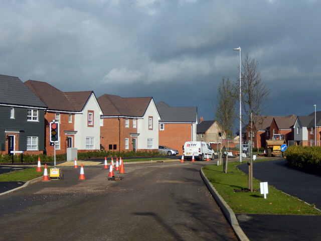
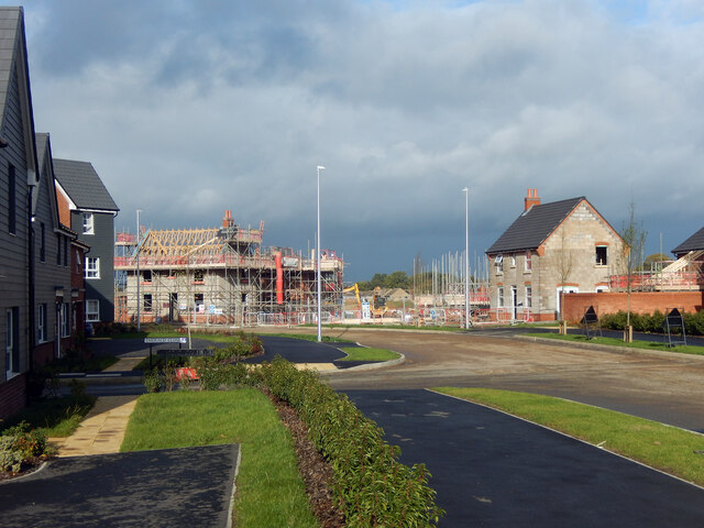
Hillmorton Paddock is a picturesque village located in the county of Warwickshire, England. Situated on the outskirts of the historic town of Rugby, Hillmorton Paddock boasts a tranquil and rural setting, making it an ideal place for those seeking a peaceful countryside retreat.

The village is characterized by its charming thatched cottages, well-maintained gardens, and idyllic landscapes. The local community takes great pride in maintaining the traditional and welcoming atmosphere of the area, creating a close-knit and friendly village environment.

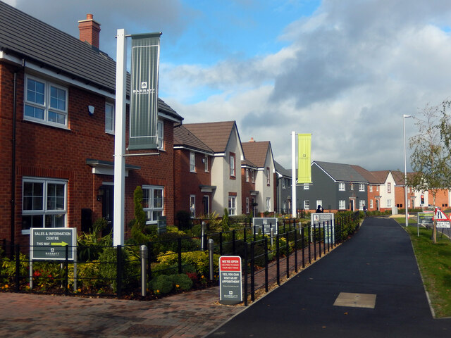
Hillmorton Paddock offers a range of amenities to cater to the needs of its residents. The village has a small but well-stocked convenience store, providing everyday essentials. Additionally, there is a local pub that serves delicious meals and offers a cozy atmosphere for socializing with friends and neighbors.

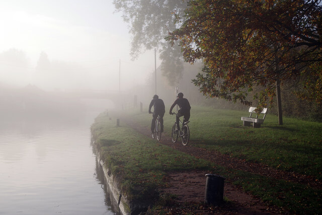
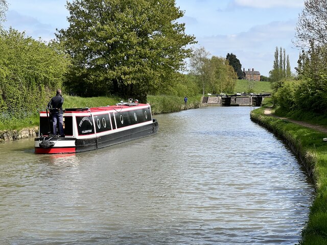
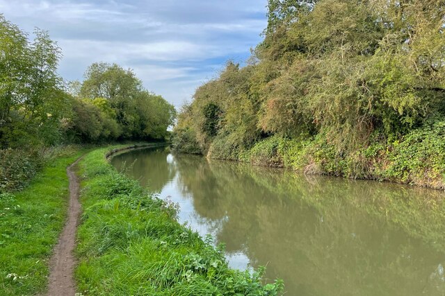
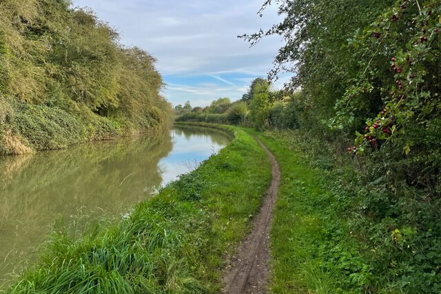
Nature enthusiasts and outdoor lovers are particularly drawn to Hillmorton Paddock due to its close proximity to stunning countryside areas. The village is surrounded by rolling hills, vast green fields, and picturesque walking trails, making it a haven for walkers, cyclists, and nature enthusiasts.

For those seeking more urban amenities, the nearby town of Rugby is easily accessible. Rugby offers a wider range of shopping, dining, and entertainment options, as well as excellent transportation links, including a train station with regular services to major cities such as Birmingham and London.

Overall, Hillmorton Paddock is a delightful and peaceful village, offering a perfect blend of idyllic countryside living and easy access to nearby amenities.

If you have any feedback on the listing, please let us know in the comments section below.

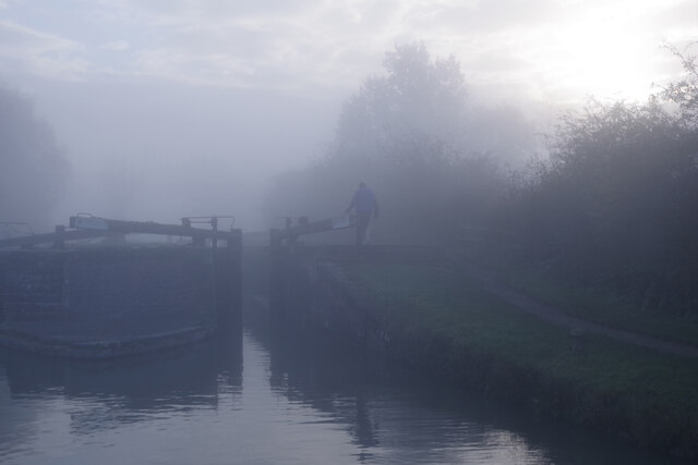
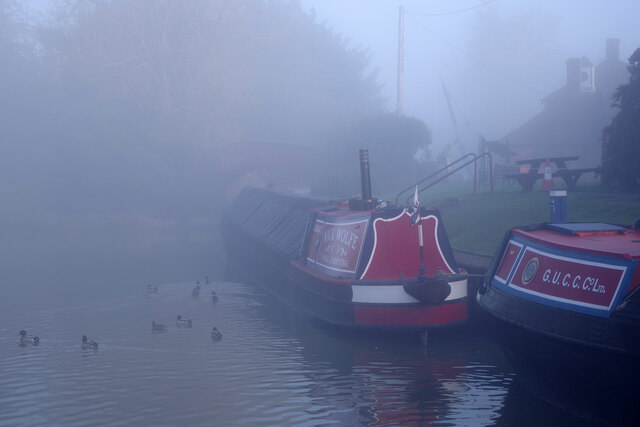
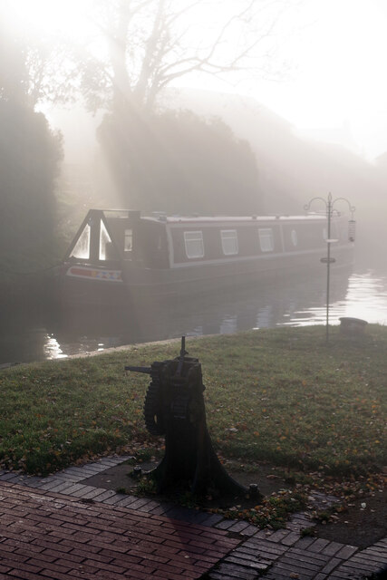
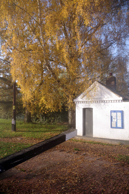
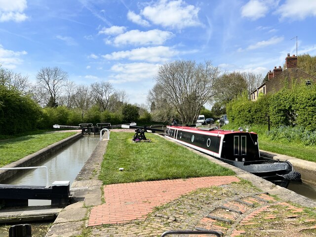
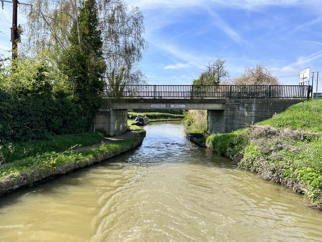
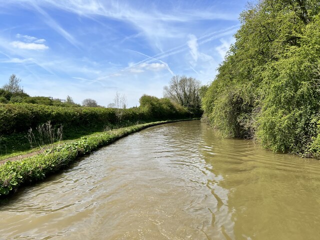
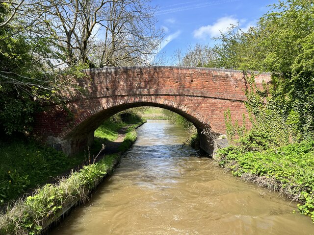
Hillmorton Paddock Images

Images are sourced within 2km of 52.356961/-1.2353383 or Grid Reference SP5273. Thanks to Geograph Open Source API. All images are credited.

Hillmorton Top Locks, Oxford Canal Misty conditions have descended on this autumn morning enveloping the top pair of locks in the Hillmorton flight. At the time the left hand lock was closed for repairs leaving only one lock for the use of boats.
Hillmorton Top Locks, Oxford Canal
Misty conditions have descended on this autumn morning enveloping the top pair of locks in the Hillmorton flight. At the time the left hand lock was closed for repairs leaving only one lock for the use of boats.
Oxford Canal, Hillmorton Barely discernable through the mist, the boat ahead is Nick Wolfe's traditional Grand Union narrowboat 'Aldgate'. It is usually moored here or hereabouts. Beyond that is Grantham's Bridge on a short arm; the canal itself leads off to the left and down Hillmorton bottom locks.
Oxford Canal, Hillmorton
Barely discernable through the mist, the boat ahead is Nick Wolfe's traditional Grand Union narrowboat 'Aldgate'. It is usually moored here or hereabouts. Beyond that is Grantham's Bridge on a short arm; the canal itself leads off to the left and down Hillmorton bottom locks.
Hillmorton Locks A shaft of sunlight pierces the mist where a boat is moored just above the bottom pair of locks at Hillmorton.
Hillmorton Locks
A shaft of sunlight pierces the mist where a boat is moored just above the bottom pair of locks at Hillmorton.
Hillmorton Locks The small Canal & River Trust building beside the bottom pair of locks at Hillmorton basks in the autumn sunshine.
Hillmorton Locks
The small Canal & River Trust building beside the bottom pair of locks at Hillmorton basks in the autumn sunshine.
Cycling along the towpath at Hillmorton Locks Two cyclists head along the towpath just above the bottom pair of locks on a misty morning.
Cycling along the towpath at Hillmorton Locks
Two cyclists head along the towpath just above the bottom pair of locks on a misty morning.
Hillmorton Locks Major work is being undertaken at Hillmorton Locks. In most locations this would entail a complete stoppage for several weeks but here, because the three sets of locks are paired, it is possible to pass through. Boaters need to be careful, however, to avoid the various work boats and other equipment on site. The name A&R Rothen Ltd is familiar to regular users of the Midlands narrow canal network; the company is based at Atherstone and operates a fleet of specialist narrow beam maintenance vessels and associated plant.
Hillmorton Locks
Major work is being undertaken at Hillmorton Locks. In most locations this would entail a complete stoppage for several weeks but here, because the three sets of locks are paired, it is possible to pass through. Boaters need to be careful, however, to avoid the various work boats and other equipment on site. The name A&R Rothen Ltd is familiar to regular users of the Midlands narrow canal network; the company is based at Atherstone and operates a fleet of specialist narrow beam maintenance vessels and associated plant.
Oxford Canal, Hillmorton Traditional working narrowboats are moored on the Oxford Canal at Hillmorton, outside Badseys Wharf Café (which was actually closed in this Monday lunchtime view). The bridge is Grantham's Bridge which is actually on a short arm (the canal itself leads off to the left).
Oxford Canal, Hillmorton
Traditional working narrowboats are moored on the Oxford Canal at Hillmorton, outside Badseys Wharf Café (which was actually closed in this Monday lunchtime view). The bridge is Grantham's Bridge which is actually on a short arm (the canal itself leads off to the left).
Oxford Canal below Hillmorton Locks The grey narrowboat is a brand new hull and has left Hillmorton Locks on its way to be fitted out.
Oxford Canal below Hillmorton Locks
The grey narrowboat is a brand new hull and has left Hillmorton Locks on its way to be fitted out.
Spectrum Avenue, Ashlawn Gardens New housing developments seem to be springing up all around Rugby making it one of the fastest growing towns in the country. Here just off Ashlawn Road several of the major house builders are at work and some of the houses are already occupied.
Spectrum Avenue, Ashlawn Gardens
New housing developments seem to be springing up all around Rugby making it one of the fastest growing towns in the country. Here just off Ashlawn Road several of the major house builders are at work and some of the houses are already occupied.
Spectrum Avenue, Ashlawn Gardens  When it is completed, Spectrum Avenue will form a crescent off Ashlawn Road; the new housing development, including several major house builders, is called Ashlawn Gardens. This view shows the eastern end of the avenue where some houses are already occupied but others are still under construction. Emerald Close leads off to the left.
Spectrum Avenue, Ashlawn Gardens
When it is completed, Spectrum Avenue will form a crescent off Ashlawn Road; the new housing development, including several major house builders, is called Ashlawn Gardens. This view shows the eastern end of the avenue where some houses are already occupied but others are still under construction. Emerald Close leads off to the left.
Spectrum Avenue, Ashlawn Gardens Several major house builders are involved here on this development off Ashlawn Road including Barratt, whose sales and information centre is on the left.
Spectrum Avenue, Ashlawn Gardens
Several major house builders are involved here on this development off Ashlawn Road including Barratt, whose sales and information centre is on the left.
Hillmorton Locks The pound between two of the locks on the Oxford Canal.
Hillmorton Locks
The pound between two of the locks on the Oxford Canal.
Hillmorton Middle Lock On the Oxford Canal.
Hillmorton Middle Lock
On the Oxford Canal.
Kent Road Bridge On the Oxford Canal.
Kent Road Bridge
On the Oxford Canal.
Oxford Canal Near Hillmorton.
Oxford Canal
Near Hillmorton.
Bridge 68 on the Oxford Canal Near Clifton Upon Dunsmore.
Bridge 68 on the Oxford Canal
Near Clifton Upon Dunsmore.
Oxford Canal Walk
Oxford Canal Walk
Oxford Canal near Rugby
Show me another place!

Hillmorton Paddock is located at Grid Ref: SP5273 (Lat: 52.356961, Lng: -1.2353383)

Administrative County: Warwickshire

District: Rugby

Police Authority: Warwickshire

What 3 Words

///anyway.pace.honest. Near Rugby, Warwickshire

Related Wikis

Ashlawn School

Ashlawn School (or simply Ashlawn), is a large partially selective secondary school located in the Hillmorton area of Rugby, Warwickshire, England that...

Hillmorton

Hillmorton is a suburb of Rugby, Warwickshire, England, around 2 miles (3.2 km) south-east of Rugby town centre, forming much of the eastern half of the...

Rugby Central railway station

Rugby Central was a railway station serving Rugby in Warwickshire on the former Great Central Main Line, which opened in 1899 and closed in 1969. The station...

Rugby Borough F.C.

Rugby Borough Football Club is a football club based in Rugby, Warwickshire. They are currently members of the United Counties League Premier Division...

Hospital of St. Cross, Rugby

The Hospital of St. Cross is a National Health Service hospital on Barby Road, in Rugby, Warwickshire, England, managed by the University Hospitals Coventry...

Rugby Town F.C.

Rugby Town Football Club is a football club based in Rugby, Warwickshire, which plays in the Northern Premier League Division One Midlands. It is nicknamed...

Bishop Wulstan School

Bishop Wulstan School was a Catholic high school situated on Oak Street in the town of Rugby, Warwickshire, England. == History == The school was best...

Lawrence Sheriff School

Lawrence Sheriff School is a boys' grammar school in Rugby, Warwickshire, England. The school is named after Lawrence Sheriff, the Elizabethan founder...

Nearby Amenities

Located within 500m of 52.356961,-1.2353383
Source: Warwicks CC Aerial Imagery 2013
Traffic Calming: bump
Lat/Long: 52.3576959/-1.2313239
Source: Warwicks CC Aerial Imagery 2013
Traffic Calming: bump
Lat/Long: 52.3580486/-1.2282696
Mini Roundabout
Direction: clockwise
Lat/Long: 52.3569674/-1.235326
Turning Circle
Source: Warwicks CC Aerial Imagery 2013
Lat/Long: 52.3583201/-1.2422303
Turning Circle
Source: Warwicks CC Aerial Imagery 2013
Lat/Long: 52.3565665/-1.2412072
Turning Circle
Source: Warwicks CC Aerial Imagery 2013
Lat/Long: 52.3570097/-1.2401502
Bus Stop
Heath Way
Bus: yes
Naptan AtcoCode: 4200F055100
Naptan Bearing: NE
Naptan CommonName: Heath Way
Naptan Indicator: Opp
Naptan NaptanCode: wardgaga
Naptan PlusbusZoneRef: RUGBY
Naptan Street: Balcombe Road
Naptan Verified: no
Public Transport: platform
Source: naptan_import
Lat/Long: 52.3584225/-1.239292
Bus Stop
Ashlawn School
Bus: yes
Naptan AtcoCode: 4200F124270
Naptan Bearing: E
Naptan CommonName: Ashlawn School
Naptan Indicator: Opp
Naptan NaptanCode: waradgtw
Naptan PlusbusZoneRef: RUGBY
Naptan Street: Ashlawn Road
Naptan Verified: no
Public Transport: platform
Source: naptan_import
Lat/Long: 52.3579194/-1.2300359
Bus Stop
Ashlawn Road
Bus: yes
Naptan AtcoCode: 4200F132250
Naptan Bearing: S
Naptan CommonName: Ashlawn Road
Naptan Indicator: Nr
Naptan NaptanCode: warawgmp
Naptan PlusbusZoneRef: RUGBY
Naptan Street: Fareham Avenue
Naptan Verified: no
Public Transport: platform
Source: naptan_import
Lat/Long: 52.3576872/-1.2355551
Bus Stop
Ashlawn Road
Bus: yes
Naptan AtcoCode: 4200F132251
Naptan Bearing: N
Naptan CommonName: Ashlawn Road
Naptan Indicator: Jcn
Naptan NaptanCode: wardjtja
Naptan Street: Fareham Avenue
Naptan Verified: no
Public Transport: platform
Source: naptan_import
Lat/Long: 52.3576901/-1.235672
Bus Stop
Fareham Avenue
Bus: yes
Naptan AtcoCode: 4200F150061
Naptan Bearing: E
Naptan CommonName: Fareham Avenue
Naptan Indicator: Adj
Naptan NaptanCode: wardjgmj
Naptan PlusbusZoneRef: RUGBY
Naptan Street: Ashlawn Road
Naptan Verified: no
Public Transport: platform
Source: naptan_import
Lat/Long: 52.3569683/-1.2356841
Bus Stop
Fareham Avenue
Bus: yes
Naptan AtcoCode: 4200F150062
Naptan Bearing: W
Naptan CommonName: Fareham Avenue
Naptan Indicator: Opp
Naptan NaptanCode: wardjgmp
Naptan PlusbusZoneRef: RUGBY
Naptan Street: Ashlawn Road
Naptan Verified: no
Public Transport: platform
Source: naptan_import
Lat/Long: 52.3568527/-1.23563
Bus Stop
Percival Road
Bus: yes
Naptan AtcoCode: 4200F150203
Naptan Bearing: NE
Naptan CommonName: Percival Road
Naptan Indicator: Adj
Naptan NaptanCode: wardjgpa
Naptan PlusbusZoneRef: RUGBY
Naptan Street: Ashlawn Road
Naptan Verified: no
Public Transport: platform
Source: naptan_import
Lat/Long: 52.355486/-1.2414362
Bus Stop
Percival Road
Bus: yes
Naptan AtcoCode: 4200F150204
Naptan Bearing: SW
Naptan CommonName: Percival Road
Naptan Indicator: Opp
Naptan NaptanCode: wardjgpd
Naptan PlusbusZoneRef: RUGBY
Naptan Street: Ashlawn Road
Naptan Verified: no
Public Transport: platform
Source: naptan_import
Lat/Long: 52.3553781/-1.2413817
Ashlawn School
Naptan AtcoCode: 4200F151480
Naptan Bearing: E
Naptan BusStopType: CUS
Naptan CommonName: Ashlawn School
Naptan Indicator: Adj
Naptan NaptanCode: wardjmtd
Naptan Street: Private Road
Naptan Verified: no
Source: naptan_import
Lat/Long: 52.3574946/-1.232136
Bus Stop
Vernin Avenue
Bus: yes
Naptan AtcoCode: 4200F152061
Naptan Bearing: W
Naptan CommonName: Vernin Avenue
Naptan Indicator: Opp
Naptan NaptanCode: wardjpaj
Naptan Street: Ashlawn Road
Naptan Verified: no
Public Transport: platform
Source: naptan_import
Lat/Long: 52.3571888/-1.2336392
Bus Stop
Fareham Avenue
Bus: yes
Naptan AtcoCode: 4200F187901
Naptan Bearing: E
Naptan CommonName: Fareham Avenue
Naptan Crossing: Fareham Avenue
Naptan Indicator: Opp
Naptan NaptanCode: wardgdjt
Naptan PlusbusZoneRef: RUGBY
Naptan Street: Balcombe Road
Naptan Verified: no
Public Transport: platform
Source: naptan_import
Lat/Long: 52.3589548/-1.2369193
Bus Stop
Charter Road
Bus: yes
Naptan AtcoCode: 4200F187902
Naptan Bearing: SW
Naptan CommonName: Charter Road
Naptan Crossing: Charter Road
Naptan Indicator: Adj
Naptan NaptanCode: wardgdjw
Naptan PlusbusZoneRef: RUGBY
Naptan Street: Balcombe Road
Naptan Verified: no
Public Transport: platform
Source: naptan_import
Lat/Long: 52.358877/-1.2371138
Bus Stop
Heath Way
Bus: yes
Naptan AtcoCode: 4200F188001
Naptan Bearing: NE
Naptan CommonName: Heath Way
Naptan Crossing: Heath Way
Naptan Indicator: Opp
Naptan NaptanCode: wardgdma
Naptan PlusbusZoneRef: RUGBY
Naptan Street: Balcombe Road
Naptan Verified: no
Public Transport: platform
Source: naptan_import
Lat/Long: 52.3584194/-1.2393301
Bus Stop
Heath Way
Bus: yes
Naptan AtcoCode: 4200F188002
Naptan Bearing: SW
Naptan CommonName: Heath Way
Naptan Crossing: Heath Way
Naptan Indicator: Adj
Naptan NaptanCode: wardgdmd
Naptan PlusbusZoneRef: RUGBY
Naptan Street: Balcombe Road
Naptan Verified: no
Public Transport: platform
Source: naptan_import
Lat/Long: 52.3583318/-1.2392297
Bus Stop
Willoughby Place
Bus: yes
Naptan AtcoCode: 4200F188101
Naptan Bearing: NE
Naptan CommonName: Willoughby Place
Naptan Crossing: Willoughby Place
Naptan Indicator: Opp
Naptan NaptanCode: wardgdmg
Naptan PlusbusZoneRef: RUGBY
Naptan Street: Balcombe Road
Naptan Verified: no
Public Transport: platform
Source: naptan_import
Lat/Long: 52.3575331/-1.2423755
Bus Stop
Willoughby Place
Bus: yes
Naptan AtcoCode: 4200F188201
Naptan Bearing: SW
Naptan CommonName: Willoughby Place
Naptan Indicator: Adj
Naptan NaptanCode: wardgdmj
Naptan PlusbusZoneRef: RUGBY
Naptan Street: Balcombe Road
Naptan Verified: no
Public Transport: platform
Source: naptan_import
Lat/Long: 52.3574623/-1.2423209
Post Box
Collection Times: Mo-Fr 17:15; Sa 11:45
Operator: Royal Mail
Operator Wikidata: Q638098
Post Box Type: pillar
Ref: CV22 78
Royal Cypher: GR
Royal Cypher Wikidata: Q33102273
Source: survey
Lat/Long: 52.3575222/-1.2420597
Barrier: kissing_gate
Lat/Long: 52.3555173/-1.2291417
Information: route_marker
Material: metal
Tourism: information
Lat/Long: 52.3578224/-1.2300161
Waste Basket
Waste: dog_excrement
Lat/Long: 52.3578287/-1.2299865
Generator Method: photovoltaic
Generator Output Electricity: yes
Generator Source: solar
Generator Type: solar_photovoltaic_panel
Location: roof
Power: generator
Lat/Long: 52.3575673/-1.2353423
Source: Warwicks CC Aerial Imagery 2013
Traffic Calming: bump
Lat/Long: 52.3571603/-1.2342416
Source: Warwicks CC Aerial Imagery 2013
Traffic Calming: bump
Lat/Long: 52.3573399/-1.2332661
Crossing
Crossing: traffic_signals
Source: Warwicks CC Aerial Imagery 2013
Lat/Long: 52.357488/-1.2324612
Source: Warwicks CC Aerial Imagery 2013
Traffic Calming: bump
Lat/Long: 52.3578934/-1.2298409
Source: Warwicks CC Aerial Imagery 2013
Traffic Calming: bump
Lat/Long: 52.3579672/-1.2290811
Source: Warwicks CC Aerial Imagery 2013
Traffic Calming: bump
Lat/Long: 52.3577892/-1.2307656
Generator Method: photovoltaic
Generator Output Electricity: yes
Generator Source: solar
Generator Type: solar_photovoltaic_panel
Location: roof
Power: generator
Lat/Long: 52.3598862/-1.2376871
Generator Method: photovoltaic
Generator Output Electricity: yes
Generator Source: solar
Generator Type: solar_photovoltaic_panel
Location: roof
Power: generator
Lat/Long: 52.3601695/-1.2348867
Generator Method: photovoltaic
Generator Output Electricity: yes
Generator Source: solar
Generator Type: solar_photovoltaic_panel
Location: roof
Power: generator
Lat/Long: 52.3596658/-1.2329916
Generator Method: photovoltaic
Generator Output Electricity: yes
Generator Source: solar
Generator Type: solar_photovoltaic_panel
Location: roof
Power: generator
Lat/Long: 52.3555085/-1.2365096
Generator Method: photovoltaic
Generator Output Electricity: yes
Generator Source: solar
Generator Type: solar_photovoltaic_panel
Location: roof
Power: generator
Lat/Long: 52.3557763/-1.2362356
The data included in this document is from www.openstreetmap.org. The data is made available under ODbL.

Have you been to Hillmorton Paddock?

Leave your review of Hillmorton Paddock below (or comments, questions and feedback).