Auldcraigoch Hill

Hill, Mountain in Ayrshire

Scotland

Auldcraigoch Hill

On the old extraction site The old OS maps show a gravel pit at this site but the grassy mound with its rocky core doesn’t really match this description. The old OS maps show other nearby sites as whinstone or freestone quarries. It’s an interesting site even though its origin is unclear. I’ll keep looking.
On the old extraction site Credit: Mary and Angus Hogg

Auldcraigoch Hill is a prominent landmark located in Ayrshire, Scotland. Rising to an elevation of 240 meters (787 feet), it is considered a hill rather than a mountain. The hill is situated on the eastern side of the River Doon, close to the village of Patna.

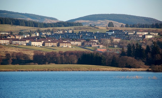
Auldcraigoch Hill is characterized by its distinctive conical shape and steep slopes. The terrain is primarily composed of grassy slopes, with patches of heather and gorse scattered across its surface. The hill offers panoramic views of the surrounding countryside, including the neighboring hills and the picturesque landscape below.

Covered in a rich tapestry of flora and fauna, Auldcraigoch Hill is a haven for wildlife enthusiasts. The hill provides a habitat for various bird species, including pheasants, buzzards, and kestrels. Additionally, it is home to rabbits, hares, and occasionally deer.

The hill is a popular destination for outdoor enthusiasts and hikers due to its accessibility and scenic beauty. Several footpaths and trails traverse its slopes, offering different levels of difficulty for walkers of all abilities. Auldcraigoch Hill also features a trig point at its summit, providing a reference point for surveying and navigation purposes.

Overall, Auldcraigoch Hill is a distinctive and picturesque landmark in Ayrshire, offering visitors the opportunity to immerse themselves in the natural beauty of the Scottish countryside while enjoying breathtaking views from its summit.

If you have any feedback on the listing, please let us know in the comments section below.

Auldcraigoch Hill Images

Images are sourced within 2km of 55.312613/-4.4591283 or Grid Reference NS4404. Thanks to Geograph Open Source API. All images are credited.

On the old extraction site The old OS maps show a gravel pit at this site but the grassy mound with its rocky core doesn’t really match this description. The old OS maps show other nearby sites as whinstone or freestone quarries. It’s an interesting site even though its origin is unclear. I’ll keep looking.
On the old extraction site
The old OS maps show a gravel pit at this site but the grassy mound with its rocky core doesn’t really match this description. The old OS maps show other nearby sites as whinstone or freestone quarries. It’s an interesting site even though its origin is unclear. I’ll keep looking.
Strange mound on the moorland A closer look at the strange mound on the moorland above the Doon Valley. The site is grassy because it lies above the moorland and is well drained. There certainly has been extraction of some kind here.
Strange mound on the moorland
A closer look at the strange mound on the moorland above the Doon Valley. The site is grassy because it lies above the moorland and is well drained. There certainly has been extraction of some kind here.
Moorland view Looking across the moor from the strange mound. The old OS maps show a gravel pit at this site but what’s on the ground doesn’t really match this description. I would have expected a gravel pit to be adjacent to the mound on a low-lying site extracting post-glacial outwash deposits. The grassy mound has a rocky core and there’s some evidence of extraction.
Moorland view
Looking across the moor from the strange mound. The old OS maps show a gravel pit at this site but what’s on the ground doesn’t really match this description. I would have expected a gravel pit to be adjacent to the mound on a low-lying site extracting post-glacial outwash deposits. The grassy mound has a rocky core and there’s some evidence of extraction.
Moorland mystery I had passed this site many times and often wondered what it was. The old OS maps show a gravel pit here but what’s on the ground doesn’t really match this description. I would have expected a gravel pit to be adjacent to the mound on a low-lying site extracting post-glacial outwash deposits. There’s nothing to suggest this on the ground. It’s an interesting site even though its origin is unclear. I’ll keep looking. See also <a href="https://www.geograph.org.uk/photo/6151059">NS4306 : The Red Burn and a curious mound</a>
Moorland mystery
I had passed this site many times and often wondered what it was. The old OS maps show a gravel pit here but what’s on the ground doesn’t really match this description. I would have expected a gravel pit to be adjacent to the mound on a low-lying site extracting post-glacial outwash deposits. There’s nothing to suggest this on the ground. It’s an interesting site even though its origin is unclear. I’ll keep looking. See also NS4306 : The Red Burn and a curious mound
Moorland near the old gravel pit site Looking west from the old gravel pit site. An early-March view of the moorland.
Moorland near the old gravel pit site
Looking west from the old gravel pit site. An early-March view of the moorland.
Some old mounds A track leads away from the old gravel pits passing by these old mounds. The old OS maps shows that there were three circular structures beside the track but I can find no other information about the site. I'll keep looking.
Some old mounds
A track leads away from the old gravel pits passing by these old mounds. The old OS maps shows that there were three circular structures beside the track but I can find no other information about the site. I'll keep looking.
An old gravel pit The old OS maps show this place as a gravel pit, with one part on each side of the modern cattle grid.
An old gravel pit
The old OS maps show this place as a gravel pit, with one part on each side of the modern cattle grid.
Auchenroy eggs If you like tasty double-yolkers, this is the place to come.
Auchenroy eggs
If you like tasty double-yolkers, this is the place to come.
Red Burn Bridge Red Burn seems to form the South Ayrshire boundary here
Red Burn Bridge
Red Burn seems to form the South Ayrshire boundary here
Red Burn by the B741
Pipe based bridge over Red Burn
Rushing roadside burn and stone wall
Cattle grid and gate on the B741
A gated track to Keirs Hill Viewed from the south-east.
A gated track to Keirs Hill
Viewed from the south-east.
A welcome to East Ayrshire Viewed from Red Burn Bridge to the west.
A welcome to East Ayrshire
Viewed from Red Burn Bridge to the west.
Road (B741) heading east down to Dalmellington
Auchenroy Bridge Looking back westward towards Straiton.
Auchenroy Bridge
Looking back westward towards Straiton.
Track to Glenhead Viewed from the north.
Track to Glenhead
Viewed from the north.
Show me another place!

Auldcraigoch Hill is located at Grid Ref: NS4404 (Lat: 55.312613, Lng: -4.4591283)

Unitary Authority: South Ayrshire

Police Authority: Ayrshire

What 3 Words

///rewriting.discloses.deduced. Near Dalmellington, East Ayrshire

Nearby Locations

Auldcraigoch Hill

Related Wikis

Waterside railway station

Waterside railway station served the village of Waterside, East Ayrshire, Scotland, from 1856 to 1964 on the Ayr and Dalmellington Railway. == History... ==

Doon Academy

Doon Academy is a secondary school in Dalmellington that caters to the local surrounding areas Dalmellington, Patna, Rankinston and Bellsbank. The current...

Dalmellington railway station

Dalmellington railway station served the town of Dalmellington, East Ayrshire, Scotland, from 1856 to 1964 on the Ayr and Dalmellington Railway. ��2�...

Bellsbank

Bellsbank is a village half a mile away from the market town of Dalmellington in East Ayrshire, Scotland. It is the second-highest place in East Ayrshire...

Nearby Amenities

Located within 500m of 55.312613,-4.4591283
The data included in this document is from www.openstreetmap.org. The data is made available under ODbL.

Have you been to Auldcraigoch Hill?

Leave your review of Auldcraigoch Hill below (or comments, questions and feedback).