An Cearcallach

Hill, Mountain in Inverness-shire

Scotland

An Cearcallach

Lochan Coire Choille-rais
Lochan Coire Choille-rais Credit: Alan Reid

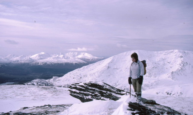
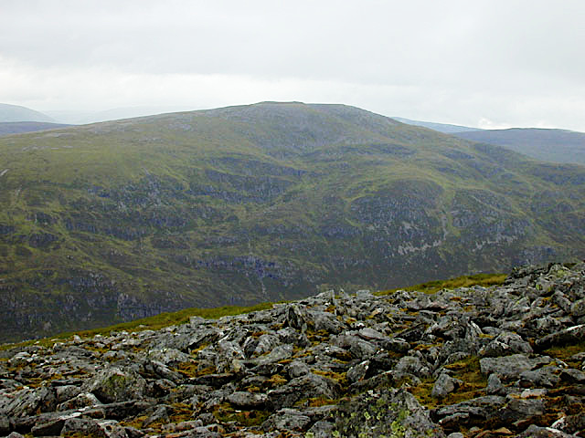
An Cearcallach is a prominent hill located in Inverness-shire, Scotland. It stands at an elevation of 811 meters (2,661 feet) and is part of the larger Monadhliath Mountains range. The hill is situated approximately 15 kilometers southeast of the town of Fort Augustus and offers stunning panoramic views of the surrounding landscape.

An Cearcallach is characterized by its distinctive rounded shape, which is a common feature of hills in the Monadhliath Mountains. The terrain is mainly composed of heather moorland and boggy areas, making it a challenging but rewarding destination for hikers and mountaineers.

The hill is accessible via various routes, with the most popular starting point being the Corrieyairack Pass to the north. This pass was historically used as a drover's road and provides an interesting historical context to the area. It is worth noting that proper navigation skills and appropriate equipment are essential when venturing onto An Cearcallach, as the weather conditions can change rapidly and visibility can be limited.

Wildlife enthusiasts will find An Cearcallach a haven for observing native species such as red deer, mountain hare, and golden eagles. The hill also supports a variety of plant life, including heather, wildflowers, and mosses.

Overall, An Cearcallach offers a challenging and rewarding outdoor experience for those seeking stunning views, a sense of tranquility, and a chance to connect with Scotland's natural beauty.

If you have any feedback on the listing, please let us know in the comments section below.

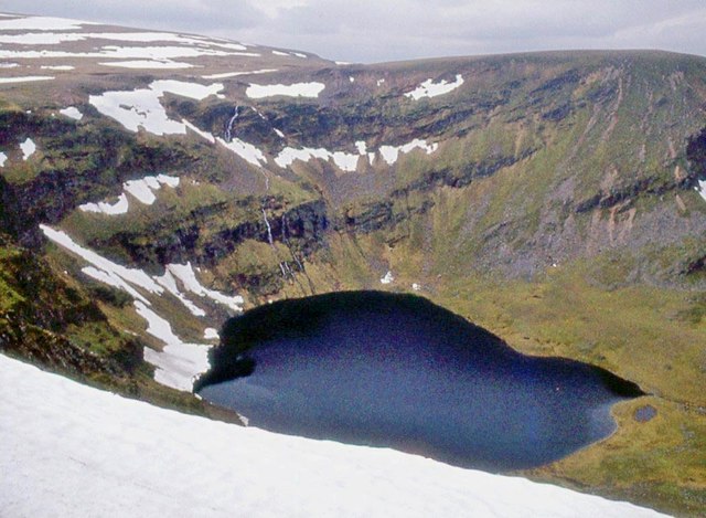
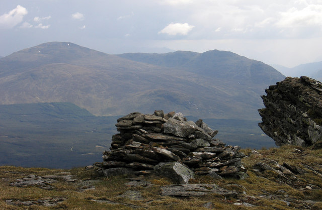
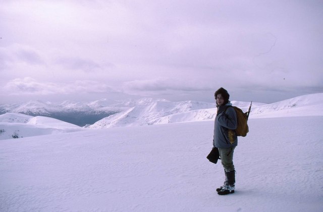
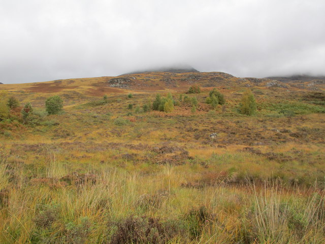
An Cearcallach Images

Images are sourced within 2km of 56.932772/-4.5940651 or Grid Reference NN4285. Thanks to Geograph Open Source API. All images are credited.

Lochan Coire Choille-rais
Snow banks in stream groove draining into Moy Corrie The stream has its origin at a tiny lochan between the outlying tops of Creag Meagaidh - Puist Coire Ardair and Meall Coire Choille-rais. The two banks would likely have been one and the appearance is that the nearer one has fallen following the sort of undercutting by the stream that's apparent for the further bank.
Snow banks in stream groove draining into Moy Corrie
The stream has its origin at a tiny lochan between the outlying tops of Creag Meagaidh - Puist Coire Ardair and Meall Coire Choille-rais. The two banks would likely have been one and the appearance is that the nearer one has fallen following the sort of undercutting by the stream that's apparent for the further bank.
Summit of An Cearcallach An Cearcallach is a subsidiary summit of Creag Meagaidh; the summit area is grassy with the well made cairn being not quite at the highest point which instead is an inclined rock slab. The mountains in the distance are Stob Coire Sgriodain and Chno Dearg.
Summit of An Cearcallach
An Cearcallach is a subsidiary summit of Creag Meagaidh; the summit area is grassy with the well made cairn being not quite at the highest point which instead is an inclined rock slab. The mountains in the distance are Stob Coire Sgriodain and Chno Dearg.
Lochan Coire Choille-rais Lochan Coire Choille-rais is a mountain corrie lochan between the subsidiary tops of the Munro Creag Meagaidh - Meall Coire Choille-rais and Puist Coire Ardair; the image was recorded from the first of those tops.
Lochan Coire Choille-rais
Lochan Coire Choille-rais is a mountain corrie lochan between the subsidiary tops of the Munro Creag Meagaidh - Meall Coire Choille-rais and Puist Coire Ardair; the image was recorded from the first of those tops.
Allt nan Cearcall The Allt nan Cearcall drains the valley between two southern outliers of Creag Meagaidh - An Cearcallach and Meall Coire Choille-rais. At and just above the camera position the stream can be seen to be flowing in an interesting in-cut slot.
Allt nan Cearcall
The Allt nan Cearcall drains the valley between two southern outliers of Creag Meagaidh - An Cearcallach and Meall Coire Choille-rais. At and just above the camera position the stream can be seen to be flowing in an interesting in-cut slot.
Boggy moorland leading to slopes of Geurachadh In the distance is An Cearcallach
Boggy moorland leading to slopes of Geurachadh
In the distance is An Cearcallach
Nearing the top of An Cearcallach Looking across the Moy Burn to Creag na Cailliche with
the east end of the Grey Corries also under snow.
Nearing the top of An Cearcallach
Looking across the Moy Burn to Creag na Cailliche with the east end of the Grey Corries also under snow.
View south from An Cearcallach Loch Laggan at Moy on the right with the River Spean flowing into it.
Lochan An Tuirc in the trees in the centre and the Abhainn Ghuilbinn flowing
from Loch Ghuilbinn in Strath Ossian.
View south from An Cearcallach
Loch Laggan at Moy on the right with the River Spean flowing into it. Lochan An Tuirc in the trees in the centre and the Abhainn Ghuilbinn flowing from Loch Ghuilbinn in Strath Ossian.
Above Moy Corrie Behind the climber is the ridge with Creag Meagaidh's summit on it.
The further ridge is Beinn a' Chaorainn.
Grey Corries on the left.
Above Moy Corrie
Behind the climber is the ridge with Creag Meagaidh's summit on it. The further ridge is Beinn a' Chaorainn. Grey Corries on the left.
Snow drifts on the south west ridge of Creag Meagaidh Loch Treig nestles between Stob Coire Sgriodain and the Easains in the distance.
Snow drifts on the south west ridge of Creag Meagaidh
Loch Treig nestles between Stob Coire Sgriodain and the Easains in the distance.
And the wall goes on Heading for Creag na Cailliche.  Lochan An Tuirc in the trees above the creag, and Loch Laggan on either side.
And the wall goes on
Heading for Creag na Cailliche. Lochan An Tuirc in the trees above the creag, and Loch Laggan on either side.
Moorland on Tom Bàn
Moorland on Tom Bàn
An Cearcallach A subsidiary top of Creag Meagaidh
An Cearcallach
A subsidiary top of Creag Meagaidh
Coire Choillie-rais The corrie is also known and as Moy Corrie which is certainly easier to pronounce. The lochan is, naturally enough, named Lochan Coire Choillie-rais and the summit on the ridge on the far side is Meall Coire Choillie-rais
Coire Choillie-rais
The corrie is also known and as Moy Corrie which is certainly easier to pronounce. The lochan is, naturally enough, named Lochan Coire Choillie-rais and the summit on the ridge on the far side is Meall Coire Choillie-rais
Coire Choillie-rais The corrie and lochan which shares its name seen from the summit that also shares the name, Meall Coire Choillie-rais. Beyond it is the summit plateau of Creag Meagaidh.
Coire Choillie-rais
The corrie and lochan which shares its name seen from the summit that also shares the name, Meall Coire Choillie-rais. Beyond it is the summit plateau of Creag Meagaidh.
An Cearcallach A subsidiary top to Creag Meagaidh. Beinn a'Chaorainn is behind the climber, Loch Laggan on the left and Ben Nevis and the Grey Corries in the centre.
An Cearcallach
A subsidiary top to Creag Meagaidh. Beinn a'Chaorainn is behind the climber, Loch Laggan on the left and Ben Nevis and the Grey Corries in the centre.
Dry stone wall With the snow this deep the wall loses its main purpose. Still it's ideal as a navigation aid. Loch Laggan in distance.
Dry stone wall
With the snow this deep the wall loses its main purpose. Still it's ideal as a navigation aid. Loch Laggan in distance.
Creag na Cailliche A pause on the 'old woman's rock'. Beinn a'Chaorainn and its coires in the background.
Creag na Cailliche
A pause on the 'old woman's rock'. Beinn a'Chaorainn and its coires in the background.
Show me another place!

An Cearcallach is located at Grid Ref: NN4285 (Lat: 56.932772, Lng: -4.5940651)

Unitary Authority: Highland

Police Authority: Highlands and Islands

What 3 Words

///merely.elastic.droplet. Near Gairlochy, Highland

Nearby Locations

An Cearcallach

Related Wikis

Creag Meagaidh

Creag Meagaidh (Scottish Gaelic: Creag Mèagaidh) is a mountain on the northern side of Glen Spean in the Highlands of Scotland. It is a complex mountain...

Beinn a' Chaorainn (Glen Spean)

Beinn a' Chaorainn is a Scottish mountain situated on the northern side of Glen Spean in the Lochaber region of the Highland Council area. The mountain...

Binnein Shuas

Binnein Shuas (747 m) is a mountain in the Grampian Mountains of Scotland. It lies between Loch Laggan and Lochan na h-Earba in Inverness-shire. A steep...

Beinn Teallach

Beinn Teallach (914.6 m) is a mountain in the Grampian Mountains of Scotland, located east of the village of Roybridge in Lochaber. A mostly rounded peak...

Nearby Amenities

Located within 500m of 56.932772,-4.5940651
An Cearcallach
Ele: 990
Ele Ft: 3250
Natural: peak
Lat/Long: 56.9327101/-4.5941674
The data included in this document is from www.openstreetmap.org. The data is made available under ODbL.

Have you been to An Cearcallach?

Leave your review of An Cearcallach below (or comments, questions and feedback).