Hillfoot
Settlement in Yorkshire
England
Hillfoot
Hillfoot is a small village located in the county of Yorkshire, England. Situated in the picturesque countryside, it is nestled within rolling hills and surrounded by lush green fields, offering residents and visitors a peaceful and scenic environment.
The village is known for its charming and traditional architecture, with many stone-built houses and cottages dating back to the 18th and 19th centuries. Its quaint streets are lined with well-maintained gardens and flower-filled planters, adding to the overall appeal of the village.
Hillfoot is home to a close-knit community, where residents take pride in their village and its heritage. The village boasts a local pub, The Hilltop Inn, which serves as a social hub for both locals and visitors alike. The pub offers a warm and friendly atmosphere, where people can enjoy a pint of local ale and traditional Yorkshire dishes.
For nature enthusiasts, Hillfoot offers a range of outdoor activities. The surrounding countryside provides ample opportunities for hiking, walking, and cycling, with several scenic trails and paths that showcase the stunning landscapes of the area. Additionally, the nearby River Aire provides a tranquil setting for fishing and boating.
Despite its rural location, Hillfoot is well-connected to neighboring towns and cities. The village benefits from good transport links, with regular bus services and easy access to major road networks. This allows residents to enjoy the tranquility of village life while still being within reach of urban amenities.
Overall, Hillfoot is a charming and idyllic village that offers a peaceful and scenic escape from the hustle and bustle of city life. Its natural beauty, historic architecture, and strong sense of community make it a delightful place to visit or call home.
If you have any feedback on the listing, please let us know in the comments section below.
Hillfoot Images
Images are sourced within 2km of 53.80128/-1.689972 or Grid Reference SE2033. Thanks to Geograph Open Source API. All images are credited.


Hillfoot is located at Grid Ref: SE2033 (Lat: 53.80128, Lng: -1.689972)
Division: West Riding
Unitary Authority: Leeds
Police Authority: West Yorkshire
What 3 Words
///obey.barn.hooks. Near Pudsey, West Yorkshire
Related Wikis

New Pudsey railway station
New Pudsey railway station serves the towns of Farsley and Pudsey in West Yorkshire, England, on the Calder Valley line. It serves the adjacent suburb...
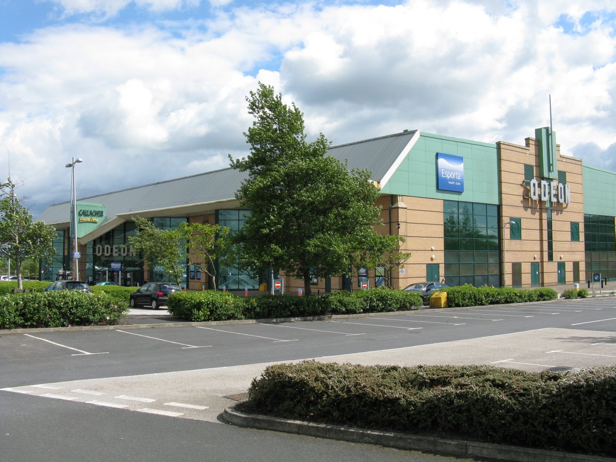
Odeon Leeds-Bradford
Odeon Leeds-Bradford is a multiplex cinema at Gallagher Leisure Park, Thornbury, West Yorkshire, between the cities of Leeds and Bradford in England. It...
Co-op Academy Priesthorpe
Co-op Academy Priesthorpe is a secondary school, academy and sixth form in Pudsey, West Yorkshire, England. == Curriculum == Co-op Academy Priesthorpe...

Bradford Moor
Bradford Moor is an electoral ward within the City of Bradford Metropolitan District Council. The population of the ward at the 2011 Census was 21,210...
Nearby Amenities
Located within 500m of 53.80128,-1.689972Have you been to Hillfoot?
Leave your review of Hillfoot below (or comments, questions and feedback).