Gass Hill

Hill, Mountain in Ayrshire

Scotland

Gass Hill

Moorland near the old gravel pit site Looking west from the old gravel pit site. An early-March view of the moorland.
Moorland near the old gravel pit site Credit: Mary and Angus Hogg

Located in Ayrshire, Scotland, Gass Hill is a prominent hill that offers stunning views of the surrounding countryside. Standing at an elevation of 312 meters (1,024 feet), it is a popular destination for hikers and nature enthusiasts.

The hill is characterized by its gently sloping terrain, covered in lush green vegetation and dotted with scattered trees. The summit of Gass Hill provides panoramic views of the Ayrshire coast, the Firth of Clyde, and the Isle of Arran on a clear day.

Visitors to Gass Hill can enjoy a leisurely hike along well-marked trails that wind their way to the top. The hill is also home to a variety of wildlife, including birds of prey and deer, making it a great spot for birdwatching and wildlife photography.

Gass Hill is easily accessible by car, with parking available at the base of the hill. It is a popular spot for outdoor activities such as picnicking, dog walking, and kite flying. Whether you're looking for a challenging hike or a peaceful retreat in nature, Gass Hill offers something for everyone to enjoy.

If you have any feedback on the listing, please let us know in the comments section below.
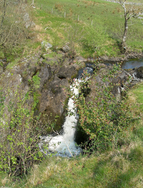
Gass Hill Images

Images are sourced within 2km of 55.311401/-4.4909665 or Grid Reference NS4204. Thanks to Geograph Open Source API. All images are credited.

Moorland near the old gravel pit site Looking west from the old gravel pit site. An early-March view of the moorland.
Moorland near the old gravel pit site
Looking west from the old gravel pit site. An early-March view of the moorland.
Some old mounds A track leads away from the old gravel pits passing by these old mounds. The old OS maps shows that there were three circular structures beside the track but I can find no other information about the site. I'll keep looking.
Some old mounds
A track leads away from the old gravel pits passing by these old mounds. The old OS maps shows that there were three circular structures beside the track but I can find no other information about the site. I'll keep looking.
An old gravel pit The old OS maps show this place as a gravel pit, with one part on each side of the modern cattle grid.
An old gravel pit
The old OS maps show this place as a gravel pit, with one part on each side of the modern cattle grid.
Moorland beside B741 The B741 is seen heading east across desolate moorland and east of the farm at Gass.
Moorland beside B741
The B741 is seen heading east across desolate moorland and east of the farm at Gass.
Track up Lambdoughty Hill by the pylon
Pylons marching up Kilachie Glen
Cattle grid and gate by Gas Farm
B741 to Straiton
B741 to Straiton
Electricity wires across the moorland
Pine plantation on the hill
Red Burn Bridge Red Burn seems to form the South Ayrshire boundary here
Red Burn Bridge
Red Burn seems to form the South Ayrshire boundary here
Red Burn by the B741
A gated track to Keirs Hill Viewed from the south-east.
A gated track to Keirs Hill
Viewed from the south-east.
A welcome to East Ayrshire Viewed from Red Burn Bridge to the west.
A welcome to East Ayrshire
Viewed from Red Burn Bridge to the west.
Red Burn Bridge The bridge carries the B741 across the Red Burn at the boundary between South Ayrshire and East Ayrshire.
Red Burn Bridge
The bridge carries the B741 across the Red Burn at the boundary between South Ayrshire and East Ayrshire.
Kilachie Glen Looking North Northeast down Kilachie Glen (as named on 1:25,000 OS map) towards the B741.
Kilachie Glen
Looking North Northeast down Kilachie Glen (as named on 1:25,000 OS map) towards the B741.
Looking towards Kilachie Glen Looking west across grazing land towards Kilachie Glen.
Looking towards Kilachie Glen
Looking west across grazing land towards Kilachie Glen.
Sheep Grazing on Largs Hill Despite the name this Largs Hill is near the village of Straiton not the town of Largs!  In the distance is Kildoach Hill.
Sheep Grazing on Largs Hill
Despite the name this Largs Hill is near the village of Straiton not the town of Largs! In the distance is Kildoach Hill.
Show me another place!

Gass Hill is located at Grid Ref: NS4204 (Lat: 55.311401, Lng: -4.4909665)

Unitary Authority: South Ayrshire

Police Authority: Ayrshire

What 3 Words

///gripes.undertook.mergers. Near Dalmellington, East Ayrshire

Nearby Locations

Black Hill Gass Hill

Related Wikis

Drunmore Linn

Drunmore Linn is a waterfall of Scotland, near Straiton, South Ayrshire. == See also == Waterfalls of Scotland == References ==

Straiton

Straiton is a village on the River Girvan in South Ayrshire in Scotland. It lies in the hills between Kirkmichael, Dalmellington, Crosshill, and Maybole...

Tairlaw Linn

Tairlaw Linn is a waterfall of Scotland, near Straiton, South Ayrshire. == See also == Waterfalls of Scotland == References ==

Waterside railway station

Waterside railway station served the village of Waterside, East Ayrshire, Scotland, from 1856 to 1964 on the Ayr and Dalmellington Railway. == History... ==

Nearby Amenities

Located within 500m of 55.311401,-4.4909665
Generator Method: wind_turbine
Generator Source: wind
Power: generator
Lat/Long: 55.3105877/-4.4943882
Generator Method: wind_turbine
Generator Source: wind
Power: generator
Lat/Long: 55.3116379/-4.4891955
Generator Method: wind_turbine
Generator Source: wind
Power: generator
Lat/Long: 55.3104045/-4.4847323
Generator Method: wind_turbine
Generator Source: wind
Power: generator
Lat/Long: 55.307388/-4.4885306
The data included in this document is from www.openstreetmap.org. The data is made available under ODbL.

Have you been to Gass Hill?

Leave your review of Gass Hill below (or comments, questions and feedback).