Carn an Daraich

Hill, Mountain in Ross-shire

Scotland

Carn an Daraich

Am Fireach Clear felled area on Am Fireach
Am Fireach Credit: valenta

Carn an Daraich is a hill located in Ross-shire, Scotland. It has an elevation of 732 meters (2,402 feet) above sea level, making it a popular destination for hikers and outdoor enthusiasts looking for a challenging climb. The hill is part of the larger Ben Wyvis range, which is known for its rugged terrain and stunning views of the surrounding countryside.

Carn an Daraich is primarily composed of granite and schist rock formations, giving it a distinctive appearance compared to other hills in the area. The hill is home to a variety of wildlife, including red deer, mountain hares, and a variety of bird species, making it a popular spot for nature lovers and wildlife enthusiasts.

Hikers can access Carn an Daraich via a well-maintained trail that winds its way up the hill, offering panoramic views of the surrounding countryside and nearby lochs. The summit of Carn an Daraich offers breathtaking views of the surrounding landscape, making it a popular spot for photographers and nature enthusiasts looking to capture the beauty of the Scottish Highlands. Overall, Carn an Daraich is a challenging yet rewarding climb that offers stunning views and a chance to experience the natural beauty of the Scottish countryside.

If you have any feedback on the listing, please let us know in the comments section below.

Carn an Daraich Images

Images are sourced within 2km of 57.582465/-4.650652 or Grid Reference NH4157. Thanks to Geograph Open Source API. All images are credited.

Am Fireach Clear felled area on Am Fireach
Am Fireach
Clear felled area on Am Fireach
River Conon
River Conon
Fishing hut on the river Conon
Loch Achilty Forestry Commission Car Park
A835 near Loch Garve The A835 is a primary road in the Scottish Highlands linking Inverness to Ullapool and the Far North of Scotland. It runs for just over 66 miles, between Tore Roundabout and Ledmore (north of Ullapool)/ The road can be particularly busy before and after ferry crossings arrive at and depart from Ullapool, and sees a great deal of goods traffic travelling to and from the Western Isles (<span class="nowrap"><a title="https://www.sabre-roads.org.uk/wiki/index.php?title=A835" rel="nofollow ugc noopener" href="https://www.sabre-roads.org.uk/wiki/index.php?title=A835">Link</a><img style="margin-left:2px;" alt="External link" title="External link - shift click to open in new window" src="https://s1.geograph.org.uk/img/external.png" width="10" height="10"/></span> SABRE).
A835 near Loch Garve
The A835 is a primary road in the Scottish Highlands linking Inverness to Ullapool and the Far North of Scotland. It runs for just over 66 miles, between Tore Roundabout and Ledmore (north of Ullapool)/ The road can be particularly busy before and after ferry crossings arrive at and depart from Ullapool, and sees a great deal of goods traffic travelling to and from the Western Isles (LinkExternal link SABRE).
Mobile Variable Message Sign (VMS) on the A835 Variable message signs (VMS), also sometimes referred to as matrix signs, are electronic traffic signs used on motorways (and some other major routes) to give drivers information about special events and to warn them about traffic congestion, accidents, incidents, roadworks or speed limits on specific sections of the route. They may also suggest (or instruct) drivers to take alternative routes, limit speed, warn of the duration and location of the incidents or just inform of the traffic conditions.
Mobile Variable Message Sign (VMS) on the A835
Variable message signs (VMS), also sometimes referred to as matrix signs, are electronic traffic signs used on motorways (and some other major routes) to give drivers information about special events and to warn them about traffic congestion, accidents, incidents, roadworks or speed limits on specific sections of the route. They may also suggest (or instruct) drivers to take alternative routes, limit speed, warn of the duration and location of the incidents or just inform of the traffic conditions.
Layby on the A835 near Tarvie The A835 is a primary road in the Scottish Highlands linking Inverness to Ullapool and the Far North of Scotland. It runs for just over 66 miles, between Tore Roundabout and Ledmore (north of Ullapool)/ The road can be particularly busy before and after ferry crossings arrive at and depart from Ullapool, and sees a great deal of goods traffic travelling to and from the Western Isles (<span class="nowrap"><a title="https://www.sabre-roads.org.uk/wiki/index.php?title=A835" rel="nofollow ugc noopener" href="https://www.sabre-roads.org.uk/wiki/index.php?title=A835">Link</a><img style="margin-left:2px;" alt="External link" title="External link - shift click to open in new window" src="https://s1.geograph.org.uk/img/external.png" width="10" height="10"/></span> SABRE).
Layby on the A835 near Tarvie
The A835 is a primary road in the Scottish Highlands linking Inverness to Ullapool and the Far North of Scotland. It runs for just over 66 miles, between Tore Roundabout and Ledmore (north of Ullapool)/ The road can be particularly busy before and after ferry crossings arrive at and depart from Ullapool, and sees a great deal of goods traffic travelling to and from the Western Isles (LinkExternal link SABRE).
A835 near Tarvie The A835 is a primary road in the Scottish Highlands linking Inverness to Ullapool and the Far North of Scotland. It runs for just over 66 miles, between Tore Roundabout and Ledmore (north of Ullapool)/ The road can be particularly busy before and after ferry crossings arrive at and depart from Ullapool, and sees a great deal of goods traffic travelling to and from the Western Isles (<span class="nowrap"><a title="https://www.sabre-roads.org.uk/wiki/index.php?title=A835" rel="nofollow ugc noopener" href="https://www.sabre-roads.org.uk/wiki/index.php?title=A835">Link</a><img style="margin-left:2px;" alt="External link" title="External link - shift click to open in new window" src="https://s1.geograph.org.uk/img/external.png" width="10" height="10"/></span> SABRE).
A835 near Tarvie
The A835 is a primary road in the Scottish Highlands linking Inverness to Ullapool and the Far North of Scotland. It runs for just over 66 miles, between Tore Roundabout and Ledmore (north of Ullapool)/ The road can be particularly busy before and after ferry crossings arrive at and depart from Ullapool, and sees a great deal of goods traffic travelling to and from the Western Isles (LinkExternal link SABRE).
Layby on the Eastbound A835 The A835 is a primary road in the Scottish Highlands linking Inverness to Ullapool and the Far North of Scotland. It runs for just over 66 miles, between Tore Roundabout and Ledmore (north of Ullapool)/ The road can be particularly busy before and after ferry crossings arrive at and depart from Ullapool, and sees a great deal of goods traffic travelling to and from the Western Isles (<span class="nowrap"><a title="https://www.sabre-roads.org.uk/wiki/index.php?title=A835" rel="nofollow ugc noopener" href="https://www.sabre-roads.org.uk/wiki/index.php?title=A835">Link</a><img style="margin-left:2px;" alt="External link" title="External link - shift click to open in new window" src="https://s1.geograph.org.uk/img/external.png" width="10" height="10"/></span> SABRE).
Layby on the Eastbound A835
The A835 is a primary road in the Scottish Highlands linking Inverness to Ullapool and the Far North of Scotland. It runs for just over 66 miles, between Tore Roundabout and Ledmore (north of Ullapool)/ The road can be particularly busy before and after ferry crossings arrive at and depart from Ullapool, and sees a great deal of goods traffic travelling to and from the Western Isles (LinkExternal link SABRE).
A835 towards Ullapool
A835 towards Garve
A835 towards Garve
A835 at Tarvie
A835 at Tarvie
A835 towards Garve
A835 towards Garve
A835 near Tarvie
A835 near Tarvie
Cafe, Tarvie On the A835.
Cafe, Tarvie
On the A835.
Show me another place!

Carn an Daraich is located at Grid Ref: NH4157 (Lat: 57.582465, Lng: -4.650652)

Unitary Authority: Highland

Police Authority: Highlands and Islands

What 3 Words

///quitter.mascot.blushes. Near Strathpeffer, Highland

Related Wikis

Loch Achilty

Loch Achilty is a large deep picturesque lowland freshwater loch set within a sloping birch and oakwood forest, located near Contin in Easter Ross in the...
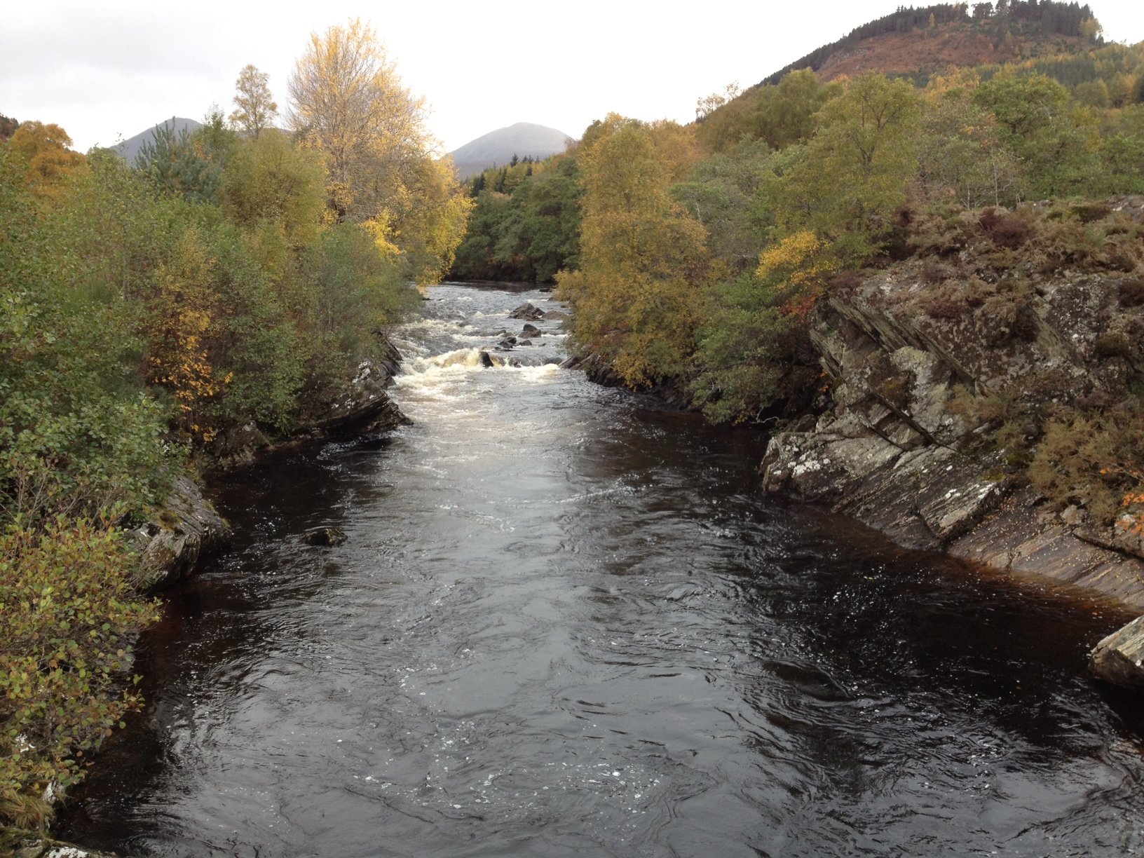
River Meig

The River Meig (Scottish Gaelic: Mìg) is a river in Easter Ross. It draws its source from the meeting of several allts in the forested hills north of Loch...
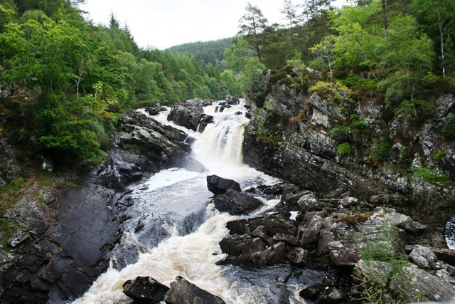
Rogie Falls

Rogie Falls (Gaelic: Eas Rothagaidh) are a series of waterfalls on the Black Water, a river in Ross-shire in the Highlands of Scotland. The falls are about...

Loch Achonachie

Loch Achonachie is a freshwater loch in Ross-Shire, Scotland, 1.9 kilometres (1.2 mi) south-west of Contin. Situated on the River Conon, the loch is a...

Have you been to Carn an Daraich?

Leave your review of Carn an Daraich below (or comments, questions and feedback).