Carn Dearg

Hill, Mountain in Inverness-shire

Scotland

Carn Dearg

Bogs north of Creag Meagaidh Creag Meagaidh's northern side rises out of a vast area of bogland covering granite bedrock at the head of Glen Roy. Deer paths and dry conditions made walking easy, but I expect this is normally a tough place to visit.
Bogs north of Creag Meagaidh Credit: Richard Webb

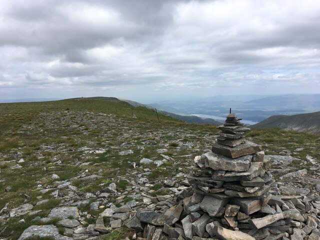
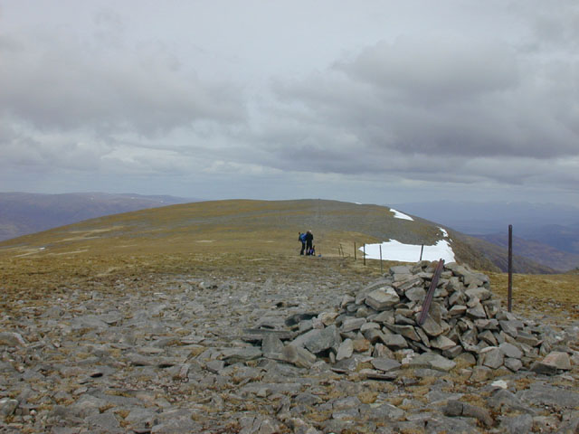
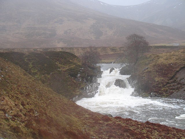
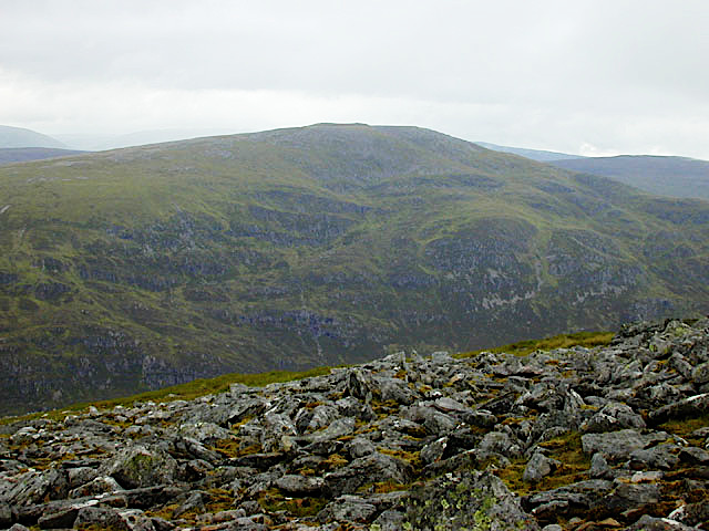
Carn Dearg is a prominent hill located in Inverness-shire, Scotland. It is part of the Grampian Mountain range and sits at an elevation of 945 meters (3,100 feet). The hill is situated in the central Highlands region, approximately 30 kilometers (19 miles) northeast of Fort William.

Carn Dearg is renowned for its stunning natural beauty and attracts numerous hikers and mountaineers throughout the year. It offers breathtaking panoramic views of the surrounding landscape, including the nearby Ben Nevis, the highest mountain in the British Isles.

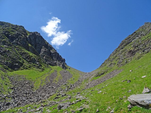
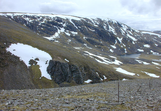
The hill features a rugged terrain with steep slopes and rocky outcrops, which adds to its allure and challenge for outdoor enthusiasts. The ascent to the summit can be demanding but is rewarding, as it provides an opportunity to witness the diverse flora and fauna of the region. Rare alpine plants, such as dwarf willow and moss campion, can be found in the higher altitudes.

Carn Dearg also holds historical significance, as it was used as a route by drovers in the past. These drovers would drive their cattle from the Highlands to markets in the lowlands. Today, remnants of their tracks can still be seen on the hillside.

Overall, Carn Dearg offers a unique and memorable experience for those seeking adventure and natural beauty in the Inverness-shire area. Its challenging terrain, stunning views, and historical significance make it an ideal destination for hikers, mountaineers, and nature enthusiasts alike.

If you have any feedback on the listing, please let us know in the comments section below.

Carn Dearg Images

Images are sourced within 2km of 56.967958/-4.6168321 or Grid Reference NN4189. Thanks to Geograph Open Source API. All images are credited.

Bogs north of Creag Meagaidh Creag Meagaidh's northern side rises out of a vast area of bogland covering granite bedrock at the head of Glen Roy. Deer paths and dry conditions made walking easy, but I expect this is normally a tough place to visit.
Bogs north of Creag Meagaidh
Creag Meagaidh's northern side rises out of a vast area of bogland covering granite bedrock at the head of Glen Roy. Deer paths and dry conditions made walking easy, but I expect this is normally a tough place to visit.
Allt nan Luibhean Burn draining towards Glen Roy. Carn Dearg, one of the tops of Creag Meagaidh in the background.
Allt nan Luibhean
Burn draining towards Glen Roy. Carn Dearg, one of the tops of Creag Meagaidh in the background.
Creag Meagaidh summit cairn
Northern slopes of Stob Poite Coire Ardair The stream drains into the River Roy
Northern slopes of Stob Poite Coire Ardair
The stream drains into the River Roy
Boulders at Uinneag Coire Ardair Uinneag Coire Ardair, otherwise known as The Window is a pass between two mountains of the Creag Meagaidh group, Creag Meagaidh itself and Stob Poite Coire Ardair, both Munros.
Boulders at Uinneag Coire Ardair
Uinneag Coire Ardair, otherwise known as The Window is a pass between two mountains of the Creag Meagaidh group, Creag Meagaidh itself and Stob Poite Coire Ardair, both Munros.
Snow covered summit cairn on Creag Meagaidh In poor visibility, before GPS, finding this summit could be difficult. 
This day was perfect!
Beinn a' Chaorainn is the next ridge with Grey Corries beyond.
Snow covered summit cairn on Creag Meagaidh
In poor visibility, before GPS, finding this summit could be difficult. This day was perfect! Beinn a' Chaorainn is the next ridge with Grey Corries beyond.
Summit area of Stob Poite Coire Adair
The Window Narrow cleft between the Munros of Creag Meagaidh to the left and Stob Poite Coire Ardair to the right, known as the Window. A hard climb to the pass on a hot day in the highlands.
The Window
Narrow cleft between the Munros of Creag Meagaidh to the left and Stob Poite Coire Ardair to the right, known as the Window. A hard climb to the pass on a hot day in the highlands.
The Window The high col at the head of Coire Ardair, on the old route linking Glen Spean to Braeroy.
The Window
The high col at the head of Coire Ardair, on the old route linking Glen Spean to Braeroy.
The summit of Stob Poite Coire Ardair Looking past the cairn along the almost level ridge to Stob Poite Coire Ardair's slightly lower other summit.
The summit of Stob Poite Coire Ardair
Looking past the cairn along the almost level ridge to Stob Poite Coire Ardair's slightly lower other summit.
View south west from Stob Poite Coire Ardair Taken from the west ridge of Stob Poite Coire Ardair. Nearby is the top of the Window, and the slopes leading to the Craig Meagaidh plateau, up which the path can be faintly seen. On the right is Lochan Uaine, most of which is in the square. In the distance the distinctive Mad Meg's Cairn can be seen on the plateau edge; the true summit of Craig Megaidh is on the rise to the right.
View south west from Stob Poite Coire Ardair
Taken from the west ridge of Stob Poite Coire Ardair. Nearby is the top of the Window, and the slopes leading to the Craig Meagaidh plateau, up which the path can be faintly seen. On the right is Lochan Uaine, most of which is in the square. In the distance the distinctive Mad Meg's Cairn can be seen on the plateau edge; the true summit of Craig Megaidh is on the rise to the right.
Slopes of Meagaidh NE towards Stob Poite Coire Ardair
The Window A view looking roughly west towards the Window.
The Window
A view looking roughly west towards the Window.
Above the Window Looking across the cleft, from the slopes leading up to Stob Poite Coire Ardair. A steep path climbs the scree opposite, and can provide a quick route to the Creag Meagaidh plateau, when not blocked by snow.
Above the Window
Looking across the cleft, from the slopes leading up to Stob Poite Coire Ardair. A steep path climbs the scree opposite, and can provide a quick route to the Creag Meagaidh plateau, when not blocked by snow.
The Creag Meagaidh plateau Looking across the Window from Stob Poite Coire Ardair to the slopes leading up to the plateau. Mad Meg's Cairn can be seen on the horizon; the true summit is the faint dot over on the right.
The Creag Meagaidh plateau
Looking across the Window from Stob Poite Coire Ardair to the slopes leading up to the plateau. Mad Meg's Cairn can be seen on the horizon; the true summit is the faint dot over on the right.
Boulders, Glen Roy Granite boulders set in peatland drained by the Allt nan Luibhean into Glen Roy. Meall a Mheanbh-chruidh in the background.
Boulders, Glen Roy
Granite boulders set in peatland drained by the Allt nan Luibhean into Glen Roy. Meall a Mheanbh-chruidh in the background.
Carn Dearg Bogs beneath Carn Dearg, a northern top of Creag Meagaidh.
Carn Dearg
Bogs beneath Carn Dearg, a northern top of Creag Meagaidh.
A corrie behind Creag Meagaidh Gently sloping peaty moorland around the Uisge nam Fichead beneath the northern crags of Creag Meagaidh.
A corrie behind Creag Meagaidh
Gently sloping peaty moorland around the Uisge nam Fichead beneath the northern crags of Creag Meagaidh.
Show me another place!

Carn Dearg is located at Grid Ref: NN4189 (Lat: 56.967958, Lng: -4.6168321)

Unitary Authority: Highland

Police Authority: Highlands and Islands

What 3 Words

///folks.cooked.cleanser. Near Gairlochy, Highland

Nearby Locations

Carn Dearg Loch Roy

Related Wikis

Creag Meagaidh

Creag Meagaidh (Scottish Gaelic: Creag Mèagaidh) is a mountain on the northern side of Glen Spean in the Highlands of Scotland. It is a complex mountain...

Loch Spey

Loch Spey is a small freshwater loch located in the Central Highlands of Scotland. This loch is significant because it forms the headwaters of the powerful...

Beinn a' Chaorainn (Glen Spean)

Beinn a' Chaorainn is a Scottish mountain situated on the northern side of Glen Spean in the Lochaber region of the Highland Council area. The mountain...

Falls of Roy

Falls of Roy is a waterfall of Scotland. == See also == Waterfalls of Scotland == References ==

Beinn Teallach

Beinn Teallach (914.6 m) is a mountain in the Grampian Mountains of Scotland, located east of the village of Roybridge in Lochaber. A mostly rounded peak...

Loch Laggan

Loch Laggan is a freshwater loch situated approximately 6+1⁄2 mi (10.5 km) west of Dalwhinnie in the Scottish Highlands. The loch has an irregular shape...

Binnein Shuas

Binnein Shuas (747 m) is a mountain in the Grampian Mountains of Scotland. It lies between Loch Laggan and Lochan na h-Earba in Inverness-shire. A steep...

A86 road

The A86 is a major road in Scotland. It runs from the Great Glen at Spean Bridge to Kingussie and the Cairngorms National Park via Loch Laggan. It is a...

Nearby Amenities

Located within 500m of 56.967958,-4.6168321
Carn Dearg
Ele: 888
Natural: peak
Lat/Long: 56.9684592/-4.6178777
The data included in this document is from www.openstreetmap.org. The data is made available under ODbL.

Have you been to Carn Dearg?

Leave your review of Carn Dearg below (or comments, questions and feedback).