Meall a' Bhaird
Hill, Mountain in Ross-shire
Scotland
Meall a' Bhaird

Meall a' Bhaird is a prominent hill located in Ross-shire, Scotland. It forms part of the eastern range of the Northwest Highlands and is situated near the small village of Contin. Measuring approximately 509 meters (1,670 feet) in height, it offers stunning views of the surrounding picturesque landscape.
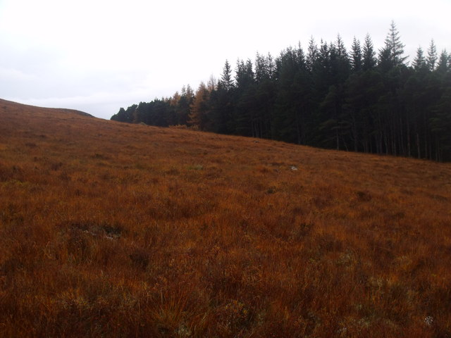
The hill is characterized by its gentle slopes, covered in heather and grass, making it a relatively easy climb for both experienced hikers and beginners. Its distinct shape and prominent position make it a popular destination for outdoor enthusiasts seeking breathtaking vistas and a serene atmosphere.
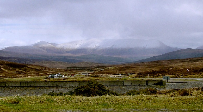
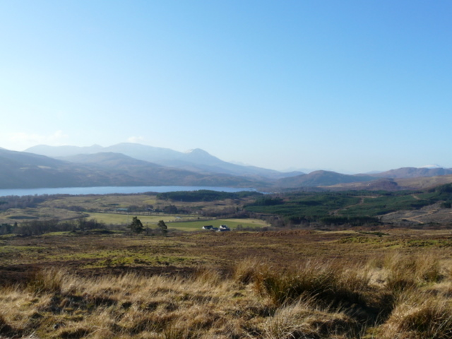
Reaching the summit of Meall a' Bhaird allows visitors to witness panoramic views of the surrounding countryside. To the west, one can admire the meandering River Blackwater as it flows through the Strathconon valley, while to the east, the vastness of the Scottish Highlands unfolds, with its rugged mountains and pristine lochs.
The hill is accessible via various footpaths and trails, making it an ideal location for walkers and nature lovers. The area is also home to a diverse range of wildlife, including red deer, mountain hares, and a variety of bird species, offering opportunities for wildlife spotting and photography.
Meall a' Bhaird is a tranquil and scenic location, providing visitors with a chance to immerse themselves in the natural beauty of the Scottish Highlands. Whether it's for a leisurely walk, a challenging hike, or simply to enjoy the breathtaking views, this hill offers something for everyone.
If you have any feedback on the listing, please let us know in the comments section below.
Meall a' Bhaird Images
Images are sourced within 2km of 57.696353/-4.671877 or Grid Reference NH4070. Thanks to Geograph Open Source API. All images are credited.


Meall a' Bhaird is located at Grid Ref: NH4070 (Lat: 57.696353, Lng: -4.671877)
Unitary Authority: Highland
Police Authority: Highlands and Islands
What 3 Words
///stroke.tour.pacifist. Near Strathpeffer, Highland
Nearby Locations
Related Wikis
Battle of Bealach nam Broig
The Battle of Bealach nam Broig (Scottish Gaelic: Pass of the Brogue; also known as the Great Battle of Bealach nam Broig, Bealach nam Brog, Beallighne...

Ben Wyvis
Ben Wyvis (Scottish Gaelic: Beinn Uais) is a mountain in Easter Ross, in the northern Highlands of Scotland. It lies north-west of Dingwall, in the council...

Beinn nan Eun
Beinn nan Eun (743 m) is a mountain in the Northwest Highlands of Scotland. It is located in Easter Ross, several miles northwest of Dingwall. A very remote...

A835 road
The A835 is a road in the Scottish Highlands linking Inverness to Ullapool and the Far North of Scotland. == Route == The A835 starts at Tore on the Black...

A832 road
The A832 is a road in the Scottish Highlands, linking Cromarty, on the east coast, to Gairloch on the west coast, and beyond Gairloch to Braemore Junction...
Gorstan
Gorstan (Scottish Gaelic: An Goirtean) is a small hamlet in Garve, Ross-shire region in the Scottish council area of Highland. == References ==

Garve
Garve (Scottish Gaelic: Gairbh) is a village on the Black Water river, in Ross-shire, and is in the Highland Council area of Scotland. It is situated 5...
Loch Glascarnoch
Loch Glascarnoch is a 7-kilometre-long (4.3 mi) reservoir in the highlands of Scotland between Ullapool and Inverness. It is dammed on its eastern end...
Nearby Amenities
Located within 500m of 57.696353,-4.671877Have you been to Meall a' Bhaird?
Leave your review of Meall a' Bhaird below (or comments, questions and feedback).