Broom Hill

Hill, Mountain in Wigtownshire

Scotland

Broom Hill

Line of trees at Barvernochan
Line of trees at Barvernochan Credit: David Purchase

Broom Hill, located in Wigtownshire, Scotland, is a notable hill standing at an elevation of approximately 303 meters (994 feet) above sea level. Situated near the village of Kirkcolm, Broom Hill offers picturesque views of the surrounding countryside and the Irish Sea in the distance.

Covered in lush green vegetation, Broom Hill is known for its diverse flora and fauna, making it a popular destination for nature enthusiasts and hikers. The hill is predominantly composed of sedimentary rocks, with its slopes featuring a mixture of grassland, heather moorland, and scattered patches of woodland.

At the summit of Broom Hill, one can find a trig point, which serves as a marker for geodetic surveys. This spot provides panoramic views of the surrounding landscape, including the rolling hills of Galloway, the coastline, and even glimpses of the Isle of Man on a clear day. The hill's location and elevation also make it an excellent vantage point for observing local birdlife and migratory species.

Broom Hill is easily accessible, with several footpaths leading to its summit, allowing visitors to explore its natural beauty. The hill is a part of the wider Southern Uplands range and is often included in hiking routes, such as the Rhins of Galloway Trail, providing an opportunity for outdoor enthusiasts to immerse themselves in the region's stunning scenery.

Overall, Broom Hill in Wigtownshire is a captivating natural landmark, offering breathtaking views and a chance to connect with the surrounding environment.

If you have any feedback on the listing, please let us know in the comments section below.

Broom Hill Images

Images are sourced within 2km of 54.831677/-4.4984465 or Grid Reference NX3951. Thanks to Geograph Open Source API. All images are credited.

Line of trees at Barvernochan
Old milestone This milestone at the north east end of Whauphill is on the left hand side of a drive into a house.   It is opposite the Station House junction.   The railway ran from Newton Stewart to Whithorn with a spur to Garlieston.   It has been cleared of vegetation and painted by a Milestone Society member.
Old milestone
This milestone at the north east end of Whauphill is on the left hand side of a drive into a house. It is opposite the Station House junction. The railway ran from Newton Stewart to Whithorn with a spur to Garlieston. It has been cleared of vegetation and painted by a Milestone Society member.
Old milestone Southwestwards into the village centre where the B7052 forms a crossroads with the B7085.
Old milestone
Southwestwards into the village centre where the B7052 forms a crossroads with the B7085.
Whaup Hotel At the time of this photo, this pub in the centre of the tiny village of Whauphill was undergoing a face lift, following the death of the landlord. It has subsequently reopened as a pub and restaurant with an lively music programme; customers are active in fund-raising for cancer research. <span class="nowrap"><a title="http://www.whauphotel.co.uk" rel="nofollow ugc noopener" href="http://www.whauphotel.co.uk">Link</a><img style="margin-left:2px;" alt="External link" title="External link - shift click to open in new window" src="https://s1.geograph.org.uk/img/external.png" width="10" height="10"/></span>
Whaup Hotel
At the time of this photo, this pub in the centre of the tiny village of Whauphill was undergoing a face lift, following the death of the landlord. It has subsequently reopened as a pub and restaurant with an lively music programme; customers are active in fund-raising for cancer research. LinkExternal link
Agricultural engineers at Whauphill
Telephone Box & purple village hall
The Whaup Hotel This looked a bit closed to me when I wanted to visit!
The Whaup Hotel
This looked a bit closed to me when I wanted to visit!
Culbae, Whauphill View northward from Culbae over the extensive grazing/hay fields.
Culbae, Whauphill
View northward from Culbae over the extensive grazing/hay fields.
Whauphill View along the B7085 in Whauphill past Tarff Valley Agricultural Merchants right of picture.
Whauphill
View along the B7085 in Whauphill past Tarff Valley Agricultural Merchants right of picture.
Whaup Hotel Rephotograph of this hotel in Whauphill Geographed previously in 2006 <a href="https://www.geograph.org.uk/photo/663378">NX4049 : The Whaup Hotel</a> and 2008 <a href="https://www.geograph.org.uk/photo/663378">NX4049 : The Whaup Hotel</a>.
Whaup Hotel
Rephotograph of this hotel in Whauphill Geographed previously in 2006 NX4049 : The Whaup Hotel and 2008 NX4049 : The Whaup Hotel.
Telephone Box in Whauphill Rephotograph of this box Geographed previously in 2008 <a href="https://www.geograph.org.uk/photo/663371">NX4049 : Telephone Box & purple village hall</a>.
Telephone Box in Whauphill
Rephotograph of this box Geographed previously in 2008 NX4049 : Telephone Box & purple village hall.
Whauphill Village Hall Rephotograph of the village hall Geographed previously in 2008 <a href="https://www.geograph.org.uk/photo/663371">NX4049 : Telephone Box & purple village hall</a>. Not quite so purple when I visited and in need of a lick of paint.
Whauphill Village Hall
Rephotograph of the village hall Geographed previously in 2008 NX4049 : Telephone Box & purple village hall. Not quite so purple when I visited and in need of a lick of paint.
Capenoch Farm View across to what remains of the farm. OS Mapping shows a building to be where I was standing to take this picture, clearly no more.
Capenoch Farm
View across to what remains of the farm. OS Mapping shows a building to be where I was standing to take this picture, clearly no more.
Capenoch Farm track leading across to the moorland to the north west of the farm. Much of the land in this area is arable.
Capenoch
Farm track leading across to the moorland to the north west of the farm. Much of the land in this area is arable.
Capenoch View north from the farm towards Doon Wood centre of picture.
Capenoch
View north from the farm towards Doon Wood centre of picture.
Last Post As you'd expect with an out-lying farm, the telegraph posts come to a halt and go nowhere else
Last Post
As you'd expect with an out-lying farm, the telegraph posts come to a halt and go nowhere else
Capenoch Farm These two smaller buildings and a couple of barns now make up the farm.
Capenoch Farm
These two smaller buildings and a couple of barns now make up the farm.
Capenoch View across to Woodside and Carseduchan.
Capenoch
View across to Woodside and Carseduchan.
Show me another place!

Broom Hill is located at Grid Ref: NX3951 (Lat: 54.831677, Lng: -4.4984465)

Unitary Authority: Dumfries and Galloway

Police Authority: Dumfries and Galloway

What 3 Words

///different.internal.arching. Near Whithorn, Dumfries & Galloway

Related Wikis

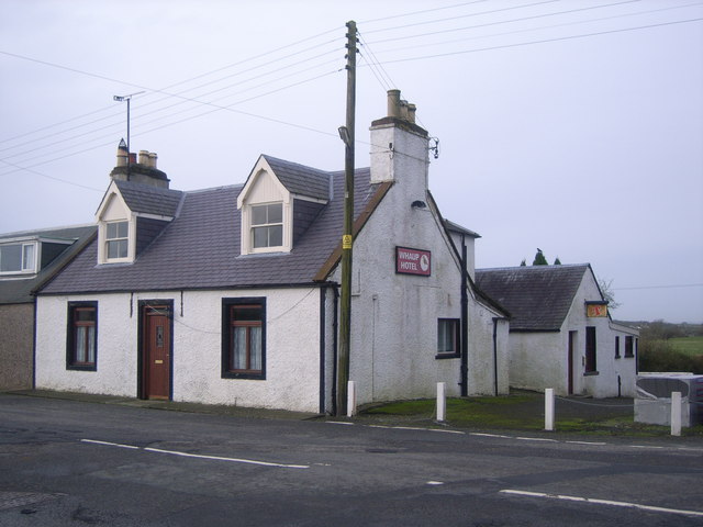
Whauphill railway station

Whauphill (NX 40462 49887) was a railway station on the Wigtownshire Railway branch line, from Newton Stewart to Whithorn, of the Portpatrick and Wigtownshire...

Kirkinner railway station

Kirkinner was a railway station on the Wigtownshire Railway branch line, from Newton Stewart to Whithorn, of the Portpatrick and Wigtownshire Joint Railway...

Kirkinner

Kirkinner (Scottish Gaelic: Cille Chainneir, IPA: [ˈkʲʰiʎə ˈxaɲɪɾʲ]) is a village in the Machars, in the historical county of Wigtownshire in Dumfries...
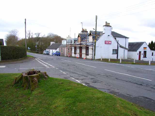
Whauphill

Whauphill is a small village located in the historical county of Wigtownshire in the Machars, Dumfries and Galloway, Scotland.Whauphill is a hub that supports...

Bladnoch Distillery and Visitor Centre

Bladnoch distillery is a single malt Scotch whisky distillery in south west Scotland. It is one of six remaining Lowland distilleries, located at Bladnoch...

Bladnoch, Wigtownshire

Bladnoch (Scottish Gaelic: Blaidneach) is a small village on the River Bladnoch in Wigtownshire, Scotland, located just outside the county town of Wigtown...

RAF Wigtown

Royal Air Force Wigtown, or more simply RAF Wigtown, is a former Royal Air Force station within the Dumfries and Galloway region of southwest Scotland...

Wigtown & Bladnoch F.C.

Wigtown & Bladnoch Football Club are a football club from the town of Wigtown in the Dumfries and Galloway area of Scotland, who play in the South of Scotland...

Nearby Amenities

Located within 500m of 54.831677,-4.4984465
Place: farm
Lat/Long: 54.8334408/-4.4955803
Barnbarroch
Historic: ruins
Lat/Long: 54.8320305/-4.4933105
Hawk Hill
Natural: peak
Lat/Long: 54.8341965/-4.5009156
Power: pole
Lat/Long: 54.8308364/-4.5056289
Power: pole
Lat/Long: 54.831122/-4.5042624
Power: pole
Lat/Long: 54.8314014/-4.502895
Power: pole
Lat/Long: 54.8316787/-4.501518
Power: pole
Lat/Long: 54.8321935/-4.4990344
Power: pole
Lat/Long: 54.8323503/-4.4982826
Power: pole
Lat/Long: 54.8326198/-4.4969497
Power: pole
Lat/Long: 54.8328054/-4.4959428
Power: pole
Lat/Long: 54.8301211/-4.5053632
Power: pole
Lat/Long: 54.8297301/-4.5027847
Power: pole
Lat/Long: 54.8290833/-4.5019485
Power: pole
Lat/Long: 54.8286149/-4.5013482
The data included in this document is from www.openstreetmap.org. The data is made available under ODbL.

Have you been to Broom Hill?

Leave your review of Broom Hill below (or comments, questions and feedback).