Hill Wood

Settlement in Warwickshire

England

Hill Wood

Rainbow over Heath Croft Road A rainbow after a short, sharp, summer shower.
Rainbow over Heath Croft Road Credit: David P Howard

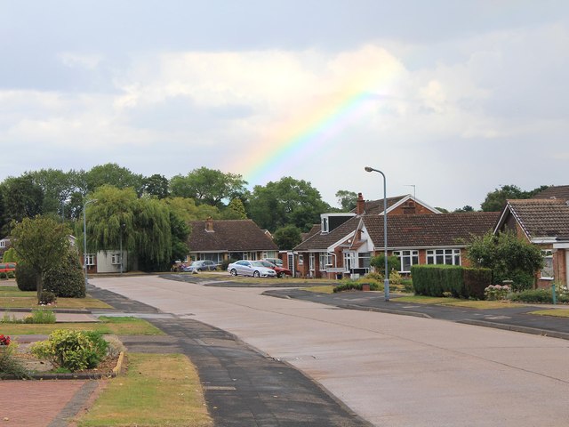
Hill Wood is a small village located in the county of Warwickshire, England. Situated approximately 7 miles north of the town of Stratford-upon-Avon, Hill Wood is known for its picturesque countryside and tranquil atmosphere.

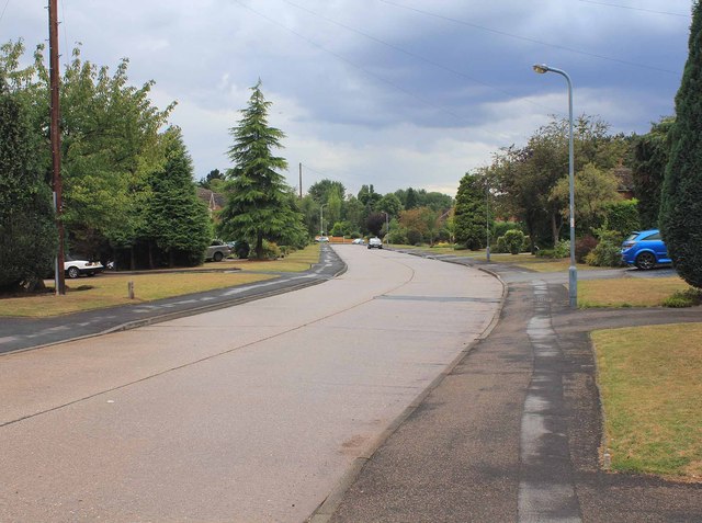
The village is surrounded by rolling hills and lush green fields, offering stunning views of the surrounding countryside. It is a popular destination for nature lovers and outdoor enthusiasts, with numerous walking and cycling trails that showcase the area's natural beauty.

Hill Wood has a small population, with a close-knit community that takes pride in its village heritage. The village is home to a quaint parish church, dating back several centuries, which serves as a focal point for the community.

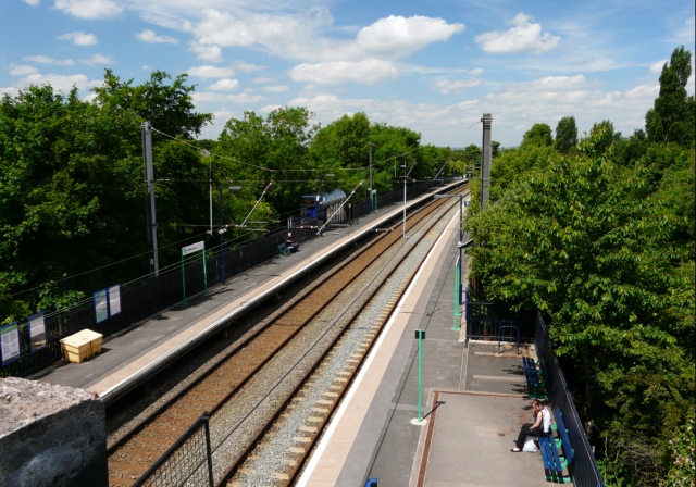
Despite its rural setting, Hill Wood benefits from good transportation links. The nearby A429 road provides easy access to major towns and cities in the region, including Stratford-upon-Avon and Warwick. The village is also well-connected by public transportation, with regular bus services that link it to neighboring areas.

Residents of Hill Wood can enjoy a range of amenities and services, including a village shop, a post office, and a primary school. The village also has several community spaces, including a village hall and a recreational ground, where locals can come together for various events and activities.

Overall, Hill Wood offers a peaceful and idyllic lifestyle, with its beautiful countryside, strong community spirit, and convenient location making it an attractive place to live or visit in Warwickshire.

If you have any feedback on the listing, please let us know in the comments section below.

Hill Wood Images

Images are sourced within 2km of 52.597902/-1.822063 or Grid Reference SK1200. Thanks to Geograph Open Source API. All images are credited.

Rainbow over Heath Croft Road A rainbow after a short, sharp, summer shower.
Rainbow over Heath Croft Road
A rainbow after a short, sharp, summer shower.
Heath Croft Road Looking SW down Heath Croft Road.
Heath Croft Road
Looking SW down Heath Croft Road.
Road sign, M6 (Toll) The M6 Toll (or Birmingham North Relief Road), connects M6 Junction 4 at the NEC to M6 Junction 11A at Wolverhampton with 27 miles of six-lane motorway. The motorway was opened in 2002 and was Britain's first toll motorway.
Road sign, M6 (Toll)
The M6 Toll (or Birmingham North Relief Road), connects M6 Junction 4 at the NEC to M6 Junction 11A at Wolverhampton with 27 miles of six-lane motorway. The motorway was opened in 2002 and was Britain's first toll motorway.
Dunton Close off Hillwood Common Road
Amington Close off Worcester Lane, Roughley
Worcester Close off Worcester Lane, Sutton Coldfield
Housing Estate being built opposite Woodside Farm on Duttons Lane
Colourful Houses on The B4151 Slade Road
View down the Old London Road The new London Road, the A38 dual carriageway runs parallel with this road, behind the trees on the left. This is looking Northwards towards Lichfield.
View down the Old London Road
The new London Road, the A38 dual carriageway runs parallel with this road, behind the trees on the left. This is looking Northwards towards Lichfield.
The M6 Toll
The M6 Toll
Butlers Lane railway station Opened in 1957 by British Rail on the line from Birmingham New Street to Lichfield. View north west towards Blake Street and Lichfield.
Butlers Lane railway station
Opened in 1957 by British Rail on the line from Birmingham New Street to Lichfield. View north west towards Blake Street and Lichfield.
Butlers Lane railway station Opened in 1957 by British Rail on the line from Birmingham New Street to Lichfield. View south east towards Four Oaks and Birmingham.
Butlers Lane railway station
Opened in 1957 by British Rail on the line from Birmingham New Street to Lichfield. View south east towards Four Oaks and Birmingham.
M6 Toll southbound 1 mile from Junction T3
Four Oaks Railway Station, Sutton Coldfield
M6 Toll Road near Roughley The M6 Toll Road is a 27-mile private-sector expressway to the north of Birmingham. The M6 is the key artery through the West Midlands, but it suffers from chronic congestion as part of Britain’s longest and most important motorway. The Birmingham Northern Relief Road, as the M6 Toll was originally known, was built to siphon off the through traffic between the South-east and the North-West.

Site clearance started in 2000, construction of the road began in 2002 and it opened in December 2003 (<span class="nowrap"><a title="http://www.m6toll.co.uk/about-us/history/" rel="nofollow ugc noopener" href="http://www.m6toll.co.uk/about-us/history/">Link</a><img style="margin-left:2px;" alt="External link" title="External link - shift click to open in new window" src="https://s1.geograph.org.uk/img/external.png" width="10" height="10"/></span>  M6 Toll History). When planned, it was forecast that 72000 vehicles would use the link, but just half that number of motorists take the route today (2013 - <span class="nowrap"><a title="http://www.independent.co.uk/news/uk/home-news/overpriced-and-underused-m6-toll-road-is-going-nowhere-fast-8606755.html" rel="nofollow ugc noopener" href="http://www.independent.co.uk/news/uk/home-news/overpriced-and-underused-m6-toll-road-is-going-nowhere-fast-8606755.html">Link</a><img style="margin-left:2px;" alt="External link" title="External link - shift click to open in new window" src="https://s1.geograph.org.uk/img/external.png" width="10" height="10"/></span>  Overpriced and underused – The Independent) whilst in contrast, the M6 itself is still carrying in excess of 125,000 vehicles a day with many claiming that the toll route’s benefits do not warrant the charges (2013 rates: currently £5.50 for private cars and £11 for trucks, with modest discounts for weekend and overnight use - see <a href="https://www.geograph.org.uk/photo/3665133">SP2685 : M6 Toll Tariff, Chapel Green</a>) and that when traffic is flowing reasonably freely on the original M6, there is no incentive to use the toll route which is marginally longer than the free motorway, with time also lost for stopping to pay at the toll booth.

The toll motorway is operated by Midland Expressway Ltd, which has the concession until 2054 – when the road is due to be handed back to the government.
M6 Toll Road near Roughley
The M6 Toll Road is a 27-mile private-sector expressway to the north of Birmingham. The M6 is the key artery through the West Midlands, but it suffers from chronic congestion as part of Britain’s longest and most important motorway. The Birmingham Northern Relief Road, as the M6 Toll was originally known, was built to siphon off the through traffic between the South-east and the North-West. Site clearance started in 2000, construction of the road began in 2002 and it opened in December 2003 (LinkExternal link M6 Toll History). When planned, it was forecast that 72000 vehicles would use the link, but just half that number of motorists take the route today (2013 - LinkExternal link Overpriced and underused – The Independent) whilst in contrast, the M6 itself is still carrying in excess of 125,000 vehicles a day with many claiming that the toll route’s benefits do not warrant the charges (2013 rates: currently £5.50 for private cars and £11 for trucks, with modest discounts for weekend and overnight use - see SP2685 : M6 Toll Tariff, Chapel Green) and that when traffic is flowing reasonably freely on the original M6, there is no incentive to use the toll route which is marginally longer than the free motorway, with time also lost for stopping to pay at the toll booth. The toll motorway is operated by Midland Expressway Ltd, which has the concession until 2054 – when the road is due to be handed back to the government.
Southbound M6 Toll Road, Roughley The M6 Toll Road is a 27-mile private-sector expressway to the north of Birmingham. The M6 is the key artery through the West Midlands, but it suffers from chronic congestion as part of Britain’s longest and most important motorway. The Birmingham Northern Relief Road, as the M6 Toll was originally known, was built to siphon off the through traffic between the South-east and the North-West.

Site clearance started in 2000, construction of the road began in 2002 and it opened in December 2003 (<span class="nowrap"><a title="http://www.m6toll.co.uk/about-us/history/" rel="nofollow ugc noopener" href="http://www.m6toll.co.uk/about-us/history/">Link</a><img style="margin-left:2px;" alt="External link" title="External link - shift click to open in new window" src="https://s1.geograph.org.uk/img/external.png" width="10" height="10"/></span>  M6 Toll History). When planned, it was forecast that 72000 vehicles would use the link, but just half that number of motorists take the route today (2013 - <span class="nowrap"><a title="http://www.independent.co.uk/news/uk/home-news/overpriced-and-underused-m6-toll-road-is-going-nowhere-fast-8606755.html" rel="nofollow ugc noopener" href="http://www.independent.co.uk/news/uk/home-news/overpriced-and-underused-m6-toll-road-is-going-nowhere-fast-8606755.html">Link</a><img style="margin-left:2px;" alt="External link" title="External link - shift click to open in new window" src="https://s1.geograph.org.uk/img/external.png" width="10" height="10"/></span>  Overpriced and underused – The Independent) whilst in contrast, the M6 itself is still carrying in excess of 125,000 vehicles a day with many claiming that the toll route’s benefits do not warrant the charges (2013 rates: currently £5.50 for private cars and £11 for trucks, with modest discounts for weekend and overnight use - see <a href="https://www.geograph.org.uk/photo/3665133">SP2685 : M6 Toll Tariff, Chapel Green</a>) and that when traffic is flowing reasonably freely on the original M6, there is no incentive to use the toll route which is marginally longer than the free motorway, with time also lost for stopping to pay at the toll booth.

The toll motorway is operated by Midland Expressway Ltd, which has the concession until 2054 – when the road is due to be handed back to the government.
Southbound M6 Toll Road, Roughley
The M6 Toll Road is a 27-mile private-sector expressway to the north of Birmingham. The M6 is the key artery through the West Midlands, but it suffers from chronic congestion as part of Britain’s longest and most important motorway. The Birmingham Northern Relief Road, as the M6 Toll was originally known, was built to siphon off the through traffic between the South-east and the North-West. Site clearance started in 2000, construction of the road began in 2002 and it opened in December 2003 (LinkExternal link M6 Toll History). When planned, it was forecast that 72000 vehicles would use the link, but just half that number of motorists take the route today (2013 - LinkExternal link Overpriced and underused – The Independent) whilst in contrast, the M6 itself is still carrying in excess of 125,000 vehicles a day with many claiming that the toll route’s benefits do not warrant the charges (2013 rates: currently £5.50 for private cars and £11 for trucks, with modest discounts for weekend and overnight use - see SP2685 : M6 Toll Tariff, Chapel Green) and that when traffic is flowing reasonably freely on the original M6, there is no incentive to use the toll route which is marginally longer than the free motorway, with time also lost for stopping to pay at the toll booth. The toll motorway is operated by Midland Expressway Ltd, which has the concession until 2054 – when the road is due to be handed back to the government.
The Old Speckled Hen, Mere Green
Mere Green Road, Mere Green
Show me another place!

Hill Wood is located at Grid Ref: SK1200 (Lat: 52.597902, Lng: -1.822063)

Unitary Authority: Birmingham

Police Authority: West Midlands

What 3 Words

///damage.hogs.grand. Near Sutton Coldfield, West Midlands

Related Wikis

Sutton Coldfield transmitting station

The Sutton Coldfield transmitting station is a broadcasting and telecommunications facility located in Sutton Coldfield, Birmingham, England. In terms...

St James' Church, Mere Green

St James’ Church is a Grade II listed Church of England parish church in Mere Green, Sutton Coldfield, England. == History == It was founded as a daughter...

Sutton Four Oaks (ward)

Sutton Four Oaks is one of the 40 electoral wards in Birmingham, England.Sutton Four Oaks is one of the four wards that make up the Parliamentary Constituency...

A5127 road

The A5127 is a major road in England which runs between Birmingham and Lichfield, Staffordshire. For much of the route the road follows the old route of...

Butlers Lane railway station

Butlers Lane railway station serves the northern part of the Four Oaks district of Sutton Coldfield, England. It is situated on the Cross-City Line....

Mere Green, Birmingham

Mere Green is a small commercial centre in Four Oaks, Sutton Coldfield , England. == Facilities == Mere Green includes a mixture of independent shops,...

The Arthur Terry School

The Arthur Terry School is a secondary school and sixth form with academy status in the Four Oaks area of Sutton Coldfield, England. It is Ofsted Good...

Roughley

Roughley is an electoral ward within the Royal Town of Sutton Coldfield, and is the most northerly part of the administrative area covered by the Royal...

Nearby Amenities

Located within 500m of 52.597902,-1.822063
Grit Bin
Lat/Long: 52.6002891/-1.8173396
Generator Method: photovoltaic
Generator Output Electricity: yes
Generator Source: solar
Generator Type: solar_photovoltaic_panel
Location: roof
Power: generator
Lat/Long: 52.5982548/-1.8288052
Generator Method: photovoltaic
Generator Output Electricity: yes
Generator Source: solar
Generator Type: solar_photovoltaic_panel
Location: roof
Power: generator
Lat/Long: 52.5984568/-1.8287864
Intermittent: yes
Natural: spring
Lat/Long: 52.5941404/-1.8221068
The data included in this document is from www.openstreetmap.org. The data is made available under ODbL.

Have you been to Hill Wood?

Leave your review of Hill Wood below (or comments, questions and feedback).