A' Ghlaise

Hill, Mountain in Sutherland

Scotland

A' Ghlaise

Perched boulder on rock slab There's a magnificently rocky area between the two Grahams, Carn an Tionail and Beinn Direach; this splendidly perched boulder is seen against the backdrop of the most northerly Munro - Ben Hope.
Perched boulder on rock slab Credit: Trevor Littlewood

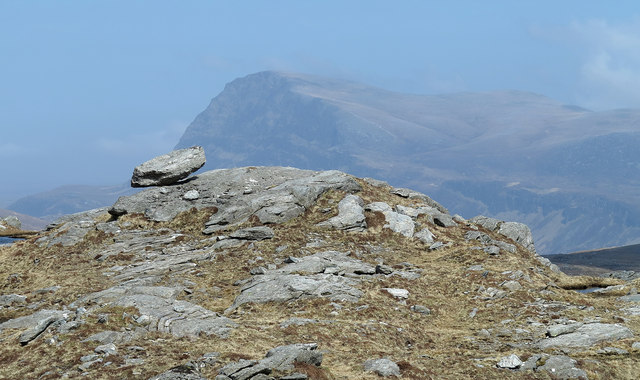
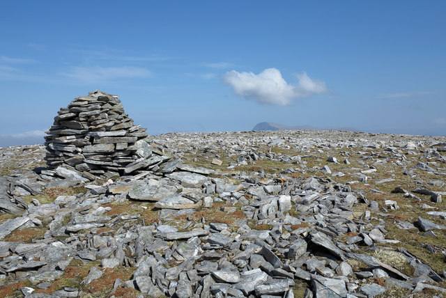
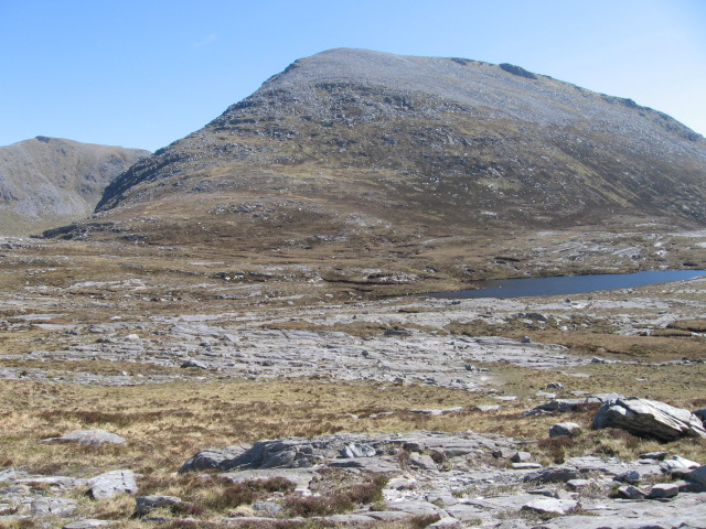
A' Ghlaise is a prominent hill located in the county of Sutherland in the Highlands of Scotland. Standing at an elevation of 611 meters (2,005 feet), it forms part of the larger mountain range known as the Foinaven Group. The hill is situated in a remote and sparsely populated area, surrounded by rugged and picturesque landscapes.

A' Ghlaise is characterized by its distinctive shape, with a long, steep ridge leading to a rounded summit. The hill is composed mainly of quartzite and offers stunning panoramic views of the surrounding countryside. On clear days, it is possible to see the nearby peaks of Foinaven and Arkle, as well as the expansive moorlands and lochs that stretch out towards the coast.

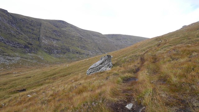
The ascent of A' Ghlaise is challenging, with steep and uneven terrain that requires a good level of fitness and experience in hillwalking. There are no established paths or trails, so navigation skills are essential. However, for those who are up to the task, the reward is a sense of solitude and tranquility, as the hill is rarely frequented by hikers.

A' Ghlaise is part of the wild and untamed landscape that characterizes Sutherland, attracting outdoor enthusiasts and nature lovers alike. Its remote location and unspoiled beauty make it a hidden gem for those seeking a true Highland adventure.

If you have any feedback on the listing, please let us know in the comments section below.

A' Ghlaise Images

Images are sourced within 2km of 58.299531/-4.747451 or Grid Reference NC3937. Thanks to Geograph Open Source API. All images are credited.

Perched boulder on rock slab There's a magnificently rocky area between the two Grahams, Carn an Tionail and Beinn Direach; this splendidly perched boulder is seen against the backdrop of the most northerly Munro - Ben Hope.
Perched boulder on rock slab
There's a magnificently rocky area between the two Grahams, Carn an Tionail and Beinn Direach; this splendidly perched boulder is seen against the backdrop of the most northerly Munro - Ben Hope.
Rocks on south side of Beinn Direach The slope immediately south from the summit of Beinn Direach descends gradually at first with rocks scattered among short grass. Ben Hee is in the distance.
Rocks on south side of Beinn Direach
The slope immediately south from the summit of Beinn Direach descends gradually at first with rocks scattered among short grass. Ben Hee is in the distance.
Boulders on north slope of Meall a' Chlèirich Meall a' Chlèirich's northern side drops steeply towards the col with Beinn Direach. The two distant lochs are of similar size and OS maps appear not to distinguish which has the name Lochan na Creige Riabhaich. In the far distance is Ben Loyal.
Boulders on north slope of Meall a' Chlèirich
Meall a' Chlèirich's northern side drops steeply towards the col with Beinn Direach. The two distant lochs are of similar size and OS maps appear not to distinguish which has the name Lochan na Creige Riabhaich. In the far distance is Ben Loyal.
Summit of Beinn Direach Looking west to the ridge of Carn an Tionail
Summit of Beinn Direach
Looking west to the ridge of Carn an Tionail
Grassy spur with peat bank The ridge running south from the Graham, Carn an Tionail broadens as it reaches a lesser top, A' Ghlaise; from that top a spur branches away south-west to end above the crags of Creag na h-Uidhe. The spur is the grassy ridge heading away beyond the peat bank. The distant mountains are in the district of Coigach - Cul Beag and Cul Mor.
Grassy spur with peat bank
The ridge running south from the Graham, Carn an Tionail broadens as it reaches a lesser top, A' Ghlaise; from that top a spur branches away south-west to end above the crags of Creag na h-Uidhe. The spur is the grassy ridge heading away beyond the peat bank. The distant mountains are in the district of Coigach - Cul Beag and Cul Mor.
Ridge rising northwards to A' Ghlaise A' Ghlaise is the long south ridge of the Graham, Carn an Tionail; at this location, around 575m, there's extensive scattered rock; higher, there's grass.
Ridge rising northwards to A' Ghlaise
A' Ghlaise is the long south ridge of the Graham, Carn an Tionail; at this location, around 575m, there's extensive scattered rock; higher, there's grass.
Ridge rising towards A' Ghlaise A' Ghlaise, at the left side of the image is a rise of the south ridge of the Graham, Carn an Tionail, which is the mountain dome seen in the distance.
Ridge rising towards A' Ghlaise
A' Ghlaise, at the left side of the image is a rise of the south ridge of the Graham, Carn an Tionail, which is the mountain dome seen in the distance.
Stone shelter south of Carn an Tionail The collection of stones is a small shelter between the peak Carn an Tionail and its lower southern top, A' Ghlaise. The mountain to the left side of the image is Càrn Dearg, an eastern top of the wonderfully named Corbett, Meallan Liath Coire Mhic Dhughaill!
Stone shelter south of Carn an Tionail
The collection of stones is a small shelter between the peak Carn an Tionail and its lower southern top, A' Ghlaise. The mountain to the left side of the image is Càrn Dearg, an eastern top of the wonderfully named Corbett, Meallan Liath Coire Mhic Dhughaill!
Summit plateau of Carn an Tionail Carn an Tionail has a flat summit scattered with rocks some of which have been assembled to form a 'beehive' cairn. The distant mountain below the cloud is Ben Hope - the most northerly of the Munros.
Summit plateau of Carn an Tionail
Carn an Tionail has a flat summit scattered with rocks some of which have been assembled to form a 'beehive' cairn. The distant mountain below the cloud is Ben Hope - the most northerly of the Munros.
Boulder on Meall a' Chleirich Slopes of Meall a' Chlèirich in the Reay Forest.
Boulder on Meall a' Chleirich
Slopes of Meall a' Chlèirich in the Reay Forest.
Meall a' Chlèirich Western side of the hill which overlooks the Bealach nam Meirleach.
Meall a' Chlèirich
Western side of the hill which overlooks the Bealach nam Meirleach.
ATV track, Meall a Chlèirich The very wet and rough track squelches its way towards the Meall a' Chlèirich - Beinn Direach col.
ATV track, Meall a Chlèirich
The very wet and rough track squelches its way towards the Meall a' Chlèirich - Beinn Direach col.
View towards Beinn Direach Nearing the top of the very wet ATV track.
View towards Beinn Direach
Nearing the top of the very wet ATV track.
Beinn Direach Southern slopes of Beinn Direach seen from the all terrain vehicle track which ascends to the col with Meall a' Chlèirich.
Beinn Direach
Southern slopes of Beinn Direach seen from the all terrain vehicle track which ascends to the col with Meall a' Chlèirich.
Meall a' Chlèirich The steep north side of the hill seen from Beinn Direach.
Meall a' Chlèirich
The steep north side of the hill seen from Beinn Direach.
Bog on Beinn Direach The wet col with Meall a' Chlèirich.
Bog on Beinn Direach
The wet col with Meall a' Chlèirich.
Southern slopes of Beinn Direach View opening out over a shoulder of Ben Hee towards low lying ground around Strath Naver.
Southern slopes of Beinn Direach
View opening out over a shoulder of Ben Hee towards low lying ground around Strath Naver.
Summit plateau, Beinn Direach Usual mix of stunted vegetation and rocks, including the flat flags so often found in the Reay Forest.
Summit plateau, Beinn Direach
Usual mix of stunted vegetation and rocks, including the flat flags so often found in the Reay Forest.
Show me another place!

A' Ghlaise is located at Grid Ref: NC3937 (Lat: 58.299531, Lng: -4.747451)

Unitary Authority: Highland

Police Authority: Highlands and Islands

What 3 Words

///outermost.eagle.warriors. Near Altnaharra, Highland

Nearby Locations

A' Ghlaise

Related Wikis

Meallan Liath Coire Mhic Dhùghaill

Meallan Liath Coire Mhic Dhughaill (801 m) is a mountain in the Northwest Highlands, Scotland. It lies in the far north of Scotland between Lairg and Durness...

Ben Hee

Ben Hee is a mountain in Scotland that rises to the height of 865.7 metres (2,840 ft). == References == == External links == Foinaven-Ben Hee Wild Land...

Loch Merkland

Loch Merkland is a large long inland loch in Sutherland, Northern Scotland. It is located adjacent to the A838 main road which provides almost all access...

Eas Creag an Luchda

Eas Creag an Luchda is a waterfall of Scotland. == See also == Waterfalls of Scotland == References ==

Have you been to A' Ghlaise?

Leave your review of A' Ghlaise below (or comments, questions and feedback).