Helenton Hill

Hill, Mountain in Ayrshire

Scotland

Helenton Hill

Kirkhill Farm
Kirkhill Farm Credit: Iain Thompson

Helenton Hill is a prominent hill located in Ayrshire, Scotland. Situated in the southern part of the county, it is part of the rolling landscape that characterizes the area. Standing at an elevation of approximately 346 meters (1,135 feet), it offers breathtaking panoramic views of the surrounding countryside, making it a popular destination for hikers and nature enthusiasts.

The hill is covered in a patchwork of grassy slopes and heather moorland, which provides a diverse habitat for a variety of plant and animal species. The surrounding area is teeming with wildlife, including red grouse, rabbits, and various songbirds. On clear days, visitors can also catch glimpses of the nearby Ailsa Craig, an uninhabited island known for its bird colonies.

The ascent to the summit of Helenton Hill can be challenging, as the terrain becomes steeper and rockier towards the top. However, once reached, the view is well worth the effort. Visitors can enjoy stunning vistas of the Ayrshire coastline, with its sandy beaches and dramatic cliffs, as well as the lush green fields and rolling hills that stretch out towards the horizon.

Helenton Hill is easily accessible by foot or by car, with a well-marked trail leading from nearby villages. It offers a peaceful and serene escape from the hustle and bustle of everyday life, allowing visitors to immerse themselves in the beauty of the Scottish countryside.

If you have any feedback on the listing, please let us know in the comments section below.

Helenton Hill Images

Images are sourced within 2km of 55.5418/-4.5548859 or Grid Reference NS3830. Thanks to Geograph Open Source API. All images are credited.

Kirkhill Farm
Kirkhill Farm
Steep Hill Down to Underhills
Track Leading to Kirkhill Farm
Steep Hill Near Underhills
Fields Near Heughmill
Barnweil Churchyard This ancient church was abandoned in 1653, when local Parish boundaries were re-drawn to split the former Barnweil Parish between Tarbolton and Craigie. (Source: "Ayrshire: Discovering A County", by Dane Love).  The churchyard contains some interesting old stones.
Barnweil Churchyard
This ancient church was abandoned in 1653, when local Parish boundaries were re-drawn to split the former Barnweil Parish between Tarbolton and Craigie. (Source: "Ayrshire: Discovering A County", by Dane Love). The churchyard contains some interesting old stones.
The Ruins Of Barnweil Church Little remains now of this old building, which was in use up to 1653.
The Ruins Of Barnweil Church
Little remains now of this old building, which was in use up to 1653.
A Gardener's Headstone In Barnweil Churchyard This side of the stone shows the tools of the trade of the deceased.  Unfortunately, the other side is too weathered to make out the personal details.
A Gardener's Headstone In Barnweil Churchyard
This side of the stone shows the tools of the trade of the deceased. Unfortunately, the other side is too weathered to make out the personal details.
A Cross At Barnweil Church This simple wooden cross lies at the gable end of the ruined Barnweil Church.  The wording reads:

EVELYN  MARY  MARIS  DUKE
TOUT  COMPRENDRE  C'EST  TOUT  PARDONNER
21st JUNE 1910
R.I.P.
A Cross At Barnweil Church
This simple wooden cross lies at the gable end of the ruined Barnweil Church. The wording reads: EVELYN MARY MARIS DUKE TOUT COMPRENDRE C'EST TOUT PARDONNER 21st JUNE 1910 R.I.P.
On Barnweil Motte This mound of earth with its surrounding ditch is located on a natural promontory.  In the 12th century, there would have been a wooden structure on the mound, occupied by the local lord.
On Barnweil Motte
This mound of earth with its surrounding ditch is located on a natural promontory. In the 12th century, there would have been a wooden structure on the mound, occupied by the local lord.
Barnweil Motte Site This view shows the earth mound (top left), perched on the top of a steep-sided promontory.  This side would have been particularly easy to defend.
Barnweil Motte Site
This view shows the earth mound (top left), perched on the top of a steep-sided promontory. This side would have been particularly easy to defend.
Grassland, Craigie Grass grown for silage.
Grassland, Craigie
Grass grown for silage.
Minor road, Craigie A cattle crush can be seen by a gate down the road.
Minor road, Craigie
A cattle crush can be seen by a gate down the road.
Ayrshire grassland Near Barnweill.
Ayrshire grassland
Near Barnweill.
Road passing Heughmill View from near Underhills.
Road passing Heughmill
View from near Underhills.
Silage crop Grass grown for silage, Underhills
Silage crop
Grass grown for silage, Underhills
Minor road near Underhills Not the best of surfaces.
Minor road near Underhills
Not the best of surfaces.
Minor road on Hill of Barnwell
Show me another place!

Helenton Hill is located at Grid Ref: NS3830 (Lat: 55.5418, Lng: -4.5548859)

Unitary Authority: South Ayrshire

Police Authority: Ayrshire

What 3 Words

///february.alley.typhoon. Near Symington, South Ayrshire

Nearby Locations

Helenton Hill

Related Wikis

Symington, South Ayrshire

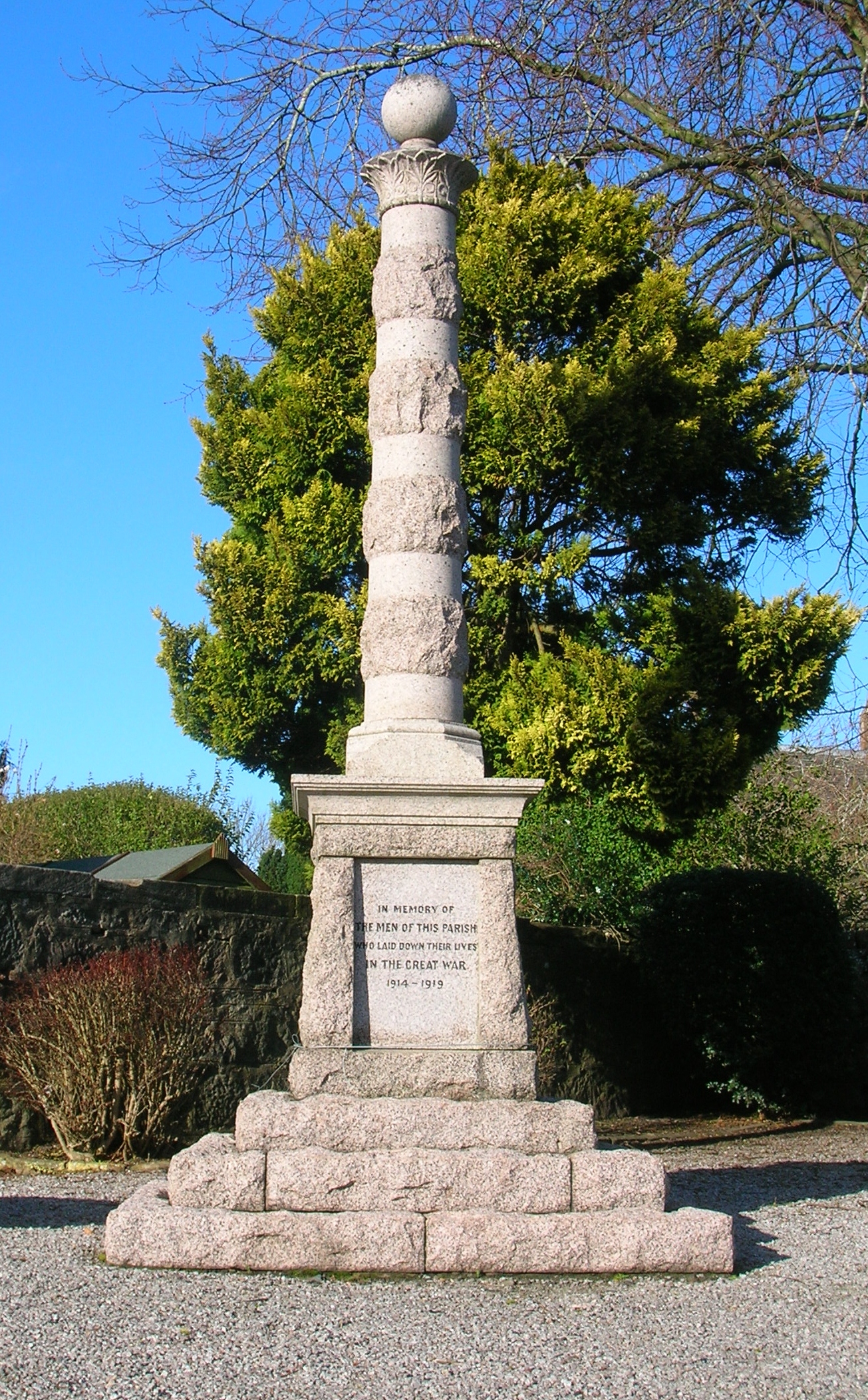
Symington is a conservation village in South Ayrshire, Scotland. It is located in Symington parish, covering 0.41 square kilometres (3⁄16 sq mi), and lies...

Helenton Loch

Helenton Loch was situated in a low lying area between the farms and dwellings of Helentongate, Mains, and Burnbank in the Parish of Symington, South Ayrshire...
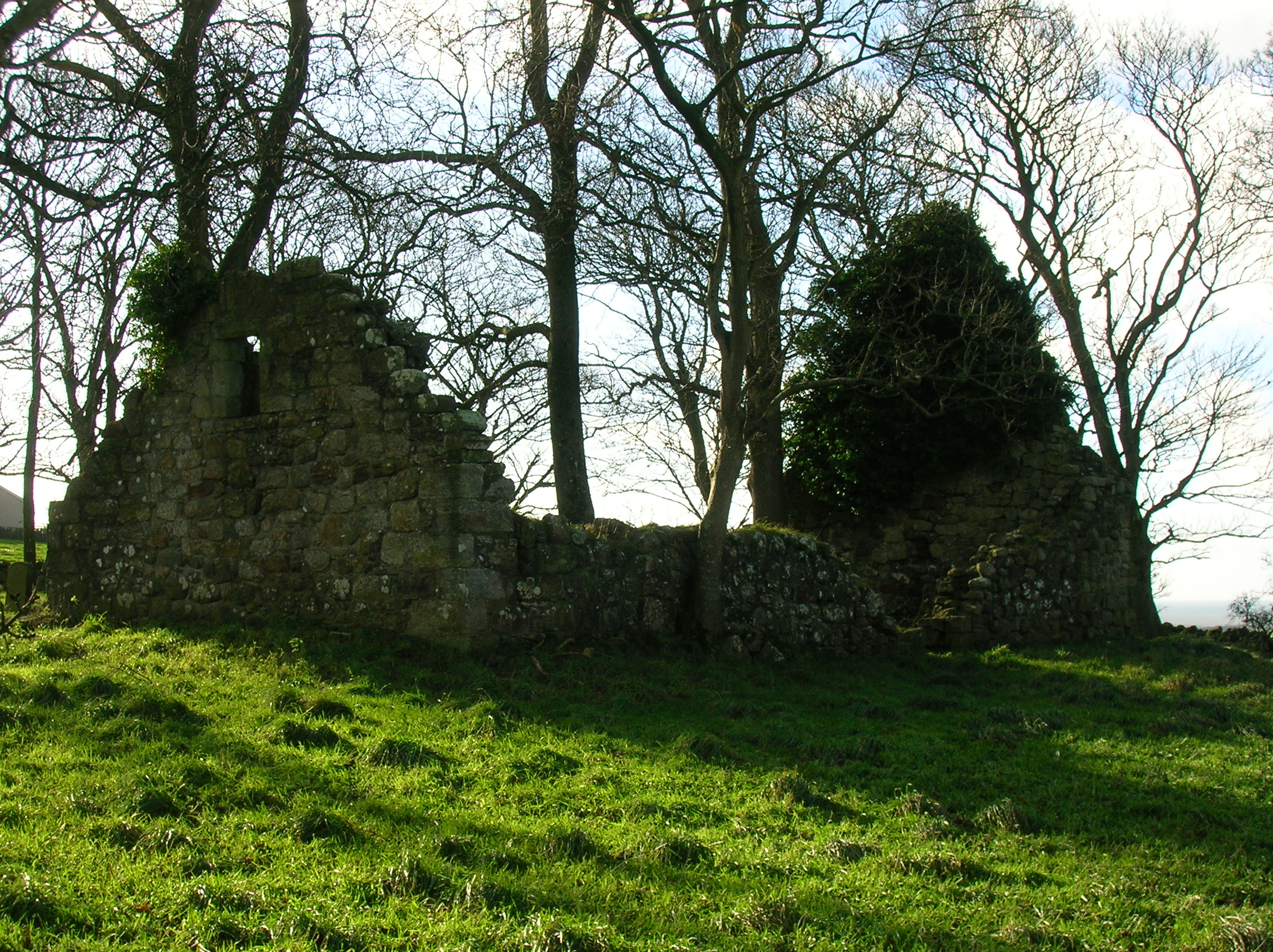
Barnweill Church

Barnweill Church or Barnweil Church (NGR NS 40506 29903) is a ruined pre-reformation kirk situated on rising ground on the slopes of Barnweill Hill, Parish...

Barnweill Castle

Barnweill Castle was a castle located at Barnweill, in the parish of Craigie, South Ayrshire, Scotland. The castle was a stronghold of the Lindsay family...

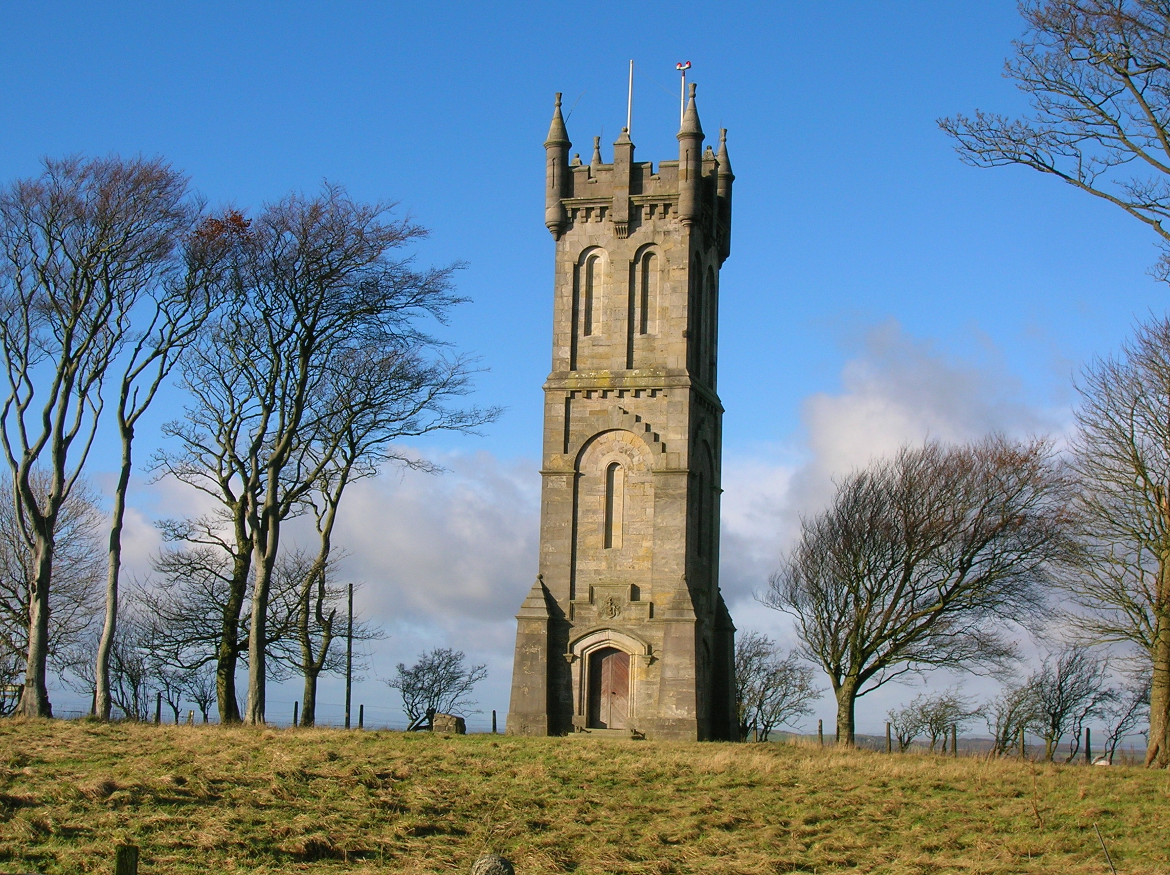
Wallace's Monument, Ayrshire

Wallace's Monument, the Wallace Tower, or the Barnweil Monument (NS 240655 629488) is a category-A-listed building dedicated to the memory of William Wallace...

Coodham

Coodham, also previously known as Cowdam or Cowdams, is a place near Symington in South Ayrshire, Scotland. The lands were held by the Mure family in the...

Craigie Castle

Craigie Castle, in the old Barony of Craigie, is a ruined fortification situated about 4 miles (6.4 km) southeast of Kilmarnock and 1 mile (1.6 km) southeast...

Kerse Castle, East Ayrshire

Kerse Castle or Carse Castle (NGR NS 4385 1413 ) is a ruined fortification once held by the Craufurd Clan, situated in the Parish of Dalrymple, East Ayrshire...

Nearby Amenities

Located within 500m of 55.5418,-4.5548859
Location Transition: yes
Power: pole
Lat/Long: 55.541883/-4.5623249
Power: pole
Lat/Long: 55.5412516/-4.5627379
Power: pole
Lat/Long: 55.5390313/-4.5602194
Power: pole
Lat/Long: 55.5397142/-4.5594254
Power: pole
Lat/Long: 55.5402181/-4.5588246
Power: pole
Lat/Long: 55.5407174/-4.5582211
Power: pole
Lat/Long: 55.5412911/-4.5575747
Power: pole
Lat/Long: 55.5418693/-4.5568532
Power: pole
Lat/Long: 55.542273/-4.55585
Power: pole
Lat/Long: 55.5426554/-4.5547798
Power: pole
Lat/Long: 55.5432882/-4.5544311
Power: pole
Lat/Long: 55.5439635/-4.5540234
Power: pole
Lat/Long: 55.5445986/-4.5536466
Power: pole
Lat/Long: 55.5452109/-4.553318
Power: pole
Lat/Long: 55.5457056/-4.552787
Power: pole
Lat/Long: 55.5433804/-4.5483161
Power: pole
Lat/Long: 55.5431321/-4.549628
Power: pole
Lat/Long: 55.5385667/-4.5502263
Power: pole
Lat/Long: 55.5390685/-4.551018
Power: pole
Lat/Long: 55.5394269/-4.5516378
Power: pole
Lat/Long: 55.5452713/-4.5580789
Power: pole
Lat/Long: 55.5458689/-4.5572555
The data included in this document is from www.openstreetmap.org. The data is made available under ODbL.

Have you been to Helenton Hill?

Leave your review of Helenton Hill below (or comments, questions and feedback).