Creag Shomhairle

Hill, Mountain in Sutherland

Scotland

Creag Shomhairle

Storm Brewing over Creag Shomhairle
Storm Brewing over Creag Shomhairle Credit: Chris and Meg Mellish

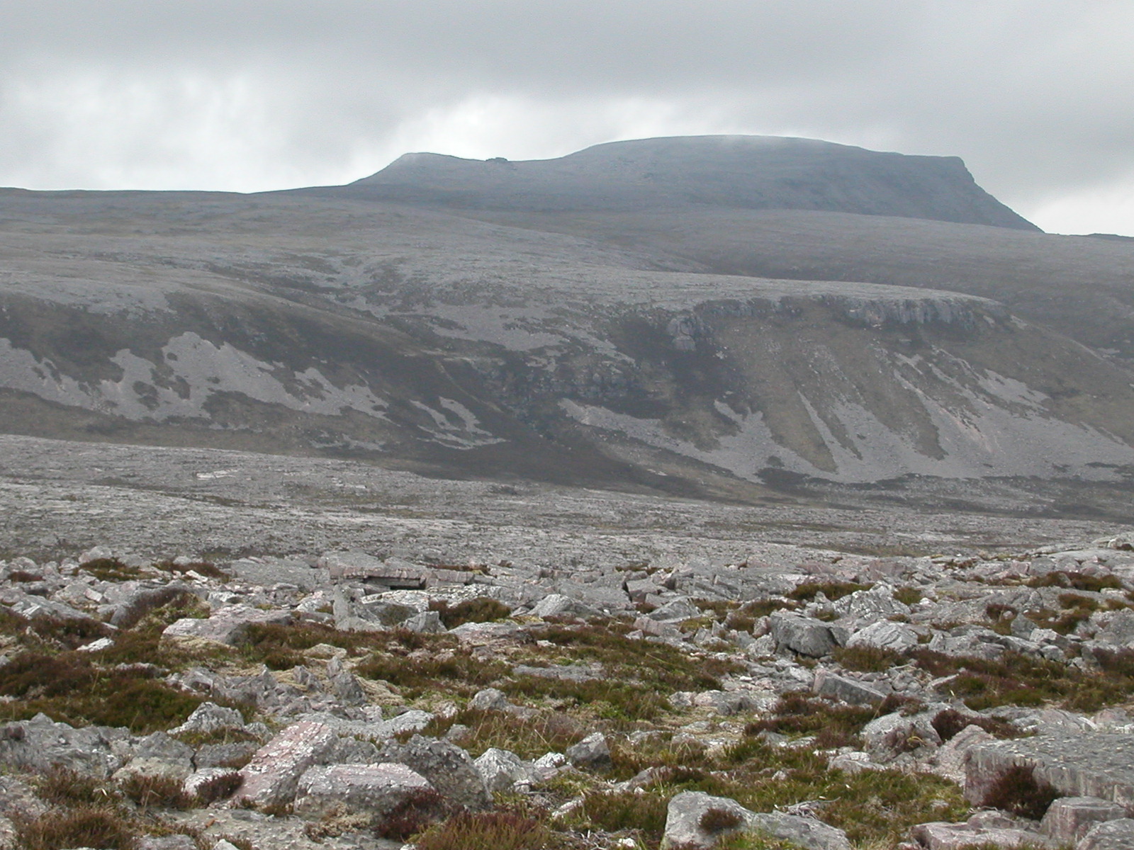
Creag Shomhairle is a prominent hill located in the county of Sutherland, in the northernmost part of the Scottish Highlands. Standing at an elevation of 675 meters (2,215 feet), it is classified as a Corbett, which means it is a Scottish hill between 2,500 and 3,000 feet with a prominence of at least 500 feet.

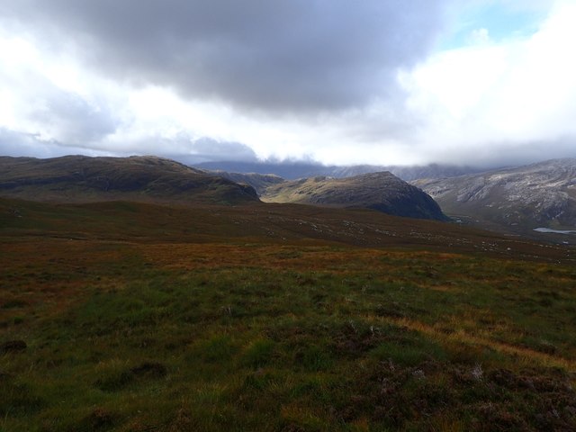
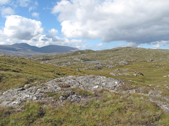
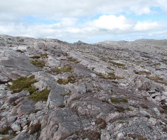
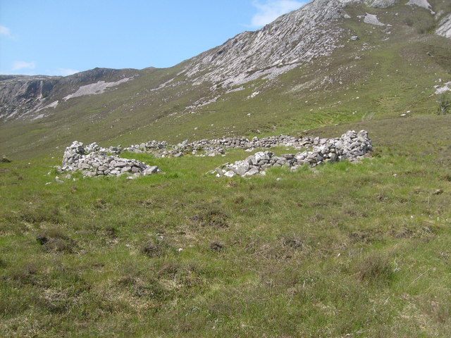
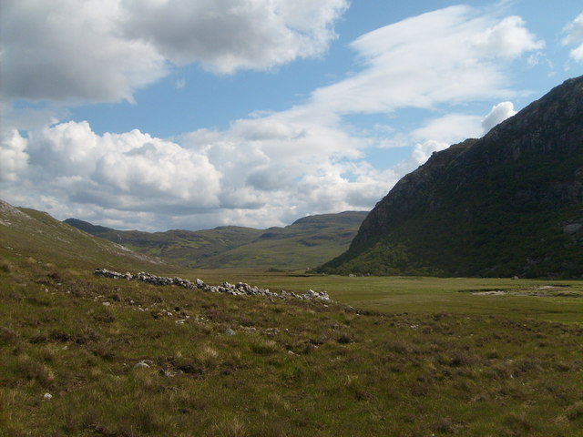
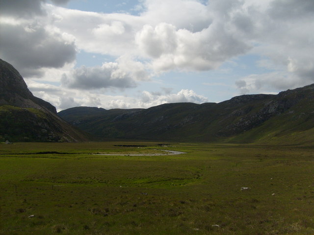
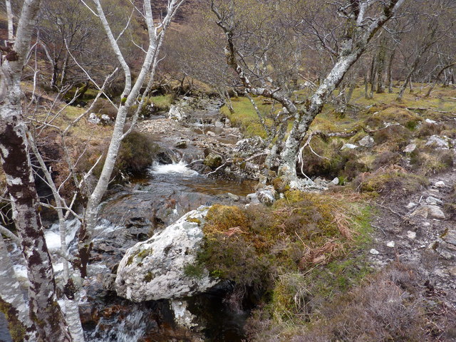
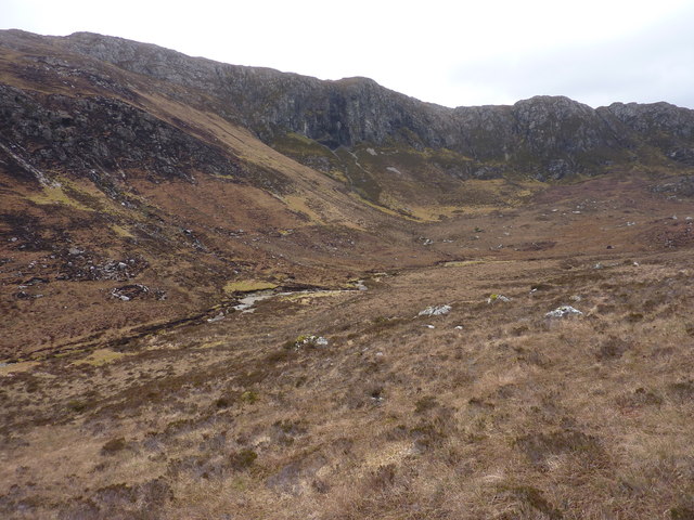
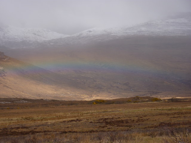
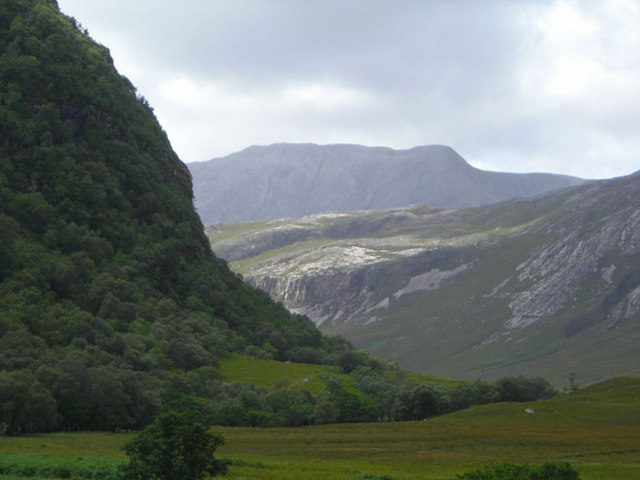
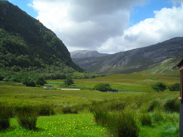
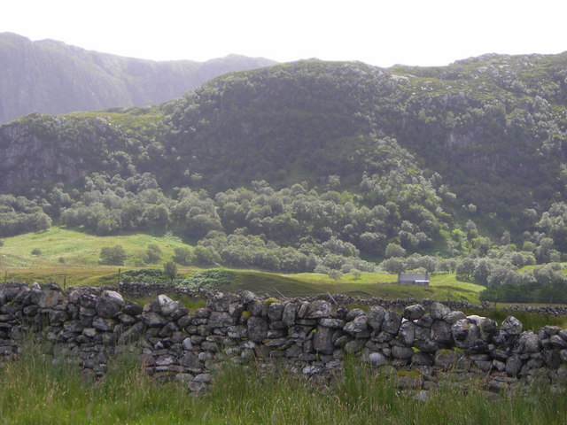
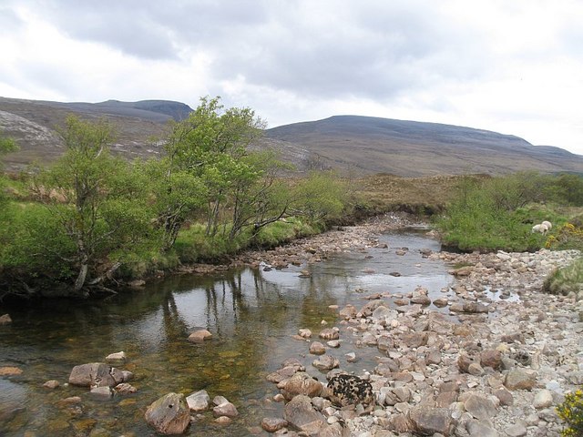
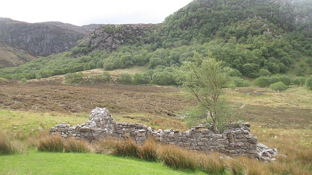
The hill is situated within the Assynt region, known for its rugged landscapes and stunning scenery. Creag Shomhairle is part of a range of hills that form the boundary between two lochs, Loch an Doire Dhuibh and Loch na Gainmhich. Its distinctive shape, with steep slopes and rocky outcrops, adds to the charm of the surrounding area.

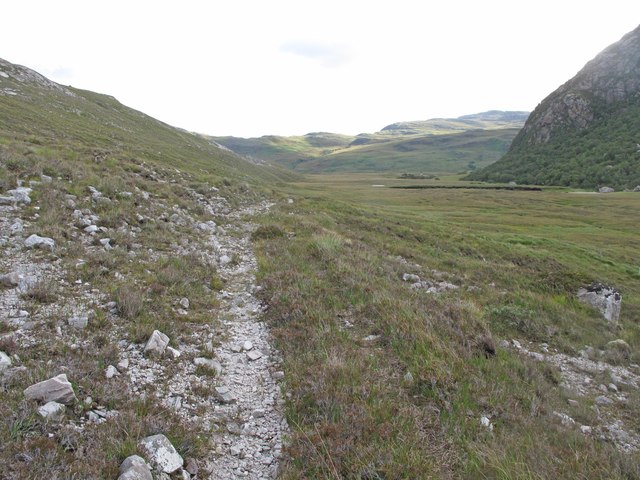
To reach the summit of Creag Shomhairle, one can follow a relatively easy and well-defined track that starts near the Lochinver cemetery. The ascent is gradual, and hikers are rewarded with breathtaking views of the surrounding mountains, lochs, and the nearby coastline.

The hill is known for its rich biodiversity, with a variety of plant and animal species inhabiting its slopes. It is home to a range of bird species, including golden eagles, peregrine falcons, and red grouse. The surrounding moorland is adorned with heather and other wildflowers, painting the landscape in vibrant colors during the summer months.

Creag Shomhairle provides a fantastic opportunity for outdoor enthusiasts to explore the beauty and tranquility of the Scottish Highlands. Its accessible location and stunning vistas make it a popular destination for hikers and nature lovers alike.

If you have any feedback on the listing, please let us know in the comments section below.

Creag Shomhairle Images

Images are sourced within 2km of 58.414618/-4.7706256 or Grid Reference NC3850. Thanks to Geograph Open Source API. All images are credited.

Storm Brewing over Creag Shomhairle
Rocky Moorland Rocky ground east of Srath Coille na Fearna.
Rocky Moorland
Rocky ground east of Srath Coille na Fearna.
Conamheall NE summit The NE summit (also without a cairn) is 2 m lower than the main summit.  Occasional Skolithos-rich beds brighten up an otherwise monotonous lithology.  Skolithos is a trace fossil worm burrow about 1 cm across and up to 15 cm long, and these exist in unimaginable numbers in these Cambrian quartzites.
Conamheall NE summit
The NE summit (also without a cairn) is 2 m lower than the main summit. Occasional Skolithos-rich beds brighten up an otherwise monotonous lithology. Skolithos is a trace fossil worm burrow about 1 cm across and up to 15 cm long, and these exist in unimaginable numbers in these Cambrian quartzites.
Strabeg bothy Taken after fording Srath Beag on the way to Foinaven
Strabeg bothy
Taken after fording Srath Beag on the way to Foinaven
The old road Large circular sheepfold and mountain pass on the way to Foinaven
The old road
Large circular sheepfold and mountain pass on the way to Foinaven
Circular sheepfold near Strath Coille na Fearna On the way to Foinaven, Stabeg bothy can be seen in the distance at the foot of Creag Shomhairle.
Circular sheepfold near Strath Coille na Fearna
On the way to Foinaven, Stabeg bothy can be seen in the distance at the foot of Creag Shomhairle.
Looking along  Strath Coille na Fearna towards Glen Golly
Looking along Strath Coille na Fearna towards Glen Golly
Old Road in Srath Coille na Fearna A continuation of the old track which starts at the Kyle of Durness and crosses the Bealach Mor to Loch Eriboll.
Old Road in Srath Coille na Fearna
A continuation of the old track which starts at the Kyle of Durness and crosses the Bealach Mor to Loch Eriboll.
A bonny spot in the burn, S.E. of Strabeg Bothy
The upper section of the burn above the gorge, and the cliffs of Creag a' Chairn Chaoruinn
Rainbow in Strath Beag
Strath Coille na Fearna At top of Strath Beag (OS), Strath Polla (local - River Polla), Foinaven in background (An t-Sail Mhor), Bealach na' h-Imrich midground, Creag Shomhairle foreground. Natural wood oak, rowan, birch - alder by river.
Strath Coille na Fearna
At top of Strath Beag (OS), Strath Polla (local - River Polla), Foinaven in background (An t-Sail Mhor), Bealach na' h-Imrich midground, Creag Shomhairle foreground. Natural wood oak, rowan, birch - alder by river.
Strath Coille na Fearna and river Polla Background Foinaven (An t-Sail Mhor), midground Bealach na h-Imrich, foreground Creag Shomhairle, natural woodland birch, oak, rowan, alder by river.
Strath Coille na Fearna and river Polla
Background Foinaven (An t-Sail Mhor), midground Bealach na h-Imrich, foreground Creag Shomhairle, natural woodland birch, oak, rowan, alder by river.
Strabeg and Creag Shomhairle Taken from Strath Beag, natural woodland oak, rowan, birch. Background Creag a' Chàirn Chaoruinn.
Strabeg and Creag Shomhairle
Taken from Strath Beag, natural woodland oak, rowan, birch. Background Creag a' Chàirn Chaoruinn.
Strabeg Farm cottage
Strabeg
Farm cottage
Strabeg Strabeg with Creag Shomhairle behind
Strabeg
Strabeg with Creag Shomhairle behind
Amhainn an t-Sratha Bhig River running through Strath Beag. It was very low at the time of visit after a long dry spell. Cranstackie and Beinn Spionnaidh in the background.
Amhainn an t-Sratha Bhig
River running through Strath Beag. It was very low at the time of visit after a long dry spell. Cranstackie and Beinn Spionnaidh in the background.
Ruin, Strabeg A birch growing out of an old cottage. The view is dominated by the birch clad slopes beneath Creag Shomhairle.
Ruin, Strabeg
A birch growing out of an old cottage. The view is dominated by the birch clad slopes beneath Creag Shomhairle.
Show me another place!

Creag Shomhairle is located at Grid Ref: NC3850 (Lat: 58.414618, Lng: -4.7706256)

Unitary Authority: Highland

Police Authority: Highlands and Islands

What 3 Words

///hillsides.strictest.maybe. Near Oldshoremore, Highland

Nearby Locations

Creag Shomhairle

Related Wikis

Loch Dionard

Loch Dionard is a medium-sized loch in the Durness Parish, in Sutherland, Highland Council Area, Northern Scotland. It is in the North-Western Highlands...

Cranstackie

Cranstackie is a mountain of 801 metres (2,628 ft) in Sutherland, the northwestern tip of the Scottish Highlands. It is a Corbett located west of Loch...

Foinaven

Foinaven (Scottish Gaelic: Foinne Bheinn) is a mountain in Scotland, situated in the far northwest corner of the Scottish Highlands. Like many of the monolithic...

Beinn Spionnaidh

Beinn Spionnaidh is a mountain of 773 m in Sutherland, the northwestern tip of the Scottish Highlands. It is a Corbett located west of Loch Eriboll and...

Have you been to Creag Shomhairle?

Leave your review of Creag Shomhairle below (or comments, questions and feedback).