Berry Hill

Hill, Mountain in Cornwall

England

Berry Hill

The River Lynher, Cornwall
The River Lynher, Cornwall Credit: Roy Hughes

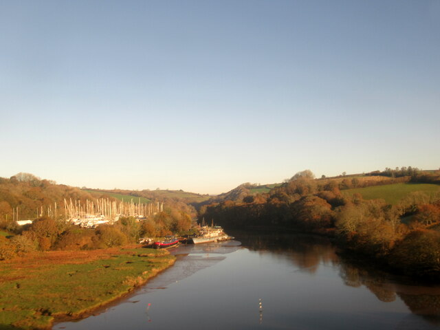
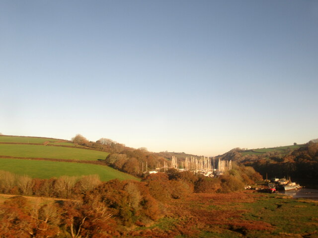
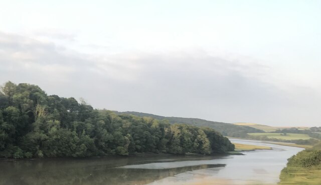
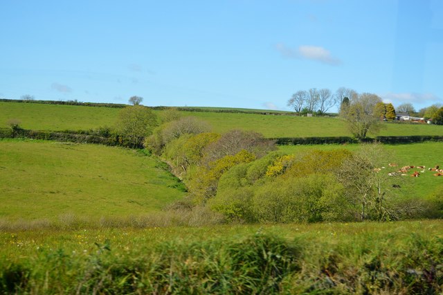
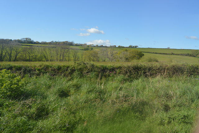
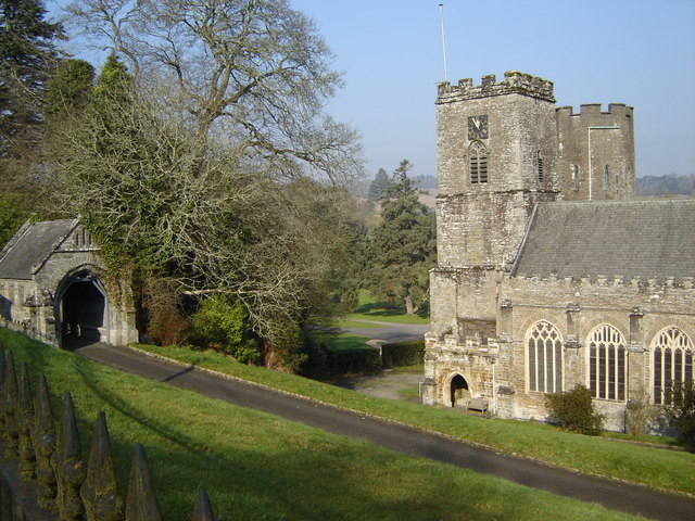
Berry Hill is a prominent hill located in Cornwall, England. Standing at an elevation of 232 meters (761 feet), it offers stunning panoramic views of the surrounding countryside and coastline. The hill is situated near the town of Bodmin, making it easily accessible for visitors looking to explore the area.

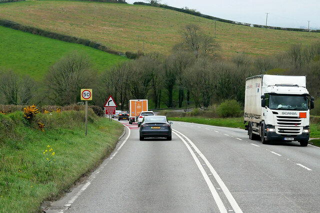
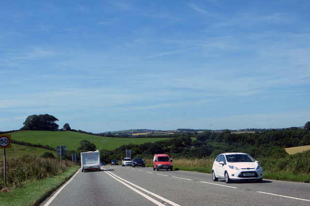
Berry Hill is a popular destination for hikers and outdoor enthusiasts, with a number of walking trails and footpaths leading to the summit. The hill is also home to a variety of wildlife, including birds of prey and small mammals, making it a great spot for nature lovers.

At the top of Berry Hill, visitors can enjoy breathtaking views of the rolling hills and valleys of Cornwall, as well as the picturesque coastline. On a clear day, it is possible to see as far as the sea, providing a truly memorable experience for those who make the trek to the summit.

Overall, Berry Hill is a must-visit destination for anyone looking to experience the natural beauty and charm of Cornwall.

If you have any feedback on the listing, please let us know in the comments section below.
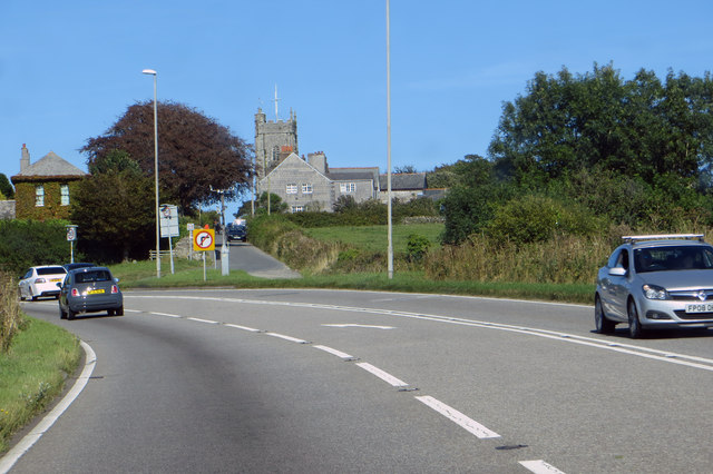
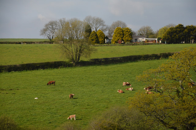
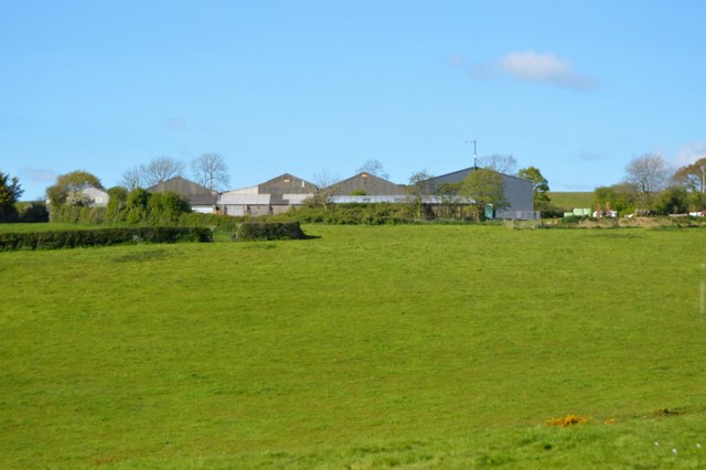
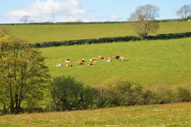
Berry Hill Images

Images are sourced within 2km of 50.405703/-4.2898474 or Grid Reference SX3758. Thanks to Geograph Open Source API. All images are credited.

The River Lynher, Cornwall
The west bank of the River Lynher, Cornwall
St Germans Priory Church The present church building dates to the 13th century when it was built as part of an Augustinian Priory on the site of the county’s first cathedral. When Henry VIII dissolved the monasteries, the Priory church was spared from destruction in 1539 due to its continued use as the parish church.
St Germans Priory Church
The present church building dates to the 13th century when it was built as part of an Augustinian Priory on the site of the county’s first cathedral. When Henry VIII dissolved the monasteries, the Priory church was spared from destruction in 1539 due to its continued use as the parish church.
Lychgate, St Germans Priory Church The Lychgate is Grade II listed, dating from the mid-19th century.
Lychgate, St Germans Priory Church
The Lychgate is Grade II listed, dating from the mid-19th century.
River Lynher
River Lynher
Footbridge over the A38 at Landrake The A38 is a major A-class trunk route. When first designated in 1922, it ran from Derby to Plymouth but it was later extended at both ends so that it now runs for 292 miles from Mansfield in Nottinghamshire to Bodmin in Cornwall.

Prior to the opening of the M5 motorway in the 1960s and 1970s, the A38 formed the main "holiday route" from the Midlands to Somerset, Devon and Cornwall and the south-western section was notorious at holiday times for the congestion. Nowadays, for most of the southern section, the A38 is a fairly quiet road shadowing the M5 extremely closely; often running alongside the motorway as a single carriageway road. The section between Exeter and Plymouth is, however, a busy dual carriageway which serves as the southern extension of the M5 and is known as “the Devon Expressway”.

More information at <span class="nowrap"><a title="http://en.wikipedia.org/wiki/A38_road" rel="nofollow ugc noopener" href="http://en.wikipedia.org/wiki/A38_road">Link</a><img style="margin-left:2px;" alt="External link" title="External link - shift click to open in new window" src="https://s1.geograph.org.uk/img/external.png" width="10" height="10"/></span>  (Wikipedia) and <span class="nowrap"><a title="http://www.sabre-roads.org.uk/wiki/index.php?title=A38" rel="nofollow ugc noopener" href="http://www.sabre-roads.org.uk/wiki/index.php?title=A38">Link</a><img style="margin-left:2px;" alt="External link" title="External link - shift click to open in new window" src="https://s1.geograph.org.uk/img/external.png" width="10" height="10"/></span>  (SABRE).
Footbridge over the A38 at Landrake
The A38 is a major A-class trunk route. When first designated in 1922, it ran from Derby to Plymouth but it was later extended at both ends so that it now runs for 292 miles from Mansfield in Nottinghamshire to Bodmin in Cornwall. Prior to the opening of the M5 motorway in the 1960s and 1970s, the A38 formed the main "holiday route" from the Midlands to Somerset, Devon and Cornwall and the south-western section was notorious at holiday times for the congestion. Nowadays, for most of the southern section, the A38 is a fairly quiet road shadowing the M5 extremely closely; often running alongside the motorway as a single carriageway road. The section between Exeter and Plymouth is, however, a busy dual carriageway which serves as the southern extension of the M5 and is known as “the Devon Expressway”. More information at LinkExternal link (Wikipedia) and LinkExternal link (SABRE).
A38 west of Landrake The A38 is a major A-class trunk route. When first designated in 1922, it ran from Derby to Plymouth but it was later extended at both ends so that it now runs for 292 miles from Mansfield in Nottinghamshire to Bodmin in Cornwall.

Prior to the opening of the M5 motorway in the 1960s and 1970s, the A38 formed the main "holiday route" from the Midlands to Somerset, Devon and Cornwall and the south-western section was notorious at holiday times for the congestion. Nowadays, for most of the southern section, the A38 is a fairly quiet road shadowing the M5 extremely closely; often running alongside the motorway as a single carriageway road. The section between Exeter and Plymouth is, however, a busy dual carriageway which serves as the southern extension of the M5 and is known as “the Devon Expressway”.

More information at <span class="nowrap"><a title="http://en.wikipedia.org/wiki/A38_road" rel="nofollow ugc noopener" href="http://en.wikipedia.org/wiki/A38_road">Link</a><img style="margin-left:2px;" alt="External link" title="External link - shift click to open in new window" src="https://s1.geograph.org.uk/img/external.png" width="10" height="10"/></span>  (Wikipedia) and <span class="nowrap"><a title="http://www.sabre-roads.org.uk/wiki/index.php?title=A38" rel="nofollow ugc noopener" href="http://www.sabre-roads.org.uk/wiki/index.php?title=A38">Link</a><img style="margin-left:2px;" alt="External link" title="External link - shift click to open in new window" src="https://s1.geograph.org.uk/img/external.png" width="10" height="10"/></span>  (SABRE).
A38 west of Landrake
The A38 is a major A-class trunk route. When first designated in 1922, it ran from Derby to Plymouth but it was later extended at both ends so that it now runs for 292 miles from Mansfield in Nottinghamshire to Bodmin in Cornwall. Prior to the opening of the M5 motorway in the 1960s and 1970s, the A38 formed the main "holiday route" from the Midlands to Somerset, Devon and Cornwall and the south-western section was notorious at holiday times for the congestion. Nowadays, for most of the southern section, the A38 is a fairly quiet road shadowing the M5 extremely closely; often running alongside the motorway as a single carriageway road. The section between Exeter and Plymouth is, however, a busy dual carriageway which serves as the southern extension of the M5 and is known as “the Devon Expressway”. More information at LinkExternal link (Wikipedia) and LinkExternal link (SABRE).
A38 towards Landrake The A38 is a major A-class trunk route. When first designated in 1922, it ran from Derby to Plymouth but it was later extended at both ends so that it now runs for 292 miles from Mansfield in Nottinghamshire to Bodmin in Cornwall.

Prior to the opening of the M5 motorway in the 1960s and 1970s, the A38 formed the main "holiday route" from the Midlands to Somerset, Devon and Cornwall and the south-western section was notorious at holiday times for the congestion. Nowadays, for most of the southern section, the A38 is a fairly quiet road shadowing the M5 extremely closely; often running alongside the motorway as a single carriageway road. The section between Exeter and Plymouth is, however, a busy dual carriageway which serves as the southern extension of the M5 and is known as “the Devon Expressway”.

More information at <span class="nowrap"><a title="http://en.wikipedia.org/wiki/A38_road" rel="nofollow ugc noopener" href="http://en.wikipedia.org/wiki/A38_road">Link</a><img style="margin-left:2px;" alt="External link" title="External link - shift click to open in new window" src="https://s1.geograph.org.uk/img/external.png" width="10" height="10"/></span>  (Wikipedia) and <span class="nowrap"><a title="http://www.sabre-roads.org.uk/wiki/index.php?title=A38" rel="nofollow ugc noopener" href="http://www.sabre-roads.org.uk/wiki/index.php?title=A38">Link</a><img style="margin-left:2px;" alt="External link" title="External link - shift click to open in new window" src="https://s1.geograph.org.uk/img/external.png" width="10" height="10"/></span>  (SABRE).
A38 towards Landrake
The A38 is a major A-class trunk route. When first designated in 1922, it ran from Derby to Plymouth but it was later extended at both ends so that it now runs for 292 miles from Mansfield in Nottinghamshire to Bodmin in Cornwall. Prior to the opening of the M5 motorway in the 1960s and 1970s, the A38 formed the main "holiday route" from the Midlands to Somerset, Devon and Cornwall and the south-western section was notorious at holiday times for the congestion. Nowadays, for most of the southern section, the A38 is a fairly quiet road shadowing the M5 extremely closely; often running alongside the motorway as a single carriageway road. The section between Exeter and Plymouth is, however, a busy dual carriageway which serves as the southern extension of the M5 and is known as “the Devon Expressway”. More information at LinkExternal link (Wikipedia) and LinkExternal link (SABRE).
St Michael's Church
St Michael's Church
The A38 The rolling hills of Cornwall.
The A38
The rolling hills of Cornwall.
The A38 Entering Landrake.
The A38
Entering Landrake.
A38 Landrake Footbridge
Footbridge over A38 at Landrake
Cornwall : Grassy Field A grassy field and cattle.
Cornwall : Grassy Field
A grassy field and cattle.
New Barton
New Barton
Cattle grazing
Cattle grazing
Sornish countryside
Sornish countryside
Hedge by the A38
Hedge by the A38
Show me another place!

Berry Hill is located at Grid Ref: SX3758 (Lat: 50.405703, Lng: -4.2898474)

Unitary Authority: Cornwall

Police Authority: Devon and Cornwall

What 3 Words

///wharfs.masks.success. Near Landrake, Cornwall

Nearby Locations

Berry Hill Treluggan Wood

Related Wikis

St Erney

St Erney is a hamlet with a Church of England church in Cornwall, England, United Kingdom. == See also == Landrake with St Erney == External links == St...

Port Eliot

Port Eliot in the parish of St Germans, Cornwall, England, United Kingdom, is the ancestral seat of the Eliot family, whose present head is Albert Eliot...

St German's Priory

St Germans Priory is a large Norman church in the village of St Germans in south-east Cornwall, England, UK. == History == According to a credible tradition...

St Germans, Cornwall

St Germans (Cornish: Lannaled) is a village and civil parish in east Cornwall, England, United Kingdom. It stands on the River Tiddy, just upstream of...

Nearby Amenities

Located within 500m of 50.405703,-4.2898474
Markwell
Name Kw: Fentenvargh
Place: hamlet
Lat/Long: 50.4029965/-4.2946221
St Erney
Name Kw: Sen Terni
Place: hamlet
Wikidata: Q7593038
Lat/Long: 50.4085216/-4.2934205
Barrier: entrance
Lat/Long: 50.4087746/-4.2902161
Barrier: yes
Lat/Long: 50.4099755/-4.2902796
The data included in this document is from www.openstreetmap.org. The data is made available under ODbL.

Have you been to Berry Hill?

Leave your review of Berry Hill below (or comments, questions and feedback).