Beinn Mhanach

Hill, Mountain in Perthshire

Scotland

Beinn Mhanach

East ridge of Beinn Mhanach The smooth grassy slope is the east ridge of Beinn Mhanach descending towards Loch Lyon, the dam of which is seen in the image. The valley is of course Glen Lyon with mountains extending to the Ben Lawers range in the distance.
East ridge of Beinn Mhanach Credit: Trevor Littlewood

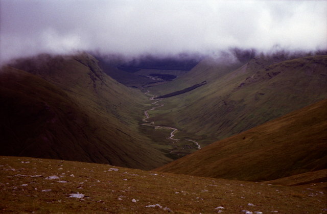
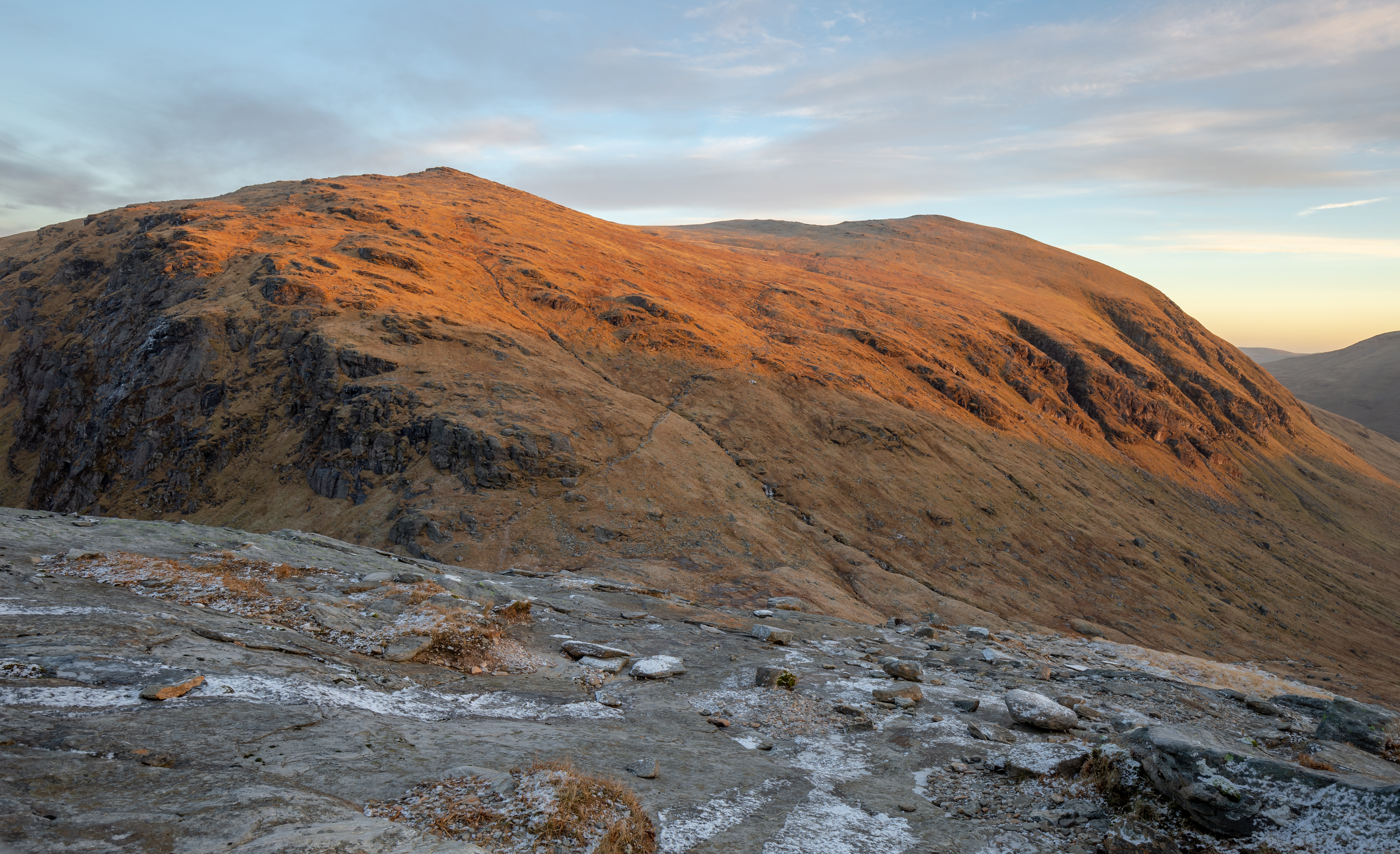
Beinn Mhanach is a prominent hill located in Perthshire, Scotland. It is part of the Scottish Highlands and stands at an elevation of 953 meters (3,127 feet) above sea level. The hill is known for its distinctive conical shape and is a popular hiking destination for outdoor enthusiasts.

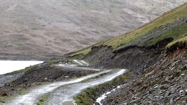
Beinn Mhanach is situated near the village of Bridge of Orchy and is easily accessible by road. The hill offers stunning panoramic views of the surrounding landscape, including the nearby Ben Dorain and Beinn Achaladair mountains.

The ascent of Beinn Mhanach is a challenging but rewarding experience, with steep slopes and rocky terrain to navigate. The hill is often shrouded in mist and cloud, adding to its mysterious and enchanting atmosphere.

Wildlife is abundant on Beinn Mhanach, with deer, hare, and various bird species commonly spotted in the area. The hill is also home to a variety of plant species, including heather, moss, and wildflowers.

Overall, Beinn Mhanach is a beautiful and rugged mountain that offers a true taste of the Scottish wilderness to those who venture to its summit.

If you have any feedback on the listing, please let us know in the comments section below.

Beinn Mhanach Images

Images are sourced within 2km of 56.534053/-4.6459866 or Grid Reference NN3741. Thanks to Geograph Open Source API. All images are credited.

East ridge of Beinn Mhanach The smooth grassy slope is the east ridge of Beinn Mhanach descending towards Loch Lyon, the dam of which is seen in the image. The valley is of course Glen Lyon with mountains extending to the Ben Lawers range in the distance.
East ridge of Beinn Mhanach
The smooth grassy slope is the east ridge of Beinn Mhanach descending towards Loch Lyon, the dam of which is seen in the image. The valley is of course Glen Lyon with mountains extending to the Ben Lawers range in the distance.
Summit of Beinn Mhanach Small summit cairn with the top of Beinn a' Chreachain behind.
Summit of Beinn Mhanach
Small summit cairn with the top of Beinn a' Chreachain behind.
Southwest ridge of Beinn a' Chuirn
View towards Beinn Achaladair from Beinn Mhanach
Beinn Mhanach summit cairn With Beinn Dorain and Beinn an Dothaidh in the distance.
Beinn Mhanach summit cairn
With Beinn Dorain and Beinn an Dothaidh in the distance.
Beinn a'  Chreachain from above Lòn na Cailliche
Beinn a' Chreachain from above Lòn na Cailliche
Looking down towards Srath Tarabhan
Estate road alongside Allt a’ Chuirn
Summit cairn on Beinn Mhanach Looking east to Loch Lyon whose dam is just visible in the mist.
Summit cairn on Beinn Mhanach
Looking east to Loch Lyon whose dam is just visible in the mist.
View from summit cairn on Beinn Mhanach Looking down Auch Gleann.
View from summit cairn on Beinn Mhanach
Looking down Auch Gleann.
On the south west slopes of Beinn a' Chuirn Looking down the Allt Kinglass towards Auch viaduct.
On the south west slopes of Beinn a' Chuirn
Looking down the Allt Kinglass towards Auch viaduct.
Allt Coire Mhanach A burn draining a corrie on Beinn Mhanach falls steeply to the enlarged Loch Lyon.
Allt Coire Mhanach
A burn draining a corrie on Beinn Mhanach falls steeply to the enlarged Loch Lyon.
Tigh nam Bodach shrine and Beinn Mhanach The pagan shrine Tigh nam Bodach, looking toward Beinn Mhanach, March 2011. The shrine is closed, the statues are inside.
Tigh nam Bodach shrine and Beinn Mhanach
The pagan shrine Tigh nam Bodach, looking toward Beinn Mhanach, March 2011. The shrine is closed, the statues are inside.
Tigh nam Bodach shrine The shrine, southern aspect, looking towards Gleann Meran
Tigh nam Bodach shrine
The shrine, southern aspect, looking towards Gleann Meran
Allt Cailliche A tributary has deposited rock and formed a boggy platform above the main burn. The Allt Cailliche is the site of a proposed run of river hydroelectric power station.
Allt Cailliche
A tributary has deposited rock and formed a boggy platform above the main burn. The Allt Cailliche is the site of a proposed run of river hydroelectric power station.
Gleann Cailliche Beinn Achaladair at the head of Gleann Cailliche, the view is from near the end of an unmapped road which runs up the glen from the Meurain Arm of Loch Lyon. The land is grazed by sheep.
Gleann Cailliche
Beinn Achaladair at the head of Gleann Cailliche, the view is from near the end of an unmapped road which runs up the glen from the Meurain Arm of Loch Lyon. The land is grazed by sheep.
Tigh Nam Bodach The figures are safe inside: outside Spring is showing up a little earlier than the last two years after a non-Winter. There is a lot of green grass in the glen, sheep are grazing high on the hill and the waders are back in their nesting grounds.
Tigh Nam Bodach
The figures are safe inside: outside Spring is showing up a little earlier than the last two years after a non-Winter. There is a lot of green grass in the glen, sheep are grazing high on the hill and the waders are back in their nesting grounds.
Landslide, Loch Lyon A slope above the road had become waterlogged bringing down soil and shale onto the lochside road. The road is also under attack from below, waves on the huge reservoir are eroding the bank.

The loch is smaller than mapped by the Ordnance Survey, it is also time that the road was put on maps.
Landslide, Loch Lyon
A slope above the road had become waterlogged bringing down soil and shale onto the lochside road. The road is also under attack from below, waves on the huge reservoir are eroding the bank. The loch is smaller than mapped by the Ordnance Survey, it is also time that the road was put on maps.
Show me another place!

Beinn Mhanach is located at Grid Ref: NN3741 (Lat: 56.534053, Lng: -4.6459866)

Unitary Authority: Perth and Kinross

Police Authority: Tayside

What 3 Words

///train.nursery.surprised. Near Pubil, Perth & Kinross

Related Wikis

Beinn Mhanach

Beinn Mhanach (Scottish Gaelic for 'monks' mountain'), also anglicized Ben Vannoch, is a mountain in the Breadalbane region of the Scottish Highlands....

Beinn a' Chreachain

Beinn a' Chreachain (lit. "Mountain of Scallops") is a Scottish mountain, with a conical top, to the north-west of Loch Lyon. == References == The Munros...

Beinn Achaladair

Beinn Achaladair is a Scottish mountain situated six kilometres north east of the hamlet of Bridge of Orchy. The mountain stands on the border of the...

Beinn an Dòthaidh

Beinn an Dòthaidh (from the Gaelic for 'hill of the scorching or singeing'), is a mountain in the Bridge of Orchy hills of Argyll and Bute, Scotland. It...

Nearby Amenities

Located within 500m of 56.534053,-4.6459866
Beinn Mhanach
Description: Monk hill
Ele: 953
Marilyn: yes
Munro: yes
Munro Number: M211
Natural: peak
Prominence: 315
Source: NPE
Wikidata: Q4881335
Wikipedia: en:Beinn Mhanach
Lat/Long: 56.5340284/-4.6460457
The data included in this document is from www.openstreetmap.org. The data is made available under ODbL.

Have you been to Beinn Mhanach?

Leave your review of Beinn Mhanach below (or comments, questions and feedback).