Sàbhal Beag

Hill, Mountain in Sutherland

Scotland

Sàbhal Beag

Boggy Area at Top of Abhainn Srath Cohainn Coir' an Easaidh Pleasant grassy slopes. Ben Hope and Ben Loyal in the distance.
Boggy Area at Top of Abhainn Srath Cohainn Coir' an Easaidh Credit: Chris and Meg Mellish

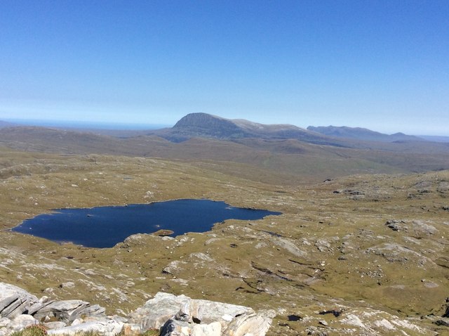
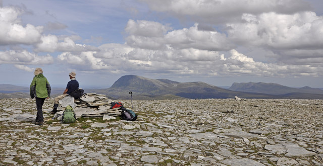
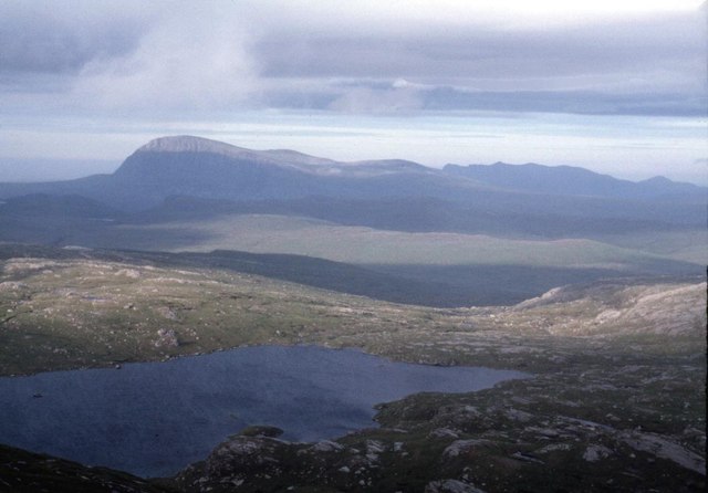
Sàbhal Beag is a prominent hill located in the county of Sutherland, in the northern part of Scotland. It is part of the Scottish Highlands, a region renowned for its stunning landscapes and rugged terrain. Sàbhal Beag stands at an elevation of approximately 582 meters (1,909 feet) above sea level, making it a notable mountain in the area.

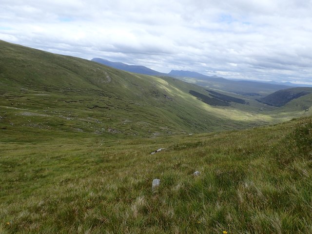
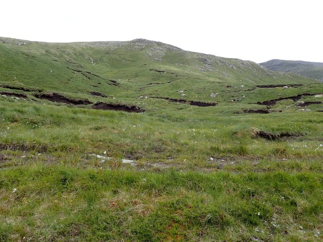
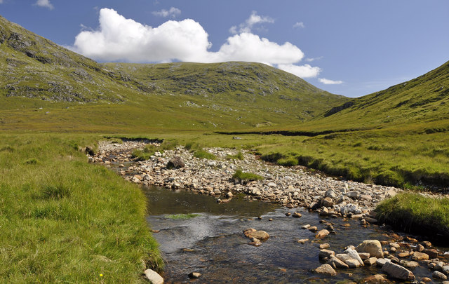
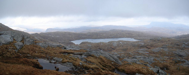
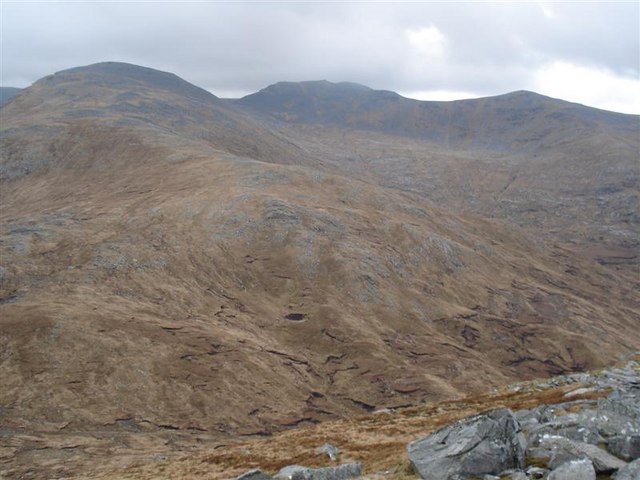
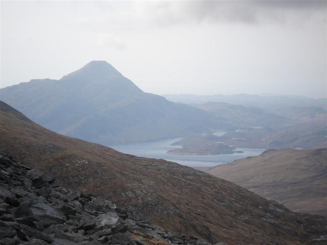
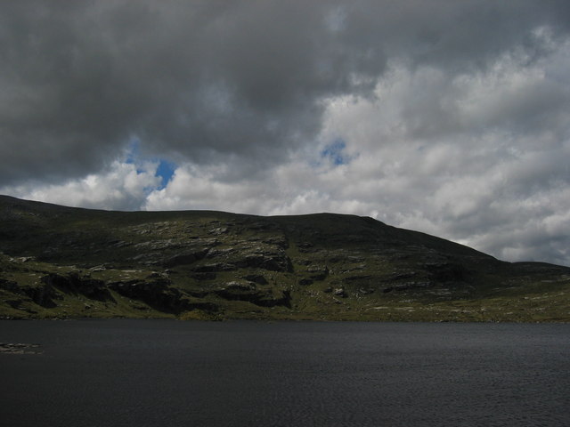
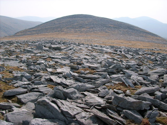
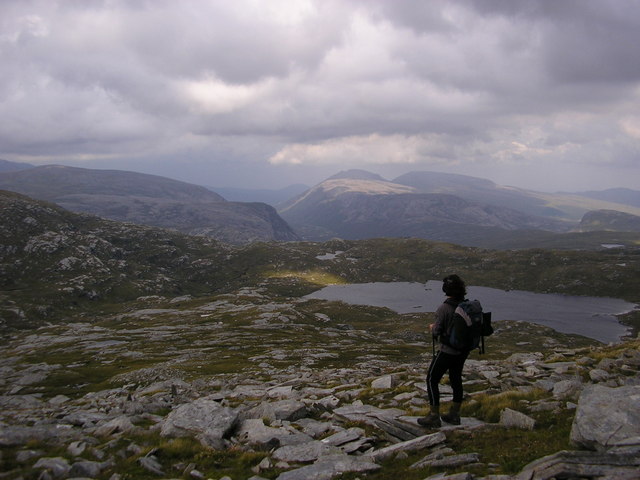
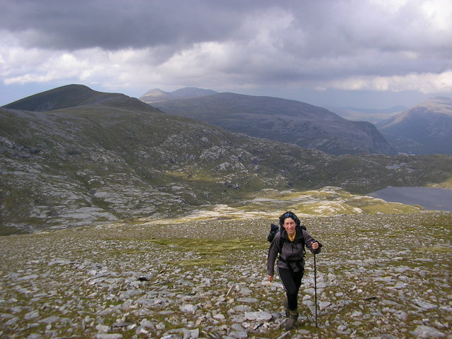
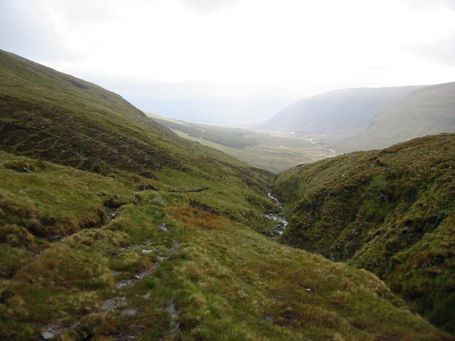
The hill is situated in an area of natural beauty, surrounded by expansive moorland and rolling hills. Its distinctive shape and steep slopes make it an attractive destination for hikers and mountaineers. The ascent to the summit of Sàbhal Beag can be challenging, but the rewarding panoramic views from the top make it well worth the effort.

The hill is known for its rich biodiversity, with various species of flora and fauna inhabiting its slopes. The lower areas are covered in heather and grasses, while higher up, the terrain becomes more rocky and barren. Wildlife enthusiasts can spot a variety of bird species, including grouse and birds of prey, as well as mammals like deer and mountain hares.

Sàbhal Beag is also steeped in history and folklore. The surrounding area is dotted with ancient remains, including standing stones and burial cairns, indicating human presence in the area for thousands of years. Local legends and stories tell tales of mythical creatures and spirits that are said to roam the hill's slopes.

Overall, Sàbhal Beag offers a challenging and rewarding outdoor experience, combining breathtaking natural beauty with a rich cultural and historical heritage.

If you have any feedback on the listing, please let us know in the comments section below.
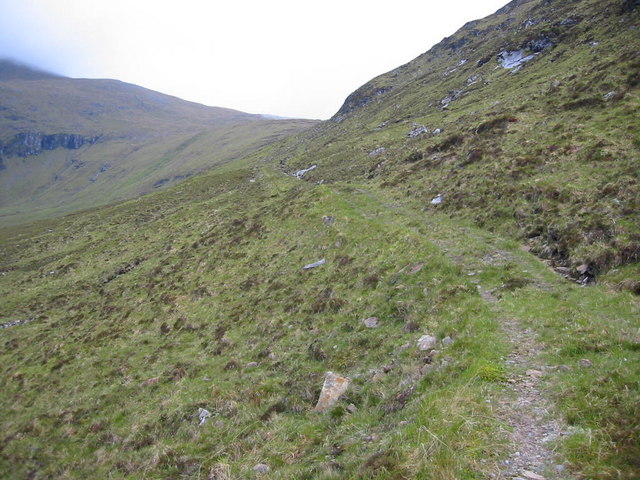
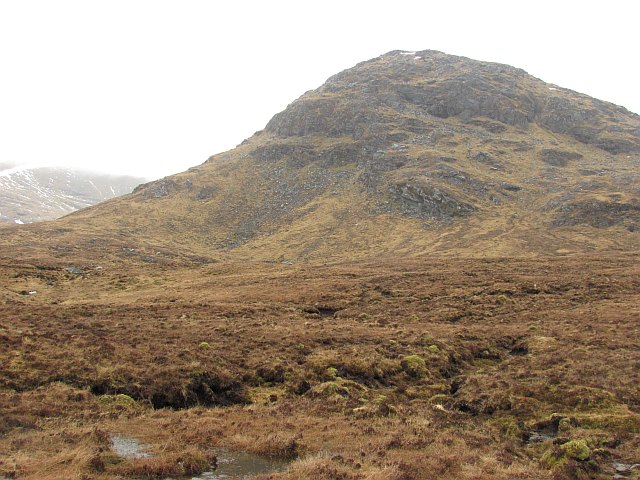
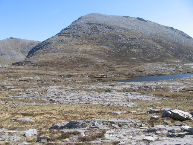
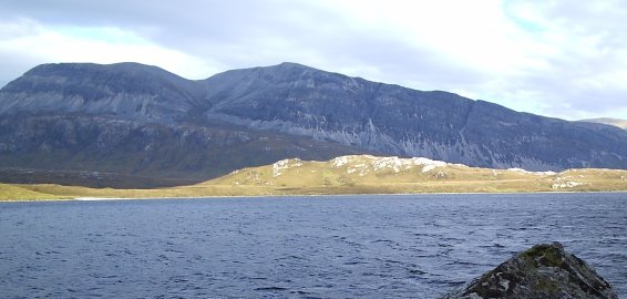
Sàbhal Beag Images

Images are sourced within 2km of 58.344453/-4.7810884 or Grid Reference NC3742. Thanks to Geograph Open Source API. All images are credited.

Boggy Area at Top of Abhainn Srath Cohainn Coir' an Easaidh Pleasant grassy slopes. Ben Hope and Ben Loyal in the distance.
Boggy Area at Top of Abhainn Srath Cohainn Coir' an Easaidh
Pleasant grassy slopes. Ben Hope and Ben Loyal in the distance.
Peat Hags below Suidheachan na Muin Looking across the track from Lone to Bealach na Feithe.
Peat Hags below Suidheachan na Muin
Looking across the track from Lone to Bealach na Feithe.
Bridge over Allt Bealach Eadar dha Shabhal This stream is called "stream of the bealach between two barns" in Gaelic, the two barns being the hills Sabhal Mor and Sabhal Beag.
Bridge over Allt Bealach Eadar dha Shabhal
This stream is called "stream of the bealach between two barns" in Gaelic, the two barns being the hills Sabhal Mor and Sabhal Beag.
Bridges over Tributaries of the Abhainn an Loin These are on the track from Lone to Bealach na Feithe. Both in very good condition.
Bridges over Tributaries of the Abhainn an Loin
These are on the track from Lone to Bealach na Feithe. Both in very good condition.
Loch na Seilge Taken from near the top of Sabhal Mor. Ben Hope in the background.
Loch na Seilge
Taken from near the top of Sabhal Mor. Ben Hope in the background.
Sabhal Beag from Strath Luib na Seilich The two Sabhals, Mor and Beag, are confusing in that Sabhal Beag (732m) is higher than Sabhal Mor (703m).
Sabhal Beag from Strath Luib na Seilich
The two Sabhals, Mor and Beag, are confusing in that Sabhal Beag (732m) is higher than Sabhal Mor (703m).
The summit cairn on Sabhal Beag Ben Hope and Ben Loyal in the background
The summit cairn on Sabhal Beag
Ben Hope and Ben Loyal in the background
Loch na Seilge Ben Hope catches the last of the day's sun
Loch na Seilge
Ben Hope catches the last of the day's sun
NE from Sabhal Mor Loch na Seilge is in the middle distance and Ben Hope is the distant hill on the right.
NE from Sabhal Mor
Loch na Seilge is in the middle distance and Ben Hope is the distant hill on the right.
Meall Garbh from Sabhal Beag The pass below is the Bealach na Feithe.
Meall Garbh from Sabhal Beag
The pass below is the Bealach na Feithe.
Ben Stack and Loch Stack from Meall Garbh
Loch Na Seilge Difficult to get to!
Loch Na Seilge
Difficult to get to!
Sabhal Mor A broad stony ridge running up to Sabhal Mor's summit cairn
Sabhal Mor
A broad stony ridge running up to Sabhal Mor's summit cairn
North ridge of Sabhal Beag Looking past Loch na Seilge to Cranstackie (sun) and Beinn Spionnaidh.
North ridge of Sabhal Beag
Looking past Loch na Seilge to Cranstackie (sun) and Beinn Spionnaidh.
North shoulder of Sabhal Beag Meall Horn in the middle distance, Foinaven beyond.
North shoulder of Sabhal Beag
Meall Horn in the middle distance, Foinaven beyond.
Bealach na Feithe Poor track to east of the bealach; it gradually improves as it descends to Gobernuisgach Lodge
Bealach na Feithe
Poor track to east of the bealach; it gradually improves as it descends to Gobernuisgach Lodge
Coire an Achaidh Looking west up to Bealach na Feithe on path between Strath More and Loch Stack.
Coire an Achaidh
Looking west up to Bealach na Feithe on path between Strath More and Loch Stack.
Sail Eilid a' Mhoraire Sail Eilid a' Mhoraire is one of three truncated spurs running south from Meall Horn towards the wide and boggy Srath Luib na Seilich.
Sail Eilid a' Mhoraire
Sail Eilid a' Mhoraire is one of three truncated spurs running south from Meall Horn towards the wide and boggy Srath Luib na Seilich.
Show me another place!

Sàbhal Beag is located at Grid Ref: NC3742 (Lat: 58.344453, Lng: -4.7810884)

Unitary Authority: Highland

Police Authority: Highlands and Islands

What 3 Words

///overpower.judge.spaceship. Near Altnaharra, Highland

Nearby Locations

Sàbhal Beag

Related Wikis

Meallan Liath Coire Mhic Dhùghaill

Meallan Liath Coire Mhic Dhughaill (801 m) is a mountain in the Northwest Highlands, Scotland. It lies in the far north of Scotland between Lairg and Durness...

Loch Dionard

Loch Dionard is a medium-sized loch in the Durness Parish, in Sutherland, Highland Council Area, Northern Scotland. It is in the North-Western Highlands...

North West Sutherland National Scenic Area

North West Sutherland is a national scenic area (NSA) covering the mountains and coastal scenery of the northwestern part of the county of Sutherland...

Arkle (Sutherland)

Arkle (Scottish Gaelic: Airceil) is a mountain in Sutherland, in the far north-west corner of the Scottish Highlands. Like its sister Foinaven, the mountain...

Nearby Amenities

Located within 500m of 58.344453,-4.7810884
Sàbhal Beag
Alt Name: Saval Beg
Corbett: no
Ele: 732
Graham: yes
Marilyn: yes
Munro: no
Natural: peak
Prominence: 169
Source: OS7
Wikidata: Q13131158
Lat/Long: 58.3442665/-4.7807935
The data included in this document is from www.openstreetmap.org. The data is made available under ODbL.

Have you been to Sàbhal Beag?

Leave your review of Sàbhal Beag below (or comments, questions and feedback).