Cruinn a' Bheinn

Hill, Mountain in Stirlingshire

Scotland

Cruinn a' Bheinn

View west from minor burn coming off Maol a' Chapuill near Inversnaid
View west from minor burn coming off Maol a' Chapuill near Inversnaid Credit: ian shiell

Cruinn a' Bheinn is a prominent hill located in Stirlingshire, Scotland. Rising to an elevation of 562 meters (1,844 feet), it is classified as a Marilyn, which is a Scottish hill with a prominence of at least 150 meters (492 feet).

Situated in the Loch Lomond and The Trossachs National Park, Cruinn a' Bheinn offers breathtaking panoramic views of the surrounding landscape. From the summit, visitors can enjoy vistas of the nearby Loch Voil, Loch Doine, and Loch Voil Reservoir, as well as the picturesque glens and rolling hills that characterize the region. On clear days, it is even possible to see the towering peaks of the Scottish Highlands in the distance.

The ascent of Cruinn a' Bheinn is relatively moderate, making it a popular destination for hikers and outdoor enthusiasts of all skill levels. There are several well-marked trails leading to the summit, with the main starting point being the village of Balquhidder. The route takes hikers through a mix of open moorland, heather-clad slopes, and rocky outcrops, providing a diverse and scenic experience.

The hill is also known for its rich biodiversity, with a variety of flora and fauna inhabiting its slopes. It is home to several species of birds, including golden eagles and peregrine falcons, as well as red deer, which can often be spotted roaming the hillsides.

Overall, Cruinn a' Bheinn offers visitors a rewarding outdoor experience, combining stunning views, diverse landscapes, and a glimpse into Scotland's natural heritage.

If you have any feedback on the listing, please let us know in the comments section below.

Cruinn a' Bheinn Images

Images are sourced within 2km of 56.210751/-4.6371758 or Grid Reference NN3605. Thanks to Geograph Open Source API. All images are credited.

View west from minor burn coming off Maol a' Chapuill near Inversnaid
View south from slopes of Maol a' Chapuill near Inversnaid The 'Cromer' road in Gleann Gaoithe then Cruinn a' Bheinn then hiding in weather and background' the home of the most southerly ptarmigan, Ben Lomond.
View south from slopes of Maol a' Chapuill near Inversnaid
The 'Cromer' road in Gleann Gaoithe then Cruinn a' Bheinn then hiding in weather and background' the home of the most southerly ptarmigan, Ben Lomond.
Bracken and rock outcrop east of minor burn coming off Maol a' Chapuill near Inversnaid
Plantation, Abhainn Beag Head of Gleann Dubh, north of Ben Lomond. There has been a lot of native tree planting here.
Plantation, Abhainn Beag
Head of Gleann Dubh, north of Ben Lomond. There has been a lot of native tree planting here.
Native woodland, Gleann Gaoithe One of several small native woodlands in the area around Comer.
Native woodland, Gleann Gaoithe
One of several small native woodlands in the area around Comer.
Cailness to Comer road, Gleann Gaoithe Well surfaced here, but the descent to Loch Lomond is very steep and the track there is in bad condition.
Cailness to Comer road, Gleann Gaoithe
Well surfaced here, but the descent to Loch Lomond is very steep and the track there is in bad condition.
Comer to Cailness road A track from Loch Ard Forest to Loch Lomond.
Comer to Cailness road
A track from Loch Ard Forest to Loch Lomond.
Ruin in Gleann Gaoithe On the edge of a small native woodland plantation.
Ruin in Gleann Gaoithe
On the edge of a small native woodland plantation.
Head of Gleann Gaoithe Gathering ground for the Abhainn Gaoithe, which flows into the Firth of Forth via the Duchray Water and Forth. This is near the East-West watershed.
Head of Gleann Gaoithe
Gathering ground for the Abhainn Gaoithe, which flows into the Firth of Forth via the Duchray Water and Forth. This is near the East-West watershed.
Road in Glenn Gaoithe The road connects Cailness on Loch Lomond with Comer and Aberfoyle.
Road in Glenn Gaoithe
The road connects Cailness on Loch Lomond with Comer and Aberfoyle.
Cruinn a' Bheinn Hill to the north of Ben Lomond.
Cruinn a' Bheinn
Hill to the north of Ben Lomond.
Comer to Cailness road At the top of the pass, shortly before crossing the watershed and plunging to Loch Lomond.
Comer to Cailness road
At the top of the pass, shortly before crossing the watershed and plunging to Loch Lomond.
South side of Cruachan Above the east shore of Loch Lomond.
South side of Cruachan
Above the east shore of Loch Lomond.
Cruinn a' Bheinn as seen from the summit of Ben Lomond Cruinn a' Bheinn is the nearest hill on the left with a bit of shadow on its eastern flank. Beinn Uamha can be seen to the right with just a glimpse of Loch Katrine beyond. Photographed on a summer evening.
Cruinn a' Bheinn as seen from the summit of Ben Lomond
Cruinn a' Bheinn is the nearest hill on the left with a bit of shadow on its eastern flank. Beinn Uamha can be seen to the right with just a glimpse of Loch Katrine beyond. Photographed on a summer evening.
Glen Gaoithe The head of the glen looking eastwards  to Beinn Uamha. The road runs from Comer Farm to the shore of Loch Lomond.
Glen Gaoithe
The head of the glen looking eastwards to Beinn Uamha. The road runs from Comer Farm to the shore of Loch Lomond.
Cailness basin This boggy bowl lies suspended 300 metres above Loch Lomond. It is a haunt of wild goats and was infamous in the early 1980s as a pumped storage powerstation was planned here. There was a large successful campaign against it. The big hill is Ben Lomond.
Cailness basin
This boggy bowl lies suspended 300 metres above Loch Lomond. It is a haunt of wild goats and was infamous in the early 1980s as a pumped storage powerstation was planned here. There was a large successful campaign against it. The big hill is Ben Lomond.
Red deer stags on Cruinn a'Bheinn Land here is rough grazing, and these guys know how to make the most of it. It's April, and most stags have shed their antlers, one or two remain. Deer stalking is still a major economic use of Scottish hill land. Picture taken about 600m up on Cruinn a'Bheinn.
Red deer stags on Cruinn a'Bheinn
Land here is rough grazing, and these guys know how to make the most of it. It's April, and most stags have shed their antlers, one or two remain. Deer stalking is still a major economic use of Scottish hill land. Picture taken about 600m up on Cruinn a'Bheinn.
Cruinn a' Bheinn This steep aptly named (Tr. Round Hill) hill lies on the main east west watershed of Scotland. It fits neatly within the square.
Cruinn a' Bheinn
This steep aptly named (Tr. Round Hill) hill lies on the main east west watershed of Scotland. It fits neatly within the square.
Show me another place!

Cruinn a' Bheinn is located at Grid Ref: NN3605 (Lat: 56.210751, Lng: -4.6371758)

Unitary Authority: Stirling

Police Authority: Forth Valley

What 3 Words

///folks.vibrate.fighters. Near Garelochhead, Argyll & Bute

Nearby Locations

Cruinn a' Bheinn

Related Wikis

Ben Lomond

Ben Lomond (Scottish Gaelic: Beinn Laomainn, 'Beacon Mountain'), 974 metres (3,196 ft), is a mountain in the Scottish Highlands. Situated on the eastern...
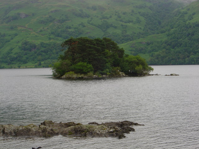
Tarbet Isle

Tarbet Isle is an island in Loch Lomond, Scotland. It is off Tarbet on the mainland. It is 10 feet (3.0 m) at its highest point, and 80 metres (260 ft...

Loch Arklet

Loch Arklet is a freshwater loch and reservoir in the Trossachs area of the Scottish Highlands. It is within the historic county and registration county...

Loch Dubh (Loch Ard Forest)

Loch Dubh ("Black Loch") is a lochan on the Duchray Water in the western part of Loch Ard Forest in the Central Highlands of Scotland. == Location == Loch...

Loch Lomond and The Trossachs National Park

Loch Lomond and The Trossachs National Park (Scottish Gaelic: Pàirc Nàiseanta Loch Laomainn is nan Tròisichean) is a national park in Scotland centred...

Inversnaid Falls

Inversnaid Falls is a waterfall of Scotland. == See also == Waterfalls of Scotland == References == Media related to Inversnaid Falls at Wikimedia Commons

Inversnaid

Inversnaid (Scottish Gaelic: Inbhir Snàthaid) is a small rural community on the east bank of Loch Lomond in Scotland, near the north end of the loch....

Tarbet, Argyll

Tarbet (Scottish Gaelic: An Tairbeart, in full Tairbeart Loch Laomainn 'Crossing Place of Loch Lomond') is a small village in Argyll and Bute, Scotland...

Nearby Amenities

Located within 500m of 56.210751,-4.6371758
Cruinn a' Bheinn
Corbett: no
Description: Roundness of the hill
Ele: 632
Graham: yes
Marilyn: yes
Munro: no
Natural: peak
Prominence: 177
Wikidata: Q13127566
Lat/Long: 56.2111893/-4.6374235
The data included in this document is from www.openstreetmap.org. The data is made available under ODbL.

Have you been to Cruinn a' Bheinn?

Leave your review of Cruinn a' Bheinn below (or comments, questions and feedback).