Sìthean a' Chatha
Hill, Mountain in Perthshire
Scotland
Sìthean a' Chatha
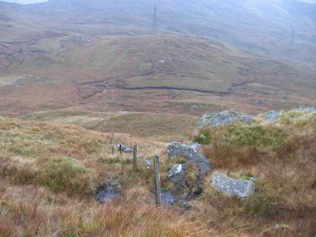
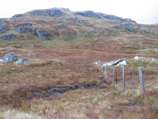
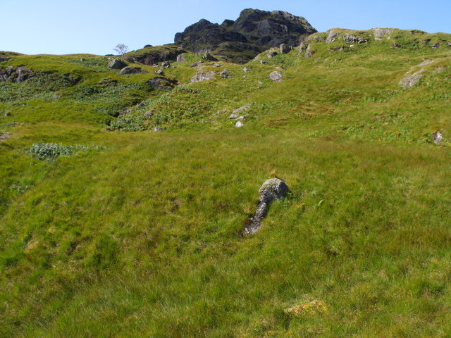
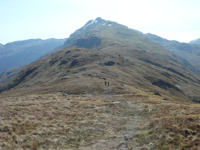
Sìthean a' Chatha is a prominent hill located in Perthshire, Scotland. It is situated near the small village of Comrie, approximately 26 miles west of Perth. With a height of around 1,288 feet (393 meters), it stands as an impressive landmark in the region.
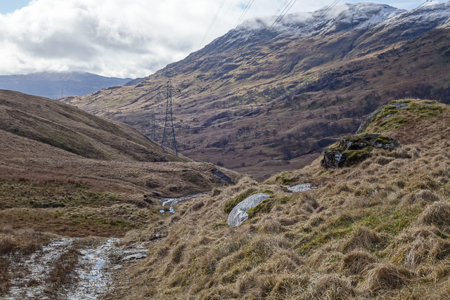
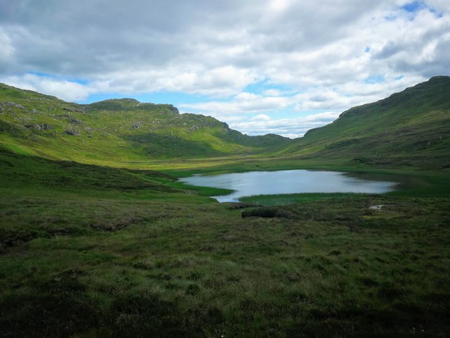
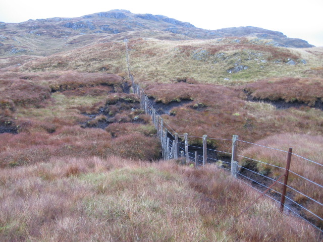
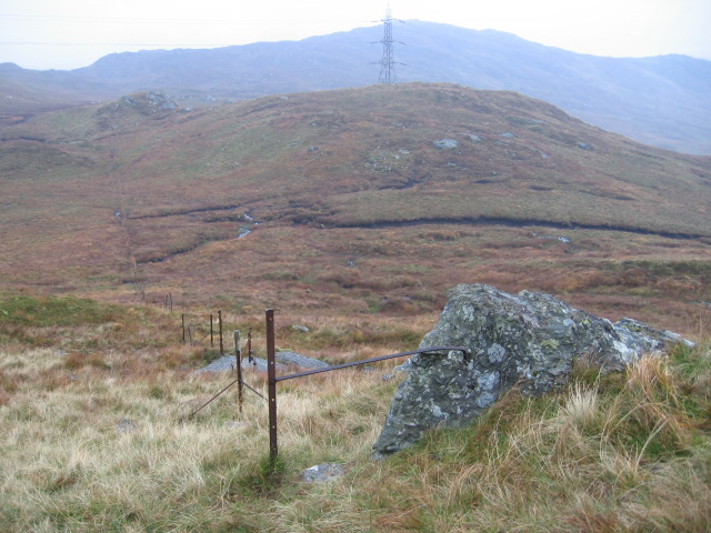
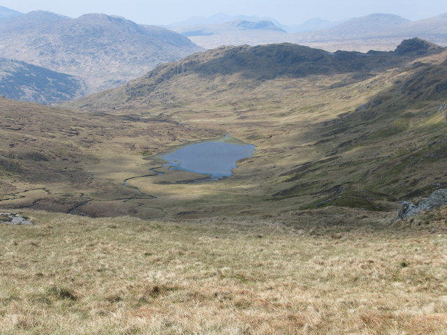
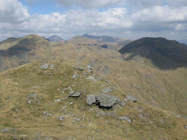
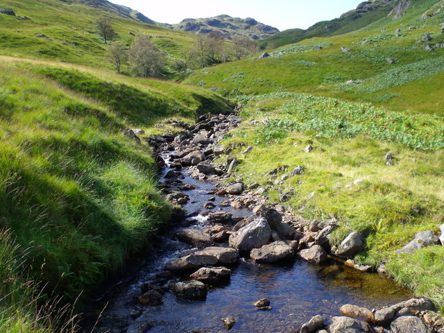
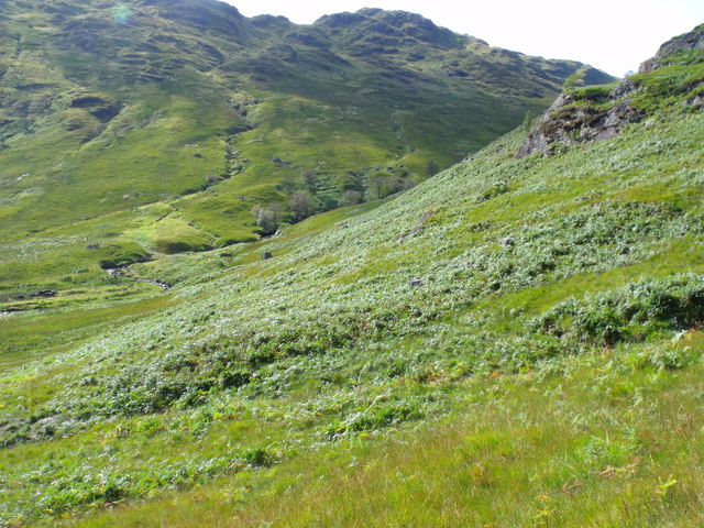
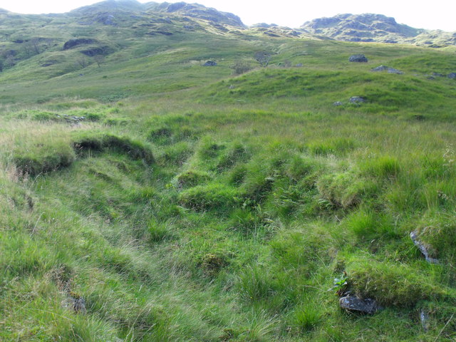
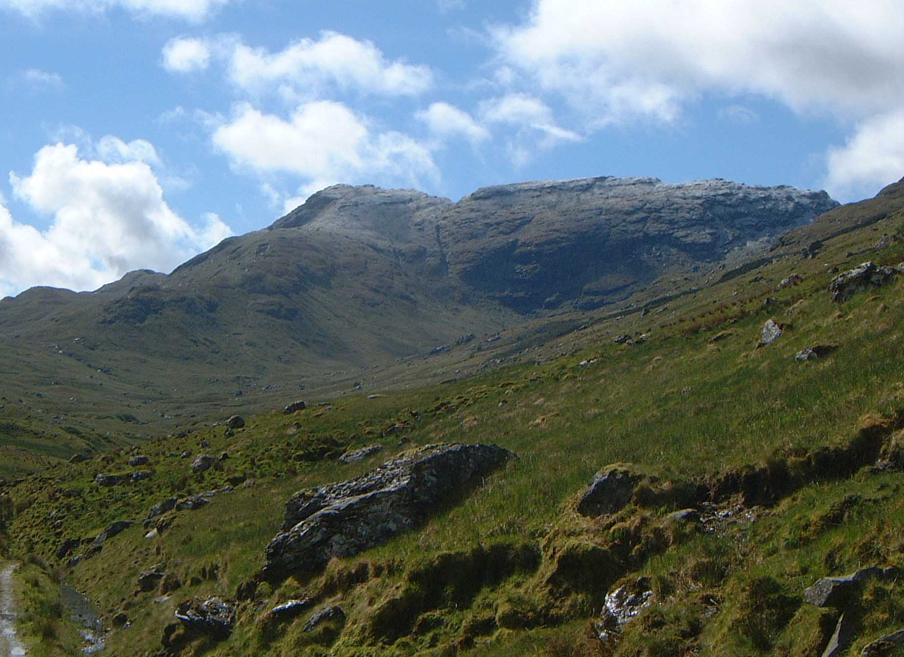
Sìthean a' Chatha is known for its stunning natural beauty and panoramic views of the surrounding countryside. The hill is covered in heather, giving it a purple hue during the blooming season. It is also home to diverse flora and fauna, including various species of birds and small mammals.
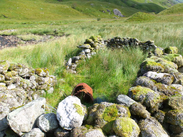
The hill has a rich historical significance, with evidence of human activity dating back thousands of years. There are several ancient cairns and burial sites located on its slopes, indicating that it has been an important place for ceremonies and rituals since ancient times.
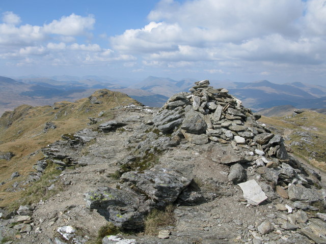
For outdoor enthusiasts, Sìthean a' Chatha offers excellent opportunities for hiking and walking. There are well-marked trails that lead to the summit, providing a challenging yet rewarding experience. From the top, visitors can enjoy breathtaking views of the surrounding Perthshire countryside, including the River Earn and the picturesque village of Comrie.
Overall, Sìthean a' Chatha is a remarkable hill in Perthshire that combines natural beauty, historical significance, and outdoor recreational opportunities. It is a popular destination for both locals and tourists seeking to immerse themselves in the stunning landscapes and rich heritage of the area.
If you have any feedback on the listing, please let us know in the comments section below.
Sìthean a' Chatha Images
Images are sourced within 2km of 56.310198/-4.6563019 or Grid Reference NN3516. Thanks to Geograph Open Source API. All images are credited.
Notice (8): Undefined index: ownername [APP/View/Records/view.ctp, line 101]Code Context<figure class="figure mb-0 pt-2"><? echo $this->Html->image($images[0]['url'], array('alt' => $images[0]['title'], 'class' => 'img-fluid mx-auto d-block')) ?><figcaption class="figure-caption text-center"><? echo $images[0]['title'] ?> Credit: <? echo $images[0]['ownername'] ?>$viewFile = '/var/www/html/uk_places.millsbomb.com/app/View/Records/view.ctp' $dataForView = array( 'meta_keywords' => 'Sìthean a' Chatha', 'meta_description' => 'Sìthean a' Chatha is a prominent hill located in Perthshire, Scotland. It is situated near the small village of Comrie, approximately 26 miles west of Perth. With a height of around 1,288 feet (393 meters), it stands as an impressive landmark in the region.Sìthean a' Chatha is known for its...', 'title_for_layout' => 'Sìthean a' Chatha Perthshire', 'videos' => null, 'wikis' => array( 'batchcomplete' => '', 'query' => array( 'geosearch' => array( [maximum depth reached] ) ) ), 'neighbours' => array( 'prev' => array( 'Record' => array( [maximum depth reached] ) ), 'next' => array( 'Record' => array( [maximum depth reached] ) ) ), 'para' => 'Sìthean a' Chatha is a Hill, Mountain in Perthshire', 'record' => array( 'Record' => array( 'id' => '208760', 'GBPNID' => '211008', 'PlaceName' => 'Sìthean a' Chatha', 'GridRef' => 'NN3516', 'Lat' => '56.310198', 'Lng' => '-4.6563019', 'HistCounty' => 'Perthshire', 'Division' => null, 'AdCounty' => null, 'District' => null, 'UniAuth' => 'Stirling', 'Police' => 'Forth Valley', 'Region' => 'Scotland', 'Alternative_Names' => null, 'Type' => 'Hill, Mountain', 'description' => 'Sìthean a' Chatha is a prominent hill located in Perthshire, Scotland. It is situated near the small village of Comrie, approximately 26 miles west of Perth. With a height of around 1,288 feet (393 meters), it stands as an impressive landmark in the region. Sìthean a' Chatha is known for its stunning natural beauty and panoramic views of the surrounding countryside. The hill is covered in heather, giving it a purple hue during the blooming season. It is also home to diverse flora and fauna, including various species of birds and small mammals. The hill has a rich historical significance, with evidence of human activity dating back thousands of years. There are several ancient cairns and burial sites located on its slopes, indicating that it has been an important place for ceremonies and rituals since ancient times. For outdoor enthusiasts, Sìthean a' Chatha offers excellent opportunities for hiking and walking. There are well-marked trails that lead to the summit, providing a challenging yet rewarding experience. From the top, visitors can enjoy breathtaking views of the surrounding Perthshire countryside, including the River Earn and the picturesque village of Comrie. Overall, Sìthean a' Chatha is a remarkable hill in Perthshire that combines natural beauty, historical significance, and outdoor recreational opportunities. It is a popular destination for both locals and tourists seeking to immerse themselves in the stunning landscapes and rich heritage of the area.', 'what3words' => 'wimp.mailboxes.vibrates', 'what3words_place' => 'Tyndrum, Stirling', 'images' => '[{"id":"7357954","title":"Path on Meall nan Tarmachan","grid_reference":"NN3518","realname":"Steven Brown","monthname":"December","hash":"d5b5cfe1","takenyear":"2022","user_id":"16100","geodist":"1990.296021","description":"","url":"https:\/\/s2.geograph.org.uk\/geophotos\/07\/35\/79\/7357954_d5b5cfe1.jpg"},{"id":"7357955","title":"Summit area of Beinn Chabhair","grid_reference":"NN3617","realname":"Steven Brown","monthname":"December","hash":"5865b679","takenyear":"2022","user_id":"16100","geodist":"1829.348022","description":"Ben Lomond in the distance.","url":"https:\/\/s3.geograph.org.uk\/geophotos\/07\/35\/79\/7357955_5865b679.jpg"},{"id":"4641689","title":"Summit cairn of Beinn Chabhair","grid_reference":"NN3617","realname":"Colin Park","monthname":"June","hash":"9fc0d478","takenyear":"2015","user_id":"4335","geodist":"1956.563965","description":"","url":"https:\/\/s1.geograph.org.uk\/geophotos\/04\/64\/16\/4641689_9fc0d478.jpg"},{"id":"4902001","title":"Power lines in the corrie","grid_reference":"NN3416","realname":"Doug Lee","monthname":"April","hash":"12e3c394","takenyear":"2016","user_id":"1265","geodist":"1553.774048","description":"The ground here is extremely boggy and more than slightly soft underfoot but this doesn't seem to be any hindrance to the stability of the pylons.","url":"https:\/\/s1.geograph.org.uk\/geophotos\/04\/90\/20\/4902001_12e3c394.jpg"},{"id":"4902003","title":"Start of the track into Glen Gyle","grid_reference":"NN3515","realname":"Doug Lee","monthname":"April","hash":"efeb0564","takenyear":"2016","user_id":"1265","geodist":"1077.713623","description":"The track marked on the map is shown starting in about this position. However, some traffic has occurred further up northwest although this is mainly flattened vegetation on the bog from occasional traffic rather than a constructed track.\r\n\r\nDespite the presence of the mapped track the ground remains more liquid than solid in many places.","url":"https:\/\/s3.geograph.org.uk\/geophotos\/04\/90\/20\/4902003_efeb0564.jpg"},{"id":"6205465","title":"Lochan Beinn Chabhair","grid_reference":"NN3518","realname":"Euan Nelson","monthname":"July","hash":"ab8406ba","takenyear":"2019","user_id":"14859","geodist":"1858.258423","description":"","url":"https:\/\/s1.geograph.org.uk\/geophotos\/06\/20\/54\/6205465_ab8406ba.jpg"},{"id":"6528731","title":"Fence towards Beinn Ducteach","grid_reference":"NN3415","realname":"Chris Wimbush","monthname":"October","hash":"161c1c93","takenyear":"2007","user_id":"5136","geodist":"1721.349854","description":"","url":"https:\/\/s3.geograph.org.uk\/geophotos\/06\/52\/87\/6528731_161c1c93.jpg"},{"id":"6528737","title":"Fence on Parlan Hill","grid_reference":"NN3416","realname":"Chris Wimbush","monthname":"October","hash":"d555b748","takenyear":"2007","user_id":"5136","geodist":"1258.332886","description":"","url":"https:\/\/s1.geograph.org.uk\/geophotos\/06\/52\/87\/6528737_d555b748.jpg"},{"id":"6528739","title":"Fence on Parlan Hill","grid_reference":"NN3416","realname":"Chris Wimbush","monthname":"October","hash":"50c6a689","takenyear":"2007","user_id":"5136","geodist":"1178.955933","description":"","url":"https:\/\/s3.geograph.org.uk\/geophotos\/06\/52\/87\/6528739_50c6a689.jpg"},{"id":"6528750","title":"Beinn Ducteach","grid_reference":"NN3415","realname":"Chris Wimbush","monthname":"October","hash":"4f6393cd","takenyear":"2007","user_id":"5136","geodist":"1517.123901","description":"","url":"https:\/\/s2.geograph.org.uk\/geophotos\/06\/52\/87\/6528750_4f6393cd.jpg"},{"id":"2395440","title":"Lochan Beinn Chabhair","grid_reference":"NN3517","realname":"G Laird","monthname":"May","hash":"c404292c","takenyear":"2011","user_id":"27852","geodist":"1690.122192","description":"Set in a beautiful location between Parlan Hill, Beinn Chabhair and Meall nan Tarmachan.","url":"https:\/\/s0.geograph.org.uk\/geophotos\/02\/39\/54\/2395440_c404292c.jpg"},{"id":"2396848","title":"Beinn Chabhair Summit Cairn","grid_reference":"NN3617","realname":"G Laird","monthname":"May","hash":"1ac9d1f5","takenyear":"2011","user_id":"27852","geodist":"1920.742432","description":"Looking towards the North Top. Beinn Dorain can be seen in the distance between the 2 tops of Beinn Chabhair.","url":"https:\/\/s0.geograph.org.uk\/geophotos\/02\/39\/68\/2396848_1ac9d1f5.jpg"},{"id":"2396864","title":"View North East from the Summit of Beinn Chabhair","grid_reference":"NN3617","realname":"G Laird","monthname":"May","hash":"37365c23","takenyear":"2011","user_id":"27852","geodist":"1985.461182","description":"From left to right are the 5 munros An Caisteal, Ben More, Cruach Ardrain, Stob Binnein and Beinn a' Chroin. A sixth neighbouring munro Beinn Tulaichean is hidden behind Beinn a' Chroin.","url":"https:\/\/s0.geograph.org.uk\/geophotos\/02\/39\/68\/2396864_37365c23.jpg"},{"id":"2602967","title":"Unmarked ruin in Glen Gyle near Loch Lomond","grid_reference":"NN3514","realname":"ian shiell","monthname":"September","hash":"ced90ac6","takenyear":"2011","user_id":"27184","geodist":"1474.604736","description":"","url":"https:\/\/s3.geograph.org.uk\/geophotos\/02\/60\/29\/2602967_ced90ac6.jpg"},{"id":"2603252","title":"Course of Lag a' Chuirn in Glen Gyle in The Trossachs","grid_reference":"NN3514","realname":"ian shiell","monthname":"September","hash":"2237ee2f","takenyear":"2011","user_id":"27184","geodist":"1489.742554","description":"","url":"https:\/\/s0.geograph.org.uk\/geophotos\/02\/60\/32\/2603252_2237ee2f.jpg"},{"id":"2603259","title":"Lower slopes of Beinn Ducteach in Glen Gyle in The Trossachs","grid_reference":"NN3514","realname":"ian shiell","monthname":"September","hash":"00f3251a","takenyear":"2011","user_id":"27184","geodist":"1474.417725","description":"","url":"https:\/\/s3.geograph.org.uk\/geophotos\/02\/60\/32\/2603259_00f3251a.jpg"},{"id":"2603263","title":"Rocky lower section of Beinn Ducteach with the summit area in the background","grid_reference":"NN3514","realname":"ian shiell","monthname":"September","hash":"841be85d","takenyear":"2011","user_id":"27184","geodist":"1288.918579","description":"","url":"https:\/\/s3.geograph.org.uk\/geophotos\/02\/60\/32\/2603263_841be85d.jpg"},{"id":"2603267","title":"Looking up watercourse on slopes of Beinn a' Choin near Loch Lomond","grid_reference":"NN3514","realname":"ian shiell","monthname":"September","hash":"4f96dd0f","takenyear":"2011","user_id":"27184","geodist":"1858.400024","description":"","url":"https:\/\/s3.geograph.org.uk\/geophotos\/02\/60\/32\/2603267_4f96dd0f.jpg"}]', 'wikis' => '{"batchcomplete":"","query":{"geosearch":[{"pageid":17738331,"ns":0,"title":"Beinn Chabhair","lat":56.32554,"lon":-4.64164,"dist":1930.7,"primary":"","url":"https:\/\/en.wikipedia.org\/wiki\/Beinn_Chabhair","image":"https:\/\/upload.wikimedia.org\/wikipedia\/commons\/5\/5e\/Chabhair.jpg","extract":"Beinn Chabhair (Gaelic: Beinn a' Chabhair) is a Scottish mountain. It has fine views down to Loch Lomond.\nA common approach is from Inverarnan, up a steep..."},{"pageid":60967129,"ns":0,"title":"Meall Mor (Loch Katrine)","lat":56.301,"lon":-4.613,"dist":2860.3,"primary":"","url":"https:\/\/en.wikipedia.org\/wiki\/Meall_Mor_(Loch_Katrine)","image":"https:\/\/upload.wikimedia.org\/wikipedia\/commons\/6\/6c\/Meall_Mor_-_geograph.org.uk_-_219121.jpg","extract":"Meall Mor (747 m) is a mountain in the Grampian Mountains of Scotland. It lies in the Stirling region, on the northern side of Loch Katrine in the Trossachs..."},{"pageid":61079881,"ns":0,"title":"Beinn a' Ch\u00f2in","lat":56.2811,"lon":-4.6599,"dist":3243.2,"primary":"","url":"https:\/\/en.wikipedia.org\/wiki\/Beinn_a%27_Ch%C3%B2in","image":"https:\/\/upload.wikimedia.org\/wikipedia\/commons\/f\/fa\/On_Beinn_a%27_Choin_-_geograph.org.uk_-_29730.jpg","extract":"Beinn a' Choin (769 m) is a mountain in the Grampian Mountains of Scotland. It lies on the border of the Stirling region and Argyll at the northern end..."},{"pageid":11627517,"ns":0,"title":"An Caisteal","lat":56.3392,"lon":-4.6251,"dist":3755.1,"primary":"","url":"https:\/\/en.wikipedia.org\/wiki\/An_Caisteal","image":"https:\/\/upload.wikimedia.org\/wikipedia\/commons\/2\/25\/Twistin_Hill_-_geograph.org.uk_-_2872460.jpg","extract":"An Caisteal (Scottish Gaelic for 'the castle') is a mountain in the Breadalbane region of the Scottish Highlands, south of the village of Crianlarich...."},{"pageid":11895670,"ns":0,"title":"Beinn a' Chroin","lat":56.331944444444,"lon":-4.6075,"dist":3860.4,"primary":"","url":"https:\/\/en.wikipedia.org\/wiki\/Beinn_a%27_Chroin","image":"https:\/\/upload.wikimedia.org\/wikipedia\/commons\/1\/12\/Beinn_a_Chroin_from_upper_Glen_Falloch.jpg","extract":"Beinn a' Chroin is a mountain in the Breadalbane region of the Scottish Highlands, six kilometres south of Crianlarich. With a height of 941 metres (3..."},{"pageid":1385915,"ns":0,"title":"Ardlui","lat":56.302222222222,"lon":-4.7211111111111,"dist":4095,"primary":"","url":"https:\/\/en.wikipedia.org\/wiki\/Ardlui","image":"https:\/\/upload.wikimedia.org\/wikipedia\/commons\/b\/b5\/Ardlui%2C_Argyll_and_Bute.jpg","extract":"Ardlui (Scottish Gaelic: \u00c0ird Laoigh) is a hamlet in Argyll and Bute, Scottish Highlands. It is located at the head of Loch Lomond. It is on the A82 road..."},{"pageid":3190556,"ns":0,"title":"Ardlui railway station","lat":56.3019,"lon":-4.7217,"dist":4138.3,"primary":"","url":"https:\/\/en.wikipedia.org\/wiki\/Ardlui_railway_station","image":"https:\/\/upload.wikimedia.org\/wikipedia\/commons\/a\/a4\/Ardlui_railway_station%2C_shelter_in_old_signal_box%2C_Loch_Lomond_and_the_Trossachs%2C_Scotland.jpg","extract":"Ardlui railway station is a rural railway station, serving Ardlui at the north end of Loch Lomond, in Scotland. The station is located on the West Highland..."},{"pageid":52126992,"ns":0,"title":"Inverarnan Canal","lat":56.326,"lon":-4.719,"dist":4246.9,"primary":"","url":"https:\/\/en.wikipedia.org\/wiki\/Inverarnan_Canal","extract":"The Inverarnan Canal was a short length of canal terminating at Garbal, close to the hamlet of Inverarnan, Scotland. This waterway once linked the old..."}]}}', 'videos' => null, 'places' => '{ "version": 0.6, "generator": "Overpass API 0.7.62.1 084b4234", "osm3s": { "timestamp_osm_base": "2024-06-13T22:05:19Z", "copyright": "The data included in this document is from www.openstreetmap.org. The data is made available under ODbL." }, "elements": [ { "type": "node", "id": 564244047, "lat": 56.3101024, "lon": -4.6562398, "tags": { "ele": "535", "munro": "no", "name": "Sithean a` Chatha", "natural": "peak", "source": "OS7" } } ] } ' ) ), 'nearbyPlaces' => array( (int) 0 => array( 'Record' => array( [maximum depth reached] ) ) ), 'noIndex' => false, 'images' => array( (int) 0 => array( 'id' => '7357954', 'title' => 'Path on Meall nan Tarmachan', 'grid_reference' => 'NN3518', 'realname' => 'Steven Brown', 'monthname' => 'December', 'hash' => 'd5b5cfe1', 'takenyear' => '2022', 'user_id' => '16100', 'geodist' => '1990.296021', 'description' => '', 'url' => 'https://s2.geograph.org.uk/geophotos/07/35/79/7357954_d5b5cfe1.jpg' ), (int) 1 => array( 'id' => '7357955', 'title' => 'Summit area of Beinn Chabhair', 'grid_reference' => 'NN3617', 'realname' => 'Steven Brown', 'monthname' => 'December', 'hash' => '5865b679', 'takenyear' => '2022', 'user_id' => '16100', 'geodist' => '1829.348022', 'description' => 'Ben Lomond in the distance.', 'url' => 'https://s3.geograph.org.uk/geophotos/07/35/79/7357955_5865b679.jpg' ), (int) 2 => array( 'id' => '4641689', 'title' => 'Summit cairn of Beinn Chabhair', 'grid_reference' => 'NN3617', 'realname' => 'Colin Park', 'monthname' => 'June', 'hash' => '9fc0d478', 'takenyear' => '2015', 'user_id' => '4335', 'geodist' => '1956.563965', 'description' => '', 'url' => 'https://s1.geograph.org.uk/geophotos/04/64/16/4641689_9fc0d478.jpg' ), (int) 3 => array( 'id' => '4902001', 'title' => 'Power lines in the corrie', 'grid_reference' => 'NN3416', 'realname' => 'Doug Lee', 'monthname' => 'April', 'hash' => '12e3c394', 'takenyear' => '2016', 'user_id' => '1265', 'geodist' => '1553.774048', 'description' => 'The ground here is extremely boggy and more than slightly soft underfoot but this doesn't seem to be any hindrance to the stability of the pylons.', 'url' => 'https://s1.geograph.org.uk/geophotos/04/90/20/4902001_12e3c394.jpg' ), (int) 4 => array( 'id' => '4902003', 'title' => 'Start of the track into Glen Gyle', 'grid_reference' => 'NN3515', 'realname' => 'Doug Lee', 'monthname' => 'April', 'hash' => 'efeb0564', 'takenyear' => '2016', 'user_id' => '1265', 'geodist' => '1077.713623', 'description' => 'The track marked on the map is shown starting in about this position. However, some traffic has occurred further up northwest although this is mainly flattened vegetation on the bog from occasional traffic rather than a constructed track. Despite the presence of the mapped track the ground remains more liquid than solid in many places.', 'url' => 'https://s3.geograph.org.uk/geophotos/04/90/20/4902003_efeb0564.jpg' ), (int) 5 => array( 'id' => '6205465', 'title' => 'Lochan Beinn Chabhair', 'grid_reference' => 'NN3518', 'realname' => 'Euan Nelson', 'monthname' => 'July', 'hash' => 'ab8406ba', 'takenyear' => '2019', 'user_id' => '14859', 'geodist' => '1858.258423', 'description' => '', 'url' => 'https://s1.geograph.org.uk/geophotos/06/20/54/6205465_ab8406ba.jpg' ), (int) 6 => array( 'id' => '6528731', 'title' => 'Fence towards Beinn Ducteach', 'grid_reference' => 'NN3415', 'realname' => 'Chris Wimbush', 'monthname' => 'October', 'hash' => '161c1c93', 'takenyear' => '2007', 'user_id' => '5136', 'geodist' => '1721.349854', 'description' => '', 'url' => 'https://s3.geograph.org.uk/geophotos/06/52/87/6528731_161c1c93.jpg' ), (int) 7 => array( 'id' => '6528737', 'title' => 'Fence on Parlan Hill', 'grid_reference' => 'NN3416', 'realname' => 'Chris Wimbush', 'monthname' => 'October', 'hash' => 'd555b748', 'takenyear' => '2007', 'user_id' => '5136', 'geodist' => '1258.332886', 'description' => '', 'url' => 'https://s1.geograph.org.uk/geophotos/06/52/87/6528737_d555b748.jpg' ), (int) 8 => array( 'id' => '6528739', 'title' => 'Fence on Parlan Hill', 'grid_reference' => 'NN3416', 'realname' => 'Chris Wimbush', 'monthname' => 'October', 'hash' => '50c6a689', 'takenyear' => '2007', 'user_id' => '5136', 'geodist' => '1178.955933', 'description' => '', 'url' => 'https://s3.geograph.org.uk/geophotos/06/52/87/6528739_50c6a689.jpg' ), (int) 9 => array( 'id' => '6528750', 'title' => 'Beinn Ducteach', 'grid_reference' => 'NN3415', 'realname' => 'Chris Wimbush', 'monthname' => 'October', 'hash' => '4f6393cd', 'takenyear' => '2007', 'user_id' => '5136', 'geodist' => '1517.123901', 'description' => '', 'url' => 'https://s2.geograph.org.uk/geophotos/06/52/87/6528750_4f6393cd.jpg' ), (int) 10 => array( 'id' => '2395440', 'title' => 'Lochan Beinn Chabhair', 'grid_reference' => 'NN3517', 'realname' => 'G Laird', 'monthname' => 'May', 'hash' => 'c404292c', 'takenyear' => '2011', 'user_id' => '27852', 'geodist' => '1690.122192', 'description' => 'Set in a beautiful location between Parlan Hill, Beinn Chabhair and Meall nan Tarmachan.', 'url' => 'https://s0.geograph.org.uk/geophotos/02/39/54/2395440_c404292c.jpg' ), (int) 11 => array( 'id' => '2396848', 'title' => 'Beinn Chabhair Summit Cairn', 'grid_reference' => 'NN3617', 'realname' => 'G Laird', 'monthname' => 'May', 'hash' => '1ac9d1f5', 'takenyear' => '2011', 'user_id' => '27852', 'geodist' => '1920.742432', 'description' => 'Looking towards the North Top. Beinn Dorain can be seen in the distance between the 2 tops of Beinn Chabhair.', 'url' => 'https://s0.geograph.org.uk/geophotos/02/39/68/2396848_1ac9d1f5.jpg' ), (int) 12 => array( 'id' => '2396864', 'title' => 'View North East from the Summit of Beinn Chabhair', 'grid_reference' => 'NN3617', 'realname' => 'G Laird', 'monthname' => 'May', 'hash' => '37365c23', 'takenyear' => '2011', 'user_id' => '27852', 'geodist' => '1985.461182', 'description' => 'From left to right are the 5 munros An Caisteal, Ben More, Cruach Ardrain, Stob Binnein and Beinn a' Chroin. A sixth neighbouring munro Beinn Tulaichean is hidden behind Beinn a' Chroin.', 'url' => 'https://s0.geograph.org.uk/geophotos/02/39/68/2396864_37365c23.jpg' ), (int) 13 => array( 'id' => '2602967', 'title' => 'Unmarked ruin in Glen Gyle near Loch Lomond', 'grid_reference' => 'NN3514', 'realname' => 'ian shiell', 'monthname' => 'September', 'hash' => 'ced90ac6', 'takenyear' => '2011', 'user_id' => '27184', 'geodist' => '1474.604736', 'description' => '', 'url' => 'https://s3.geograph.org.uk/geophotos/02/60/29/2602967_ced90ac6.jpg' ), (int) 14 => array( 'id' => '2603252', 'title' => 'Course of Lag a' Chuirn in Glen Gyle in The Trossachs', 'grid_reference' => 'NN3514', 'realname' => 'ian shiell', 'monthname' => 'September', 'hash' => '2237ee2f', 'takenyear' => '2011', 'user_id' => '27184', 'geodist' => '1489.742554', 'description' => '', 'url' => 'https://s0.geograph.org.uk/geophotos/02/60/32/2603252_2237ee2f.jpg' ), (int) 15 => array( 'id' => '2603259', 'title' => 'Lower slopes of Beinn Ducteach in Glen Gyle in The Trossachs', 'grid_reference' => 'NN3514', 'realname' => 'ian shiell', 'monthname' => 'September', 'hash' => '00f3251a', 'takenyear' => '2011', 'user_id' => '27184', 'geodist' => '1474.417725', 'description' => '', 'url' => 'https://s3.geograph.org.uk/geophotos/02/60/32/2603259_00f3251a.jpg' ), (int) 16 => array( 'id' => '2603263', 'title' => 'Rocky lower section of Beinn Ducteach with the summit area in the background', 'grid_reference' => 'NN3514', 'realname' => 'ian shiell', 'monthname' => 'September', 'hash' => '841be85d', 'takenyear' => '2011', 'user_id' => '27184', 'geodist' => '1288.918579', 'description' => '', 'url' => 'https://s3.geograph.org.uk/geophotos/02/60/32/2603263_841be85d.jpg' ), (int) 17 => array( 'id' => '2603267', 'title' => 'Looking up watercourse on slopes of Beinn a' Choin near Loch Lomond', 'grid_reference' => 'NN3514', 'realname' => 'ian shiell', 'monthname' => 'September', 'hash' => '4f96dd0f', 'takenyear' => '2011', 'user_id' => '27184', 'geodist' => '1858.400024', 'description' => '', 'url' => 'https://s3.geograph.org.uk/geophotos/02/60/32/2603267_4f96dd0f.jpg' ) ), 'amp' => false ) $meta_keywords = 'Sìthean a' Chatha' $meta_description = 'Sìthean a' Chatha is a prominent hill located in Perthshire, Scotland. It is situated near the small village of Comrie, approximately 26 miles west of Perth. With a height of around 1,288 feet (393 meters), it stands as an impressive landmark in the region.Sìthean a' Chatha is known for its...' $title_for_layout = 'Sìthean a' Chatha Perthshire' $videos = null $wikis = array( 'batchcomplete' => '', 'query' => array( 'geosearch' => array( (int) 0 => array( [maximum depth reached] ), (int) 1 => array( [maximum depth reached] ), (int) 2 => array( [maximum depth reached] ), (int) 3 => array( [maximum depth reached] ), (int) 4 => array( [maximum depth reached] ), (int) 5 => array( [maximum depth reached] ), (int) 6 => array( [maximum depth reached] ), (int) 7 => array( [maximum depth reached] ) ) ) ) $neighbours = array( 'prev' => array( 'Record' => array( 'id' => '208759', 'GBPNID' => '211007', 'PlaceName' => 'Barflawen Hill', 'GridRef' => 'NX3557', 'Lat' => '54.880699', 'Lng' => '-4.5616623', 'HistCounty' => 'Wigtownshire', 'Division' => null, 'AdCounty' => null, 'District' => null, 'UniAuth' => 'Dumfries and Galloway', 'Police' => 'Dumfries and Galloway', 'Region' => 'Scotland', 'Alternative_Names' => null, 'Type' => 'Hill, Mountain', 'description' => 'Barflawen Hill is a prominent landmark located in Wigtownshire, a region in southwest Scotland. Rising to an elevation of 284 meters (932 feet), it is classified as a hill rather than a mountain. The hill is situated about 5 kilometers (3 miles) northeast of the town of Newton Stewart. Barflawen Hill is characterized by its distinctive shape and rugged terrain. It is composed mainly of granite, which gives it a weathered appearance with exposed rocky outcrops. The summit provides panoramic views of the surrounding countryside, including the expansive Galloway Forest Park to the east. The hill is a popular destination for hikers and nature enthusiasts. Several well-marked trails traverse its slopes, allowing visitors to explore the diverse flora and fauna that thrive in this region. The hill is home to a variety of plant species, including heather, bracken, and gorse, which create a colorful landscape during the summer months. Barflawen Hill also holds historical significance in the area. It is believed to have been used as a vantage point during various conflicts, including the Wars of Independence in the 13th and 14th centuries. The remains of ancient settlements and fortifications can still be seen on its slopes, providing a glimpse into the region's rich history. Overall, Barflawen Hill offers a unique combination of natural beauty, recreational opportunities, and historical significance. Whether exploring its trails or simply enjoying the breathtaking views, visitors to Wigtownshire should not miss the chance to experience this remarkable hill.', 'what3words' => 'crackles.clash.tornado', 'what3words_place' => 'Newton Stewart, Dumfries & Galloway', 'images' => '[{"id":"7447528","title":"Old milestone","grid_reference":"NX3558","realname":"Jacqueline Crowther","monthname":"March","hash":"bdcd99ac","takenyear":"2023","user_id":"132323","geodist":"1085.582886","description":"Another of the Wigtownshire style milestones that has had vegetation cleared from around it and a new coat of paint with the work done by a Milestone Society member. The G is for Glen Luce with W (for Wigtown), an arrow pointing right and 5 on the left hand face.","url":"https:\/\/s0.geograph.org.uk\/geophotos\/07\/44\/75\/7447528_bdcd99ac.jpg"},{"id":"7479564","title":"Old milestone","grid_reference":"NX3657","realname":"Chris Minto","monthname":"April","hash":"1b9b1482","takenyear":"2023","user_id":"132323","geodist":"1104.300171","description":"This milestone, 4 miles from Wigtown, can just be spotted beneath the double-trunked tree. Glenluce is 13 miles to the north west. Hopfully that isn't unlucky for this milestone.","url":"https:\/\/s0.geograph.org.uk\/geophotos\/07\/47\/95\/7479564_1b9b1482.jpg"},{"id":"7479572","title":"Old milestone","grid_reference":"NX3657","realname":"Chris Minto","monthname":"April","hash":"0e7cb1c2","takenyear":"2023","user_id":"132323","geodist":"1104.300171","description":"The milestone is about 100m south east of Duddingstone Lodge with Grange of Bladnoch just out of sight down the dip in the road.","url":"https:\/\/s0.geograph.org.uk\/geophotos\/07\/47\/95\/7479572_0e7cb1c2.jpg"},{"id":"7479584","title":"Old milestone","grid_reference":"NX3558","realname":"Chris Minto","monthname":"April","hash":"4d03099f","takenyear":"2023","user_id":"132323","geodist":"1085.582886","description":"This is the milestone on the B733 just north of the B7052 junction. The previous photograph <a href=\"https:\/\/www.geograph.org.uk\/photo\/7447528\">NX3558 : Old milestone<\/a> was wrongly identified and is the milestone on the A747, 2 miles north of Port William.","url":"https:\/\/s0.geograph.org.uk\/geophotos\/07\/47\/95\/7479584_4d03099f.jpg"},{"id":"7479587","title":"Old milestone","grid_reference":"NX3558","realname":"Chris Minto","monthname":"April","hash":"71ff388b","takenyear":"2023","user_id":"132323","geodist":"1085.582886","description":"Not much has changed since 2008. The field gate is the same and the lichen encrusted wall still survives. The mason didn't bother too much about the top and back of this milestone.","url":"https:\/\/s3.geograph.org.uk\/geophotos\/07\/47\/95\/7479587_71ff388b.jpg"},{"id":"4824911","title":"Craigdow Moor and the Craigdow Burn","grid_reference":"NX3456","realname":"David Baird","monthname":"February","hash":"aa880c56","takenyear":"2016","user_id":"7213","geodist":"1428.753784","description":"The Craigdow Burn snakes its way across Craigdow Moor.","url":"https:\/\/s3.geograph.org.uk\/geophotos\/04\/82\/49\/4824911_aa880c56.jpg"},{"id":"4845129","title":"Craigdow","grid_reference":"NX3456","realname":"David Baird","monthname":"February","hash":"da30214b","takenyear":"2016","user_id":"7213","geodist":"1685.279175","description":"A long abandoned farm lying on the moor southwest of Clugston Loch. It was noted to be in ruins on the 1850 6" OS map.","url":"https:\/\/s1.geograph.org.uk\/geophotos\/04\/84\/51\/4845129_da30214b.jpg"},{"id":"4845140","title":"Through the lunky hole","grid_reference":"NX3456","realname":"David Baird","monthname":"February","hash":"6a589fe0","takenyear":"2016","user_id":"7213","geodist":"1651.431030","description":"A lunky hole is built in a drystone dyke to allow sheep to pass through it while holding back cattle. It can easily be blocked up with a small gate, board or stones. This one is in the dyke enclosing the old ruined farm of Craigdow.","url":"https:\/\/s0.geograph.org.uk\/geophotos\/04\/84\/51\/4845140_6a589fe0.jpg"},{"id":"4845161","title":"The Craigdow Burn","grid_reference":"NX3456","realname":"David Baird","monthname":"February","hash":"ccb85679","takenyear":"2016","user_id":"7213","geodist":"1614.561279","description":"The Craigdow Burn runs down from Craigdow Moor into the southern end of Clugston Loch.","url":"https:\/\/s1.geograph.org.uk\/geophotos\/04\/84\/51\/4845161_ccb85679.jpg"},{"id":"4984329","title":"Farmland at Torhousekie","grid_reference":"NX3657","realname":"Billy McCrorie","monthname":"June","hash":"bd7130b9","takenyear":"2016","user_id":"22650","geodist":"1230.490601","description":"","url":"https:\/\/s1.geograph.org.uk\/geophotos\/04\/98\/43\/4984329_bd7130b9.jpg"},{"id":"4984332","title":"Farm Track at Torhousekie","grid_reference":"NX3657","realname":"Billy McCrorie","monthname":"June","hash":"5d890f73","takenyear":"2016","user_id":"22650","geodist":"1232.104492","description":"","url":"https:\/\/s0.geograph.org.uk\/geophotos\/04\/98\/43\/4984332_5d890f73.jpg"},{"id":"4984333","title":"Farmland at Torhousekie","grid_reference":"NX3757","realname":"Billy McCrorie","monthname":"June","hash":"77be3077","takenyear":"2016","user_id":"22650","geodist":"1341.047729","description":"","url":"https:\/\/s1.geograph.org.uk\/geophotos\/04\/98\/43\/4984333_77be3077.jpg"},{"id":"4984334","title":"The Grange Burn","grid_reference":"NX3656","realname":"Billy McCrorie","monthname":"June","hash":"b38de7b8","takenyear":"2016","user_id":"22650","geodist":"1217.070801","description":"","url":"https:\/\/s2.geograph.org.uk\/geophotos\/04\/98\/43\/4984334_b38de7b8.jpg"},{"id":"4984337","title":"The Grange Burn","grid_reference":"NX3656","realname":"Billy McCrorie","monthname":"June","hash":"0545fe7a","takenyear":"2016","user_id":"22650","geodist":"1206.061279","description":"","url":"https:\/\/s1.geograph.org.uk\/geophotos\/04\/98\/43\/4984337_0545fe7a.jpg"},{"id":"4984339","title":"Farmland at Torhousekie","grid_reference":"NX3656","realname":"Billy McCrorie","monthname":"June","hash":"7088b2ce","takenyear":"2016","user_id":"22650","geodist":"1213.405884","description":"","url":"https:\/\/s3.geograph.org.uk\/geophotos\/04\/98\/43\/4984339_7088b2ce.jpg"},{"id":"4984341","title":"Outnumbered","grid_reference":"NX3656","realname":"Billy McCrorie","monthname":"June","hash":"2dd0ff1b","takenyear":"2016","user_id":"22650","geodist":"1233.346558","description":"","url":"https:\/\/s1.geograph.org.uk\/geophotos\/04\/98\/43\/4984341_2dd0ff1b.jpg"},{"id":"4984343","title":"Farmland at Torhousekie","grid_reference":"NX3656","realname":"Billy McCrorie","monthname":"June","hash":"128762bc","takenyear":"2016","user_id":"22650","geodist":"1205.455566","description":"","url":"https:\/\/s3.geograph.org.uk\/geophotos\/04\/98\/43\/4984343_128762bc.jpg"},{"id":"4984344","title":"Torhousekie Farm","grid_reference":"NX3756","realname":"Billy McCrorie","monthname":"June","hash":"e876628d","takenyear":"2016","user_id":"22650","geodist":"1983.750854","description":"","url":"https:\/\/s0.geograph.org.uk\/geophotos\/04\/98\/43\/4984344_e876628d.jpg"}]', 'wikis' => '{"batchcomplete":"","query":{"geosearch":[{"pageid":3666360,"ns":0,"title":"Torhouse","lat":54.877472222222,"lon":-4.5226388888889,"dist":2522,"primary":"","url":"https:\/\/en.wikipedia.org\/wiki\/Torhouse","image":"https:\/\/upload.wikimedia.org\/wikipedia\/commons\/5\/59\/Stone_Circle_-_geograph.org.uk_-_2979829.jpg","extract":"The Standing Stones of Torhouse (also Torhousekie) are a stone circle of nineteen granite boulders on the land of Torhouse, three miles west of Wigtown..."},{"pageid":17159295,"ns":0,"title":"Kirkcowan","lat":54.914,"lon":-4.609,"dist":4782.6,"primary":"","url":"https:\/\/en.wikipedia.org\/wiki\/Kirkcowan","extract":"Kirkcowan is an area about 15 miles in length, and from nearly two to nearly seven miles in breadth, comprising 30,580 acres, of which 7000 are arable..."},{"pageid":27448061,"ns":0,"title":"Kirkcowan railway station","lat":54.9157,"lon":-4.6183,"dist":5316.2,"primary":"","url":"https:\/\/en.wikipedia.org\/wiki\/Kirkcowan_railway_station","image":"https:\/\/upload.wikimedia.org\/wikipedia\/commons\/6\/6a\/Kirkcowan_geograph-3726683-by-Ben-Brooksbank.jpg","extract":"Kirkcowan railway station served the village of Kirkcowan, Dumfries and Galloway, Scotland from 1861 to 1965 on the Portpatrick and Wigtownshire Joint..."},{"pageid":58922646,"ns":0,"title":"Mains of Penninghame Platform railway station","lat":54.919,"lon":-4.48,"dist":6738,"primary":"","url":"https:\/\/en.wikipedia.org\/wiki\/Mains_of_Penninghame_Platform_railway_station","image":"https:\/\/upload.wikimedia.org\/wikipedia\/commons\/f\/fb\/Trackbed_of_the_Newton_Stewart_to_Whithorn_branch_at_the_Clachan_of_Penninghame%2C_Scotland.jpg","extract":"Mains of Penninghame Platform railway station (NX410617) was a halt on the Wigtownshire Railway branch line, from Newton Stewart to Whithorn, of the Portpatrick..."}]}}', 'videos' => null, 'places' => '{ "version": 0.6, "generator": "Overpass API 0.7.62.1 084b4234", "osm3s": { "timestamp_osm_base": "2024-05-18T17:12:26Z", "copyright": "The data included in this document is from www.openstreetmap.org. The data is made available under ODbL." }, "elements": [ { "type": "node", "id": 9966282207, "lat": 54.8765993, "lon": -4.5621525, "tags": { "power": "pole" } }, { "type": "node", "id": 9966282208, "lat": 54.8772955, "lon": -4.5626204, "tags": { "power": "pole" } }, { "type": "node", "id": 9966282209, "lat": 54.8778935, "lon": -4.5630289, "tags": { "power": "pole" } }, { "type": "node", "id": 9966282210, "lat": 54.8793897, "lon": -4.5640185, "tags": { "power": "pole" } }, { "type": "node", "id": 9966282211, "lat": 54.8800870, "lon": -4.5644942, "tags": { "power": "pole" } }, { "type": "node", "id": 9966282212, "lat": 54.8807512, "lon": -4.5648125, "tags": { "power": "pole" } }, { "type": "node", "id": 9966282213, "lat": 54.8814308, "lon": -4.5651558, "tags": { "power": "pole" } }, { "type": "node", "id": 9966282214, "lat": 54.8819780, "lon": -4.5654224, "tags": { "power": "pole" } }, { "type": "node", "id": 9966282215, "lat": 54.8827260, "lon": -4.5657964, "tags": { "power": "pole" } }, { "type": "node", "id": 9966282216, "lat": 54.8835126, "lon": -4.5661742, "tags": { "power": "pole" } }, { "type": "node", "id": 9966282217, "lat": 54.8841966, "lon": -4.5665194, "tags": { "power": "pole" } } ] } ' ) ), 'next' => array( 'Record' => array( 'id' => '208761', 'GBPNID' => '211009', 'PlaceName' => 'Meall nan Tarmachan', 'GridRef' => 'NN3518', 'Lat' => '56.330418', 'Lng' => '-4.6576911', 'HistCounty' => 'Perthshire', 'Division' => null, 'AdCounty' => null, 'District' => null, 'UniAuth' => 'Stirling', 'Police' => 'Forth Valley', 'Region' => 'Scotland', 'Alternative_Names' => null, 'Type' => 'Hill, Mountain', 'description' => 'Meall nan Tarmachan is a prominent hill located in Perthshire, Scotland. With a height of 1,044 meters (3,425 feet), it is often referred to as a mountain, although it falls just short of the official classification. The hill is situated within the Ben Lawers National Nature Reserve, a protected area known for its stunning natural beauty and diverse wildlife. Meall nan Tarmachan offers breathtaking views of the surrounding landscape, including Loch Tay and the Tarmachan Ridge. It is a popular destination for hikers and outdoor enthusiasts, attracting visitors from all over the country. The hill can be accessed via a well-maintained trail that starts at a car park near the visitor center. The ascent of Meall nan Tarmachan is relatively challenging, with steep sections and rocky terrain. However, the reward at the summit is well worth the effort. On a clear day, hikers are treated to panoramic vistas of the surrounding mountains, lochs, and glens. The Tarmachan Ridge, a series of rocky peaks extending from Meall nan Tarmachan, offers an exhilarating ridge walk for those looking for an extra challenge. The area around Meall nan Tarmachan is rich in biodiversity, with a variety of plant and animal species inhabiting the region. Birdwatchers may spot golden eagles, peregrine falcons, and buzzards soaring above, while red deer and mountain hares can sometimes be seen in the lower slopes. Overall, Meall nan Tarmachan is a stunning natural feature in Perthshire, offering outdoor enthusiasts a rewarding and memorable experience amidst Scotland's rugged beauty.', 'what3words' => 'scorch.subject.automatic', 'what3words_place' => 'Tyndrum, Stirling', 'images' => '[{"id":"7357950","title":"Path towards Beinn Chabhair","grid_reference":"NN3417","realname":"Steven Brown","monthname":"December","hash":"2a43df8e","takenyear":"2022","user_id":"16100","geodist":"1811.676147","description":"","url":"https:\/\/s2.geograph.org.uk\/geophotos\/07\/35\/79\/7357950_2a43df8e.jpg"},{"id":"7357952","title":"Path towards Beinn Chabhair","grid_reference":"NN3418","realname":"Steven Brown","monthname":"December","hash":"3509cc4d","takenyear":"2022","user_id":"16100","geodist":"1546.334717","description":"","url":"https:\/\/s0.geograph.org.uk\/geophotos\/07\/35\/79\/7357952_3509cc4d.jpg"},{"id":"7357954","title":"Path on Meall nan Tarmachan","grid_reference":"NN3518","realname":"Steven Brown","monthname":"December","hash":"d5b5cfe1","takenyear":"2022","user_id":"16100","geodist":"492.024475","description":"","url":"https:\/\/s2.geograph.org.uk\/geophotos\/07\/35\/79\/7357954_d5b5cfe1.jpg"},{"id":"7357955","title":"Summit area of Beinn Chabhair","grid_reference":"NN3617","realname":"Steven Brown","monthname":"December","hash":"5865b679","takenyear":"2022","user_id":"16100","geodist":"1175.780640","description":"Ben Lomond in the distance.","url":"https:\/\/s3.geograph.org.uk\/geophotos\/07\/35\/79\/7357955_5865b679.jpg"},{"id":"7358125","title":"Icy path on Beinn Chabhair","grid_reference":"NN3618","realname":"Steven Brown","monthname":"December","hash":"35961f21","takenyear":"2022","user_id":"16100","geodist":"526.238403","description":"","url":"https:\/\/s1.geograph.org.uk\/geophotos\/07\/35\/81\/7358125_35961f21.jpg"},{"id":"4641687","title":"View SE along summit ridge of Beinn Chabhair","grid_reference":"NN3618","realname":"Colin Park","monthname":"June","hash":"9de5ff8e","takenyear":"2015","user_id":"4335","geodist":"855.135925","description":"","url":"https:\/\/s3.geograph.org.uk\/geophotos\/04\/64\/16\/4641687_9de5ff8e.jpg"},{"id":"4641689","title":"Summit cairn of Beinn Chabhair","grid_reference":"NN3617","realname":"Colin Park","monthname":"June","hash":"9fc0d478","takenyear":"2015","user_id":"4335","geodist":"1130.165649","description":"","url":"https:\/\/s1.geograph.org.uk\/geophotos\/04\/64\/16\/4641689_9fc0d478.jpg"},{"id":"5268518","title":"Snowfield, An Caisteal","grid_reference":"NN3719","realname":"Richard Webb","monthname":"January","hash":"640e6097","takenyear":"2017","user_id":"196","geodist":"1866.959961","description":"Shortlived snow, lying directly on the ground which is unusual for the time of year. By now there should be a build up of snow over the Winter. A result of this is that you are walking not on the snow, but the ground beneath - you cannot see what is there, so every step is lucky dip. Hit a slabby rock and over you go. As the day wore on, I accumulated damage like a computer game character and was a bit wrecked when I got down.\r\nPretty though!","url":"https:\/\/s2.geograph.org.uk\/geophotos\/05\/26\/85\/5268518_640e6097.jpg"},{"id":"5268526","title":"Snow covered boulders, An Caisteal","grid_reference":"NN3719","realname":"Richard Webb","monthname":"January","hash":"e0cd8476","takenyear":"2017","user_id":"196","geodist":"1950.706299","description":"On the west ridge. The snow was fresh and shortlived, lying directly on the ground which is unusual for the time of year. By now there should be a build up of snow over the Winter. A result of this is that you are walking not on the snow, but the ground beneath - you cannot see what is there, so every step is lucky dip. Hit a slabby rock and over you go. As the day wore on, I accumulated damage like a computer game character and was a bit wrecked when I got down.\r\nPretty though!","url":"https:\/\/s2.geograph.org.uk\/geophotos\/05\/26\/85\/5268526_e0cd8476.jpg"},{"id":"5268532","title":"West ridge of An Caisteal","grid_reference":"NN3619","realname":"Richard Webb","monthname":"January","hash":"c59a73f5","takenyear":"2017","user_id":"196","geodist":"1598.494873","description":"Not as popular as Twistin Hill, but a fine way up or down An Caisteal. Lots of craggy bumps along the ridge.","url":"https:\/\/s0.geograph.org.uk\/geophotos\/05\/26\/85\/5268532_c59a73f5.jpg"},{"id":"5268533","title":"Stob Creag an Fhitich","grid_reference":"NN3419","realname":"Richard Webb","monthname":"January","hash":"218a15c0","takenyear":"2017","user_id":"196","geodist":"1008.842773","description":"A top of Beinn Chabhair, perched above a cloud sea. View from the slopes of Beinn Chabhair.","url":"https:\/\/s1.geograph.org.uk\/geophotos\/05\/26\/85\/5268533_218a15c0.jpg"},{"id":"5314611","title":"On Bealach na B\u00c3\u00a0n Leacainn","grid_reference":"NN3619","realname":"Alan Reid","monthname":"April","hash":"fe3239c9","takenyear":"1982","user_id":"45856","geodist":"1595.661011","description":"Beinn Chabhair through the gap.","url":"https:\/\/s3.geograph.org.uk\/geophotos\/05\/31\/46\/5314611_fe3239c9.jpg"},{"id":"5314619","title":"On the Stob Glas ridge of An Caisteal","grid_reference":"NN3719","realname":"Alan Reid","monthname":"April","hash":"1a7c573f","takenyear":"1982","user_id":"45856","geodist":"1715.479370","description":"Taking a breather on one of many steps on this undulating ridge. The Ben Lui group of Munros rise snow-clad in the distance.","url":"https:\/\/s3.geograph.org.uk\/geophotos\/05\/31\/46\/5314619_1a7c573f.jpg"},{"id":"6203394","title":"Approaching north summit of Beinn Chabhair","grid_reference":"NN3618","realname":"Euan Nelson","monthname":"July","hash":"3f4813fc","takenyear":"2019","user_id":"14859","geodist":"918.130432","description":"The summit cairn (933m) can be made out in the distance.","url":"https:\/\/s2.geograph.org.uk\/geophotos\/06\/20\/33\/6203394_3f4813fc.jpg"},{"id":"6205465","title":"Lochan Beinn Chabhair","grid_reference":"NN3518","realname":"Euan Nelson","monthname":"July","hash":"ab8406ba","takenyear":"2019","user_id":"14859","geodist":"737.337891","description":"","url":"https:\/\/s1.geograph.org.uk\/geophotos\/06\/20\/54\/6205465_ab8406ba.jpg"},{"id":"857509","title":"Stob Glas","grid_reference":"NN3620","realname":"Alan Pitkethley","monthname":"May","hash":"064064e7","takenyear":"2005","user_id":"6015","geodist":"1795.440063","description":"A view of Stob Glas from Beinn Chabhair <a href=\"https:\/\/www.geograph.org.uk\/gridref\/NN3617\">NN3617<\/a> showing the ridge to An Caisteal <a href=\"https:\/\/www.geograph.org.uk\/gridref\/NN3719\">NN3719<\/a>","url":"https:\/\/s1.geograph.org.uk\/photos\/85\/75\/857509_064064e7.jpg"},{"id":"2393778","title":"Waterfall on Ben Glas Burn","grid_reference":"NN3417","realname":"G Laird","monthname":"May","hash":"fd2f6fe5","takenyear":"2011","user_id":"27852","geodist":"1789.449829","description":"An isolated small tree growing in this relatively sheltered spot. There are no other trees in the immediate vicinity.","url":"https:\/\/s2.geograph.org.uk\/geophotos\/02\/39\/37\/2393778_fd2f6fe5.jpg"},{"id":"2393788","title":"Ben Glas Burn","grid_reference":"NN3418","realname":"G Laird","monthname":"May","hash":"1bc62f0c","takenyear":"2011","user_id":"27852","geodist":"1100.201538","description":"The somewhat complex mountain Beinn Chabhair dominating the background.","url":"https:\/\/s0.geograph.org.uk\/geophotos\/02\/39\/37\/2393788_1bc62f0c.jpg"}]', 'wikis' => '{"batchcomplete":"","query":{"geosearch":[{"pageid":17738331,"ns":0,"title":"Beinn Chabhair","lat":56.32554,"lon":-4.64164,"dist":1128.5,"primary":"","url":"https:\/\/en.wikipedia.org\/wiki\/Beinn_Chabhair","image":"https:\/\/upload.wikimedia.org\/wikipedia\/commons\/5\/5e\/Chabhair.jpg","extract":"Beinn Chabhair (Gaelic: Beinn a' Chabhair) is a Scottish mountain. It has fine views down to Loch Lomond.\nA common approach is from Inverarnan, up a steep..."},{"pageid":11627517,"ns":0,"title":"An Caisteal","lat":56.3392,"lon":-4.6251,"dist":2233.7,"primary":"","url":"https:\/\/en.wikipedia.org\/wiki\/An_Caisteal","image":"https:\/\/upload.wikimedia.org\/wikipedia\/commons\/2\/25\/Twistin_Hill_-_geograph.org.uk_-_2872460.jpg","extract":"An Caisteal (Scottish Gaelic for 'the castle') is a mountain in the Breadalbane region of the Scottish Highlands, south of the village of Crianlarich...."},{"pageid":28844079,"ns":0,"title":"Falls of Falloch","lat":56.35027,"lon":-4.69111,"dist":3019.1,"primary":"","url":"https:\/\/en.wikipedia.org\/wiki\/Falls_of_Falloch","image":"https:\/\/upload.wikimedia.org\/wikipedia\/commons\/f\/fd\/Falls_of_Falloch_05.jpg","extract":"Falls of Falloch (Gaelic: Eas Falach, means waterfall of the river Falloch) is a waterfall and local beauty spot on the river Falloch off the A82. It is..."},{"pageid":11895670,"ns":0,"title":"Beinn a' Chroin","lat":56.331944444444,"lon":-4.6075,"dist":3098.7,"primary":"","url":"https:\/\/en.wikipedia.org\/wiki\/Beinn_a%27_Chroin","image":"https:\/\/upload.wikimedia.org\/wikipedia\/commons\/1\/12\/Beinn_a_Chroin_from_upper_Glen_Falloch.jpg","extract":"Beinn a' Chroin is a mountain in the Breadalbane region of the Scottish Highlands, six kilometres south of Crianlarich. With a height of 941 metres (3..."},{"pageid":69810709,"ns":0,"title":"Clach nam Breatann","lat":56.357497222222,"lon":-4.6931222222222,"dist":3719.4,"primary":"","url":"https:\/\/en.wikipedia.org\/wiki\/Clach_nam_Breatann","image":"https:\/\/upload.wikimedia.org\/wikipedia\/commons\/9\/98\/Clach_nam_Breatann%2C_Alba.jpg","extract":"The Clach nam Breatann (or Minvircc) is a large stone which marked the boundary between D\u00e1l Riata, Alt Clut and the homeland of the Picts in what is now..."},{"pageid":52126992,"ns":0,"title":"Inverarnan Canal","lat":56.326,"lon":-4.719,"dist":3811.5,"primary":"","url":"https:\/\/en.wikipedia.org\/wiki\/Inverarnan_Canal","extract":"The Inverarnan Canal was a short length of canal terminating at Garbal, close to the hamlet of Inverarnan, Scotland. This waterway once linked the old..."},{"pageid":44858754,"ns":0,"title":"Inverarnan","lat":56.3285,"lon":-4.7223,"dist":3988.7,"primary":"","url":"https:\/\/en.wikipedia.org\/wiki\/Inverarnan","image":"https:\/\/upload.wikimedia.org\/wikipedia\/commons\/f\/f4\/The_Drover%27s_Inn%2C_Inverarnan_-_geograph.org.uk_-_410531.jpg","extract":"Inverarnan is a small hamlet in Stirling, Scotland, near the village of Crianlarich and the hamlet of Ardlui, Argyll and Bute. It is the only settlement..."},{"pageid":52134637,"ns":0,"title":"Glen Falloch Halt railway station","lat":56.341142,"lon":-4.724205,"dist":4269.7,"primary":"","url":"https:\/\/en.wikipedia.org\/wiki\/Glen_Falloch_Halt_railway_station","extract":"Glen Falloch Halt railway station was a remote rural railway station in Glen Falloch, Stirlingshire, Scotland. Opened in 1946 by the LNER, it was located..."}]}}', 'videos' => null, 'places' => '{ "version": 0.6, "generator": "Overpass API 0.7.62.1 084b4234", "osm3s": { "timestamp_osm_base": "2024-04-22T05:00:13Z", "copyright": "The data included in this document is from www.openstreetmap.org. The data is made available under ODbL." }, "elements": [ ] } ' ) ) ) $para = 'Sìthean a' Chatha is a Hill, Mountain in Perthshire' $record = array( 'Record' => array( 'id' => '208760', 'GBPNID' => '211008', 'PlaceName' => 'Sìthean a' Chatha', 'GridRef' => 'NN3516', 'Lat' => '56.310198', 'Lng' => '-4.6563019', 'HistCounty' => 'Perthshire', 'Division' => null, 'AdCounty' => null, 'District' => null, 'UniAuth' => 'Stirling', 'Police' => 'Forth Valley', 'Region' => 'Scotland', 'Alternative_Names' => null, 'Type' => 'Hill, Mountain', 'description' => 'Sìthean a' Chatha is a prominent hill located in Perthshire, Scotland. It is situated near the small village of Comrie, approximately 26 miles west of Perth. With a height of around 1,288 feet (393 meters), it stands as an impressive landmark in the region. Sìthean a' Chatha is known for its stunning natural beauty and panoramic views of the surrounding countryside. The hill is covered in heather, giving it a purple hue during the blooming season. It is also home to diverse flora and fauna, including various species of birds and small mammals. The hill has a rich historical significance, with evidence of human activity dating back thousands of years. There are several ancient cairns and burial sites located on its slopes, indicating that it has been an important place for ceremonies and rituals since ancient times. For outdoor enthusiasts, Sìthean a' Chatha offers excellent opportunities for hiking and walking. There are well-marked trails that lead to the summit, providing a challenging yet rewarding experience. From the top, visitors can enjoy breathtaking views of the surrounding Perthshire countryside, including the River Earn and the picturesque village of Comrie. Overall, Sìthean a' Chatha is a remarkable hill in Perthshire that combines natural beauty, historical significance, and outdoor recreational opportunities. It is a popular destination for both locals and tourists seeking to immerse themselves in the stunning landscapes and rich heritage of the area.', 'what3words' => 'wimp.mailboxes.vibrates', 'what3words_place' => 'Tyndrum, Stirling', 'images' => '[{"id":"7357954","title":"Path on Meall nan Tarmachan","grid_reference":"NN3518","realname":"Steven Brown","monthname":"December","hash":"d5b5cfe1","takenyear":"2022","user_id":"16100","geodist":"1990.296021","description":"","url":"https:\/\/s2.geograph.org.uk\/geophotos\/07\/35\/79\/7357954_d5b5cfe1.jpg"},{"id":"7357955","title":"Summit area of Beinn Chabhair","grid_reference":"NN3617","realname":"Steven Brown","monthname":"December","hash":"5865b679","takenyear":"2022","user_id":"16100","geodist":"1829.348022","description":"Ben Lomond in the distance.","url":"https:\/\/s3.geograph.org.uk\/geophotos\/07\/35\/79\/7357955_5865b679.jpg"},{"id":"4641689","title":"Summit cairn of Beinn Chabhair","grid_reference":"NN3617","realname":"Colin Park","monthname":"June","hash":"9fc0d478","takenyear":"2015","user_id":"4335","geodist":"1956.563965","description":"","url":"https:\/\/s1.geograph.org.uk\/geophotos\/04\/64\/16\/4641689_9fc0d478.jpg"},{"id":"4902001","title":"Power lines in the corrie","grid_reference":"NN3416","realname":"Doug Lee","monthname":"April","hash":"12e3c394","takenyear":"2016","user_id":"1265","geodist":"1553.774048","description":"The ground here is extremely boggy and more than slightly soft underfoot but this doesn't seem to be any hindrance to the stability of the pylons.","url":"https:\/\/s1.geograph.org.uk\/geophotos\/04\/90\/20\/4902001_12e3c394.jpg"},{"id":"4902003","title":"Start of the track into Glen Gyle","grid_reference":"NN3515","realname":"Doug Lee","monthname":"April","hash":"efeb0564","takenyear":"2016","user_id":"1265","geodist":"1077.713623","description":"The track marked on the map is shown starting in about this position. However, some traffic has occurred further up northwest although this is mainly flattened vegetation on the bog from occasional traffic rather than a constructed track.\r\n\r\nDespite the presence of the mapped track the ground remains more liquid than solid in many places.","url":"https:\/\/s3.geograph.org.uk\/geophotos\/04\/90\/20\/4902003_efeb0564.jpg"},{"id":"6205465","title":"Lochan Beinn Chabhair","grid_reference":"NN3518","realname":"Euan Nelson","monthname":"July","hash":"ab8406ba","takenyear":"2019","user_id":"14859","geodist":"1858.258423","description":"","url":"https:\/\/s1.geograph.org.uk\/geophotos\/06\/20\/54\/6205465_ab8406ba.jpg"},{"id":"6528731","title":"Fence towards Beinn Ducteach","grid_reference":"NN3415","realname":"Chris Wimbush","monthname":"October","hash":"161c1c93","takenyear":"2007","user_id":"5136","geodist":"1721.349854","description":"","url":"https:\/\/s3.geograph.org.uk\/geophotos\/06\/52\/87\/6528731_161c1c93.jpg"},{"id":"6528737","title":"Fence on Parlan Hill","grid_reference":"NN3416","realname":"Chris Wimbush","monthname":"October","hash":"d555b748","takenyear":"2007","user_id":"5136","geodist":"1258.332886","description":"","url":"https:\/\/s1.geograph.org.uk\/geophotos\/06\/52\/87\/6528737_d555b748.jpg"},{"id":"6528739","title":"Fence on Parlan Hill","grid_reference":"NN3416","realname":"Chris Wimbush","monthname":"October","hash":"50c6a689","takenyear":"2007","user_id":"5136","geodist":"1178.955933","description":"","url":"https:\/\/s3.geograph.org.uk\/geophotos\/06\/52\/87\/6528739_50c6a689.jpg"},{"id":"6528750","title":"Beinn Ducteach","grid_reference":"NN3415","realname":"Chris Wimbush","monthname":"October","hash":"4f6393cd","takenyear":"2007","user_id":"5136","geodist":"1517.123901","description":"","url":"https:\/\/s2.geograph.org.uk\/geophotos\/06\/52\/87\/6528750_4f6393cd.jpg"},{"id":"2395440","title":"Lochan Beinn Chabhair","grid_reference":"NN3517","realname":"G Laird","monthname":"May","hash":"c404292c","takenyear":"2011","user_id":"27852","geodist":"1690.122192","description":"Set in a beautiful location between Parlan Hill, Beinn Chabhair and Meall nan Tarmachan.","url":"https:\/\/s0.geograph.org.uk\/geophotos\/02\/39\/54\/2395440_c404292c.jpg"},{"id":"2396848","title":"Beinn Chabhair Summit Cairn","grid_reference":"NN3617","realname":"G Laird","monthname":"May","hash":"1ac9d1f5","takenyear":"2011","user_id":"27852","geodist":"1920.742432","description":"Looking towards the North Top. Beinn Dorain can be seen in the distance between the 2 tops of Beinn Chabhair.","url":"https:\/\/s0.geograph.org.uk\/geophotos\/02\/39\/68\/2396848_1ac9d1f5.jpg"},{"id":"2396864","title":"View North East from the Summit of Beinn Chabhair","grid_reference":"NN3617","realname":"G Laird","monthname":"May","hash":"37365c23","takenyear":"2011","user_id":"27852","geodist":"1985.461182","description":"From left to right are the 5 munros An Caisteal, Ben More, Cruach Ardrain, Stob Binnein and Beinn a' Chroin. A sixth neighbouring munro Beinn Tulaichean is hidden behind Beinn a' Chroin.","url":"https:\/\/s0.geograph.org.uk\/geophotos\/02\/39\/68\/2396864_37365c23.jpg"},{"id":"2602967","title":"Unmarked ruin in Glen Gyle near Loch Lomond","grid_reference":"NN3514","realname":"ian shiell","monthname":"September","hash":"ced90ac6","takenyear":"2011","user_id":"27184","geodist":"1474.604736","description":"","url":"https:\/\/s3.geograph.org.uk\/geophotos\/02\/60\/29\/2602967_ced90ac6.jpg"},{"id":"2603252","title":"Course of Lag a' Chuirn in Glen Gyle in The Trossachs","grid_reference":"NN3514","realname":"ian shiell","monthname":"September","hash":"2237ee2f","takenyear":"2011","user_id":"27184","geodist":"1489.742554","description":"","url":"https:\/\/s0.geograph.org.uk\/geophotos\/02\/60\/32\/2603252_2237ee2f.jpg"},{"id":"2603259","title":"Lower slopes of Beinn Ducteach in Glen Gyle in The Trossachs","grid_reference":"NN3514","realname":"ian shiell","monthname":"September","hash":"00f3251a","takenyear":"2011","user_id":"27184","geodist":"1474.417725","description":"","url":"https:\/\/s3.geograph.org.uk\/geophotos\/02\/60\/32\/2603259_00f3251a.jpg"},{"id":"2603263","title":"Rocky lower section of Beinn Ducteach with the summit area in the background","grid_reference":"NN3514","realname":"ian shiell","monthname":"September","hash":"841be85d","takenyear":"2011","user_id":"27184","geodist":"1288.918579","description":"","url":"https:\/\/s3.geograph.org.uk\/geophotos\/02\/60\/32\/2603263_841be85d.jpg"},{"id":"2603267","title":"Looking up watercourse on slopes of Beinn a' Choin near Loch Lomond","grid_reference":"NN3514","realname":"ian shiell","monthname":"September","hash":"4f96dd0f","takenyear":"2011","user_id":"27184","geodist":"1858.400024","description":"","url":"https:\/\/s3.geograph.org.uk\/geophotos\/02\/60\/32\/2603267_4f96dd0f.jpg"}]', 'wikis' => '{"batchcomplete":"","query":{"geosearch":[{"pageid":17738331,"ns":0,"title":"Beinn Chabhair","lat":56.32554,"lon":-4.64164,"dist":1930.7,"primary":"","url":"https:\/\/en.wikipedia.org\/wiki\/Beinn_Chabhair","image":"https:\/\/upload.wikimedia.org\/wikipedia\/commons\/5\/5e\/Chabhair.jpg","extract":"Beinn Chabhair (Gaelic: Beinn a' Chabhair) is a Scottish mountain. It has fine views down to Loch Lomond.\nA common approach is from Inverarnan, up a steep..."},{"pageid":60967129,"ns":0,"title":"Meall Mor (Loch Katrine)","lat":56.301,"lon":-4.613,"dist":2860.3,"primary":"","url":"https:\/\/en.wikipedia.org\/wiki\/Meall_Mor_(Loch_Katrine)","image":"https:\/\/upload.wikimedia.org\/wikipedia\/commons\/6\/6c\/Meall_Mor_-_geograph.org.uk_-_219121.jpg","extract":"Meall Mor (747 m) is a mountain in the Grampian Mountains of Scotland. It lies in the Stirling region, on the northern side of Loch Katrine in the Trossachs..."},{"pageid":61079881,"ns":0,"title":"Beinn a' Ch\u00f2in","lat":56.2811,"lon":-4.6599,"dist":3243.2,"primary":"","url":"https:\/\/en.wikipedia.org\/wiki\/Beinn_a%27_Ch%C3%B2in","image":"https:\/\/upload.wikimedia.org\/wikipedia\/commons\/f\/fa\/On_Beinn_a%27_Choin_-_geograph.org.uk_-_29730.jpg","extract":"Beinn a' Choin (769 m) is a mountain in the Grampian Mountains of Scotland. It lies on the border of the Stirling region and Argyll at the northern end..."},{"pageid":11627517,"ns":0,"title":"An Caisteal","lat":56.3392,"lon":-4.6251,"dist":3755.1,"primary":"","url":"https:\/\/en.wikipedia.org\/wiki\/An_Caisteal","image":"https:\/\/upload.wikimedia.org\/wikipedia\/commons\/2\/25\/Twistin_Hill_-_geograph.org.uk_-_2872460.jpg","extract":"An Caisteal (Scottish Gaelic for 'the castle') is a mountain in the Breadalbane region of the Scottish Highlands, south of the village of Crianlarich...."},{"pageid":11895670,"ns":0,"title":"Beinn a' Chroin","lat":56.331944444444,"lon":-4.6075,"dist":3860.4,"primary":"","url":"https:\/\/en.wikipedia.org\/wiki\/Beinn_a%27_Chroin","image":"https:\/\/upload.wikimedia.org\/wikipedia\/commons\/1\/12\/Beinn_a_Chroin_from_upper_Glen_Falloch.jpg","extract":"Beinn a' Chroin is a mountain in the Breadalbane region of the Scottish Highlands, six kilometres south of Crianlarich. With a height of 941 metres (3..."},{"pageid":1385915,"ns":0,"title":"Ardlui","lat":56.302222222222,"lon":-4.7211111111111,"dist":4095,"primary":"","url":"https:\/\/en.wikipedia.org\/wiki\/Ardlui","image":"https:\/\/upload.wikimedia.org\/wikipedia\/commons\/b\/b5\/Ardlui%2C_Argyll_and_Bute.jpg","extract":"Ardlui (Scottish Gaelic: \u00c0ird Laoigh) is a hamlet in Argyll and Bute, Scottish Highlands. It is located at the head of Loch Lomond. It is on the A82 road..."},{"pageid":3190556,"ns":0,"title":"Ardlui railway station","lat":56.3019,"lon":-4.7217,"dist":4138.3,"primary":"","url":"https:\/\/en.wikipedia.org\/wiki\/Ardlui_railway_station","image":"https:\/\/upload.wikimedia.org\/wikipedia\/commons\/a\/a4\/Ardlui_railway_station%2C_shelter_in_old_signal_box%2C_Loch_Lomond_and_the_Trossachs%2C_Scotland.jpg","extract":"Ardlui railway station is a rural railway station, serving Ardlui at the north end of Loch Lomond, in Scotland. The station is located on the West Highland..."},{"pageid":52126992,"ns":0,"title":"Inverarnan Canal","lat":56.326,"lon":-4.719,"dist":4246.9,"primary":"","url":"https:\/\/en.wikipedia.org\/wiki\/Inverarnan_Canal","extract":"The Inverarnan Canal was a short length of canal terminating at Garbal, close to the hamlet of Inverarnan, Scotland. This waterway once linked the old..."}]}}', 'videos' => null, 'places' => '{ "version": 0.6, "generator": "Overpass API 0.7.62.1 084b4234", "osm3s": { "timestamp_osm_base": "2024-06-13T22:05:19Z", "copyright": "The data included in this document is from www.openstreetmap.org. The data is made available under ODbL." }, "elements": [ { "type": "node", "id": 564244047, "lat": 56.3101024, "lon": -4.6562398, "tags": { "ele": "535", "munro": "no", "name": "Sithean a` Chatha", "natural": "peak", "source": "OS7" } } ] } ' ) ) $nearbyPlaces = array( (int) 0 => array( 'Record' => array( 'id' => '208760', 'PlaceName' => 'Sìthean a' Chatha' ) ) ) $noIndex = false $images = array( (int) 0 => array( 'id' => '7357954', 'title' => 'Path on Meall nan Tarmachan', 'grid_reference' => 'NN3518', 'realname' => 'Steven Brown', 'monthname' => 'December', 'hash' => 'd5b5cfe1', 'takenyear' => '2022', 'user_id' => '16100', 'geodist' => '1990.296021', 'description' => '', 'url' => 'https://s2.geograph.org.uk/geophotos/07/35/79/7357954_d5b5cfe1.jpg' ), (int) 1 => array( 'id' => '7357955', 'title' => 'Summit area of Beinn Chabhair', 'grid_reference' => 'NN3617', 'realname' => 'Steven Brown', 'monthname' => 'December', 'hash' => '5865b679', 'takenyear' => '2022', 'user_id' => '16100', 'geodist' => '1829.348022', 'description' => 'Ben Lomond in the distance.', 'url' => 'https://s3.geograph.org.uk/geophotos/07/35/79/7357955_5865b679.jpg' ), (int) 2 => array( 'id' => '4641689', 'title' => 'Summit cairn of Beinn Chabhair', 'grid_reference' => 'NN3617', 'realname' => 'Colin Park', 'monthname' => 'June', 'hash' => '9fc0d478', 'takenyear' => '2015', 'user_id' => '4335', 'geodist' => '1956.563965', 'description' => '', 'url' => 'https://s1.geograph.org.uk/geophotos/04/64/16/4641689_9fc0d478.jpg' ), (int) 3 => array( 'id' => '4902001', 'title' => 'Power lines in the corrie', 'grid_reference' => 'NN3416', 'realname' => 'Doug Lee', 'monthname' => 'April', 'hash' => '12e3c394', 'takenyear' => '2016', 'user_id' => '1265', 'geodist' => '1553.774048', 'description' => 'The ground here is extremely boggy and more than slightly soft underfoot but this doesn't seem to be any hindrance to the stability of the pylons.', 'url' => 'https://s1.geograph.org.uk/geophotos/04/90/20/4902001_12e3c394.jpg' ), (int) 4 => array( 'id' => '4902003', 'title' => 'Start of the track into Glen Gyle', 'grid_reference' => 'NN3515', 'realname' => 'Doug Lee', 'monthname' => 'April', 'hash' => 'efeb0564', 'takenyear' => '2016', 'user_id' => '1265', 'geodist' => '1077.713623', 'description' => 'The track marked on the map is shown starting in about this position. However, some traffic has occurred further up northwest although this is mainly flattened vegetation on the bog from occasional traffic rather than a constructed track. Despite the presence of the mapped track the ground remains more liquid than solid in many places.', 'url' => 'https://s3.geograph.org.uk/geophotos/04/90/20/4902003_efeb0564.jpg' ), (int) 5 => array( 'id' => '6205465', 'title' => 'Lochan Beinn Chabhair', 'grid_reference' => 'NN3518', 'realname' => 'Euan Nelson', 'monthname' => 'July', 'hash' => 'ab8406ba', 'takenyear' => '2019', 'user_id' => '14859', 'geodist' => '1858.258423', 'description' => '', 'url' => 'https://s1.geograph.org.uk/geophotos/06/20/54/6205465_ab8406ba.jpg' ), (int) 6 => array( 'id' => '6528731', 'title' => 'Fence towards Beinn Ducteach', 'grid_reference' => 'NN3415', 'realname' => 'Chris Wimbush', 'monthname' => 'October', 'hash' => '161c1c93', 'takenyear' => '2007', 'user_id' => '5136', 'geodist' => '1721.349854', 'description' => '', 'url' => 'https://s3.geograph.org.uk/geophotos/06/52/87/6528731_161c1c93.jpg' ), (int) 7 => array( 'id' => '6528737', 'title' => 'Fence on Parlan Hill', 'grid_reference' => 'NN3416', 'realname' => 'Chris Wimbush', 'monthname' => 'October', 'hash' => 'd555b748', 'takenyear' => '2007', 'user_id' => '5136', 'geodist' => '1258.332886', 'description' => '', 'url' => 'https://s1.geograph.org.uk/geophotos/06/52/87/6528737_d555b748.jpg' ), (int) 8 => array( 'id' => '6528739', 'title' => 'Fence on Parlan Hill', 'grid_reference' => 'NN3416', 'realname' => 'Chris Wimbush', 'monthname' => 'October', 'hash' => '50c6a689', 'takenyear' => '2007', 'user_id' => '5136', 'geodist' => '1178.955933', 'description' => '', 'url' => 'https://s3.geograph.org.uk/geophotos/06/52/87/6528739_50c6a689.jpg' ), (int) 9 => array( 'id' => '6528750', 'title' => 'Beinn Ducteach', 'grid_reference' => 'NN3415', 'realname' => 'Chris Wimbush', 'monthname' => 'October', 'hash' => '4f6393cd', 'takenyear' => '2007', 'user_id' => '5136', 'geodist' => '1517.123901', 'description' => '', 'url' => 'https://s2.geograph.org.uk/geophotos/06/52/87/6528750_4f6393cd.jpg' ), (int) 10 => array( 'id' => '2395440', 'title' => 'Lochan Beinn Chabhair', 'grid_reference' => 'NN3517', 'realname' => 'G Laird', 'monthname' => 'May', 'hash' => 'c404292c', 'takenyear' => '2011', 'user_id' => '27852', 'geodist' => '1690.122192', 'description' => 'Set in a beautiful location between Parlan Hill, Beinn Chabhair and Meall nan Tarmachan.', 'url' => 'https://s0.geograph.org.uk/geophotos/02/39/54/2395440_c404292c.jpg' ), (int) 11 => array( 'id' => '2396848', 'title' => 'Beinn Chabhair Summit Cairn', 'grid_reference' => 'NN3617', 'realname' => 'G Laird', 'monthname' => 'May', 'hash' => '1ac9d1f5', 'takenyear' => '2011', 'user_id' => '27852', 'geodist' => '1920.742432', 'description' => 'Looking towards the North Top. Beinn Dorain can be seen in the distance between the 2 tops of Beinn Chabhair.', 'url' => 'https://s0.geograph.org.uk/geophotos/02/39/68/2396848_1ac9d1f5.jpg' ), (int) 12 => array( 'id' => '2396864', 'title' => 'View North East from the Summit of Beinn Chabhair', 'grid_reference' => 'NN3617', 'realname' => 'G Laird', 'monthname' => 'May', 'hash' => '37365c23', 'takenyear' => '2011', 'user_id' => '27852', 'geodist' => '1985.461182', 'description' => 'From left to right are the 5 munros An Caisteal, Ben More, Cruach Ardrain, Stob Binnein and Beinn a' Chroin. A sixth neighbouring munro Beinn Tulaichean is hidden behind Beinn a' Chroin.', 'url' => 'https://s0.geograph.org.uk/geophotos/02/39/68/2396864_37365c23.jpg' ), (int) 13 => array( 'id' => '2602967', 'title' => 'Unmarked ruin in Glen Gyle near Loch Lomond', 'grid_reference' => 'NN3514', 'realname' => 'ian shiell', 'monthname' => 'September', 'hash' => 'ced90ac6', 'takenyear' => '2011', 'user_id' => '27184', 'geodist' => '1474.604736', 'description' => '', 'url' => 'https://s3.geograph.org.uk/geophotos/02/60/29/2602967_ced90ac6.jpg' ), (int) 14 => array( 'id' => '2603252', 'title' => 'Course of Lag a' Chuirn in Glen Gyle in The Trossachs', 'grid_reference' => 'NN3514', 'realname' => 'ian shiell', 'monthname' => 'September', 'hash' => '2237ee2f', 'takenyear' => '2011', 'user_id' => '27184', 'geodist' => '1489.742554', 'description' => '', 'url' => 'https://s0.geograph.org.uk/geophotos/02/60/32/2603252_2237ee2f.jpg' ), (int) 15 => array( 'id' => '2603259', 'title' => 'Lower slopes of Beinn Ducteach in Glen Gyle in The Trossachs', 'grid_reference' => 'NN3514', 'realname' => 'ian shiell', 'monthname' => 'September', 'hash' => '00f3251a', 'takenyear' => '2011', 'user_id' => '27184', 'geodist' => '1474.417725', 'description' => '', 'url' => 'https://s3.geograph.org.uk/geophotos/02/60/32/2603259_00f3251a.jpg' ), (int) 16 => array( 'id' => '2603263', 'title' => 'Rocky lower section of Beinn Ducteach with the summit area in the background', 'grid_reference' => 'NN3514', 'realname' => 'ian shiell', 'monthname' => 'September', 'hash' => '841be85d', 'takenyear' => '2011', 'user_id' => '27184', 'geodist' => '1288.918579', 'description' => '', 'url' => 'https://s3.geograph.org.uk/geophotos/02/60/32/2603263_841be85d.jpg' ), (int) 17 => array( 'id' => '2603267', 'title' => 'Looking up watercourse on slopes of Beinn a' Choin near Loch Lomond', 'grid_reference' => 'NN3514', 'realname' => 'ian shiell', 'monthname' => 'September', 'hash' => '4f96dd0f', 'takenyear' => '2011', 'user_id' => '27184', 'geodist' => '1858.400024', 'description' => '', 'url' => 'https://s3.geograph.org.uk/geophotos/02/60/32/2603267_4f96dd0f.jpg' ) ) $amp = false $image = array( 'id' => '2603267', 'title' => 'Looking up watercourse on slopes of Beinn a' Choin near Loch Lomond', 'grid_reference' => 'NN3514', 'realname' => 'ian shiell', 'monthname' => 'September', 'hash' => '4f96dd0f', 'takenyear' => '2011', 'user_id' => '27184', 'geodist' => '1858.400024', 'description' => '', 'url' => 'https://s3.geograph.org.uk/geophotos/02/60/32/2603267_4f96dd0f.jpg' ) $key = (int) 17 $img = 'https://s3.geograph.org.uk/geophotos/02/60/32/2603267_4f96dd0f.jpg'include - APP/View/Records/view.ctp, line 101 View::_evaluate() - CORE/Cake/View/View.php, line 971 View::_render() - CORE/Cake/View/View.php, line 933 View::render() - CORE/Cake/View/View.php, line 473 Controller::render() - CORE/Cake/Controller/Controller.php, line 963 Dispatcher::_invoke() - CORE/Cake/Routing/Dispatcher.php, line 200 Dispatcher::dispatch() - CORE/Cake/Routing/Dispatcher.php, line 167 [main] - APP/webroot/index.php, line 118
Sìthean a' Chatha is located at Grid Ref: NN3516 (Lat: 56.310198, Lng: -4.6563019)
Unitary Authority: Stirling
Police Authority: Forth Valley
What 3 Words
///wimp.mailboxes.vibrates. Near Tyndrum, Stirling
Nearby Locations
Related Wikis
Beinn Chabhair
Beinn Chabhair (Gaelic: Beinn a' Chabhair) is a Scottish mountain. It has fine views down to Loch Lomond. A common approach is from Inverarnan, up a steep...

Meall Mor (Loch Katrine)
Meall Mor (747 m) is a mountain in the Grampian Mountains of Scotland. It lies in the Stirling region, on the northern side of Loch Katrine in the Trossachs...
Beinn a' Chòin
Beinn a' Choin (769 m) is a mountain in the Grampian Mountains of Scotland. It lies on the border of the Stirling region and Argyll at the northern end...
An Caisteal
An Caisteal (Scottish Gaelic for 'the castle') is a mountain in the Breadalbane region of the Scottish Highlands, south of the village of Crianlarich....
Beinn a' Chroin
Beinn a' Chroin is a mountain in the Breadalbane region of the Scottish Highlands, six kilometres south of Crianlarich. With a height of 941 metres (3...

Ardlui
Ardlui (Scottish Gaelic: Àird Laoigh) is a hamlet in Argyll and Bute, Scottish Highlands. It is located at the head of Loch Lomond. It is on the A82 road...

Ardlui railway station
Ardlui railway station is a rural railway station, serving Ardlui at the north end of Loch Lomond, in Scotland. The station is located on the West Highland...

Inverarnan Canal
The Inverarnan Canal was a short length of canal terminating at Garbal, close to the hamlet of Inverarnan, Scotland. This waterway once linked the old...
Nearby Amenities
Located within 500m of 56.310198,-4.6563019Have you been to Sìthean a' Chatha?
Leave your review of Sìthean a' Chatha below (or comments, questions and feedback).