Creag a' Bhocain

Hill, Mountain in Stirlingshire

Scotland

Creag a' Bhocain

Memorial to Loch Lomond fatality Mid morning on Sunday 23 November 1975, a party of walkers got into trouble whilst trying to wade through an in-spate Cailness Burn. This burn is approximately 2 km south of Inversnaid on the West Highland Way long distance walk. At that time there was no foot-bridge across the burn; the previous one had been washed away in July of that year. Three of the walkers were swept out into Loch Lomond and their leader, 6ft 5in Bill Lobban, waded in to the water to try and rescue them.
All this was witnessed by 68 year old John Groome from nearby Caillnes Cottage. John launched his motorised ten foot open dinghy and managed to rescue three of those in trouble, but there was no sign of Bill Lobban, his body was never recovered.
The full story is available as part of John Groome’s Diaries. These are available via the Friends of Loch Lomond’s website. <span class="nowrap"><a title="https://www.lochlomondtrossachs.org.uk/john-groome-diaries" rel="nofollow ugc noopener" href="https://www.lochlomondtrossachs.org.uk/john-groome-diaries">Link</a><img style="margin-left:2px;" alt="External link" title="External link - shift click to open in new window" src="https://s1.geograph.org.uk/img/external.png" width="10" height="10"/></span>
Memorial to Loch Lomond fatality Credit: Pete Marrison

Creag a' Bhocain is a prominent hill located in Stirlingshire, Scotland. It stands at an elevation of 460 meters (1,509 feet) and is part of the Campsie Fells range. The hill is situated approximately 20 kilometers northeast of the city of Stirling.

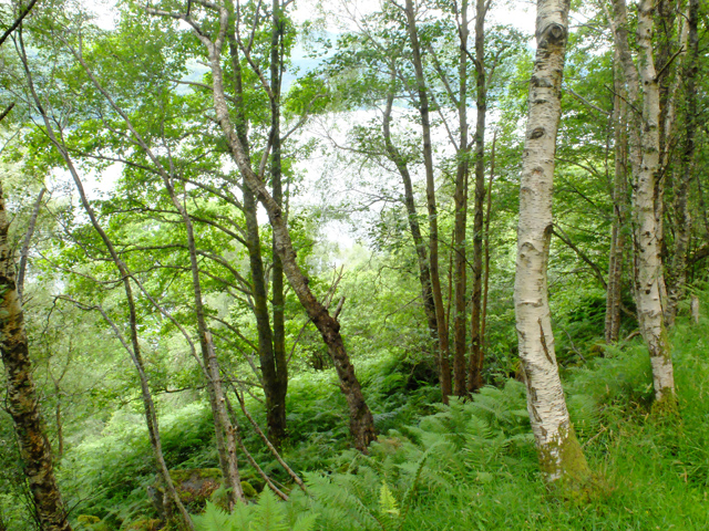
Creag a' Bhocain is characterized by its steep and rocky slopes, making it a challenging but rewarding climb for hikers and hillwalkers. The hill offers stunning panoramic views of the surrounding area, including the nearby towns of Kilsyth and Cumbernauld, as well as the Campsie Glen and the Campsie Fells range.

The hill is home to a variety of flora and fauna, including heather, gorse, and various grasses, providing a colorful and diverse landscape. The area is also known for its wildlife, with bird species such as buzzards, kestrels, and peregrine falcons frequently spotted soaring above.

Access to Creag a' Bhocain is available from various points, including from the nearby villages of Twechar and Milton of Campsie. There are several established walking trails that lead to the summit, each varying in difficulty and length.

The hill is a popular destination for outdoor enthusiasts, offering opportunities for hiking, hillwalking, and birdwatching. It provides a peaceful and scenic retreat from the bustling nearby cities, allowing visitors to immerse themselves in the natural beauty of the Scottish countryside.

If you have any feedback on the listing, please let us know in the comments section below.

Creag a' Bhocain Images

Images are sourced within 2km of 56.203662/-4.6617953 or Grid Reference NN3404. Thanks to Geograph Open Source API. All images are credited.

Memorial to Loch Lomond fatality Mid morning on Sunday 23 November 1975, a party of walkers got into trouble whilst trying to wade through an in-spate Cailness Burn. This burn is approximately 2 km south of Inversnaid on the West Highland Way long distance walk. At that time there was no foot-bridge across the burn; the previous one had been washed away in July of that year. Three of the walkers were swept out into Loch Lomond and their leader, 6ft 5in Bill Lobban, waded in to the water to try and rescue them.
All this was witnessed by 68 year old John Groome from nearby Caillnes Cottage. John launched his motorised ten foot open dinghy and managed to rescue three of those in trouble, but there was no sign of Bill Lobban, his body was never recovered.
The full story is available as part of John Groome’s Diaries. These are available via the Friends of Loch Lomond’s website. <span class="nowrap"><a title="https://www.lochlomondtrossachs.org.uk/john-groome-diaries" rel="nofollow ugc noopener" href="https://www.lochlomondtrossachs.org.uk/john-groome-diaries">Link</a><img style="margin-left:2px;" alt="External link" title="External link - shift click to open in new window" src="https://s1.geograph.org.uk/img/external.png" width="10" height="10"/></span>
Memorial to Loch Lomond fatality
Mid morning on Sunday 23 November 1975, a party of walkers got into trouble whilst trying to wade through an in-spate Cailness Burn. This burn is approximately 2 km south of Inversnaid on the West Highland Way long distance walk. At that time there was no foot-bridge across the burn; the previous one had been washed away in July of that year. Three of the walkers were swept out into Loch Lomond and their leader, 6ft 5in Bill Lobban, waded in to the water to try and rescue them. All this was witnessed by 68 year old John Groome from nearby Caillnes Cottage. John launched his motorised ten foot open dinghy and managed to rescue three of those in trouble, but there was no sign of Bill Lobban, his body was never recovered. The full story is available as part of John Groome’s Diaries. These are available via the Friends of Loch Lomond’s website. LinkExternal link
The Arrochar Alps Looking Alpine....cloud inversion over The Cobbler, Beinn Narnain, Ben Ime and Ben Vane with Beinn an Lochain between The Cobbler and Beinn Narnain.
A fantastic day on Scotlands most popular Munro.
The Arrochar Alps
Looking Alpine....cloud inversion over The Cobbler, Beinn Narnain, Ben Ime and Ben Vane with Beinn an Lochain between The Cobbler and Beinn Narnain. A fantastic day on Scotlands most popular Munro.
Steep birch woods above Loch Lomond Viewed from the West Highland Way.
Steep birch woods above Loch Lomond
Viewed from the West Highland Way.
Track junction A minor forest track drops to the left towards the shore of the loch. The West Highland Way continues ahead.
Track junction
A minor forest track drops to the left towards the shore of the loch. The West Highland Way continues ahead.
O ye'll take the High Road... ...and I'll take the Low Road

The junction of the alternative routes of the West Highland Way, seen under repair in <a href="https://www.geograph.org.uk/photo/4041800">NN3304 : Upgrading of the West Highland Way</a>
O ye'll take the High Road...
...and I'll take the Low Road The junction of the alternative routes of the West Highland Way, seen under repair in NN3304 : Upgrading of the West Highland Way
The West Highland Way towards Cailness The West Highland Way is a long distance footpath, running for 154km (96miles) between Milngavie and Fort William. 
It passes through countryside north of Glasgow, follows the east shore of Loch Lomond to Glen Falloch and Strathfillan, crosses Rannoch Moor to the head of Glencoe, climbs the Devil’s Staircase and descends to Loch Leven, before crossing the Lairigmor and Glen Nevis to finish in Gordon Square, Fort William.
The West Highland Way towards Cailness
The West Highland Way is a long distance footpath, running for 154km (96miles) between Milngavie and Fort William. It passes through countryside north of Glasgow, follows the east shore of Loch Lomond to Glen Falloch and Strathfillan, crosses Rannoch Moor to the head of Glencoe, climbs the Devil’s Staircase and descends to Loch Leven, before crossing the Lairigmor and Glen Nevis to finish in Gordon Square, Fort William.
Boulder by the West Highland Way The West Highland Way is a long distance footpath, running for 154km (96miles) between Milngavie and Fort William. 
It passes through countryside north of Glasgow, follows the east shore of Loch Lomond to Glen Falloch and Strathfillan, crosses Rannoch Moor to the head of Glencoe, climbs the Devil’s Staircase and descends to Loch Leven, before crossing the Lairigmor and Glen Nevis to finish in Gordon Square, Fort William.
Boulder by the West Highland Way
The West Highland Way is a long distance footpath, running for 154km (96miles) between Milngavie and Fort William. It passes through countryside north of Glasgow, follows the east shore of Loch Lomond to Glen Falloch and Strathfillan, crosses Rannoch Moor to the head of Glencoe, climbs the Devil’s Staircase and descends to Loch Leven, before crossing the Lairigmor and Glen Nevis to finish in Gordon Square, Fort William.
The Cailness Burn Viewed from the West Highland Way footbridge.
The Cailness Burn
Viewed from the West Highland Way footbridge.
Cailness Truly remote living on the east side of Loch Lomond.
Cailness
Truly remote living on the east side of Loch Lomond.
Woodland, Loch Lomond Steep slopes between the paths on the east side of Loch Lomond.
Woodland, Loch Lomond
Steep slopes between the paths on the east side of Loch Lomond.
Birch woods, Loch Lomond Not far off the road carrying the West Highland Way alternative route, but a steep slippery slog to get over the grid line.   Typical of the woodland along Loch Lomond, but the bluebells are late this year.
Birch woods, Loch Lomond
Not far off the road carrying the West Highland Way alternative route, but a steep slippery slog to get over the grid line. Typical of the woodland along Loch Lomond, but the bluebells are late this year.
Loch Lomond, A' Chrois and Ben Vane A long line of noisy boats pass, the first of the day.  View from above the upper path.
Loch Lomond, A' Chrois and Ben Vane
A long line of noisy boats pass, the first of the day. View from above the upper path.
Loch Lomond, A' Chrois and Ben Vane Before the leaves are fully out there are views from the top path. Looking towards The Cobbler and Beinn Narnain.
Loch Lomond, A' Chrois and Ben Vane
Before the leaves are fully out there are views from the top path. Looking towards The Cobbler and Beinn Narnain.
The upper path Now the lochside path has been upgraded, this is a much quieter route.
The upper path
Now the lochside path has been upgraded, this is a much quieter route.
Linking path A wide path descends to the loch side, providing a link between the upper and lower options of the West Highland Way.
Linking path
A wide path descends to the loch side, providing a link between the upper and lower options of the West Highland Way.
The lower path, Loch Lomond The newly improved lochside option on the West Highland Way.
The lower path, Loch Lomond
The newly improved lochside option on the West Highland Way.
Woodland, Rowchoish Some conifers lower down the slope than usual in this forest.
Woodland, Rowchoish
Some conifers lower down the slope than usual in this forest.
Ruin, Rowchoish A short distance from the remains of the main house which is within the background conifers.
Ruin, Rowchoish
A short distance from the remains of the main house which is within the background conifers.
Show me another place!

Creag a' Bhocain is located at Grid Ref: NN3404 (Lat: 56.203662, Lng: -4.6617953)

Unitary Authority: Stirling

Police Authority: Forth Valley

What 3 Words

///overjoyed.overdone.results. Near Garelochhead, Argyll & Bute

Nearby Locations

Creag a' Bhocain

Related Wikis

Ben Lomond

Ben Lomond (Scottish Gaelic: Beinn Laomainn, 'Beacon Mountain'), 974 metres (3,196 ft), is a mountain in the Scottish Highlands. Situated on the eastern...
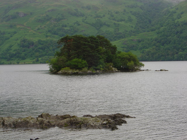
Tarbet Isle

Tarbet Isle is an island in Loch Lomond, Scotland. It is off Tarbet on the mainland. It is 10 feet (3.0 m) at its highest point, and 80 metres (260 ft...

Tarbet, Argyll

Tarbet (Scottish Gaelic: An Tairbeart, in full Tairbeart Loch Laomainn 'Crossing Place of Loch Lomond') is a small village in Argyll and Bute, Scotland...

Arrochar and Tarbet railway station

Arrochar and Tarbet railway station is a railway station on the West Highland Line in Scotland. It stands between the villages of Arrochar and Tarbet....

Nearby Amenities

Located within 500m of 56.203662,-4.6617953
Creag Bhocarn
Ele: 491
Natural: peak
Lat/Long: 56.2004475/-4.6649805
The data included in this document is from www.openstreetmap.org. The data is made available under ODbL.

Have you been to Creag a' Bhocain?

Leave your review of Creag a' Bhocain below (or comments, questions and feedback).