Meikle Hill

Hill, Mountain in Ayrshire

Scotland

Meikle Hill

Road approaching the Diel's Elbow The upper slopes of Claughrie Hill ahead have been scalped - all timber extracted. This road is also part of Cycle Route 7 - 547.2 miles long from Sunderland in the northeast of England to Inverness.
Road approaching the Diel's Elbow Credit: Gordon Brown

Meikle Hill, located in Ayrshire, Scotland, is a prominent hill that forms part of the Southern Uplands. Standing at an elevation of approximately 299 meters (981 feet), it offers stunning panoramic views of the surrounding countryside and nearby towns. Meikle Hill is situated just south of the village of Ochiltree and is easily accessible by foot.

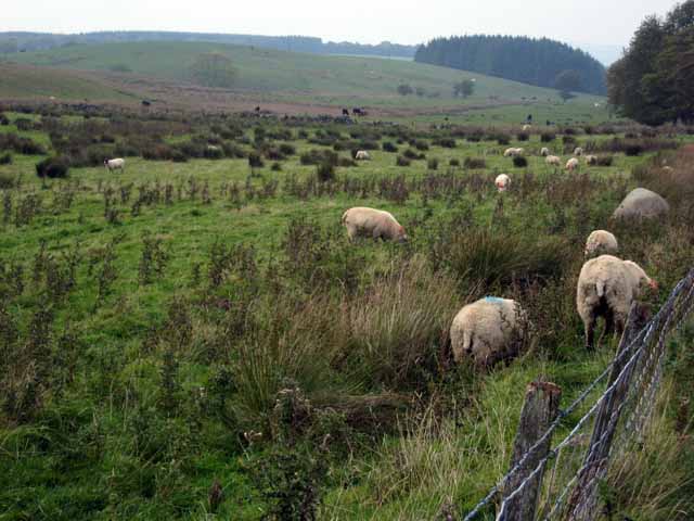
Covered in lush green vegetation, the hill boasts a diverse range of flora and fauna, making it a popular destination for nature enthusiasts and hikers. The slopes are adorned with heather, bracken, and grasses, providing a vibrant display of colors throughout the year. Visitors may also spot various bird species, rabbits, and other small mammals that call the area home.

The ascent to the top of Meikle Hill is relatively gentle, making it suitable for hikers of all abilities. Once at the summit, one can admire the breathtaking views stretching across the Ayrshire countryside, with rolling hills and farmland extending as far as the eye can see. On clear days, it is even possible to catch a glimpse of the Ailsa Craig, an uninhabited island in the Firth of Clyde.

Meikle Hill offers a tranquil escape from the bustling towns and cities, allowing visitors to reconnect with nature and enjoy the serene beauty of the Scottish landscape. Whether for a leisurely stroll or a more challenging hike, this Ayrshire hill provides an ideal destination for outdoor enthusiasts seeking adventure and natural splendor.

If you have any feedback on the listing, please let us know in the comments section below.
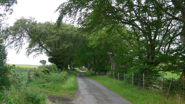
Meikle Hill Images

Images are sourced within 2km of 55.289135/-4.6273307 or Grid Reference NS3302. Thanks to Geograph Open Source API. All images are credited.

Road approaching the Diel's Elbow The upper slopes of Claughrie Hill ahead have been scalped - all timber extracted. This road is also part of Cycle Route 7 - 547.2 miles long from Sunderland in the northeast of England to Inverness.
Road approaching the Diel's Elbow
The upper slopes of Claughrie Hill ahead have been scalped - all timber extracted. This road is also part of Cycle Route 7 - 547.2 miles long from Sunderland in the northeast of England to Inverness.
Buildings near Cullochknowes
Road with copious tree canopy
Autumn tones at Auchalton A simple roadside shot of tall beech trees near Auchalton Meadow.
Autumn tones at Auchalton
A simple roadside shot of tall beech trees near Auchalton Meadow.
Auchalton Toll Cottage On the old toll road from Ayr to Newton Stewart.
Auchalton Toll Cottage
On the old toll road from Ayr to Newton Stewart.
Auchalton Meadow A wildlife reserve managed by the Scottish Wildlife Trust.
Auchalton Meadow
A wildlife reserve managed by the Scottish Wildlife Trust.
Fields near Auchalton
Rough grazing near Kirkbride
Cattle near Ladyburn
Auchalton Farm
Auchalton Farm
Kirkbride Farm
Kirkbride Farm
Tree-lined road near Kirkbride
Clear fell A clear fell area in Glenalla Forest, with Clauchrie Hill in the background.
Clear fell
A clear fell area in Glenalla Forest, with Clauchrie Hill in the background.
Recent Clear Fell Current timber extraction from Glenalla Forest.
Recent Clear Fell
Current timber extraction from Glenalla Forest.
Towards Shawsknowe Looking towards Shawsknowe Farm from the hill road.  Many of the old roadside beech trees have had to be cut back after this year's winter storm damage.
Towards Shawsknowe
Looking towards Shawsknowe Farm from the hill road. Many of the old roadside beech trees have had to be cut back after this year's winter storm damage.
Forest and Moor Trees of various ages and stages in Glenalla Forest.
Forest and Moor
Trees of various ages and stages in Glenalla Forest.
Forest edge The edge of the Galloway Forest Park. To see the difference after clear-felling, look at <a href="https://www.geograph.org.uk/photo/4489420">NS3400 : Clear fell edge at Glenalla</a>, taken 8 years later.
Forest edge
The edge of the Galloway Forest Park. To see the difference after clear-felling, look at NS3400 : Clear fell edge at Glenalla, taken 8 years later.
Edge of The Pilot Rocky crags on the northern slopes of The Pilot, viewed on a fine March afternoon.
Edge of The Pilot
Rocky crags on the northern slopes of The Pilot, viewed on a fine March afternoon.
Show me another place!

Meikle Hill is located at Grid Ref: NS3302 (Lat: 55.289135, Lng: -4.6273307)

Unitary Authority: South Ayrshire

Police Authority: Ayrshire

What 3 Words

///grapevine.suckle.slurs. Near Maybole, South Ayrshire

Nearby Locations

Drumyork Hill Meikle Hill

Related Wikis

Ayr, Carrick and Cumnock (UK Parliament constituency)

Ayr, Carrick and Cumnock is a county constituency represented in the House of Commons of the Parliament of the United Kingdom. It was created for the 2005...

Kilkerran House

Kilkerran House is an 18th-century private house near Maybole, Ayrshire, Scotland. It is a category A listed building set within grounds included in the...

Kilkerran railway station

Kilkerran railway station served an area of rural Ayrshire, Scotland from 1860 to 1965 on the Maybole and Girvan Railway. == History == The station opened...

Crosshill, South Ayrshire

Crosshill is a small village in South Ayrshire, Scotland.Crosshill has a primary school. == References ==

Nearby Amenities

Located within 500m of 55.289135,-4.6273307
Power: pole
Lat/Long: 55.2875033/-4.6252412
Power: pole
Lat/Long: 55.2888867/-4.6248758
Power: pole
Lat/Long: 55.2929331/-4.6275952
Power: pole
Lat/Long: 55.2899187/-4.6239376
Power: pole
Lat/Long: 55.2868011/-4.6250234
Power: pole
Lat/Long: 55.2927983/-4.6275278
Power: pole
Lat/Long: 55.2897319/-4.6239359
Power: pole
Lat/Long: 55.2920892/-4.6271736
Power: pole
Lat/Long: 55.2914009/-4.6261473
Power: pole
Lat/Long: 55.2906593/-4.6250417
Power: pole
Lat/Long: 55.2883282/-4.625497
Power: pole
Lat/Long: 55.2858343/-4.6247237
Power: pole
Lat/Long: 55.2850812/-4.6244901
Power: pole
Lat/Long: 55.2930016/-4.6249343
Power: pole
Lat/Long: 55.2925217/-4.6257394
Power: pole
Lat/Long: 55.2915767/-4.6273518
Power: pole
Lat/Long: 55.2911089/-4.6281592
Power: pole
Lat/Long: 55.2906371/-4.6289761
Power: pole
Lat/Long: 55.2900967/-4.6298779
Power: pole
Lat/Long: 55.289641/-4.6306641
Power: pole
Lat/Long: 55.2891624/-4.6314809
Power: pole
Lat/Long: 55.2887134/-4.6322387
Power: pole
Lat/Long: 55.2885131/-4.6331217
Power: pole
Lat/Long: 55.2882818/-4.6341085
Power: pole
Lat/Long: 55.2907688/-4.6296701
Power: pole
Lat/Long: 55.2898198/-4.6289619
Power: pole
Lat/Long: 55.2895442/-4.6280388
Power: pole
Lat/Long: 55.289235/-4.6270024
Power: pole
Lat/Long: 55.2887174/-4.6264476
Power: pole
Lat/Long: 55.2871149/-4.624762
Power: pole
Lat/Long: 55.2866094/-4.6242166
Power: pole
Lat/Long: 55.2860851/-4.62365
Power: pole
Lat/Long: 55.2854895/-4.623015
The data included in this document is from www.openstreetmap.org. The data is made available under ODbL.

Have you been to Meikle Hill?

Leave your review of Meikle Hill below (or comments, questions and feedback).