Cnoc an t-Saic

Hill, Mountain in Ross-shire

Scotland

Cnoc an t-Saic

The summit of Cnoc Bad a' Choille Looking towards Suilven (left) and Canisp (centre).
The summit of Cnoc Bad a' Choille Credit: Michael Earnshaw

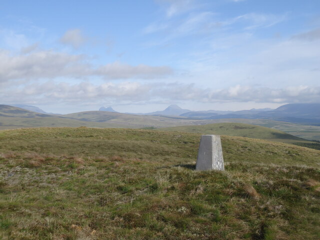
Cnoc an t-Saic, located in Ross-shire, Scotland, is a picturesque hill and mountain formation that holds significant historical and geographical importance. Rising at an elevation of approximately 567 meters (1,860 feet), it offers breathtaking panoramic views of the surrounding landscapes.

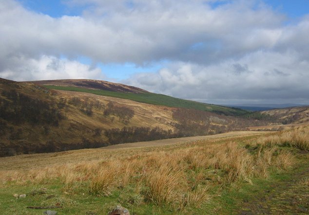
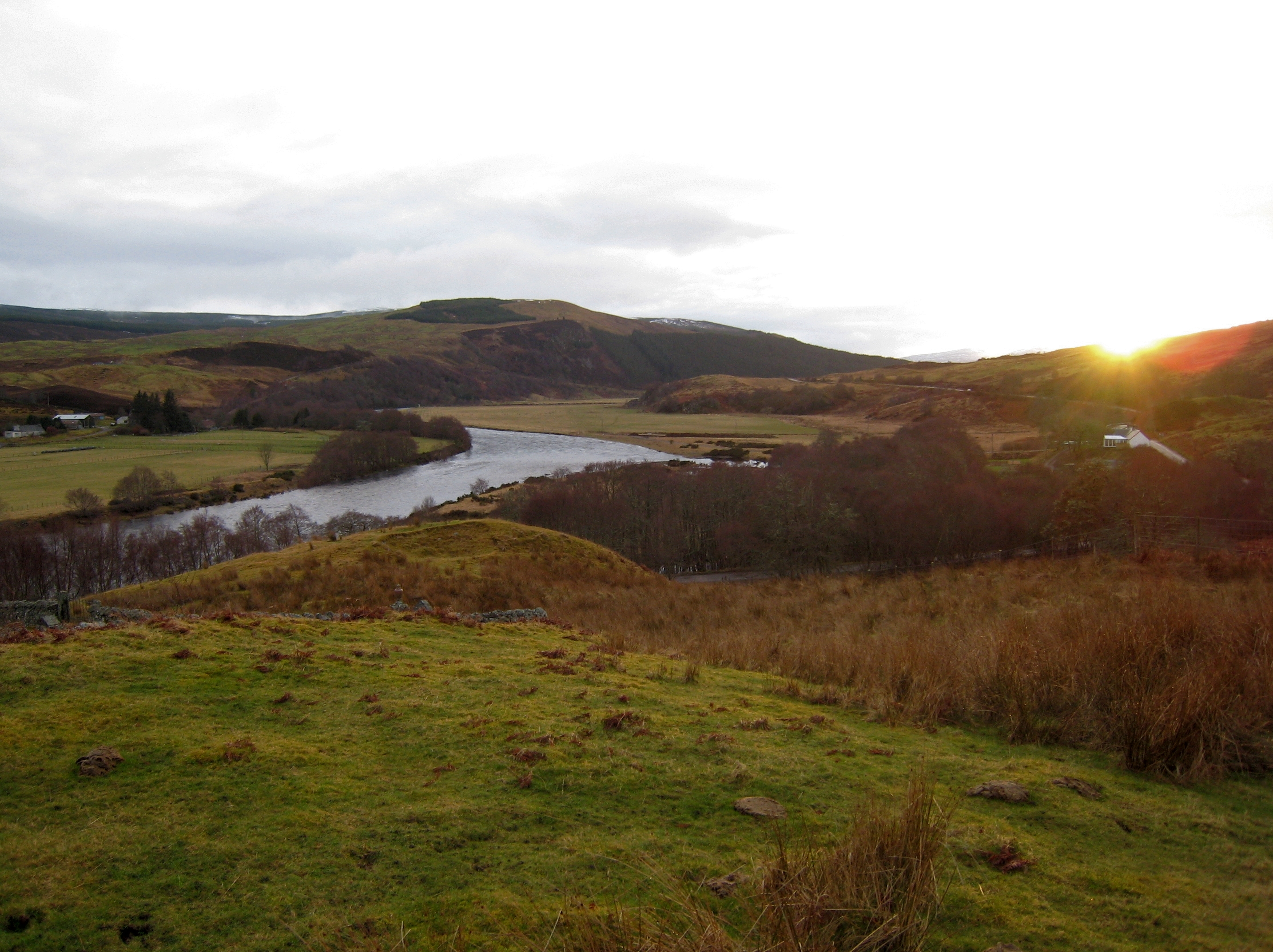
Covered in heather, grasses, and scattered rocks, Cnoc an t-Saic is a part of the Torridon Hills, which belong to the Northwest Highlands. Its distinctive shape and prominent position make it a prominent feature of the region's skyline. The hill is formed primarily of ancient Lewisian gneiss, a type of metamorphic rock that gives the landscape a rugged and dramatic character.

Cnoc an t-Saic is a popular destination among hikers and mountaineers due to its challenging yet rewarding terrain. The hill offers various routes for different levels of experience, with some paths leading to the summit providing a more challenging ascent. The well-maintained trails and footpaths ensure safe passage for visitors, allowing them to explore the natural beauty of the area.

Aside from its natural allure, Cnoc an t-Saic holds historical significance. The hill is believed to have been used as a lookout point during ancient times, with its strategic position offering clear views across the region. This historical presence adds an extra layer of fascination for visitors interested in delving into the past.

Overall, Cnoc an t-Saic in Ross-shire is a captivating hill and mountain formation, offering an exhilarating experience for outdoor enthusiasts and providing a glimpse into the rich history and natural splendor of the Scottish Highlands.

If you have any feedback on the listing, please let us know in the comments section below.

Cnoc an t-Saic Images

Images are sourced within 2km of 57.94822/-4.8199029 or Grid Reference NH3398. Thanks to Geograph Open Source API. All images are credited.

The summit of Cnoc Bad a' Choille Looking towards Suilven (left) and Canisp (centre).
The summit of Cnoc Bad a' Choille
Looking towards Suilven (left) and Canisp (centre).
Abhainn Dubhag after a night of rain The river in spate after a night of heavy rain.  For contrast, see photo taken from the same spot the previous evening (<a href="https://www.geograph.org.uk/photo/5249069">NH3397 : Abhainn Dubhag</a>).

Photo taken while walking the Cape Wrath Trail.
Abhainn Dubhag after a night of rain
The river in spate after a night of heavy rain. For contrast, see photo taken from the same spot the previous evening (NH3397 : Abhainn Dubhag). Photo taken while walking the Cape Wrath Trail.
Abhainn Dubhag The river before a night of heavy rain.  For contrast, see photo taken from the same spot the following morning (<a href="https://www.geograph.org.uk/photo/5249062">NH3397 : Abhainn Dubhag after a night of rain</a>). 

Photo taken while walking the Cape Wrath Trail.
Abhainn Dubhag
The river before a night of heavy rain. For contrast, see photo taken from the same spot the following morning (NH3397 : Abhainn Dubhag after a night of rain). Photo taken while walking the Cape Wrath Trail.
Run rig system Traces of old run rig system near Duag Bridge
Run rig system
Traces of old run rig system near Duag Bridge
Footbridge Footbridge over the Rappach Water near Duag Bridge
Footbridge
Footbridge over the Rappach Water near Duag Bridge
Cattle grid, Glen Einig On the Corriemulzie access road. There is now a locked gate a short way on with car parking here.
Cattle grid, Glen Einig
On the Corriemulzie access road. There is now a locked gate a short way on with car parking here.
Clas na Cnàimh The Corriemulzie road passing through dense birch woodland. Previously this was a conifer plantation.
Clas na Cnàimh
The Corriemulzie road passing through dense birch woodland. Previously this was a conifer plantation.
The Corriemulzie road After leaving the forest, the road descends to Duag Bridge and its well preserved school house (the glen no longer has permanent residents), before climbing to Corriemulzie Lodge.  The glen to the right provides a popular through route to Ullapool. Going back a few years, outdoor recreation was mostly about munro bagging, but now through routes and exploring glens is very popular with increasing numbers of visitors from the mainland and beyond. This has become a far busier place.

The pointy hill is Cnoc Daimh.
The Corriemulzie road
After leaving the forest, the road descends to Duag Bridge and its well preserved school house (the glen no longer has permanent residents), before climbing to Corriemulzie Lodge. The glen to the right provides a popular through route to Ullapool. Going back a few years, outdoor recreation was mostly about munro bagging, but now through routes and exploring glens is very popular with increasing numbers of visitors from the mainland and beyond. This has become a far busier place. The pointy hill is Cnoc Daimh.
Abhainn Dubhag Upstream of Duag Bridge
Abhainn Dubhag
Upstream of Duag Bridge
Road to Corriemulzie The road up to Corriemulzie Lodge at Duag Bridge. Another track leaves here to the right and provides a now very popular through route to Ullapool.
Road to Corriemulzie
The road up to Corriemulzie Lodge at Duag Bridge. Another track leaves here to the right and provides a now very popular through route to Ullapool.
After crossing the Abhainn Poiblidh, en route to Oykel Bridge Shin deep, and fairly fast flowing, after recent rain.
After crossing the Abhainn Poiblidh, en route to Oykel Bridge
Shin deep, and fairly fast flowing, after recent rain.
Duag Bridge The road to Corriemulzie.
Duag Bridge
The road to Corriemulzie.
Corriemulzie road, Duag Bridge Greenery and savage midges in Glen Einig.
Corriemulzie road, Duag Bridge
Greenery and savage midges in Glen Einig.
Rough farmland, Duaig Bridge. Several miles up Glen Einig, beyond the forestry farming returns. Cattle and sheep are grazed here on wet grassland.
Rough farmland, Duaig Bridge.
Several miles up Glen Einig, beyond the forestry farming returns. Cattle and sheep are grazed here on wet grassland.
River Einig The shingle bank is exposed on the inside of a bend, the river cutting hard into the outside. The river drains a vast area of very wet deer forest. There are no high hills here and few visitors.
River Einig
The shingle bank is exposed on the inside of a bend, the river cutting hard into the outside. The river drains a vast area of very wet deer forest. There are no high hills here and few visitors.
Corriemulzie River / Abhainn Dubhag Looking upstream from Daug Bridge.
Corriemulzie River / Abhainn Dubhag
Looking upstream from Daug Bridge.
Glen Einig Heading east out of the glen, this track just cuts over the south east corner of this grid square. The bulk of the square is monotonous commercial pine as seen in the left of the image.
Glen Einig
Heading east out of the glen, this track just cuts over the south east corner of this grid square. The bulk of the square is monotonous commercial pine as seen in the left of the image.
Glen Einig Heading east out of Glen Einig.
Glen Einig
Heading east out of Glen Einig.
Show me another place!

Cnoc an t-Saic is located at Grid Ref: NH3398 (Lat: 57.94822, Lng: -4.8199029)

Unitary Authority: Highland

Police Authority: Highlands and Islands

What 3 Words

///shadow.enchanted.item. Near Ullapool, Highland

Nearby Locations

Cnoc an t-Saic

Related Wikis

Lubcroy

Lubcroy is a lodge in Glen Oykel, in Sutherland, Scottish Highlands and is in the Scottish council area of Highland.The A837 road passes through Lubcroy...

River Oykel

The River Oykel (Scottish Gaelic: Òiceall or Abhainn Òiceall, pronounced [ˈa.ɪɲ ˈɔːçkʲəl̪ˠ]) is a major river in northern Scotland that is famous for its...

Rhidorroch

Rhidorroch (Scottish Gaelic: An Ruigh Dhorcha) is a deer forest east of Ullapool, Ross-shire, Scotland, centred on the extended catchment of the Ullapool...

Nearby Amenities

Located within 500m of 57.94822,-4.8199029
Conc an t Saic
Natural: peak
Lat/Long: 57.9483875/-4.8211957
The data included in this document is from www.openstreetmap.org. The data is made available under ODbL.

Have you been to Cnoc an t-Saic?

Leave your review of Cnoc an t-Saic below (or comments, questions and feedback).