Blaen Sylltyn

Hill, Mountain in Cardiganshire

Wales

Blaen Sylltyn

Stone bridge at Cwmdu Georgian stone bridge, dated 1812, at Cwmdu, crossing over the River Ceri.
Stone bridge at Cwmdu Credit: Jake Rayson

Blaen Sylltyn is a hill located in Cardiganshire, Wales. It rises to an elevation of approximately 1,312 feet (400 meters) above sea level and offers stunning views of the surrounding countryside. The hill is part of the Cambrian Mountains range, known for its rugged terrain and natural beauty.

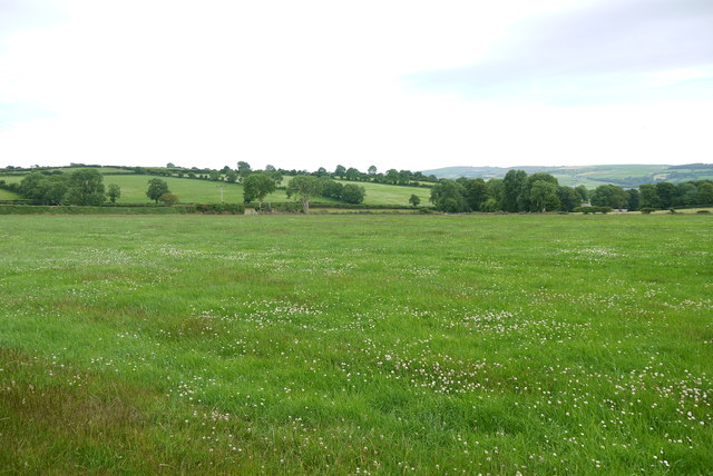
Blaen Sylltyn is a popular destination for hikers and outdoor enthusiasts, with several walking trails and paths leading to the summit. The hill is covered in lush green vegetation, including grasses, shrubs, and wildflowers, making it a picturesque location for nature lovers.

The summit of Blaen Sylltyn offers panoramic views of the rolling hills and valleys of Cardiganshire, as well as glimpses of nearby mountains and peaks. On a clear day, visitors can see for miles around, taking in the beauty of the Welsh countryside.

Overall, Blaen Sylltyn is a peaceful and scenic spot for outdoor recreation and exploration, providing a glimpse into the natural wonders of the Cambrian Mountains region.

If you have any feedback on the listing, please let us know in the comments section below.

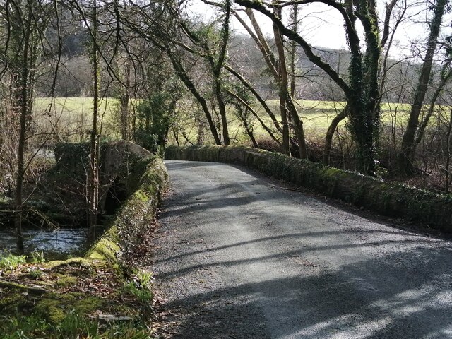
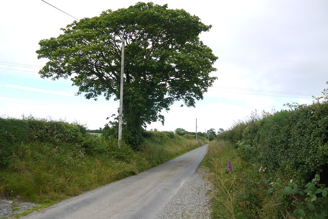
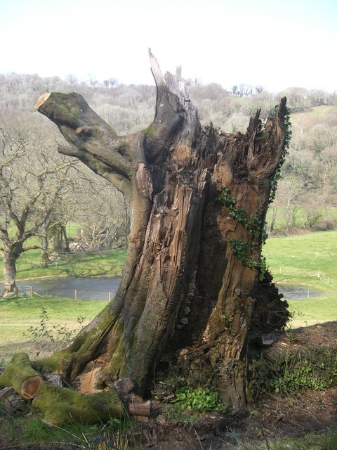
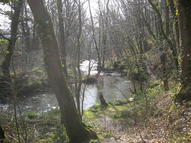
Blaen Sylltyn Images

Images are sourced within 2km of 52.072067/-4.4704997 or Grid Reference SN3044. Thanks to Geograph Open Source API. All images are credited.

Stone bridge at Cwmdu Georgian stone bridge, dated 1812, at Cwmdu, crossing over the River Ceri.
Stone bridge at Cwmdu
Georgian stone bridge, dated 1812, at Cwmdu, crossing over the River Ceri.
Ordnance Survey Cut Mark This OS cut mark can be found on a boulder behind the gate on the NE side of the road. It marks a point 138.088m above mean sea level.
Ordnance Survey Cut Mark
This OS cut mark can be found on a boulder behind the gate on the NE side of the road. It marks a point 138.088m above mean sea level.
Ordnance Survey Cut Mark This OS cut mark can be found on a disturbed boulder at the hedge junction NE side of the road. It marked a point 452.6ft above mean sea level.
Ordnance Survey Cut Mark
This OS cut mark can be found on a disturbed boulder at the hedge junction NE side of the road. It marked a point 452.6ft above mean sea level.
Ordnance Survey Cut Mark This OS cut mark can be found on the SW parapet of the bridge. It marks a point 59.227m above mean sea level.
Ordnance Survey Cut Mark
This OS cut mark can be found on the SW parapet of the bridge. It marks a point 59.227m above mean sea level.
Ordnance Survey Cut Mark This OS cut mark can be found on the wall north side of the road. It marks a point 89.114m above mean sea level.
Ordnance Survey Cut Mark
This OS cut mark can be found on the wall north side of the road. It marks a point 89.114m above mean sea level.
Country Lane near Panteinon This solitary oak tree is on the minor road between Brongwyn and Groesffordd about a mile north of Cwm Cou.
Country Lane near Panteinon
This solitary oak tree is on the minor road between Brongwyn and Groesffordd about a mile north of Cwm Cou.
Field at Groesffordd This lush pasture meadow is just off the minor road between Brongwyn and Groessffordd. The view is south towards Cilfallen.
Field at Groesffordd
This lush pasture meadow is just off the minor road between Brongwyn and Groessffordd. The view is south towards Cilfallen.
Ordnance Survey Cut Mark This OS cut mark can be found on the wall at Blaen-y-ffynnon. It marks a point 155.351m above mean sea level.
Ordnance Survey Cut Mark
This OS cut mark can be found on the wall at Blaen-y-ffynnon. It marks a point 155.351m above mean sea level.
Ordnance Survey Rivet This OS rivet can be found on the concrete base in front of the house which was once a Smithy. It marks a point 155.846m above mean sea level.
Ordnance Survey Rivet
This OS rivet can be found on the concrete base in front of the house which was once a Smithy. It marks a point 155.846m above mean sea level.
Ordnance Survey Cut Mark This OS cut mark can be found on the stone at the road junction. It marks a point 134.473m above mean sea level.
Ordnance Survey Cut Mark
This OS cut mark can be found on the stone at the road junction. It marks a point 134.473m above mean sea level.
Ordnance Survey Cut Mark This OS cut mark can be found on the gatepost NE side of the road. It marks a point 150.375m above mean sea level.
Ordnance Survey Cut Mark
This OS cut mark can be found on the gatepost NE side of the road. It marks a point 150.375m above mean sea level.
Ordnance Survey Cut Mark This OS cut mark can be found on the wall at the entrance to Plas Troedyraur. It marks a point 135.536m above mean sea level.
Ordnance Survey Cut Mark
This OS cut mark can be found on the wall at the entrance to Plas Troedyraur. It marks a point 135.536m above mean sea level.
Houses, Bryngwyn
Houses, Bryngwyn
Bryn-einon, Brongwyn
The hamlet of Groesffordd
Bryngwyn Congregationalist.
Built 1845, rebuilt 1900. 
The adjacent vestry was built in 1903.
Bryngwyn
Congregationalist. Built 1845, rebuilt 1900. The adjacent vestry was built in 1903.
Storm Torn Tree Having been damaged in a storm this tree is now host to fungi and ivy.
Storm Torn Tree
Having been damaged in a storm this tree is now host to fungi and ivy.
The Afon Ceri The Afon Ceri is a tributary to the Afon Teifi that weaves its fluid path through the Teifi Valley of West Wales. The word 'afon' is welsh for 'river'.
The Afon Ceri
The Afon Ceri is a tributary to the Afon Teifi that weaves its fluid path through the Teifi Valley of West Wales. The word 'afon' is welsh for 'river'.
Show me another place!

Blaen Sylltyn is located at Grid Ref: SN3044 (Lat: 52.072067, Lng: -4.4704997)

Unitary Authority: Ceredigion

Police Authority: Dyfed Powys

What 3 Words

///aura.sideboard.massaged. Near Newcastle Emlyn, Ceredigion

Nearby Locations

Blaen Sylltyn

Related Wikis

Bryngwyn, Ceredigion

Bryngwyn (Welsh: "White hill") is a small village in the community of Beulah, Ceredigion, Wales. Bryngwyn is represented in the Senedd by Elin Jones (Plaid...

Brongest

Brongest is a small village in the community of Troedyraur, Ceredigion, Wales, which is 68.4 miles (110.1 km) from Cardiff and 188.9 miles (303.9 km)...

Brongwyn

Brongwyn is a hamlet in the community of Beulah, Ceredigion, Wales, which is 69.5 miles (111.9 km) from Cardiff and 190.7 miles (306.9 km) from London...

Beddgeraint

Beddgeraint is a small village in the community of Penbryn, Ceredigion, Wales, which is 69 miles (111.1 km) from Cardiff and 189.1 miles (304.4 km) from...

Nearby Amenities

Located within 500m of 52.072067,-4.4704997
Direction: SSE
Generator Method: photovoltaic
Generator Output Electricity: yes
Generator Solar Modules: 14
Generator Source: solar
Generator Type: solar_photovoltaic_panel
Location: roof
Power: generator
Lat/Long: 52.074075/-4.4757928
Blaen-sylltyn
Place: farm
Lat/Long: 52.0690415/-4.4757326
The data included in this document is from www.openstreetmap.org. The data is made available under ODbL.

Have you been to Blaen Sylltyn?

Leave your review of Blaen Sylltyn below (or comments, questions and feedback).