Beinn Dubhchraig

Hill, Mountain in Perthshire

Scotland

Beinn Dubhchraig

Bealach Buidhe
Bealach Buidhe Credit: Steven Brown

Beinn Dubhchraig is a mountain located in Perthshire, Scotland. It is part of the Arrochar Alps range and is situated near the village of Crianlarich. The mountain stands at a height of 978 meters (3,209 feet) and is a popular destination for hikers and outdoor enthusiasts.

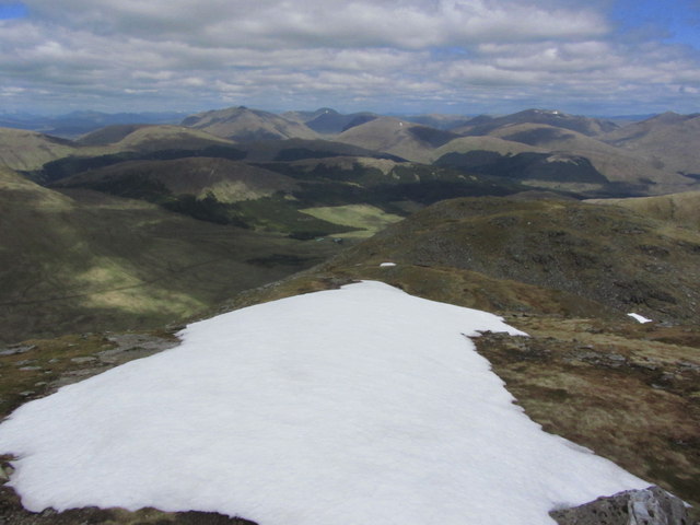
Beinn Dubhchraig is known for its rugged and rocky terrain, offering a challenging yet rewarding climb for those who attempt it. The summit provides stunning panoramic views of the surrounding countryside, including Loch Lomond and the Trossachs National Park.

The mountain is often hiked as part of the Arrochar Alps Munros, a group of seven peaks in the area that are over 3,000 feet in height. Beinn Dubhchraig is typically climbed in conjunction with its neighboring peak, Ben Oss, with both mountains forming a popular circular route for hikers.

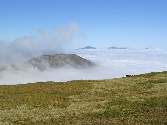
Visitors to Beinn Dubhchraig should be prepared for changeable weather conditions, as the mountain is known for experiencing sudden shifts in weather. Proper hiking gear and navigation skills are essential for a safe and enjoyable ascent of this picturesque mountain in Perthshire.

If you have any feedback on the listing, please let us know in the comments section below.

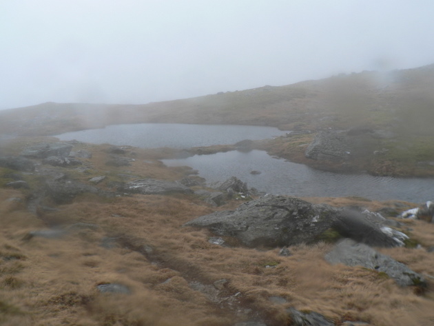
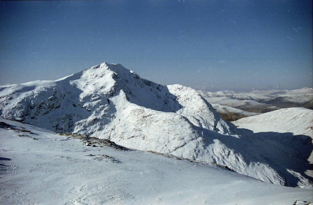
Beinn Dubhchraig Images

Images are sourced within 2km of 56.391208/-4.7432569 or Grid Reference NN3025. Thanks to Geograph Open Source API. All images are credited.

Bealach Buidhe
Bealach Buidhe
Path on Ben Oss
Path on Ben Oss
Burn below Ben Oss
Burn below Ben Oss
Bealach Buidhe Looking from slopes of Ben Oss towards Beinn Dubhchraig.
Bealach Buidhe
Looking from slopes of Ben Oss towards Beinn Dubhchraig.
Mountain Lochan Lochans at Bealach Buidhe on the trek between 2 summits
Mountain Lochan
Lochans at Bealach Buidhe on the trek between 2 summits
Rock outcrop, Beinn Dubhcraig On the west ridge of the mountain.  Loch Lomond can be seen in the distance on the right of the photo.
Rock outcrop, Beinn Dubhcraig
On the west ridge of the mountain. Loch Lomond can be seen in the distance on the right of the photo.
Bealach between Ben Oss and Ben Dubhchraig Looking towards Ben Dubhchraig (978m) <a href="https://www.geograph.org.uk/gridref/NN3025">NN3025</a>.
Bealach between Ben Oss and Ben Dubhchraig
Looking towards Ben Dubhchraig (978m) NN3025.
Loch Oss The lochan is split between two grid-squares. This is the view from the knoll (slightly below the 941 metres spot height) on the ridge between Ben Oss and Beinn Dubhchraig.
Loch Oss
The lochan is split between two grid-squares. This is the view from the knoll (slightly below the 941 metres spot height) on the ridge between Ben Oss and Beinn Dubhchraig.
Coire Bhuidhe The course of Allt Bhuidhe and the streams feeding it can be seen. Below is the confluence with the River Cononish.
Coire Bhuidhe
The course of Allt Bhuidhe and the streams feeding it can be seen. Below is the confluence with the River Cononish.
Burn on Ben Oss
Burn on Ben Oss
Ben Oss The eastern side of the hill, above Coire Garbh. The north top, (missing from Munro's Tables), is in the square with much of the face. Beinn Laoigh is the sharp peak behind the north top of Beinn Oss.
Ben Oss
The eastern side of the hill, above Coire Garbh. The north top, (missing from Munro's Tables), is in the square with much of the face. Beinn Laoigh is the sharp peak behind the north top of Beinn Oss.
Ben Oss Think this was taken on a Boots across Scotland Challenge in May 2000. Might be mistaken
Ben Oss
Think this was taken on a Boots across Scotland Challenge in May 2000. Might be mistaken
On the ridge to Ben Oss With Ben Lui to the north west.
On the ridge to Ben Oss
With Ben Lui to the north west.
View looking down north eastern ridge of Ben Oss
Sea of Cloud As seen from near the summit of Ben Oss on a stunner of a summer's day a cloud inversion in the valley means that to the east I can just see my destination of Beinn Dubhchraig. Further east still and only the bigger peaks of Ben More, Stob Binnein can be seen with just a hint of Cruach Ardrain peeking through the clouds. Further west the cloud is broken as seen here:-
<a title="https://www.geograph.org.uk/photo/6579084" href="https://www.geograph.org.uk/photo/6579084">Link</a>
Sea of Cloud
As seen from near the summit of Ben Oss on a stunner of a summer's day a cloud inversion in the valley means that to the east I can just see my destination of Beinn Dubhchraig. Further east still and only the bigger peaks of Ben More, Stob Binnein can be seen with just a hint of Cruach Ardrain peeking through the clouds. Further west the cloud is broken as seen here:- Link
Hillside from crag towards Allt Oss
Lower hillside of Ben Oss
Show me another place!

Beinn Dubhchraig is located at Grid Ref: NN3025 (Lat: 56.391208, Lng: -4.7432569)

Unitary Authority: Stirling

Police Authority: Forth Valley

What 3 Words

///rejoins.september.helm. Near Tyndrum, Stirling

Nearby Locations

Beinn Dubhchraig Loch Oss

Related Wikis

Beinn Dubhchraig

Beinn Dubhchraig (Scottish Gaelic: Beinn Dubhchreig) is a mountain in the Scottish Highlands, west of Crianlarich in the northern part of Loch Lomond and...

Tyndrum Hills

The Tyndrum Hills are a mountain range located to the south-west of Tyndrum in the Scottish Highlands, within the Strath Fillan and Breadalbane area. They...

Ben Oss

Ben Oss (Scottish Gaelic: Beinn Os) is a mountain in the southern Highlands of Scotland. It is a Munro with a height of 1,029 metres (3,376 ft). Ben Oss...

Ben Lui

Ben Lui (Scottish Gaelic: Beinn Laoigh) is a mountain in the southern Highlands of Scotland. It is a Munro with a height of 1,130 metres (3,710 ft). Ben...

Nearby Amenities

Located within 500m of 56.391208,-4.7432569
Beinn Dubhchraig
Corbett: no
Description: Black-rock hill
Donald: no
Ele: 978
Graham: no
Marilyn: yes
Munro: yes
Munro Number: M175
Name Gd: Beinn Dubh-chreig
Natural: peak
Prominence: 199
Source: NPE
Wikidata: Q3397916
Wikipedia: en:Beinn Dubhchraig
Lat/Long: 56.3913389/-4.7432864
The data included in this document is from www.openstreetmap.org. The data is made available under ODbL.

Have you been to Beinn Dubhchraig?

Leave your review of Beinn Dubhchraig below (or comments, questions and feedback).