Chapel Hill

Hill, Mountain in Wigtownshire

Scotland

Chapel Hill

Bags of (Empty) Bags All these bags once contained Sitka Spruce (Picea sitchensis) plants.
Bags of (Empty) Bags Credit: Jon Alexander

Chapel Hill, located in Wigtownshire, Scotland, is a prominent hill that offers stunning views and a serene atmosphere. Rising to an elevation of approximately 234 meters (768 feet), it is a popular destination for nature enthusiasts and hikers alike.

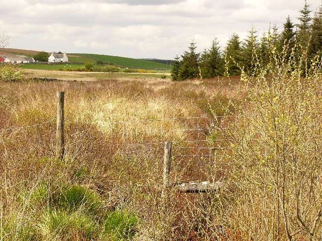
Situated in the picturesque countryside, Chapel Hill is surrounded by rolling green fields and meadows, adding to its natural beauty. The hill is covered in lush grass and dotted with vibrant wildflowers during the summer months, creating a picturesque landscape that attracts visitors throughout the year.

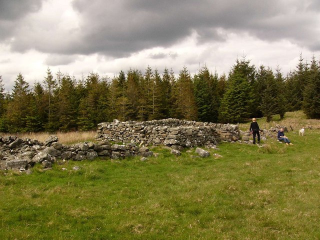
At the summit of Chapel Hill, there is a small chapel, providing the hill with its name. The chapel is a historical landmark, believed to have been built during the medieval period. Although the chapel is now in ruins, it adds an air of mystery and history to the hill.

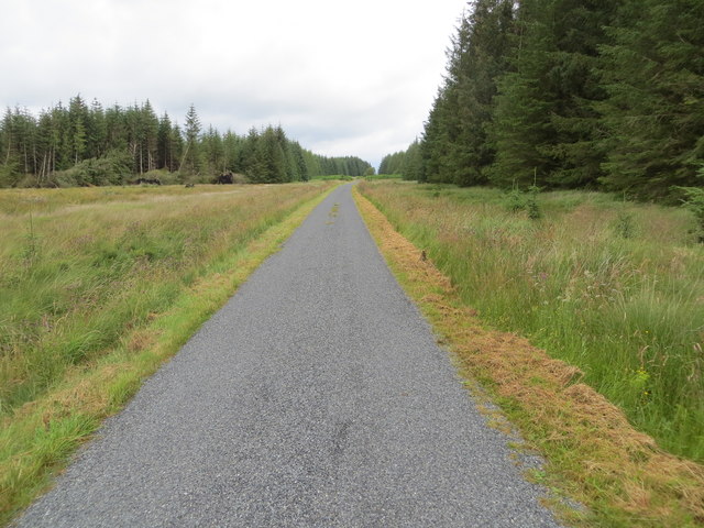
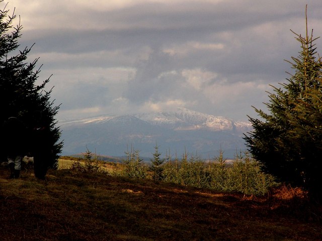
The ascent to the top of Chapel Hill is relatively easy, with well-maintained trails and pathways leading to the summit. As visitors make their way up, they can enjoy the panoramic views of the surrounding countryside, including the nearby town of Wigtown and the stunning coastline of Wigtown Bay.

Chapel Hill is also home to a variety of wildlife, including birds of prey, rabbits, and deer, making it a haven for nature lovers and birdwatchers. The hill provides an ideal opportunity for bird spotting and observing the local flora and fauna.

Overall, Chapel Hill in Wigtownshire offers visitors a chance to immerse themselves in the natural beauty of the Scottish countryside, with its stunning views, historical landmarks, and abundant wildlife.

If you have any feedback on the listing, please let us know in the comments section below.

Chapel Hill Images

Images are sourced within 2km of 54.896593/-4.6462749 or Grid Reference NX3058. Thanks to Geograph Open Source API. All images are credited.

Bags of (Empty) Bags All these bags once contained Sitka Spruce (Picea sitchensis) plants.
Bags of (Empty) Bags
All these bags once contained Sitka Spruce (Picea sitchensis) plants.
Another View of Empty Bags These appear to have been here a while.
Another View of Empty Bags
These appear to have been here a while.
Skip and Empty Bags I wonder if those bags should, perhaps, have been put in the skip!
Skip and Empty Bags
I wonder if those bags should, perhaps, have been put in the skip!
Firebeaters by the Gate At the entrance to part of Mindork Moss, they look fairly new.
Firebeaters by the Gate
At the entrance to part of Mindork Moss, they look fairly new.
Road junction near High Mindork
Minor road passing through forestry land near Mindork Moss Looking northward.
Minor road passing through forestry land near Mindork Moss
Looking northward.
Forest track heading in the direction of Drumcagerie Looking south-westward.
Forest track heading in the direction of Drumcagerie
Looking south-westward.
Wall and fence-lined minor road between High Mindork and Barnearnie Looking north-eastward.
Wall and fence-lined minor road between High Mindork and Barnearnie
Looking north-eastward.
Roadside plantation Alongside the road from Kirkcowan to Mindork
Roadside plantation
Alongside the road from Kirkcowan to Mindork
Trackbed of the Dumfries-Stranraer railway. This was known as the "Port Road" until the Beeching cuts of the 1960s closed the line.
Trackbed of the Dumfries-Stranraer railway.
This was known as the "Port Road" until the Beeching cuts of the 1960s closed the line.
Barhapple An abandoned farm near Craichlaw.
Barhapple
An abandoned farm near Craichlaw.
Moorland near the Ballochrae Burn Looking to Barlennan Hill
Moorland near the Ballochrae Burn
Looking to Barlennan Hill
Drumdow
Drumdow
Drumdow Burn Almost completely hidden by vegetation. The farm is Annabaglish.
Drumdow Burn
Almost completely hidden by vegetation. The farm is Annabaglish.
The Merrick seen from the north end of Drumcagerie
Mark of Luce road end
Forest road
Forest road
Lunky hole. Originally a hole in a dyke designed to allow sheep through but not cattle. The dyke has gone, leaving only the hole! The view is looking onto Knocketie Moss with the Knock of Luce on the far horizon.
Lunky hole.
Originally a hole in a dyke designed to allow sheep through but not cattle. The dyke has gone, leaving only the hole! The view is looking onto Knocketie Moss with the Knock of Luce on the far horizon.
Show me another place!

Chapel Hill is located at Grid Ref: NX3058 (Lat: 54.896593, Lng: -4.6462749)

Unitary Authority: Dumfries and Galloway

Police Authority: Dumfries and Galloway

What 3 Words

///troubles.rinsed.obviously. Near Newton Stewart, Dumfries & Galloway

Nearby Locations

Chapel Hill

Related Wikis

Kirkcowan railway station

Kirkcowan railway station served the village of Kirkcowan, Dumfries and Galloway, Scotland from 1861 to 1965 on the Portpatrick and Wigtownshire Joint...

Kirkcowan

Kirkcowan is an area about 15 miles in length, and from nearly two to nearly seven miles in breadth, comprising 30,580 acres, of which 7000 are arable...

Barhapple Loch

Barhapple Loch is a small semicircular freshwater loch located in Wigtownshire, Dumfries and Galloway in Scotland. Barhapple Loch is principally known...

Castle Loch, Dumfries and Galloway

Castle Loch is a large, shallow, freshwater loch in Dumfries and Galloway, in the Southern Uplands of south-west Scotland. It lies to the west of Mochrum...

Nearby Amenities

Located within 500m of 54.896593,-4.6462749
Power: pole
Lat/Long: 54.8939621/-4.6513644
Power: pole
Lat/Long: 54.8944728/-4.6510017
Power: pole
Lat/Long: 54.8959554/-4.6486794
Power: pole
Lat/Long: 54.8961733/-4.6494186
Power: pole
Lat/Long: 54.8964206/-4.6502648
Power: pole
Lat/Long: 54.8937709/-4.6408709
Power: pole
Lat/Long: 54.8944808/-4.6415869
Power: pole
Lat/Long: 54.8950797/-4.6422192
Power: pole
Lat/Long: 54.8955717/-4.6427352
Power: pole
Lat/Long: 54.8961933/-4.6434024
Power: pole
Lat/Long: 54.8968283/-4.644058
Power: pole
Lat/Long: 54.8975622/-4.6448135
Power: pole
Lat/Long: 54.8982921/-4.6456271
Power: pole
Lat/Long: 54.8985661/-4.6465756
Power: pole
Lat/Long: 54.8971277/-4.6458642
Power: pole
Lat/Long: 54.8968016/-4.646643
Power: pole
Lat/Long: 54.8963818/-4.6476542
Power: pole
Lat/Long: 54.8955062/-4.6497952
Power: pole
Lat/Long: 54.8952228/-4.6504926
The data included in this document is from www.openstreetmap.org. The data is made available under ODbL.

Have you been to Chapel Hill?

Leave your review of Chapel Hill below (or comments, questions and feedback).