Cairncurran Hill

Hill, Mountain in Renfrewshire

Scotland

Cairncurran Hill

Green Water Bridge Hillside farm on the hill. Locally Green Water is called Dippany Burn. Cairncurran Hill on the skyline left of farm house.
Green Water Bridge Credit: wfmillar

Cairncurran Hill is a prominent hill located in Renfrewshire, Scotland. It is situated near the town of Lochwinnoch, approximately 20 miles west of the city of Glasgow. With an elevation of 335 meters (1,099 feet), it is considered a significant landmark in the region.

The hill is characterized by its distinctive conical shape, which is a result of glacial erosion during the last ice age. It is composed mainly of sandstone and is covered in a mixture of grass and heather, giving it a lush and picturesque appearance.

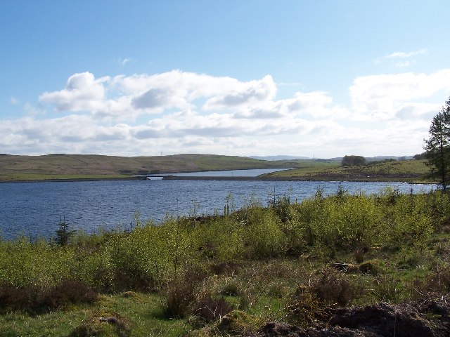
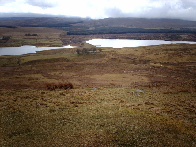
Cairncurran Hill offers breathtaking panoramic views of the surrounding countryside, including the Clyde Valley, the Kilpatrick Hills, and the distant peaks of the Trossachs. On a clear day, it is even possible to see as far as the Isle of Arran in the Firth of Clyde.

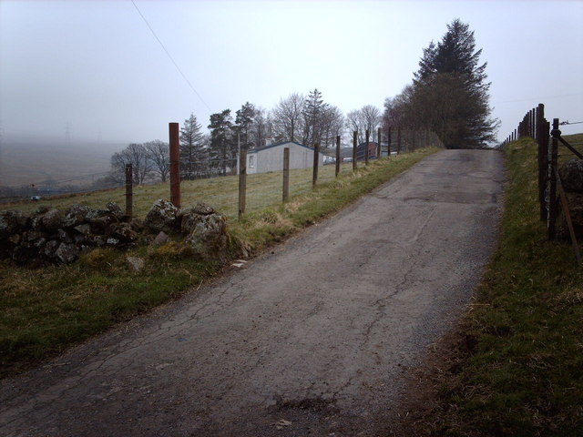
The hill is a popular destination for hikers and nature enthusiasts, with several well-marked trails leading to the summit. It is also home to a variety of wildlife, including deer, foxes, and various bird species, making it an ideal spot for birdwatching.

In addition to its natural beauty, Cairncurran Hill holds historical significance as well. It is believed to have been an ancient hill fort, with remnants of Iron Age defensive structures still visible today. Archaeological excavations have uncovered evidence of human occupation dating back thousands of years.

Overall, Cairncurran Hill is a must-visit destination for those seeking stunning views, outdoor activities, and a glimpse into the region's rich history.

If you have any feedback on the listing, please let us know in the comments section below.

Cairncurran Hill Images

Images are sourced within 2km of 55.896341/-4.7243809 or Grid Reference NS2970. Thanks to Geograph Open Source API. All images are credited.

Green Water Bridge Hillside farm on the hill. Locally Green Water is called Dippany Burn. Cairncurran Hill on the skyline left of farm house.
Green Water Bridge
Hillside farm on the hill. Locally Green Water is called Dippany Burn. Cairncurran Hill on the skyline left of farm house.
Moorland Inhospitable moorland with conifer stand and pylon in the background.
Moorland
Inhospitable moorland with conifer stand and pylon in the background.
Stone Wall Stone wall at southeast corner of forested area.
Stone Wall
Stone wall at southeast corner of forested area.
Footbridge Since there is little sign of a path in the vicinity and the stream is narrow enough to jump I suspect this bridge enjoys very light use.
Footbridge
Since there is little sign of a path in the vicinity and the stream is narrow enough to jump I suspect this bridge enjoys very light use.
Fences and Stones Large pile of stones in corner of field near Green Water. Mainly sheep grazing fields here.
Fences and Stones
Large pile of stones in corner of field near Green Water. Mainly sheep grazing fields here.
Reeds, Strathgryfe Mainly sheep grazing land here.
Reeds, Strathgryfe
Mainly sheep grazing land here.
Hill Track A rarely used track which runs west from Dippany. Cairncurran Hill is in the background.
Hill Track
A rarely used track which runs west from Dippany. Cairncurran Hill is in the background.
Old Farm Machinery Close to the track west of Dippany. I don't know what it is , but it was made by Wm. Dickie of East Kilbride, Glasgow.
Old Farm Machinery
Close to the track west of Dippany. I don't know what it is , but it was made by Wm. Dickie of East Kilbride, Glasgow.
Auchenfoil Farm On the road going to Greenock from Kilmacolm.
Auchenfoil Farm
On the road going to Greenock from Kilmacolm.
Auchenfoyle Road Junction
New Plantation Planting work is still in progress. Cairncurran Hill can be seen in the background.
New Plantation
Planting work is still in progress. Cairncurran Hill can be seen in the background.
Small forestry plantation beside the unclassified road to Kilmacolm
Bridge between Gryfe Reservoirs
Mansfield Bridge, Gryfe Water
Lower Gryfe Reservoir from Corlick Hill Looking SE from the summit of Corlick Hill. Most of the reservoir is in <a href="https://www.geograph.org.uk/gridref/NS2971">NS2971</a>.
Lower Gryfe Reservoir from Corlick Hill
Looking SE from the summit of Corlick Hill. Most of the reservoir is in NS2971.
Gryfe Reservoirs from Corlick Hill Looking south, Lower Gryfe on the left, Upper Gryfe on the right.
Gryfe Reservoirs from Corlick Hill
Looking south, Lower Gryfe on the left, Upper Gryfe on the right.
Hillside Farm This aptly named farm is on the southern slope of Cairncurran Hill.
Hillside Farm
This aptly named farm is on the southern slope of Cairncurran Hill.
Plantation at Upper Gryfe A plantation in the Upper Gryfe Valley, near the Upper Gryffe reservoir.
Plantation at Upper Gryfe
A plantation in the Upper Gryfe Valley, near the Upper Gryffe reservoir.
Show me another place!

Cairncurran Hill is located at Grid Ref: NS2970 (Lat: 55.896341, Lng: -4.7243809)

Unitary Authority: Inverclyde

Police Authority: Renfrewshire and Inverclyde

What 3 Words

///hurt.bribing.spearhead. Near Port Glasgow, Inverclyde

Nearby Locations

Cairncurran Hill

Related Wikis

Inverclyde

Inverclyde (Scots: Inerclyde, Scottish Gaelic: Inbhir Chluaidh, pronounced [iɲiɾʲˈxl̪ˠuəj], "mouth of the Clyde") is one of 32 council areas used for local...

Gryffe Reservoirs

The Gryffe Reservoirs, also spelled 'Gryfe', take their name from the River Gryffe, name deriving from the Gaelic garbh meaning "rough stream". are two...

Inverclyde (UK Parliament constituency)

Inverclyde is a parliamentary constituency of the House of Commons of the Parliament of the United Kingdom. It replaced Greenock and Inverclyde and the...

Loch Thom

Loch Thom is a reservoir which since 1827 has provided a water supply to the town of Greenock in Inverclyde, Scotland. It is named after the civil engineer...

Nearby Amenities

Located within 500m of 55.896341,-4.7243809
Cairncurran Hill
Corbett: no
Ele: 277
Munro: no
Natural: peak
Lat/Long: 55.896152/-4.724552
Power: pole
Lat/Long: 55.900542/-4.7235765
Power: pole
Lat/Long: 55.8998051/-4.7231327
Power: pole
Lat/Long: 55.8990588/-4.7226744
Power: pole
Lat/Long: 55.8982867/-4.7222161
Power: pole
Lat/Long: 55.8976093/-4.721837
Power: pole
Lat/Long: 55.8970148/-4.7214808
Power: pole
Lat/Long: 55.896295/-4.7209915
Power: pole
Lat/Long: 55.8954777/-4.7211933
Power: pole
Lat/Long: 55.8946378/-4.7213475
Power: pole
Lat/Long: 55.8941087/-4.7214495
Power: pole
Lat/Long: 55.8940082/-4.7201246
Power: pole
Lat/Long: 55.8939265/-4.7189664
Power: pole
Lat/Long: 55.8938272/-4.7177373
The data included in this document is from www.openstreetmap.org. The data is made available under ODbL.

Have you been to Cairncurran Hill?

Leave your review of Cairncurran Hill below (or comments, questions and feedback).