Barhapple Hill

Hill, Mountain in Wigtownshire

Scotland

Barhapple Hill

Old milestone A short distance from this milestone can be seen the road sign for the A75 and the Give Way sign.   This is the last of a complete set of 10 milestones on the B733 from Wigtown 0.   It is now 8 miles of A75, new and old sections, into Glenluce.
Old milestone Credit: Chris Minto

Barhapple Hill is a prominent hill located in the Wigtownshire region of Scotland. It sits approximately 2 kilometers northeast of the village of Kirkinner and stands at an elevation of 266 meters (873 feet). The hill is part of the larger Galloway Hills range, which is known for its scenic beauty and diverse wildlife.

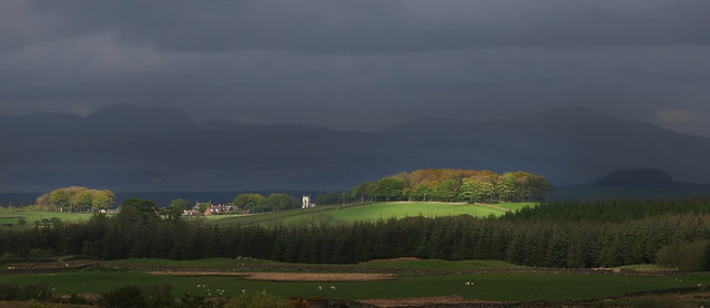
Barhapple Hill is characterized by its rounded shape and gentle slopes, making it a popular destination for hikers and nature enthusiasts. The hill is covered in heather, grasses, and scattered trees, creating a picturesque landscape that changes colors with the seasons. From the summit, visitors are treated to panoramic views of the surrounding countryside, including the nearby Solway Firth and the rolling hills of Wigtownshire.

The hill is also home to a variety of wildlife, including red grouse, pheasants, and rabbits. Birdwatchers may spot species such as buzzards, kestrels, and skylarks soaring above the hill. The diverse flora and fauna make the area a haven for nature lovers and provide ample opportunities for photography and wildlife observation.

Barhapple Hill is easily accessible by foot, with several well-marked paths leading to its summit. The hill is a popular destination for both locals and tourists alike, offering a peaceful and tranquil escape from the bustling towns nearby. Whether it's for a leisurely walk or a more challenging hike, Barhapple Hill offers visitors a chance to immerse themselves in the natural beauty of Wigtownshire.

If you have any feedback on the listing, please let us know in the comments section below.

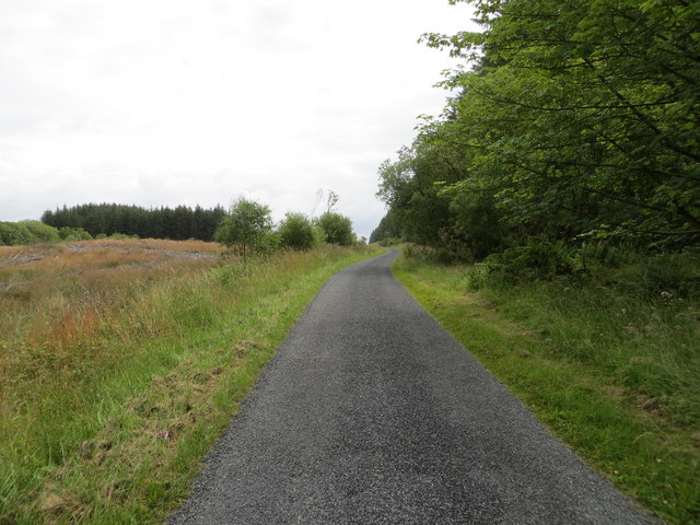
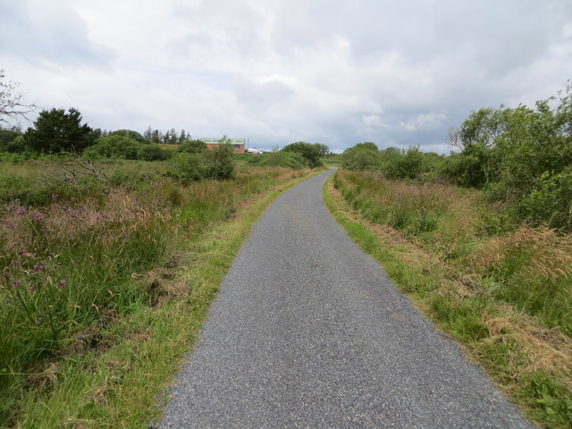
Barhapple Hill Images

Images are sourced within 2km of 54.911225/-4.6583607 or Grid Reference NX2960. Thanks to Geograph Open Source API. All images are credited.

Old milestone A short distance from this milestone can be seen the road sign for the A75 and the Give Way sign.   This is the last of a complete set of 10 milestones on the B733 from Wigtown 0.   It is now 8 miles of A75, new and old sections, into Glenluce.
Old milestone
A short distance from this milestone can be seen the road sign for the A75 and the Give Way sign. This is the last of a complete set of 10 milestones on the B733 from Wigtown 0. It is now 8 miles of A75, new and old sections, into Glenluce.
Old milestone From this photograph it can be seen that the milestone has, at some time, been reset with the W face to the road.  And it has been painted since 2008 when first recorded for the Milestone Society.
Old milestone
From this photograph it can be seen that the milestone has, at some time, been reset with the W face to the road. And it has been painted since 2008 when first recorded for the Milestone Society.
A75 near Barmore Moss The distant road sign tells of the new dual carriageway ahead.
A75 near Barmore Moss
The distant road sign tells of the new dual carriageway ahead.
A bend on the A75
A bend on the A75
Tracks on Barskeoch Fell The left track leads to the telecommunication masts and right to the now derelict farmstead Barskeoch, seen centre of picture on the horizon, which appears as 'Barskeath' on the mapping of 1832.
Tracks on Barskeoch Fell
The left track leads to the telecommunication masts and right to the now derelict farmstead Barskeoch, seen centre of picture on the horizon, which appears as 'Barskeath' on the mapping of 1832.
Track by Kiltersan Hill Viewed in the direction of Kiltersan Farm as you drop down off Barskeoch Fell.
Track by Kiltersan Hill
Viewed in the direction of Kiltersan Farm as you drop down off Barskeoch Fell.
Track to Barskeoch Fell View to the fell on the horizon as you leave Kiltersan Farm.
Track to Barskeoch Fell
View to the fell on the horizon as you leave Kiltersan Farm.
Kiltersan Farm Entrance track to the farm.
Kiltersan Farm
Entrance track to the farm.
Cattle at Kiltersan Winter feed from a trailer is probably one of the few ways to keep the food dry in the waterlogged fields by the farm.
Cattle at Kiltersan
Winter feed from a trailer is probably one of the few ways to keep the food dry in the waterlogged fields by the farm.
Farm Track at Kiltersan Leads down to the main A75 in this direction.
Farm Track at Kiltersan
Leads down to the main A75 in this direction.
Waterlogged field at Kiltersan A pretty common sight throughout the Machars at the moment.
Waterlogged field at Kiltersan
A pretty common sight throughout the Machars at the moment.
A75 westbound at Far Barbunny
A75 westbound at Barmore Hill
Minor road near to Mark of Luce Moss Looking eastward.
Minor road near to Mark of Luce Moss
Looking eastward.
Minor road near to Derwill Looking north-westward.
Minor road near to Derwill
Looking north-westward.
Farmland near Muil Farm The ridge is called Near Barbunny - barr buin duibh - the hill of the black bottom, or bog.
Farmland near Muil Farm
The ridge is called Near Barbunny - barr buin duibh - the hill of the black bottom, or bog.
The old military road near Kiltersan Built in the 18th century, it runs to the port at Portpatrick. It was constructed so that troops could be moved quickly to Ireland in times of trouble.
The old military road near Kiltersan
Built in the 18th century, it runs to the port at Portpatrick. It was constructed so that troops could be moved quickly to Ireland in times of trouble.
Kiltersan Kiltersan - Cill tarsuinn - means the chapel at the crossing, although the crossing of what isn't obvious.
Kiltersan
Kiltersan - Cill tarsuinn - means the chapel at the crossing, although the crossing of what isn't obvious.
Show me another place!

Barhapple Hill is located at Grid Ref: NX2960 (Lat: 54.911225, Lng: -4.6583607)

Unitary Authority: Dumfries and Galloway

Police Authority: Dumfries and Galloway

What 3 Words

///ordinary.thud.field. Near Newton Stewart, Dumfries & Galloway

Related Wikis

Kirkcowan railway station

Kirkcowan railway station served the village of Kirkcowan, Dumfries and Galloway, Scotland from 1861 to 1965 on the Portpatrick and Wigtownshire Joint...

Kirkcowan

Kirkcowan is an area about 15 miles in length, and from nearly two to nearly seven miles in breadth, comprising 30,580 acres, of which 7000 are arable...

Barhapple Loch

Barhapple Loch is a small semicircular freshwater loch located in Wigtownshire, Dumfries and Galloway in Scotland. Barhapple Loch is principally known...

Tarf Water, Wigtownshire

The Tarf Water is a river in the former county of Wigtownshire in south-west Scotland. It rises on the Ayrshire border (55.0048°N 4.7815°W / 55.0048;...

Have you been to Barhapple Hill?

Leave your review of Barhapple Hill below (or comments, questions and feedback).