Corkney Top
Hill, Mountain in Renfrewshire
Scotland
Corkney Top

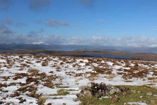
Corkney Top, located in Renfrewshire, is a prominent hill in the southern part of Scotland. Rising to an elevation of approximately 335 meters (1,099 feet), it is considered one of the highest points in the region. The hill is situated amidst the picturesque countryside, offering breathtaking views of the surrounding landscape.
Corkney Top is characterized by its rugged terrain, with steep slopes and rocky outcrops dotting its surface. The hill is covered in lush green vegetation, comprising a mix of grasses, heather, and small shrubs. This rich plant diversity supports a wide array of wildlife, including various bird species and small mammals.
The ascent to Corkney Top is relatively challenging, making it a popular destination for hikers and outdoor enthusiasts seeking a more demanding climb. The hill is accessible via well-marked footpaths, which snake through the surrounding countryside and lead to the summit. Along the way, visitors can enjoy the tranquility of the rural setting and take in the stunning panoramic views of the nearby hills and valleys.
Corkney Top also holds historical significance, as it is believed to have been inhabited since ancient times. Archaeological remains, such as stone circles and burial mounds, can be found in the vicinity, providing clues to the area's past.
Overall, Corkney Top is a remarkable natural landmark in Renfrewshire, offering visitors a chance to immerse themselves in the beauty of the Scottish countryside while enjoying a challenging outdoor adventure.
If you have any feedback on the listing, please let us know in the comments section below.
Corkney Top Images
Images are sourced within 2km of 55.890343/-4.7591972 or Grid Reference NS2769. Thanks to Geograph Open Source API. All images are credited.


Corkney Top is located at Grid Ref: NS2769 (Lat: 55.890343, Lng: -4.7591972)
Unitary Authority: Inverclyde
Police Authority: Renfrewshire and Inverclyde
What 3 Words
///amounting.cuddling.roadmap. Near Greenock, Inverclyde
Nearby Locations
Related Wikis

Inverclyde
Inverclyde (Scots: Inerclyde, Scottish Gaelic: Inbhir Chluaidh, pronounced [iɲiɾʲˈxl̪ˠuəj], "mouth of the Clyde") is one of 32 council areas used for local...

Inverclyde (UK Parliament constituency)
Inverclyde is a parliamentary constituency of the House of Commons of the Parliament of the United Kingdom. It replaced Greenock and Inverclyde and the...

Gryffe Reservoirs
The Gryffe Reservoirs, also spelled 'Gryfe', take their name from the River Gryffe, name deriving from the Gaelic garbh meaning "rough stream". are two...

Loch Thom
Loch Thom is a reservoir which since 1827 has provided a water supply to the town of Greenock in Inverclyde, Scotland. It is named after the civil engineer...
Nearby Amenities
Located within 500m of 55.890343,-4.7591972Have you been to Corkney Top?
Leave your review of Corkney Top below (or comments, questions and feedback).